Gandhidham-Navlakhi

We start in the morning from Gandhidham. This is an industrial town which owes much to the Sindhi refugees who settled here after the partition of India. Apart from the large number of industries and Kandla port nearby, nothing much to write about.

gandhidham

We drive through the Little Runn of Kutch and Asiatic Wild Ass Sanctuary. With this we are out of the Kutch region. At a place called Malia, one enters the Morbi district of SAURASHTRA, also known as KATHIAWAD.

otw1

otw2

The Mudskipper is a fish found in abundance in the marshes. It was amazing to see them coming on to the surface and then instantly disappear in the mud, the moment they sense a bird flying overhead, looking for food.

otw4

otw5

Birds of various species make their presence felt along the creek.

otw3

So do the modes of transport.

otw6

Our first spot at Morbi is Navlakhi port. A small port currently involved in importing bulk coal for power plants. We know there is a Lighthouse inside the port but the permission to enter is denied. The port authority person allows us to communicate with his boss and permission is given to enter the port area with a condition that we will not use our cameras. We comply.

The Chief Photographer of this expedition is restless and tries to photograph the Divadandi from outside which is not prohibited. The results are not bad considering the distance and the time of the day.

navlakhi lighthouse

The road from Morbi town and Navlakhi port has a beautiful straight road and a parallel railway line. One can see extensive Mangrove area and beautiful flamingos. The railways as well as the port are pre-independence creations of erstwhile rulers of Morbi.

navlakhi2

navlakhi4

The Salt pans and the small hills of salt cant be missed.

Navlakhi1

Photography demands fitness and involves acrobatics

DSC_6846

Suryakiran & Veena Naik

25.08.2016

Mundra-Kandla-Bhadreshwar


Between Mandvi in Kutch and Morbi in Kathiawad Peninsula, there lies a huge area which is a wet desert, neither land nor sea. The marshes are extensive and inaccessible. In the northern parts abutting Pakistan, Border Security Force uses special all-terrain vehicles.

In view of the inaccessible sea-front, we are moving faster than originally envisaged.

Industrialization is taking place wherever possible mainly in the form of power plants. The ports of Mundra and Kandla and the town of Gandhidham are the major activity spots. The little Rann of Kutch and the sanctuary protecting the Asiatic White Ass occupies a major part of the landscape. After Monsoons it is flooded and inaccessible.

We start from Mandvi with a view to make a stopover at Mundra or a nearby place. We skip the beautiful highway and take a smaller road nearer to the coast. In fact, we return back to Mandvi after driving 15 Kms. on the highway. We take the Mandvi-Gundiyali-Nana Bhadiya-Shiracha- Mundra road.

We experience our first flat tyre. The Michelin pump we bought passes the first test successfully.

On the way temples galore.

1

2

Temples are accompanied by Tea Shops serving the milky brew of rural life. This is haji Ibrahim’s shop at Nana Ladiya.

3

A part of the landscape is dominated by two power plants. One of Tatas and the other of Adani group.

4

5

Once it was dominated by the Kharik palm, the dry date palm. It is still cultivated commercially.

6

It is green everywhere after the recent rains but one can see it is temporary. The dryness of the desert will return shortly. We arrive at Mundra and decide to skip the port area. Ports and industrial units are not on our agenda unless we get an easy access.

7

We move on through the old town towards the next place. The Bhandreshwar is an ancient Jain centre and an important Jain pilgrimage place. We have our lunch here. Rs. 50/- for Jains and Rs. 60/- for Hindus. The eating places are different within the same hall.

8

9

Bhadreshwar has a beach and a Diwadandi. I think the Gujarati word Diwadandi describes the structure better than the English word Lighthouse.

As usual permission to enter was refused.

DSC_6736

The next stop is Kandla. Looks deserted, almost a ghost town. This was once among the top five ports of India.

11

12

We look at the Diwadandi from a distance. Don’t want to ask for permission to enter.

13

One needs to go through the town of Gandhidham to reach Kandla. In fact, Gandhidham is the town and Kandla is the port. We stay overnight at Gandhidham after a long day on the road.

We found this man on the way collecting taxes in the name of Ashapura Mata.

14

Suryakiran Naik &

Veena Naik

24.08.2016

Ships of Mandvi

Shipbuilding at Mandvi is a part of the town’s heritage, I must say a major part of it. The craftsmen from Mandvi were known for their quality Dhows and other timber vessels which were used extensively in the western Indian Ocean trade involving Arabia, Eastern Africa and other ports within the Indian sub-continent. The activity and the tradition still continues although sails have been replaced by diesel engines.

1

2

Timber for shipbuilding on this scale is not available in the Kutch region. Most of it is being imported. Inquiries reveal that the labour is also not local, it is mostly from the East coast- Andhra Pradesh and Odisha.

3

Haji Hassan is among the ship-owners. He is a veteran seafarer and now owns three ships.

5

‘’ No, we don’t build ships for others. We build and ply them. It is just like owning trucks’’.

His 4th ship is under construction behind where he sits.

4

What is the life-span of these ships?

‘’ with good maintenance they can last a hundred years’’

Where are your ships plying?

‘’ the Gulf and East Africa- Mombasa’’

The construction takes up to 4 years and during this time the ship has to compete for space on the land with the other vehicles.

6

Less than a hundred meters from where Haji Hassan supervises his ship-building , young Nishant Fofindi is supervising another business started by his grandfather. It is called Sagar Ship Models.

7

Craftsmen are making scale models of various ships, not necessarily those made in Mandvi.

8

9

Outside, large number of parrots like this one supervise the work of makers of both types of ships.

11

Suryakiran & Veena Naik

22.08.2016   suryakiran.naik@gmail.com


Day 6. Mandvi.

Mandvi ( Continued)

Mandvi is a small town, a Tehsil town where river Rukmavati drains into the Arabian sea. There is not much to drain, it is almost dry.

a

The highlights of the town are the beaches (various stretches on either side of the river). This one is called Windmill beach.

b

This one has a lot of dogs, camels and horses around.

c

A much better beach is not far from the city. The beach behind the Ashapura Mata temple at Laija is a wonderful stretch of endless white sand.

f

And the Lighthouse in the town. This is the rebuilt one. The original was destroyed in the last earthquake.

d

The famous Jai Ambe temple is at Godhra nearby.

g

Green coconuts are sold here at Rs. 10/- apiece as against Rs.30/- at the beach near the city.

h

Kranti Tirth is the memorial to freedom fighter Shyamji Krishna Varma whose birthplace is Mandvi. It is located outside the town in an extremely well laid out site and complete in all possible facilities. The memorial includes a full size replica of India House in London from where S K Varma carried out his activities.

i

Mandvi has seen better days than it does now. It used to be a busy port trading with East Africa, Persian Gulf and other ports in the Indian sub-continent.

The Brahmapuri waterfront with the Customs House at the end should have been a busy place once but is now deserted except for the numerous stray dogs. The Customs House is still operational as is the port. Bureaucratic arrogance prevents us from entering the place.

j

The inner city which was once inside quite a large fort is congested like most other Indian towns. The student passengers of the rickshaws have to clear the road of other vehicles to allow theirs to pass.

k

The best known eatery in Mandvi is called OSHO. The pictures we took inside did not come off well except the one below which is the picture of a picture behind the cash counter. Here you can eat as much as you can (vegetarian food) for Rs. 110/- . In fact the staff and the owner make the rounds of the tables forcing people to eat.

l

There is one more aspect of Mandvi which needs to be looked at in a bit more detail and hence I keep it for the next Blog.

Thanks for reading.

Suryakiran Naik & Veena Naik

21.08.2016

Day 5. Naliya- Mandvi

We have done with much of Naliya and its surroundings. We are about to leave when we hear about a Heritage Village surrounding an old fort built by Jadeja rulers at a place called TERA, about 15 Kms. from Naliya. We decide to have a look. It was a disappointment. There is nothing like a Heritage Village except for the tourism department’s sign post at the entrance to the village. With some difficulty we could access the Fort. It was closed, locked. We could see the cows through the chinks in the main door. It is quite clear that it is used as a cowshed. Nobody could tell us anything about the fort and it’s history.

reva fort

reva 2

The next place we are going to visit is Mandvi, another historic place and an ancient trading and shipbuilding centre. But before that we need to visit a Lighthouse which is located between Jakhau and Mandvi ports. The Lighthouse is about 18 Kms. from the Naliya- Mandvi road. Finding the place was an adventure. The lighthouse is majestic, the beach in the front is alluring and the babhul forest between the Lighthouse and the village is amazing. The person in-charge of the Lighthouse stays alone at this place, the nearest human beings about 2 kilometres away in the Chhachhi village

Chhachhi

Chchachi Lighthouse

During the return journey we lost our way and wandered in the forest for about an hour until Abbas rescued us and showed us the way out of the maze. He left his buffaloes and came to show us the way out. He refused to sit in the car. He has a phobia of automobiles. Does the English language have a word for this?
abbas

Even the smallest villages in Kutch offer extremely good quality tea, made on coal fire. Here is such a small place between the Lighthouse and the main road.

cha

Back on the main road, the drive to Mandvi is a pleasure on the beautiful, smooth and straight road. As we enter Mandvi we get the first glimpse of the Coconut palm since we started. For those born in brought up in Goa, like both of us, the seashore is unthinkable without the coconut palm. However, the first about 150 kilometers of Indian coast does not have coconut palms. The ones appearing in the picture are tall plants and one of them has grown in a Zigzag fashion.

coconut

We start looking at  Mandvi shortly after our arrival. This is the bridge on Rukmavati river which divides the town into two parts- one in the old fort (which no longer exists) and the other side, on the way down south towards Mundra.

Mandvi1

The Vijay Vilas Palace of the Jadeja rulers made famous by Bollywood movies ( including HDDCS) is billed as a highlight of the town. It is located about 3 kms from the town.

Vijay Vilas

Vijay Vilas2

On display in the palace are many photographs, paintings, stuffed animals hunted by the Maharaja. The admission to the palace is as under. At the gate for the vehicle rs. 20/-, visit to the palace Rs. 30/- (pp) , Still Camera Rs. 50/- Mobile camera Rs. 15/-, Movie camera Rs 100/-. They are not abreast of the technology.

Among the displays is this beautiful painting.

VV3

On the way back we came across this group of deer. The rainwater accumulated in the ditches attracted quite a few species of birds as well.

hiran

Mandvi is an interesting place. Will touch on the remaining aspects in the next post.

20.08.2016

suryakiran.naik@gmail.com


Day 3 & 4. Naliya, Kutch.

The distance from Narayan Sarovar to Naliya is only 68 Kms. but it is an interesting drive through the desert and within a short range of the Arabian sea and several industries.

A short distance from Narayan Sarovar and within it’s village Panchayat area lies GUHAR MOTI or GUHAR MOTA or simply GUHER as per the official records. If correct, the importance of this place lies in the fact that it is the western-most INHABITATED village of India. There appear to be BSF observation posts beyond this but no permanent settlement.

My equipment recorded the co-ordinates as under:

23.630172, 68.581296 Or

23d 37’ 48.6’’ N, 68d 34’ 52.7’’ E

DSC_6437

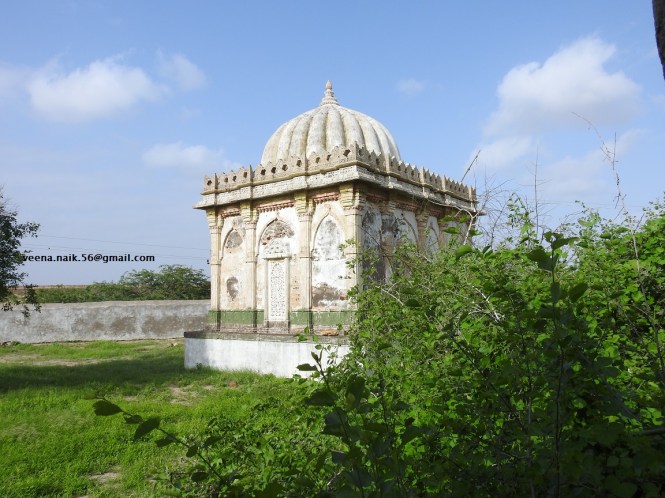
A few more kilometers south your map shows you Harudi Lighthouse. It also appears on the list of Lighthouses on the website of the Directorate General of Lighthouses and Lightships. One starts looking for it without any success. Our inquiries with the village elder reveals that there is a ‘Diwadandi’ nearby but it does not have lights. He directs us to the place nearby. Yes, we find it shortly to get the explanation for the absence of the light in the ‘Diwadandi’. No, it has not been shut down. It is merely a signal relay station and not a typical Lighthouse. The officer at the station was very helpful with the explanation of how it works.

DSCN2152

(In fact we had missed these two items when we travelled from Narayan Sarovar to Naliya on 16th and drove back to-day, 18th to cover the gap)

17th August.

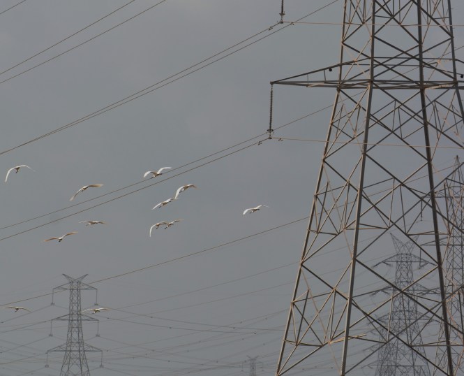
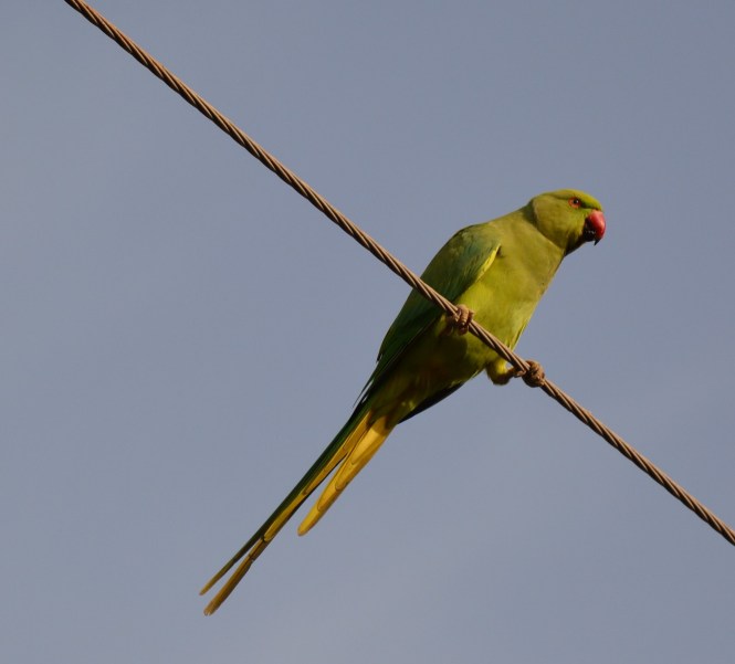
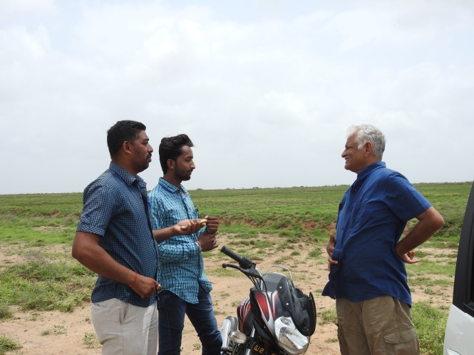
Spent the first half day looking for a single species of bird. The Great Indian Bustard. It was an unsuccessful search at three different locations covering a vast area. No. Nothing. We had to satisfy ourselves with some commoner birds and this pretty hare jumping.

hare

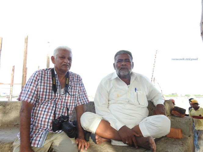
These two local guys- Charan Sinh Gadhvi and Ram Gadhvi spent a lot of time looking for the bird in the vast grassland which is being developed as a sanctuary. Our sincere thanks to them. Ram later on helped us with our internet connection. Charan is a lawyer, Ram works for Vodafone.


Gadhvi

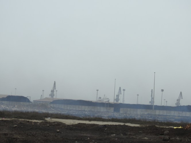
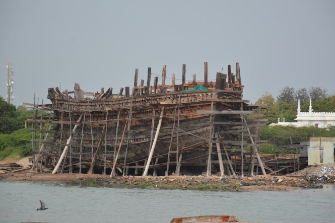
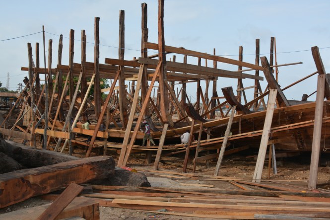
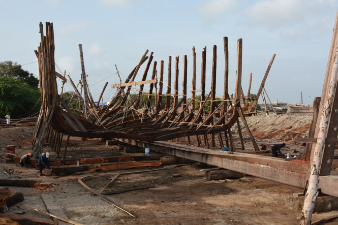
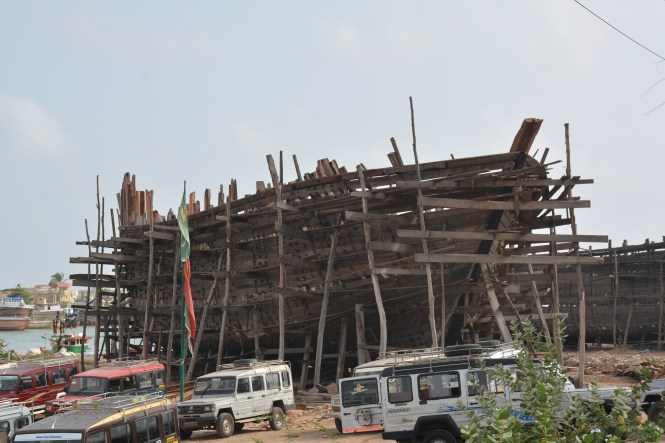
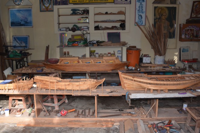
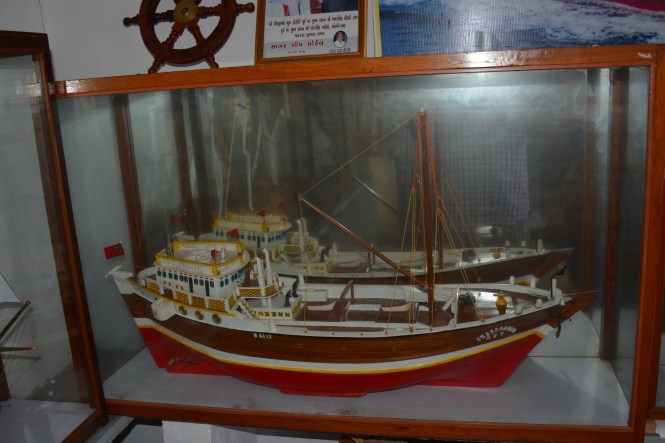
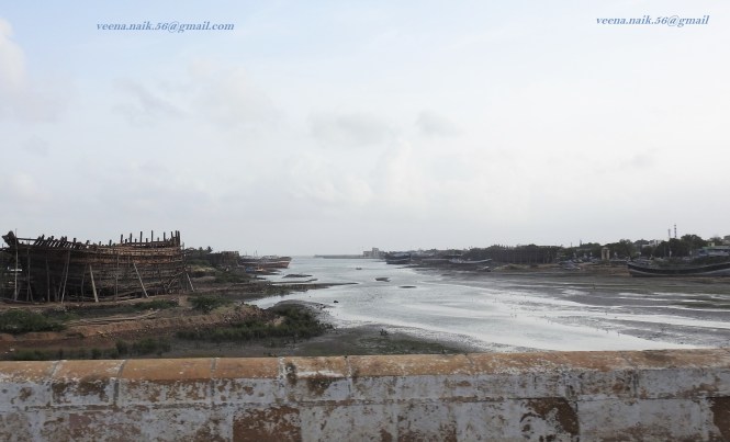
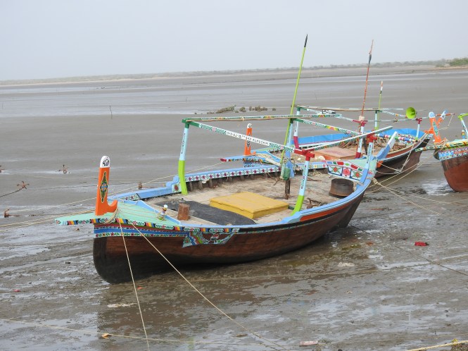
The next location nearer to Naliya is Jhakau (pronounced more like Jhako by the locals). It is an ancient port known to have traded with Arabia and Eastern Africa including Zanzibar. This place also appears to have been a victim of changes brought about by nature- the sea, earthquakes etc. Now it is difficult to believe that this place was once a thriving international port. Salt transportation appears to be a major activity.

salt

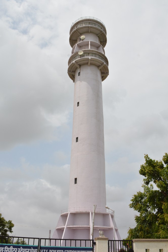
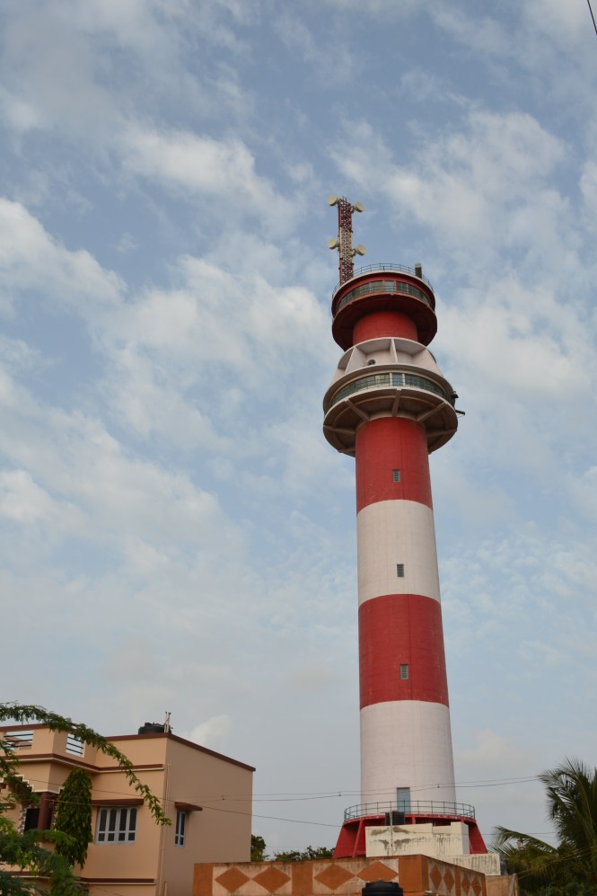
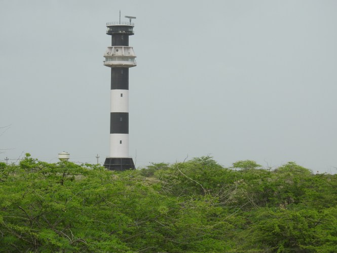
This place also sports the tallest lighthouse in India at 46 meters. The one on the left is the new one. The older one is on the right. It looks brighter as it is freshly painted.

Lighthouse

This place also appears to be the first place on the western coast of India to sport a mangrove forest. The species of mangrove here in the creak is very short in size. We found some people fishing mud-crabs using a fishing line, not nets as is the practice on the southern part of the coast.

Mangrove

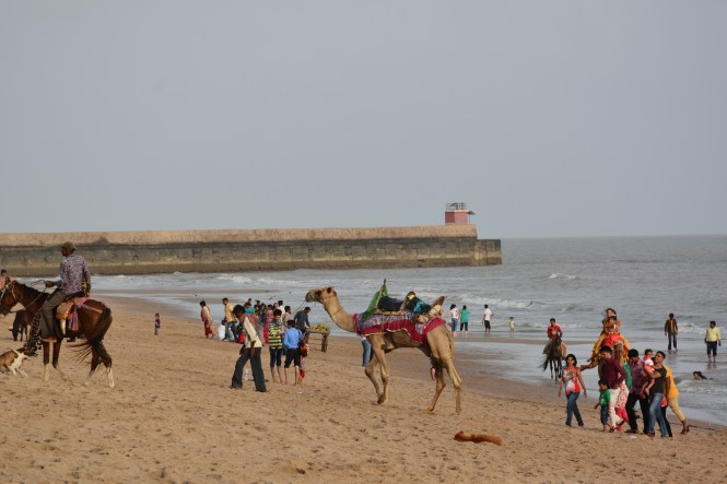
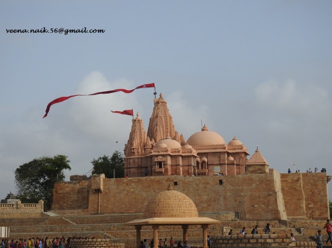
This Blog appears to be about a lot of records. First the western-most village, then the tallest Lighthouse, perhaps the western-most Mangrove forest. Now let us wind this up with the northern-most and western-most sea beach of India. It is called PINGLESHWAR.

beach

There is the temple of Pingleshwar Mahadev two kms. before the beach. One is expected to make an entry in the register maintained before driving to the beach. When asked the reason for the same, the security person explained that it is because people go to the beach to commit suicide. I spent a lot of time wondering how maintaining the register will prevent people from committing suicide and what about those who can walk to the beach?

Pingleshwar Mahadev

The Gujarat Police use this vehicle for Coastal Patrolling.

tractor

Thank you for reading.

18.08.2016

Day 2. Narayan Sarovar

Narayan Sarovar & Koteshwar Mahadev Temple.

After a delightful 38 kilometres’ journey through the post-monsoon greenery of the Kutch scrub forest, we reached our next station- Narayan Sarovar. In fact, this part was designated a wildlife sanctuary but was later on de-notified to accommodate Lignite mining. A 250X2 MW power plant can be seen from the road towards the west. The highlight on the vegetation side are these white mushrooms seen almost everywhere. Later on we were told that this is an edible species of mushroom. Edible when it is young and not fully spawned as in this picture.

mushroom

Narayan Sarovar has quite a bit of history and religious significance as it is claimed to be one of the five Holy Lakes of Hinduism. However, there is not much of water because of changes in the landscape.

Narayan Sarovar

N Sarovar

More visible and equally important temple is one of Koteshwar Mahadev, 2 Kms. from Narayan Sarovar.

Before starting from Pune, we had checked on this place on the internet. The Wikipedia article provided the valuable information that it is an ancient Shiva Temple. There is a tendency to call most temples ‘ancient’. It is high time we define the term ‘ancient’. The more damaging information provided is ‘ Koteshwar Shiva is said to be Bhairava of Hinglaj Mata residing at Hinglaj. The virtuous devotees are therefore recommended to visit Koteshwar after they have visited Hinglaj Mata’. This looks quite simple until you learn that Hinglaj Mata currently resides 250 kms north-west of Karachi in Balochistan. As this place is beyond my means to visit, I decide to become a non-virtuous devotee. As an atheist I am entitled to this non-compliance anyways.

Koteshwar

The seashore near the lake is an important fishing harbor. The boats however are laid off for the Monsoons. They will back to the sea on 17th the full moon night.

fishing boats.

The place between the two temples have a specimen of a more modern architecture- a Lighthouse. This lighthouse happens to be the western-most and northern-most on India’s coast. Presently under the guard of Border Security Force and one cannot possibly go up to see the view from the top. We were shooed away.

 Lighthouse

After the previous night at a Gurudwara, we spent this night in the accommodation attached to the Narayan Sarovar temple. Neat and clean place and at Rs. 200/-, thanks to the donors to the temple. Food is free for all twice a day, hence there are no eateries except small tea & snacks stalls.

residence

Day One. (Part 2.)

Apart from the Gurudwara , various temples and mosques, the Fort has two Dargahs of Sufi saints.

The one of Ghous Mohammed is majestic and has beautiful carvings in stone.

darga1

and with the dargah of Pir Kamalshah form the Sufi heritage of the place. Mr. Usman Notiyar who resides in the fort is  a guide and is well- versed with the history of the Fort. Everyone knows him and he can be easily reached.


darga2

Here the expedition starts. The vehicle and the driver are ready, the national flag is flying, people are having their tea in the right-hand corner.

take off

The National Bird is present in large numbers inside as well as outside Fort Lakhpat, that’s how they write it in Gujarati- Kot Lakhpat.


peacock

At a short few kilometers there is this distraction on the roadside. Two Mongooses. Veena says they were fighting. I have my reservations. I think they were up to something more serious. Please see the pictures and let us know.

mungose

mungose2

We look forward to your comments.

17.08.2016

Day One

TheBlueDrive Our expedition along the coast of India started yesterday, the 59th Independence Day of India. The starting point is the place Lakhpat in the district of Kutch in Gujarat. We started off after the flag-hoisting on the fort in the hands of Mr. K B Zala, the police inspector in charge of the place


flag

One interesting information we received here is that the flag hoisting on the Lakhpat Fort and Red Fort at Delhi has to take place precisely at the same time. Mr. Narendra Modi and Mr. Zala have therefore to act in great harmony and precision. I hope they achieved it.

Now, why Lakhpat? Is it the westernmost point of India? No. the westernmost point is Guhar Moti which is a little down south in the same district. Is it the northernmost along the sea? Perhaps not if you consider the Arabian sea proper. The sea is starting a bit down south again but the creeks and marshes along the coast can be easily considered part of the sea. The Sir Creek is the disputed boundary with Pakistan.

What made us to decide on Lakhpat is the fact that it is a named village with a civilian road nearest to the westernmost point of India. And then this place also has a lot of history and a huge fort.fort2

Lakhpat used to be a prosperous town which acted as a border between Gujarat and Sindh provinces of colonial India with the Sindhu river flowing near Lakhpat. Looking at the terrain now, one can’t believe this place was used for rice cultivation in a big way. After an earthquake 197 years ago the Sindhu river decided to change her course and flow from a more northerly place in Sindh, leaving Lakhpat and its surroundings a desert which now forms a part of great Rann of Kutch.  2011 census recorded 566 souls inhabiting the village in the fort. One cement factory (or its remains) lie abandoned not far from the Fort. The places beyond are under the care and control of Border Security Force, being close to the Pakistan Border.

fort1

The small village boasts of a Fort with 7 Kms. long walls (1801 vintage) couple of Tombs of Sufi saints, a temple and a Gurudwara. The last is quite interesting. It is said that Guru Nanak stayed at this place on his way to Mecca for Hajj. It is not clear if this was a route for Hajj pilgrims in those days in the 16th century AD. Perhaps it was used to get into Sindh and then proceed towards Arabia by land route or simply to reach one of the Gujarat ports with sea route to Arabia. The Gurudwara hosts the palkhi and the wooden sandals of Guru Nanak.gurudwara 1

We stayed here the night of 14th August. The Granthis and others in the Gurudwara are very hospitable and helpful. We had lunch and dinner at the Langar. This was our first time to be in a Gurudwara.

gurdwara2

When did Guru Nanak visit this place? According to the Granthi at the Gurudwara it was in 1512-13. I guess he meant the round trip. When asked how the Guru travelled, the Granthi said it was by way of the Arabian sea, ruling out the possibility of a land route. 

We are at a place called Naliya in Kutch. The internet connectivity is bad. Cant upload pictures. Will try again to-morrow with the remaining part of this blog.

16th August 2016.


The Start

Great people have explored land from the sea, idiots. We are exploring the seas from the land. Starting from 15th August 2016 we start driving along the coast of India and exploring Arabian Sea, Indian Ocean and the Bay of Bengal.

Why?

  1. How does one get to eat all kind of seafood? Fish, shellfish, seagrass, all kinds of weird marine creatures which are not frozen, F R E S H ?
  2. How does one see different kind of sea beaches with different kind of sands, colours of sunsets, collect different species of shells? See and photograph wide variety of Birds- local and migratory visiting the seashores?
  3. How does one see the different fishing methods and fish varieties and piscine cuisine without paying a fortune?
  4.      How does one see the architecture of forts, temples, mosques, churches and other monuments along the coast?
  5. How does one see the mysterious Lighthouses which can exist only on the seashore and nowhere else?
  6. (please add) or send me an e-mail

Obviously, one can’t do all the above from the comfort of an armchair. One needs to travel along the coast. There appear to be no railway train service or Airlines service meeting our requirements. The options left are Walking or Cycling (ruled out by our age) or Driving. This is precisely what we are doing. Covering the Arabian Sea, Indian Ocean and the Bay of Bengal abutting India over the next 18 months subject to our survival. Bad health and Bankruptcy are other possible causes of discontinuation.

We will be writing periodically about what we see and post photographs of what we see. Your comments and suggestions are welcome.

Our friends are welcome to join us for limited duration trips or Holidays, if not for the whole journey. We will be keeping you informed of our whereabouts and the calendar for the next week.