102.ANDHRA PRADESH. (6) Sacramento, Yanam, Coringa.

Between Antarvedi in the south to Yanam in the north the river Godavari meets the Bay of Bengal by means of 4 distributaries, forming a classic river delta, rich with soil brought in by the river. This is the rice bowl of India made all the more useful and productive by an intricate network of canals and waterways. The irrigation system is credited to the British administration and more specifically to an irrigation engineer who has become a legend by the name of Sir Arthur Thomas Cotton. The importance of the irrigation system built by Sir Cotton is of immense importance to the region and is so acknowledged by the people benefited by it. You will see the statues raised to the memory of Sir Cotton everywhere competing for space with the post-independence political leaders. In 2015 a ‘Pindaparidhanam’ ceremony was conducted on the banks of Godavari to the memory of Sir Cotton, a honour reserved for one’s departed ancestors. That gives us an idea about the degree of reverence the people have for this irrigation engineer.

DSC_9783

Sir Cotton on Horseback at a village square.

DSC_9677

Sir Cotton with Lord Parashurama for company.


3

Bust at a village in West Godavari district


4

Among the statues at Yanam


Starting from Dindi on the banks of Godavari we decide to make a stopover at Yanam (which is a part of the Union Territory of Puducherry) but before we do that we have another spot to visit, a lighthouse in fact.

DSC_9951

The new Lighthouse (L) and the old one (R)


 One has to pass through Bojjavaripeta and Kandikuppa in the Amalapuram Taluk to reach a fishing village called Pora to find a lighthouse named Sacramento Lighthouse. Is the name not a contrast to the surrounding places? Does it not sound very foreign? The lighthouse got it’s name from a ship that floundered and perished in the sands near the coast. The sand bars formed along the coast in this area of east Godavari district are notoriously treacherous. To ensure safety of the ships the Sacramento Lighthouse was completed in the year 1895.

DSCN3544

The orignal 1895 lighthouse, now discarded.


 The picture below shows the lighthouse compound with the staff quarters bearing the imprint of colonial administration.


 Sacramento Lighthouse is difficult to reach. It is not the distance but the terrain. One has to drive through a maze of village roads, cross a number of fish and prawn culture ponds, cross a couple of mangroves and at last a bridge so narrow, a car can barely pass. This must be one of the narrowest motorable bridges anywhere!!

DSCN3554

village on the way.


DSCN3550

A Bridge Too Narrow


 The striking part of the region indeed the whole of Andhra Pradesh is the existence of large number of statues at every conceivable place.


XXXXXXXX  YANAM

DSCN3575

Yanam Entrance


DSCN3576

The trademark gates of Puducherry at all the 4 places


When you cross the last distributary of the mighty Godavari, you drive into the former French territory of Yanam. Yanam which is now a part of the Union Territory of Puducherry and the surrounding areas of Andhra Pradesh have nothing to distinguish between them. One can walk from one to the other without knowing. The only differentiating factor perhaps is the price of fuel and liquor which is lower on the Yanam side.

We try to find some ‘French’ past- architecture, art, food, monument etc. There is none or next to nothing. Yes, there are a couple of government buildings and a Church. Surprising? Or we were not properly guided.


 What dominates the town is the post-independence riverside beach and recreation area on the north Bank of Godavari, replete with statues of politicians and the large plaques indicating which politician inaugurated the statues.


Yanam has a couple of good restaurants purely local and do not indicate even remotely any French influence. Culturally the place is pure Andhrite. We could witness the procession of Virabhadra right in the centre of the town.

DSC_9940

 Yanam is now shaping up in a different way. It is the hub for the KG-2. The Krishna-Godavari Gasfields. Reliance group is quite active here.


DSC_9837

XXXXXXXXXXXXXx Coringa.

The area north of the mouth of Godavari where there is considerable drilling activity for natural gas is also a bilogical hotspot. The dense mangrove forest has prompted the Andhra government to declare a sizable area as a wildlife Sanctuary. Coringa is located between Yanam and the port town of Kakinada to the north.


This sanctuary will not survive long despite the dense mangrove cover. It is under threat from all directions. To to the south are the gas drilling activities. To the west are the prawn culture ponds which are almost inside the sanctuary. The overall picture of the sanctuary indicates that it is being turned into a picnic spot. A road  inside is even named. To add to the problem are the huge number of students who make the sanctuary a lovers lane.

DSC_9913

Nobody seems to be bothered about the wildlife for which the place was set up.


At low tide the mudskippers are quite active in the mangroves.

DSCN3524

The extensive wetlands facing the Bay of Bengal and the meeting of the Godavari made this area economically important during the British regime. This is born out by the fact that there used to be extensive shipping activity along this part of the coast. In spite of the wetlands and the mangrove cover the area boasted two lighthouses. We have seen one at Sacramento and another one was supposed to be functional at a place in the mangroves in the past. It is no longer functional and cannot be reached by road. There is a possibility of reaching the place by a boat journey of four hours as indicated by the boat operators. We decided to pass it and be satisfied with a pictureof it found in the sanctuary.

DSC_9868

Text by Suryakiran Naik. suryakiran.naik@gmail.com

Photographed by Veena Naik & Suryakiran Naik

101.ANDHRA PRADESH. (5) KAIKALURU TO ANTARVEDI


Kaikalaru may not ring a bell even among the born Andhrites. It is a very small town. The only reason this place has achieved some kind of fame is perhaps the presence of a bird sanctuary and that precisely is the reason for us to be here. The Sanctuary is called Kolleru Bird Sanctuary.

The first hurdle is finding a place to stay. We have driven all the way from Kuchipudi and don’t want to dance here looking for a hotel. There are not many options available. There are a couple of lodges in the town. The best one among them admits us for a night with a condition that we will wind up and disappear from the place before 8 am. A ‘marriage party’ has booked the entire hotel from early morning onwards, next day. We agree to the terms and conditions and dump our bags and proceed to Kolleru, not very far, for a sunset view of the birds. This is the second time in Andhra Pradesh that we found it difficult to get a place to stay, courtesy marriages.

We dump our bags and rush to the sanctuary which is not very far off for a sunset view. Not bad. Lot of birds though not a great variety. The winter has ended and most of the migrants have found their way back to their homes. We have to make-do with whatever is left behind. Not bad. We enjoyed.

1

To their credit the Forest Department of the AP government has maintained this place very well. Creditable cleanliness. The guys around there try to make some money by taking people for a boat-ride in the lagoon which is not really required. You can see all the birds without the boat ride. Interestingly most of the people visiting the sanctuary do so for the boat-ride.

2

4

The steel structures that you in the picture above are unprecedented on a large scale like this. Anyways the birds make good use of these stands.

The silhouettes of the birds seen against the light of the setting sun are really worth seeing.

We get up early the next day to make sure we are not thrown out of the room by the ‘marriage party’. We get back to the Sanctuary for a sunrise session of pictures. Lovely. There is a bund through the sanctuary over which the locals take their buffaloes for grazing in the wetlands beyond which adds to the glamour of the place.

8

Among the species we found were Asian Pied Starling, not found on the west/south coast of India.

DSCN3284

Asian Pied Starling

And a few other passerines.


After a round of morning birding we continue northwards. We drive through the towns of Bhimavaram and Narsapur to cross the Godavari at Dindi. The Godavari delta is charming. The greenery appears to be year-long. As much as nature there is a human being who takes the credit for this. Sir Arthur Cotton a British irrigation engineer is worshipped in this part of the world, deservedly. He will appear in detail in another post in this series.

The riverside is calm and serene:

DSC_9682

From east Coast of Godavari,late in the evening.

Kaikalaru to Dindi is a long drive taking us the entire morning. We reach the Dindi Coconut Country Resort for a late lunch. This place is on the east bank of the river. The river is navigable for small craft and the surrounding countryside is lush green with coconut plantations and paddy fields.

This greenery stays with you all along the coastal belt and more particularly in what is called the Krishna Godavari Basin. We are in the month of February, but that does not seem to make any difference here with the irrigation-induced greenery.

The next day morning  we drive to a place called Anatarvedi. Coconut plantations, harvesting and processing is a part of the life here.

Rope-making out of the coconut husk does not seem to be an industry here. We did not see it anywhere. Maybe it did not develop here or the locals here were quick to abandon it with the advent of the nylon. Or perhaps we did not notice it.

Antarvedi is where one of the three distributaries of the great Godavari meet the Bay of Bengal and is considered as a holy place by Hindus. The modern people in Andhra call it ‘MIXING’. The term ‘mixing’ here means mixing of the sweet waters of the river with the saltwater of the sea. ‘Mixing’ is a widely used term in Andhrite English. Is Teluglish the right word?

Before we reach the mixing place, we come across this very popular temple of Laxminarasimha . The pilgrimage to Godavari ‘mixing’ is not complete without visiting the temple.

The Mixing ( I continue with this word as I don’t know a better substitute. Confluence does not appear to be right term as it refers to mixing of two rivers) by itself is not a spectacular place. In fact it is not a specific place. It is a general area where the river meets the sea and this is not the only place. This river meets the sea at three different places and  this is the last northwards ( or eastwards depending on how you hold the map).

The lighthouse is more than a kilometer from the seashore and does not give a much better view of the mixing from the top.

The  Red Ghost Crab appears here in large numbers.

DSCN3419

This boy insisted that he has a Driving Permit.

DSC_9763

There is a temple between the town and the beach. We stop here for a few pictures of the Deepstambha, the lamp-post which is wooden, for a change. In most other temples they are made of metal.

Done with the mixing and we take a different route to get back to the Coconut Country Resort, through a different set of villages and diffrent canals, for a part of the way. And then we stumble upon another temple with a lot of artwork on its walls. Unfortunately we have did not bother to ask for the name of the place and the temple and all the writing are in Telugu. Anyway the paintings are done by someone who understands art.

As you drive around the rural and semi-urban areas of Andhra Pradesh, you cannot escape he Telugu love of statues. They are everywhere. This tempts me to make a separate post on that subject. Here are a few.

The above selection includes mythological figures, recent politicians, Irrigation Engineers etc. Andhra Pradesh is incomplete without these images.

Text by Suryakiran Naik

Pictures by Veena Naik & Suryakiran Naik

suryakiran.naik@gmail.com


100.ANDHRA PRADESH. (4) Guntur-Uppalapadu,Undavalli, Machilipatnam, Challapalli, Kuchipudi.

We leave Nizamapatnam and decide to drive to Guntur although it is not on the coast. The idea was to see the Chili growing region and the sight of red Chilies being dried in large quantities. Added to this was the desire to see Vijayawada-Amaravati. and how the new capital of the state shaping up.

Looking back, it was a disastrous decision. We missed a lot of coast, a Sanctuary and a Lighthouse in the Krishna river delta. In fact, we missed out on the entire Krishna river basin. However, there was the possibility that we would not have made it at all if we had tried to drive in the area. Krishna meets the Bay of Bengal using three different distributaries creating the delta which is marshy and wet. There are hardly any roads in the region. We were warned by an engineer at one of other lighthouses that it would be difficult for us to reach the Lighthouse as it requires a journey of 3 hours by country boat in addition to long road journey.

1

If you look at the map above it clearly shows the absence of habitation in the Delta. I am not yet sure if made a major mistake by going up the Krishna and coming back to join the coast at Machilipatnam. One thing is sure, we missed some coastal places and also the bridge across Krishna.

The trip to Guntur was a disaster. There was no scene of drying chilies. It was not the season. We could not manage to get a reasonable accommodation and when we found one it had a horrible parking underground with an incline of more than 180 degrees.

Having come all the way to Guntur we decided to visit Uppalapadu a bird sanctuary located not far from the town. In fact, it is a largish Pond facing a temple which many birds find it convenient to breed.

It is managed by Forest department and they charge an entrance fee. The birds are the usual Spot-billed Pelicans, the Jacanas and a few others.

DSC_9022

DSC_9164

DSCN3059

Spot-billed Pelican

In short this is the Beginners Guide to birds. I hope the Guntur residents make good use of it.

We have now to get back to the coast and continue with our travel programme. We have to either get back to near to Nizamapatnam and cross Krishna downstream  or cross Krishna at Vijayawada and go south- eastwards. Our destination is Machilipatnam. We decide on the latter.

We decide to visit Undavalli Caves on the way.

DSCN3129

Undavalli caves are dated to 4th and 5th Century. Initially started as a Buddhist Viharas carved into the hill by Buddhist monks, the place was taken over by Hindus later on. It appears to be as a result to change of royal mind of the local kings who initially supported the Buddhist but later on favoured Hindus.

The exteriors:

Some scenes of the interiors:

Most of the statues, idols and images are now Hindu.The reclining Vishnu on serpent is the highlight.

DSCN3107DSCN3109DSCN3110DSCN3105

A part of the cave is a functional temple where Puja is conducted. The carvings are numerous and are in pretty good condition. Lovers graffiti is conspicuous by it’s absence. The place being a functional temple appears to dissuades the lovers-cum-artists.

The surrounding part of the countryside is green and beautiful. The Krishna is not far from here.

As you drive through this part of Andhra you will notice that the grass /hay generated by the paddy is stored in  the fields. In other parts of the country it is carried and stored near the place of farmer’s residence. The cattle who consume the hay is generally kept nearer the residences rather than the farms.

———–

We pass through Vijayawada but do not stop. Here is the Prakasam in the town. Krishna has a large number of islands in its stream, big and small.

We reach Machilipatnam late in the day to find that all hotels in the town are fully booked till the next day. A big man’s son is getting married and a large number of guests have arrived from other places. The bride or bridegroom seem to be studying or working in US or Europe as we see a number of young white men and women around, most certainly wedding guests.

We make another round of the hotels and lodges trying our luck and at the same time considering other possibilities like getting back on to the highway and look for accommodation. At last we come to a hotel where the receptionist says that they don’t have any rooms but they can offer a suit. This is OK by us. We need to take some rest urgently. They have a basement parking like most hotels in the area do and the entrance to the parking is a steep incline.

Machilipatnam has been a French colony which was subsequently taken over by the British. There appears to be no signs of the French presence left behind. At least they are not known. Before that it also used to be the principal port of the Golconda Kingdom and a major centre for the production and export of the famed muslin cloth.

The people here seem to be big fans of Saibaba of Shirdi, not the one nearer home.

DSCN3155

There is not much to be seen in the town but there is a beach and a Lighthouse about 12 Kms away. We go for it. It is called Manginapudi beach. The stretch nearer the beach is a very pleasant drive.

The beach has an ‘entrance’. Beaches should not have entrances and exits. It is a huge beach both lengthwise (seashore) as well the breadth from the sea to the ordinary land.

DSC_9318

entrance


DSC_9319

Religious icons add colour to the flat beach.

One of the visitors to the beach:

DSC_9324

The Lighthouse at the beach is quite tall, among the tallest in India and according to the keeper, people are not allowed to climb it. Every lighthouse has its own rules. Taking pictures? No problem.

DSC_9306

Next day morning we take off from Machilipatnam to visit two small towns. Challapalli and Kuchipudi.

On the way, we again come across a canal. These canals are the lifeline of coastal Andhra.

DSC_9339

Freshwater canal used for irrigation And fishing.

Between Machilipatnam and Challapalli we come across this depiction of Lord Krishna drinking fresh milk straight from the udders of the cow.

Challapalli is the closest that we approached the Krishna river on the Diviseema Island where the last northern distributary of  the river separates the other two parts of the peninsula. We do not reach the river banks.

Challapalli was the headquarters of  Yarlagadda Jamindars who rules this place and the surrounding countryside in the 16th to the 20th centuries. In the 19th century the ruling Jamindar constructed a palace which is the purpose of our visit.

DSCN3161

The Palace or Fort


The palace is not seen easily from the main road outside which is lined up with motor mechanics. There is an outer gate. As you enter, a couple of people materialize from nowhere demanding , what else, money. They say there are the caretakers. By the time we return they have disappeared.

The palace grounds seem to start at this entrance but there are some educational institutions inside which can be accessed through this gate.

DSC_9350

Main entrance

The palace, referred to here as Fort’, is a modest building with a few artefacts and portraits in the ground floor hall. The upper floor is not open to public. All in all is not a must-see place.

The palace compound has a number of fruiting trees which invite a number of birds including parrots feeding on the bananas. The descendents of the Jamindars do not seem to mind.

DSCN3175

The next stop is Kuchipudi which gave the name to a famous dance form. The town displays the artistic inclinations of its residents.  The entrance gate to the town has been done artistically:

The town Bus Stand has a small garden!!. The Bus Stand is miraculously clean.

DSC_9400

We make a brief visit to the school where the Kuchipudi dance is taught. It is a residential academy.


Text by Suryakiran Naik

Pictures by Suryakiran Naik & Veena Naik

99.ANDHRA PRADESH. (3) BAPATLA-SURYALANKA, NIZAMAPATNAM.

Our original plan to stay at Chirala beach has gone haywire as no accommodation was available that Sunday afternoon. The nearby beach of Vodareru did not welcome us either and we were advised to go and find accommodation at Bapatla. Bapatla is a typical small town which has an engineering college.

As you enter the place various models of manual bicycle/tricycle vehicles attract your attention, a feature that will continue till the end of our tour in West Bengal. Here is a goods carrier which can comfortably double up as passenger carrier. I don’t know how they manage in the rains.

What do we do in Bapatla? The Engineering college is not likely to admit us. There are not many things to be seen here. Right? Wrong. Every place in this world seem to have something to offer as its own.

Here is a hearth, a cooking place which uses the rice husk very effectively. In fact, rice husk (and groundnut husk) can provide a lot of fuel for the rural people. The rice husk is commercially available in bags.

Probably that is the reason the Rikshaw puller we saw above is able to get a good meal at an affordable price at such places. We, coming from Pune found the breakfast ridiculously cheap. And it is GOOD and fresh, and it is not using any fancy plastics- this leaf is good enough. In Andhra they rarely serve Masala Dosa, most of the time it is the plain Dosa with Chuttney.

DSC_8881

The serving leaves under the paper, usually yesterday’s newpaper but the application forms for mobile phone connection serves the purpose better.

We had, whilst checking on the places of in this part of the world on the internet come across a place called Suryalanka or Surya Lanka. We thought we will drive down from Bapatla for a few minutes and continue on our way. When we actually land at Suryalanka, we change our mind. The beach is quite good. When we say, a beach is good, please also consider the fact that both of us are born and brought up in Goa.

We make a reservation at the APTDC’s Haritha Beach Resort for the next day and return to Bapatla for the night halt as we have already booked at a hotel there, but not before we see this fried-fish market at the beach.

A variety of fish is available on the beach, ready to eat and at fiercely competitive prices.

The next day we return to Suryalanka. The Haritha beach resort is as close to the beach as possible. If it is any nearer water will enter the rooms at high tides. That is the reason probably they are built on stilts. Just in case.

DSC_8898

DSC_8910

If you are a keen observer you will, late in the evening, find the lights from two different lighthouses from the middle of the Suryalanka beach- to your right (which is south) is the Vodarevu lighthouse we visited yesterday and to your left (the north) you see the lights of Nizamapatnam lighthouse. This is made possible by the crescent-shaped beach starting from north of Chirala and ending south of Nizamapatnam.

The beach is quite a busy place during the day but later in the evening as people return to Bapatla and other places.

The beach is sandy but the colour of the sand is not white. It is yellowish and a lot of black.

The seawater is pumped from the beach to the private ponds in which prawns and shrimp are grown. Here you can the pipelines going across the beach. At first glance they look like fishing nets which they are not.

The RED GHOST CRAB, a creature so famous in Odisha and West Bengal coast makes its first appearance in this area. It is a fabulous creature, very shy though.

DSCN2923

The Crabs that we ate here are a different species. They are the Mud Crabs which were caught in the estuary a mile away from the beach. This is the freshest seafood one can have. Mud Crabs live a couple of days out of water, very sturdy creatures!

DSC_8904

And here is how they are cooked at the Suryalanka Beach.

DSC_8908

There is a method of cleaning fish- removing the scales which we observed here. The fish are rubbed on a stone. This would require some skill to make sure that you remove only the scales.

The Statue Culture of Andhra Pradesh starts appearing near Bapatla with some force. Between Bapatla and Suryalanka you will find this statue of Mrs. Indira Gandhi modelled on her grand-daughter.

At Suryalanka beach and the Haritha resort you can’t fail to see the Rose-Ringed Parakeets. They are in large numbers.

Our next port of call is Nizamapatnam. As the crow flies Nizamapatnam is hardly 15Kms from Suryalanka. As I mentioned earlier the light from the lighthouse there can be seen from Suryalanka. However, there are two creeks in-between and therefore no road to connect the two places. The shortest road is via Bapatla and is 40 Kms.

We first gothrough Bapatla and then branch off on a country road. Driving through the countryside is a pleasure. We skip the Nizamapatnam town and head for the coast.

The fishing harbour and market are located on the mouth of a creak. It is a sizable and busy fishing harbour.

DSC_8954

The harbour has a ice-loading bay whereby the fishing boats can get the ice directly into the hold.  This is a labour saving innovations which many of the fishing ports in India have not adopted. The process is done manually and it is quite tedious. At times the loaders have to rally across several boats to get to the target hold. Unfortunately at the time of our visit it was not operational.

The warehouses/ Cold Storage are is quite extensive giving an idea about the importance of this harbour.

DSC_8960

The fishing harbour are seems to have expanded in the near past at the cost of the Mangrove forest surrounding it. One can easily see the encroachment on the Mangrove habitat.  If this continues on a large scale there will be the harbour and no fish.

The entire fishing port area is dominated by the trade in dry fish. Fish of the low value not commanding good price at the retail market is dried. The deciding factor is the transport cost and the cost of ice.  You can’t spend money on transport and face a situation wherein there are no buyers at the end.

The dried fish has two end users. The major one in terms of quantity are the manufacturers of fishmeal used extensively as protein-rich poultry feed. This is the low quality , high volume and high weight catch. It makes sense to dry it. It is sold in bulk.

And then there is the edible dry fish which commands good price depending on where you sell it. The Ribbonfish and the Bombay Duck can make you rich if you get the right market.

DSCN2967

And if you have the time, inclination and knowledge, you can make ‘premium’ dry fish. It needs the efforts to clean, remove the innards and then dry. This lasts longer and as I said is a premium product.

DSC_8963

The cheap  bagged dry fish mostly meant for the factories with ready money will continue to dominate the market until some value addition is cleverly done.

Nizamapatnam has a lighthouse. I am not sure if it serves any useful purpose other than providing employment to a few people. This applies not only to this lighthouse but to all of them in these times of GPS etc. This one is very close to the harbour and not a problem in reaching.

We are done with Nizamapatnam, named after the Nizam of Hyderabad the erstwhile ruler.

Dont you want to visit the town?

No, Thank you. We are tired and have to drive quite a bit before we stop for the day.

We come back to the main road and see these ladies selling something off their aluminium pots.

It is Toddy ( will convert into an alcoholic beverage if fermented). It is a healthy drink rich in nutrients before fermentation. We taste some.

It is the sap of this palm tree. We use the sign language to confirm the source.

DSC_8989

We continue, leaving behind a fish-rich place.

Text by Suryakiran Naik

Pictures by Suryakiran Naik & Veena Naik.

98.ANDHRA PRADESH. (2) NELLORE To CHIRALA.

From Armagaon we drive to Nellore for the night halt. Geographically we should have first touched Krishnapatanam first as it is to the south of Nellore.For logistical reasons, we come to Guntur first, check in a hotel, arrange for servicing of the car next morning and take some rest.

Nellore  is a commercial town and except for a couple of old temples there is nothing of interest to be visited. We decide to take some rest.

The car is delivered back after servicing in the early afternoon next day and we drive to Krishnapatnam. The port appears to be used mainly for imported coal meant for use in the thermal power stations. The long conveyor belts bear this out.

There are a number of power stations in the area and the landscape is almost completely dominated by them.

4

3

The lighthouse is unremarkable but has a pretty garden in the compound. It has a Relay Station as well.

The beach is quite good but do not seem to have many visitors. Firstly, it a bit far from Guntur the nearest town, then one has to cross the port area to reach it.

The main purpose of the beach appears to be for immersion of idols. Or have these idols come from another place, thrown ashore by the sea?

6

We return to Nellore for the night halt and start early morning next day for Kavali which we decide to make our next stop. There is not much to be explored here except the Lighthouse at Ramayapatnam.

The highway up north is a beauty. You drive through the rich green landscape for miles and miles:

DSCN2865

DSC_8784

You cant miss the Hanumans- Anjaneya, on the way. there are a number of them- in all shapes, sizes and colours. I think there is a competition in Andhra Pradesh to build these statues- bigger, taller and colourful.

DSC_8794

h

Thinly veiled Christian evangelism is in competition:

DSC_8813

Ramayapatnam is a small village. You cross the Buckingham Canal and enter it. This is the second time Iam referring to this canal and I will have to defer the expalanation a bit to the next post. In the meatime you can have a look at it as we enter the village:

DSCN2872

This fishing village has a lovely beach.

The Lighthouse is the highlight of the village.

As we move around the village and the beach we across these fishermen mending their nests in the village square:

DSC_8817

There is a small temple as well just opposite the Christian ‘ Meditation Park’. It has a number of megaphones mounted on it, in all direction. A brilliant recipe for a communal riots. If the village folks manage without it, they are great.

DSC_8807

And then my attention is attracted by a solitary man sitting in a corner and working quietly on something. As I approach closer I realize that it is something close to my heart- Shellfish. They find a species of it here which I am seeing forthe first time:

It is difficult to separate the edible portion without breaking the shell. They break the shell and recover the edible flesh. very tedious and very time-consuming. I guess they cook it after separating ( as is done with some types on the Karnataka coast) or the flesh is dried for storage. The language barrier is huge and I am not able to communicate with the person and he does not appear to be very happy doing what he is. It is like forced labour to him.

This area also happens to the groundnut growing area. You will find the groundnut shells being used as fuel for cooking- in large quantities:

We drive through the villages for quite some time and see a rich agricultural region. Watermelons are one of the fruits grown in large quantities here. We stop at a farm to buy some fresh fruit.

We retire to Kavali for the night halt but not before a flat tyre in a remote village. A couple of young guys were very helpful in getting us out of the trouble and make sure that we reached Kavali in time for dinner.

The next day early morning we start from Kavali for Vodarevu Lighthouse and with the intention of  staying at Chirala, probably the best and the most famous beach in Andhra Pradesh after Vizag.

We start very early without breakfast and with the intention that we will have breakfast at one of those small roadside eateries who serve fresh home-made south Indian items. That was not to be.

We are a Tanguturu Toll Plaza and find a ‘Food Plaza’ on top of the Toll Plaza. This is novelty for us:

DSC_8843

We park and take a lift up. The view is good and the food is not bad either.

We proceed towards Chirala bypassing the large town of Ongole on the way. The distance we cover today is about 130 Kms which is not we intended initially but there was nothing much to be seen on the way. Ongole could have been made a stop but that being not on the seashore we decided in favour of Chirala.

Before we reach Chirala we stop at a small village for some coconut water and witness this phenomena.

A small Pick Up parked by the roadside attracts my attention as some people have gathered around it. As I go closer I realize that fish is being sold from the Pick-Up.

DSC_8844

Fish is sold on the roadside on Sunday morning. What is the big deal?

The big deal is that the fishes are alive,in water in the load body of the Pick-Up.

DSC_8845

And to keep them alive an Oxygen cylinders are carried in  the vehicle to keep the water oxygenated.

The fish variety is from freshwater ponds and seems to be in great demand here on this Sunday morning. It is expensive but people are willing to pay for the live fish dressed in front of them.

The cleaning involves ‘skinning’, removing the skin off a living fish. Look at this video:


After this new experience we reach Chirala after midday to find that there is no accommodation available anywhere. The hotels and resorts are full for the week-end. What is the option? try Vodarevu beach six kilometers away.

Vodarevu is an extension of Chirala, the only difference is that Vodarevu is a fishing harbour and Chirala is an upmarket beach destination. Vodarevu does not have many places to stay at but the beach appears to be quite nice although a bit smelly because of the fishing activities.

DSCN2888

One resort agrees to provide us a room but the same is not ready. Some people who checked in on Saturday are likely to vacate. When? the manager is uncertain.

Which is the nearest other place where we can rest? The unanimous advice is -Bapatla.

We turn towards Bapatla but after having a look at the Lighthouse at Vodarevu.

The Indian Roller has been keeping us company from the time we touched eastern coast of India. He shows up every day from the telephone or electrical wires.Here we find him close by on a mound of paddy straw.

We move on to Bapatla.


Text & Video by Suryakiran Naik

Pictures Suryakiran Naik & Veena Naik


97.ANDHRA PRADESH. (1) Sullurupeta- Sriharikota- Armagaon.

We leave Pulicat and drive towards Sullurupeta 71 Kms. away and in the process, cross the Tamilnadu border to enter Andhra Pradesh. Except for the script on the sign boards nothing changes for the first few Kilometers.

We drive westwards to come to the coastal road which will take us to Sullurupeta. We lose our way and drive some distance to see this temple.

1

 And then two botanical surprises. One is a palm in full bloom but dying. The leaves (fronds) have dried but the upper part is full of fruit which I believe the plant is using for propagation of the species.

2

 The second one is a Peepal (fig) tree growing with the support of a palm. The palm is totally weakened and may not survive long. On a closer look I find that the Peepal has its roots in the soil. It is not likely that it is dependent on the palm for the nutrients. This tree usually grows on its own. Then why should it strangulate the palm and virtually kill it? I found the same phenomena once again in another part of Andhra much later.

3

 The place bearing the name Sullurupeta is not well known but Sriharikota is. It is the place where the Satish Dhawan Space Centre of Indian Space Research Organization, is located and forms the nucleus of India’s aerospace launches. We stayed at Sullurupeta on 7th and 8th of February. The manager of the hotel we stayed advised us to stay a few days more if we want to witness the launch of a rocket. On 15th February, they successfully launched the rocket carrying a world-record 104 satellites.

Sullurupeta is 22 Kms. from Sriharikota on the eastern side. A road cuts across the northern edge of Pulicat lake to carry the ISRO people most of whom appear to be staying at Sullurupeta, to the Satish Dhawan Centre.

We never expected to go so close to the place from where the launches take place. Surprisingly one can drive up to the gate of the launch centre without any security check along the dedicated road which cuts through the Pulicat lake.

 Sullurupeta is a small town and apparently is dependent on Sriharikota for much of the action. It is on the Chennai-Kolkata highway. Here is the Google map which gives a good idea of the place. You can see what appears to be a bridge between the two places which is actually a road with provision for the water to pass underneath at various places.

Screenshot_2017-04-17-18-09-07

 We have a look at the local fish market which sells both the freshwater as well as the sea-fish.

 Among the barber shops in town is this one. The customers include many rocket scientists. I decide to have an Haircut here with the hope of getting some rocket science in my head.

  We had decided on a halt at Sullurupeta as it is credited with two bird sanctuaries. The vast Pulicat lake shared by Tamilnadu and Andhra Pradesh is a shallow lagoon that supports a huge variety of marine life which in turn attract a large number of migratory as well as local birds.

It is the second week of February and the summer has set early this year which reduced our chances of any significant bird sightings. We were happy to be proved wrong. On the very first visit we were greeted with a huge flock of Flamingos feeding on the northern side of the lake.

 Here is a video clip:


The next morning was the turn of a sizable number of Spot-billed pelicans to appear and in between there was a wide variety of waders and of course the Painted Storks.

 The shallow water along the road are also used by local people to for small-scale fishing. The water is not deep enough to use boats.

 Nelapattu is officially designated Bird Sanctuary by the Andhra Pradesh Forest Department and it is close to the sea and therefore we cannot ignore it. There are not many people in Sullurupeta in the know of this place. We decide to drive on and try to spend some time there. The nearest place to the sanctuary is Polireddy Palem. We are at the gate early afternoon and it is closed. We wait and look inside to see some signs of life- wild as well as human. There is none. After half an hour some women workers appear at the fence.

I must record here something that I experienced. Many people presume that since Andhra Pradesh was a part of the erstwhile Hyderabad principality, people would be knowing some form of Hindi/Urdu. It is not true. That presumption may be true of region around the city of Hyderabad. The typical lingo of Hyderabad never percolated down to the whole state. Certainly not to the coastal Andhra Pradesh.

The ladies try to explain to us about a death of a staff and that being reason for the closure of the sanctuary. We return to the hotel. The hotel manager makes his inquiries and informs us the next day that one of the staff members of the sanctuary had died in a road accident that day and the sanctuary had to be closed and will remain closed the next day as well. We have no option but to skip it and proceed with our travels.

Our next night halt is to be the town of Nellore but south of Nellore along the coast is a lighthouse. The name of the place is Armagaon. We try to find out from various people at Sullurupeta if we can go to Armagaon driving along the coast and without going up to the highway. There are no satisfactory answers and the Google map is not of much use. At last we meet a young guy who is conversant with the topography.

‘Yes, you can go along the coast’

We are very happy.

‘But you will have to leave the car behind. Your car will not go’

‘Why? is the road so bad?’

‘Road is good but there are a couple of places where you have to cross in country boats and they might find it difficult to take the car in’

We get the message and drop the idea. The lake is shallow but the guys at Renault did not make my Duster fit enough for a Normandy-style landing We drive along the highway up north and branch off to Armagon Lighthouse the next day. It is quite a bit of driving. The first part is on the highway and pleasant. Then you leave the highway and take the country roads with a number of villages along. We reach Armagaon early afternoon.

 One has to cross an institution called to Buckingham Canal to reach the Lighthouse. We will visit this Canal later on in another post in some detail.

 A lighthouse was built here in the year 1853 by the British. It was abandoned in the year 1928 on account of widespread attacks of Malaria. It was brought back into use in 1938. It worked from 1938 to 1983 when a new and taller lighthouse was built.

This is the old lighthouse now used as a water tank. Brilliant alternative use of a Lighthouse. Who says bureaucracy is inefficient?

DSC_8740

 The new Lighthouse. This one was more or less abandoned when we visited. There was nobody inside the compound. We waited for some time then made inquiries in the surrounding locality. The locals tried to be supportive of the staff who had gone about their own business leaving the lighthouse to the winds. They assured us that the guys will come back after half an hour.

We decided to go and visit the beach. A good beach but so remote from the population centres.

  We drive back and have our customary coconut water on the way. Here we find a new type of knife for cutting the green coconut,  quite different from the one we had seen down south. This one has a long handle.

DSC_8751

 We drive through rich agricultural lands where combined harvesters are used even in paddy fields. We are now nearing the rich Krishna-Godavari basin.

DSCN2845

 We reach Nellore for a late lunch and for some rest.


Text by Suryakiran Naik

Pictures by Suryakiran Naik & Veena Naik

Video: Veena Naik


96.TAMILNADU (11). VEDANTHANGAL, SANDRAS MAHABALIPURAM, CHENNAI & PULICAT.

VEDANTHANGAL is not on the coast and therefore it should not have been a part of this tour. But it is not very from the coast either. It is only 53 Kms. from Mahabalipuram. We decided to succumb to the temptation and visit it for its uniqueness and the bird life that one is expected to see here.

In the year 1858 the then British collector of Chengalpattu passed an executive order establishing Vedanthangal as a ‘sanctuary’ apparently without any supporting legislation. In 1936 it was officially declared a ‘wildlife sanctuary’ and in 1962 it became a Reserve Forest under the Madras Forest Act. In 1988 the Vedanthagal Lake Bird Sanctuary came into existence under the Wildlife Protection Act, 1972. All through these legal tangles the farmers of this area zealously guarded the lake and it’s birds especially the visiting migratory species. It is on record that they even petitioned the government against the British officers hunting in the area.

v3

The farmers have a good reason to guard the place and the birds. On the opposite side of the lake is a large area growing paddy using the lake water. Because of the birds, free fertilizers are added to the lake water. A Bund separates the lake from the paddy fields and the water flow is controlled by 4 small gates. The Bund is now converted into a beautiful pathway and two watch towers have been constructed. The small sanctuary with a very high density of birds is regulated by the Forest Department of the state.

Many farmers are benefitted by the bird droppings which work as a natural fertilizer. Here at Vedanthangal this same phenomenon has been harnessed to the maximum benefit and very systematically.

The lake and the paddy fields on the opposite side.

DSC_7956

The water level was quite low this year (2016) on account of lesser rainfall and consequently the lake attracted fewer birds. By the time of our visit in early February 2017, most the migratory species had already made their way back to their own countries but a number of them could still be seen.

DSCN2475

Pair of  Painted Storks

DSCN2399

pair of Spotted Owlets


DSCN2291

Asian Spoonbill


DSCN2440

An young whistling Dock


DSCN2450

Rare view of a Painted Snipe.


A Moorhen with her chicks:


We came to Vedanthangal later in the afternoon Chengalput and decided to come back next morning again so we retire to Chengalput and make a second visit the next day ear;ly morning. This lake affords great opportunities for bird photography even for the amauteurs.

Vedanthangal is a place to remember.

XXXXXXXXXXXXXXXXXXXXXXXXXXXXXXXXXXXXXXXXXXx

Everyone knows MADRAS. Now it is called Chennai and after some time people will forget Madras as they have forgotten the name SADARS which is 68Kms. south of Madras or Chennai. Sadurangapattinam was the original name before the White Man arrived.

During the Europeans’ race for the colonies on the Coromandel coast Dutch established a post here in the 17th century. The fort or at least the part which exists is in a fairly good condition and free of encroachments. The location is between the Madras Atomic Power Plant and its residential colony. The existence of the power plant and a Research establishment ensures excellent road connectivity to the fort, right up to the doorsteps.

The entrance:

DSC_7599

The Granary:

Sadras was basically a trading post and not a military garrison. It has a lot of space for storing merchandise. The major items traded in the area at that time were grains, ghee, muslin cloth and salt. The view of the sea from the Fort:

DSC_7642

In 1818 the British raided the fort and probably the first war between the two  powers was fought here in 1818 and is called the Battle of Sadras in the history books. The Dutch lost.

The Dutch seem to had been preparing well for their dead. Wherever there were Dutch establishments the graves have survived very well. We have seen them at Surat, Cochin, Pulicat and here. Immaculate graves with proper inscriptions and what is to be noted- extremely good construction which has survived 300 years or more.

When you enter the fort, turn to your right to get a view of the cemetery and the graves.

The ghosts here are friendly:

DSCN2169

XXXXXXXXXXXXXXXXXXXXXXXXXXXXXXXXXXXx

MAHABALIPURAM or MAMALLAPURAM is an UNESCO World Heritage site is our next stop. Much has been written about its fabulous sculptures and temples. It is too technical for me to comment on.

Historically this place was also a port trading with Sri Lanka and South-East Asia. It flourished from the 1st century AD under various South Indian dynasties including the Pallavas ruling from Kanchipuram.

Some unfinished work of the sculptors:

DSCN2112

Krishna’s Butter Bowl. is this what they call this stone?

DSCN2141

Among the living things is a tree which has taken this curious shape among the granite boulders as if imitating them:

Mahabalipuram has a lighthouse ensconced in the granitic rocks. It provides an excellent view of the surroundings even from its base.

DSCN2108

The recently started Museum of seashells is a must-see. It is a private museum housing a huge collection of a seashell put together by a single individual. It must rank as the biggest such museum in the country. The only competitor is on the island of Diu in Gujarat and is much smaller.

A fish merchant with a passion for the seashell – Mr Raja Mohammed has spent time and money to collect a vast 2000 species and 40,000 specimen of seashells. An entrance fee is charged but you will feel it justified.

The displays have been arranged in a professional way but need some rearrangement to bring the exhibits in line with the biological classification of the shells.

XXXXXXXXXXXXXX

CHENNAI  is not on our itinerary. We have been there before. We would have skipped it altogether but we had to be there to attend two weddings. Lighthouses is something we do not skip on this coastal trip. We landed at the Chennai Lighthouse which is attractive as it has an elevator. It happens to be a Monday their weekly off. The only other two places we dropped by is the Fort St George and the Church of St Thomas. The latter because we had met him on our way on the western coast in Kerala.

The Lighthouse:

Fort St George. I must record here that our visit to this place was during the third short-lived Chief – ministership of O Paneerselvam. The security was tight indicating his presence on the premises. A week later he was out.

The Church of St Thomas:

The next day morning we start early and this is our last day in the state of Tamilnadu. The destination is Pulicat.

The 60 Kms drive from Chennai through Thiruvallur district to Pulicat takes you through interesting countryside. The first half is through the areas abutting the new ports that have sprung up north of Chennai and the other half is the typical seaside villages. The roads, by and large, are good though narrow.

Pulicat Lighthouse is an elegant structure and at 50 meters high one of the tallest in India.

Tamilnadu shares the Lake Pulicat with Andhra Pradesh and has only the southern end of it to its share. Fishing activity on the Tamilnadu side is quite high. Probably the fishing takes place mostly in the Andhra waters.

DSC_8422

Pulicat is supposed to have a fort, a Dutch Fort. It is nowhere to be seen. We make inquiries and sent from one corner to another. I understand that the fort was more of a warehouse and a flat building which is now used as a government school and health centre.

True to their reputation the Dutch cemetary survives unscathed.

The gate is closed and we had to take the pictures from the gate. On notable feature of these graves is that there is no Cross to be seen. Instead you can the skulls and bones as seen on the sign boards indicating danger.

In between the above four place that we visited we attended two weddings in Chennai city. Here are some pictures from the weddings:

Late in the day we leave Pulicat and make our way towards Andhra Pradesh. Our travels along the Tamilnadu coast lasted 22 days.


Text by Suryakiran Naik

Pictures by Suryakiran Naik & Veena Naik

95.TAMILNADU (10). POOMPUHAR, PUDUCHERY, ALAMPARAI.

In the last post (No. 94) I made an error by omitting a place we visited lying between Karaikal and Cuddalore. Poompuhar cannot be ignored.

The southern Coromandel Coast mostly within the territory of Tamilnadu state is thick with history.This history is not only of the European colonization but goes back to the ancient times when many places along the coast were centres of international trade. One such place which is said to have flourished from 200 BC onward is Poompuhar. The seaside town which was once the second capital of the Chola dynasty and a major centre of international trade with both eastern and western people. Silk appears to be a major item of exports from here. The ancient port as destroyed and is now found by the archaeologists submerged off the coast for up to 5 Kms. Erosion of land or a Tsunami have been cited as possible causes.

There are no archaeological remains on the shore. A small maritime museum displays a few objects, not very impressive.

  The beach is a major attraction and the tourism department of the state seems to have made efforts to promote the destination.

 Poompuhar has a lighthouse which resembles the one at Mallipatnam in design and the colours.

 There are a couple of temples, quite nice. We did not go into the details. One is of Godess Kamakshi.

One impressive feature of the Poompuhar beach is the fish trading activity. This is of two types. Fresh fish is sold fried in the several small kiosks. Apart from fish Crabs and Prawns are also sold. The tourists seem to be providing the client base.

 The second one is sale of dried fish. This appears to be economically more important. This market has a vast variety of dried fish in sizable quantities. I cannot imagine a tourist carrying dry fish in his bags on his way back home. It is seriously smelly. The market must be for tradesmen dealing in fish for other parts of the State or the local consumers.


 XXXXXXXXXXXXXXXXXXXXXXXXX

 Our next stop after Cuddalore is Pondicherry or Puducherry as it is now renamed. The former French colony was established in the year 1674 and this status lasted till 1954. This is about 280 years and much less than the 450 years’ rule of the Portuguese in Goa. The Portuguese were the First-In-Last-Out of the European colonialists in India. They appeared on the Kerala Coast at the beginning of 16th century and left Goa in 1961, which gives them a time-frame of four and half centuries, without making any significant impression on this sub-continent. Of course this is not the subject matter of this blog. Let us move on.   One feature of this French territory and also the other three in the country is that they are highly fragmented parcels of land. (There are other two- Chandranagore in present day in W bengal and Musulipatnam in Andhra Pradesh- French territories that did not last till 1954).

 One has to pass through other territories (which were earlier British possessions) to reach another part of the same geographical entity. This situation still continues and is more relevant from the point of view of the liquor trade. When you enter Puducherry from the south, you drive a bit and re-enter Tamilnadu, drive a bit more and get back into Puducherry and so on until you drive past the last little parcel of land and drive into Tamilnadu. It is not at all easy to understand which part of political India you are in. The only determining indicators are the liquor shops on Puducherry territory. In Tamilnadu territory you will not find them. They cannot compete with the prices in the Puducherry territory.

Here is the Google map:

Screenshot_2017-04-12-22-08-03

The only other way to assure yourself that you are in Puducherry is to find a policeman with a red flat cap. They are found only in Puducherry and nowhere else in this country.

Puducherry town smells of Europe. The neatly arranged streets with European names and the design of the buildings distinguishes it from the rest of Tamilnadu.

The buildings:

 The Streets:

The Street Names:

 The old lighthouse near the beach, the Café and the statues makes it look older.

We had a long walk on the beach, north to south in the evening avoiding the main tourist circuit. But then Puducherry  is all about tourism. Wherever we went along the seashore it was Tourists , the European tourists. They sustain the place’s existence as an independent entity. The same cannot be said of the other three parts of the Union Territory.

X X X X

Early morning the next day we drive northwards with an intention to make the night halt at Mahabalipuram. The territory between Puducherry and Mahabalipuram is very interesting. It has water on both sides. There is a huge lagoon separated by a narrow stretch of land through which the East Coast Road passes. It is early February and there are still some migratory birds seen here in the lagoon.  Before the halt at Mahabalipuram we visit another seaside place.

Kadapakkam is not a famous place but is worth visiting. It has the potential to develop as a tourist destination. It has a pretty beach, a beachside early 18th century fort, a lighthouse and temples, of course.

We leave the East Coast Road and and drive eastwards to come to the Lighthouse. The lighthouse is located quite far from the seashore.

Very close to the lighthouse is a temple of Lord Vishnu.

DSCN2067

It has these figurines which are found at many other Tamil temples. Are they the guardians of the temples?


The beach is along the shallow waters of the lagoon. The place also has an active fishing community.

The area we are visiting used to be a seaport in historical times, probably even before the Fort was built. It used to be known by the names of Idaikazhinadu (the name of the region), Alamparva and Alampuravi. Recorded history starts from the rule of the Nawabs of Arcot under the Mughals. The Muslim kings built this 15 acre fort between 1736 and 1740. During the early colonial period the fort came under the control of French as well the English. The trade in Ghee, Salt and cloth because of which the place prospered seems to have declined in the later years and that led to its eventual abandonment. It is said that the fort was in a much better condition before the 2004 Tsunami.

And  the fort. It is being looked after (or not looked-after) by the Tamilnadu Government Department of Archaeology.  I think although the fort is not great in terms of antiquity, it deserves to be looked after.

DSCN2074


Having said that I am aware of the difficulties involved. The sheer size of the place, the salty and sandy terrain, the winds and the heat makes it a difficult task. The masonry work which has crumbled will be a challenge to restore.

It is to the credit of the villagers that the fort is free of trespassers. We did not see any squatters except a few goats and no encroachments.


There is an excellent motorable road up to the fort and that is another reason the tourism angle should not be ignored. Going  by the lack of plastic waste, not many people seems to be visiting the place.

DSC_7322

If you are at Alamparai at mid-day, it is extremely hot outside and the only shade is provided by the Palm tree. What will you do?

DSCN2071

Call the barber and have a shave!!


Text by Suryakiran Naik

Pictures by Suryakiran Naik & Veena Naik


93.TAMILNADU (8). NAGAPATTINAM, NAGORE & KARAIKAL


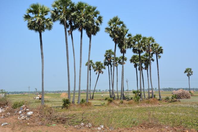
Velankanni to Nagapattinam is a short distance. Nagapattinam to Nagore is shorter still. They in fact are twin towns. From Nagore people go to Karaikal to have their drink. That makes the entire belt from Velankanni to Karaikal one single continuous stretch of coast, closely interlinked.

Velankanni has Christian miracles, Nagore has Islamic miracles and in-between there are plenty of Hindu miracles. No miracle worked when thousands of people died in the 2004 Tsunami. Probably the only real miracle in the area is the difference in the prices of liquor. Just cross the bridge from Nagore into Karaikal and it is reduced by almost 50%. Thank the French for this miracle. We will look at this ‘French Connection’ a little later.

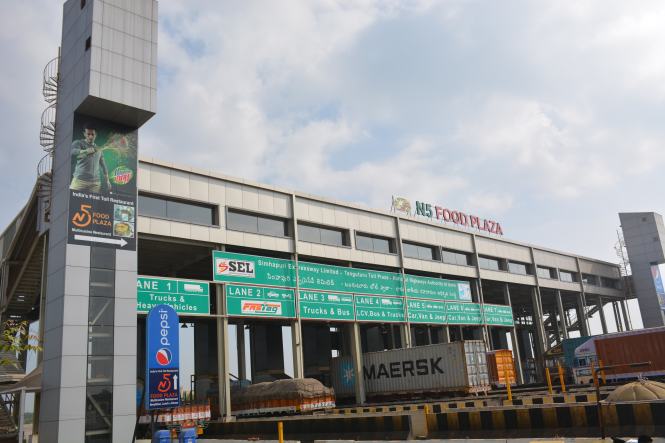
The port town of Nagapattinam was badly affected by the Tsunami. It is trying to get back to its earlier position. It is quite interesting to note that if a port loses its pre-eminence another one quickly jumps in and takes the place. Velankanni was a great port before Nagapattinam gained importance and so one.

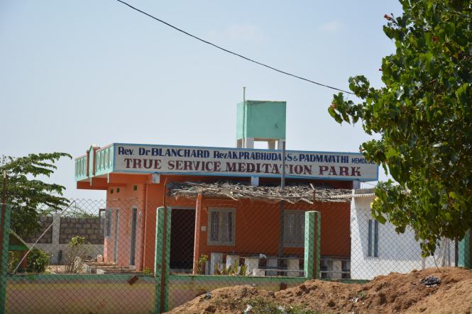
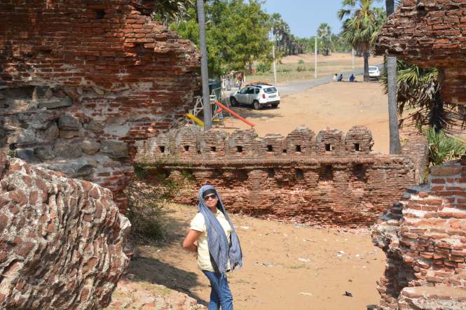
Nagapattinam looks like a shrunk town. Something which was important once but no longer. The Tamil Nadu Hotel, the government run property is no longer functional. We drive up north and find a reasonable place to stay between Nagapattinam and Nagore. The seaside is separated from the town by a railway line which runs close to the sea and runs into the port.

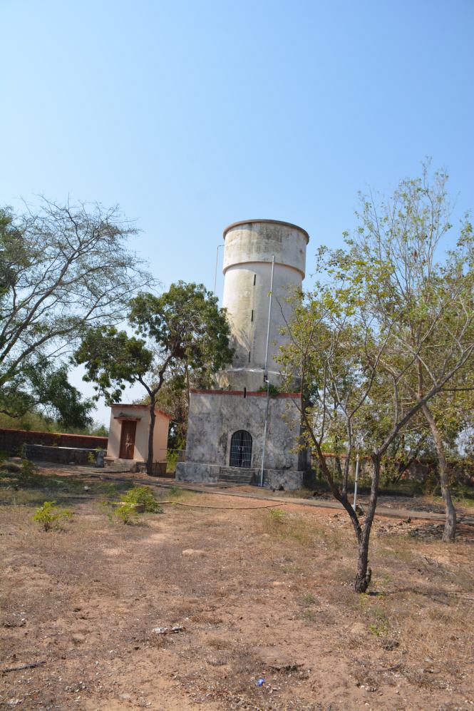
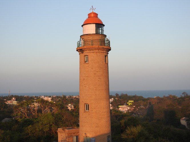
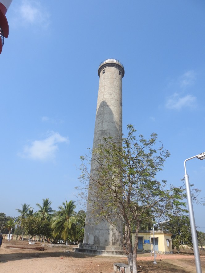
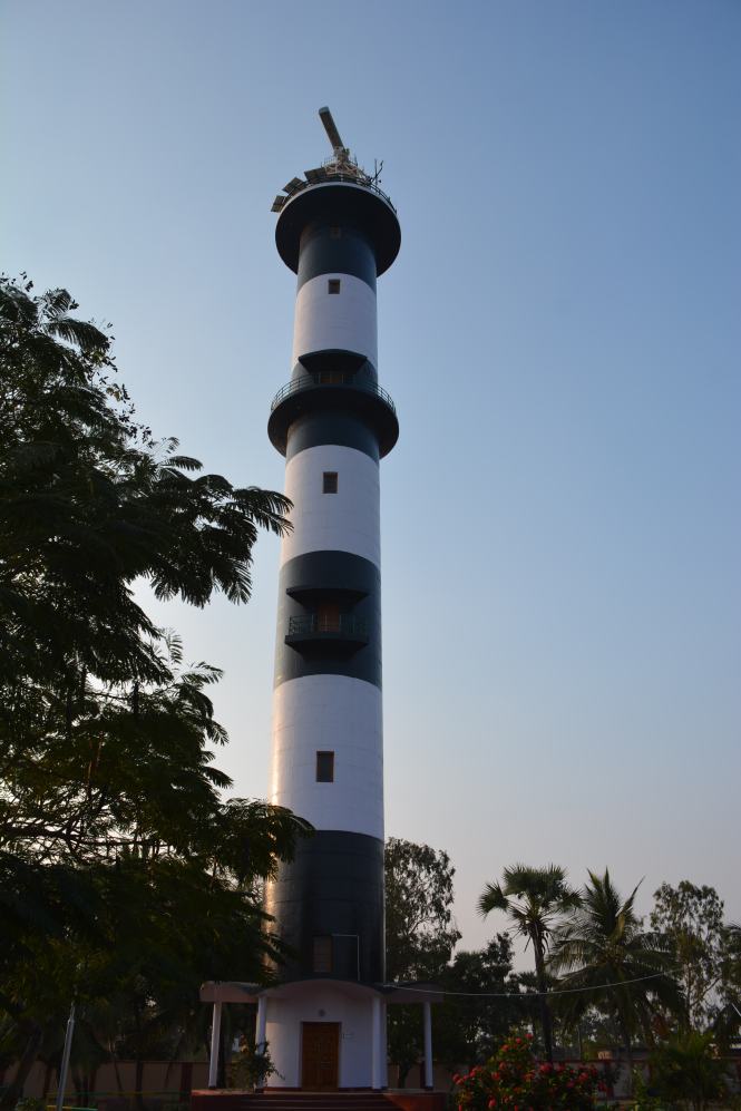
There is a Lighthouse at Nagapattinam which perhaps was very important once when the trade was brisk.

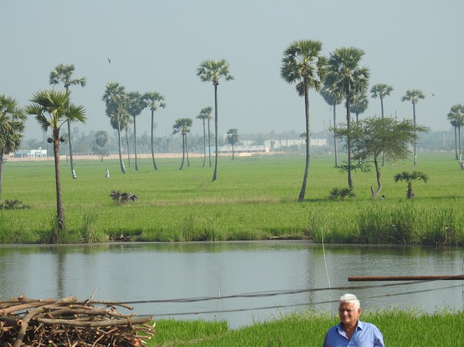
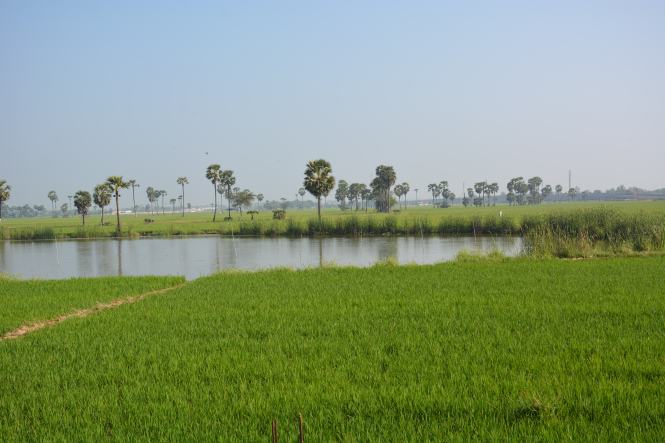
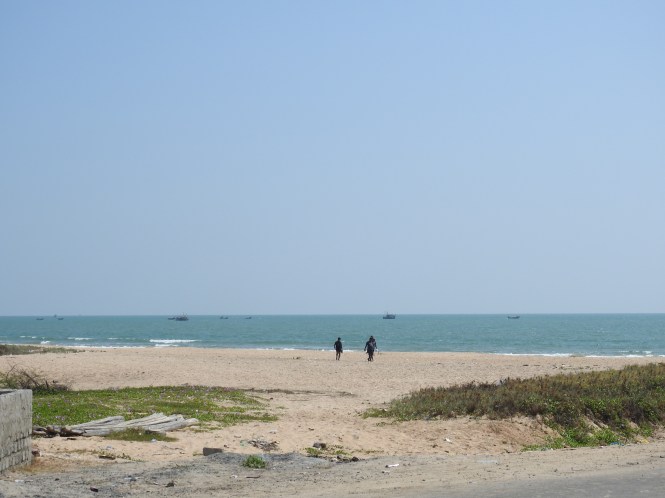
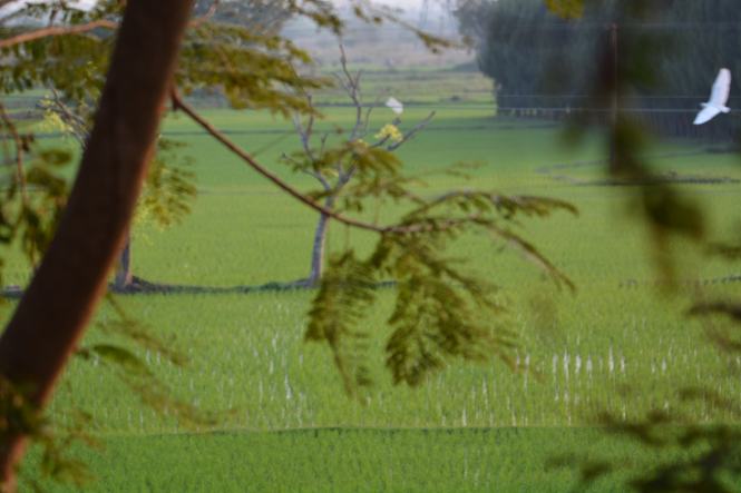
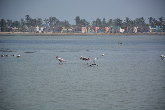
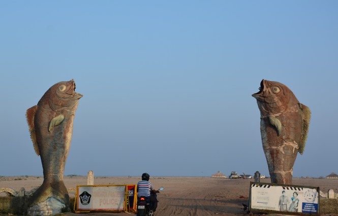
The beach is somewhere between Nagapattinam and Nagore. They charge you Rs. 50/- to park a car. The beach is one of the dirtiest I have seen and has more plastic waste accumulated than sand. Otherwise it is a pretty good beach.

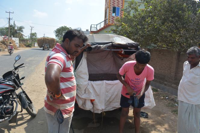
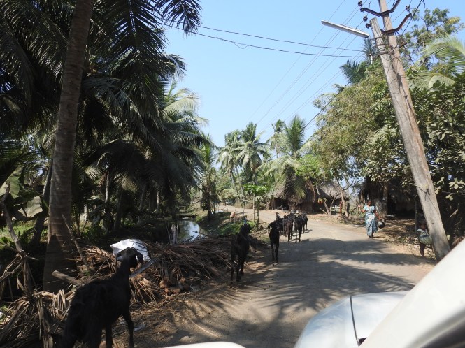
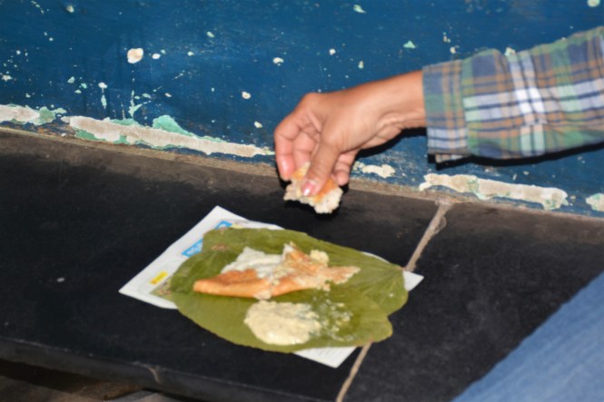
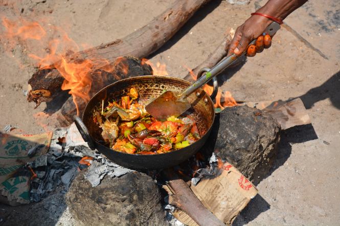
There is not much else to do in the town. We go back from the beach and sleep. Early next day morning we visit the dargah at Nagore. Before that we have breakfast at this roadside eatery somewhere on the Nagapattinam- Nagore road.

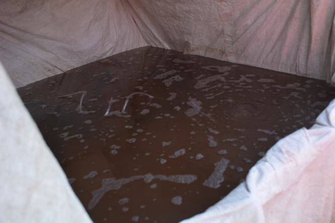
I am making a note of this  eatery as a representative sample of such places all over coastal Tamilnadu and Rayalseema in Andhra Pradesh where this ‘tiffin’ cuisine is served. Probably the dough/batter is made at home by one of the elderly ladies and that makes it different. It is probably the tastiest and safest food in the world at the price it is sold. Only thing these guys should imporove on is the cleanliness. That would not cost them a great deal to affect the prices.

Our post-breakfast encounter is with a Dargah and I wish I should have had a heavier breakfast of eggs and meat to face the onslaught of this place on my senses.

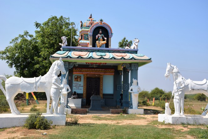
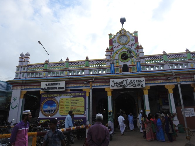
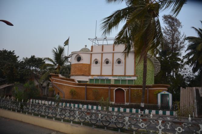
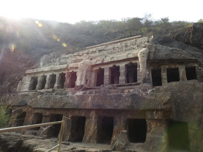
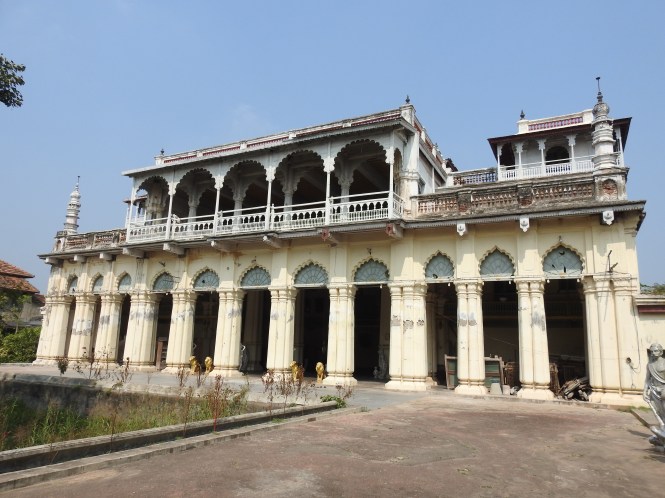
The Dargah at Nagore is a miracle by itself.  It is said that Saint whose resting place this is performed numerous miracles during his lifetime and continues to help people with miracles even now. The principal set of miracles performed here at this time is blessing childless women with child/children.  In effect Nagore Dargah is India’s biggest Infertility Clinic.

DSCN1862

The Saint who came from the North blessed many a women with children. Among them were Kings. I am quoting here from a book written by a prominent authority on the subject Dr. A S Mohamed Rafee (Nagore Rumi) in his book The Ocean of Miracles: Life of Qadir Wali’,  (Kathavugal, Chennai, 2014).

‘The Queen became very happy over the recovery of the king. She bent down and touched the feet of the saint in gratitude. And she was wise enough to request the saint to bless her for a child’ ,

which the saint promptly did.

The saint seems to have performed this miracle quite often in this area. He was a celibate.  According to the Wikipedia article :

Since Shahul Hamid was a celibate, he is offered a Sehra (head dress), and not the customary flowers as at other dargahs.

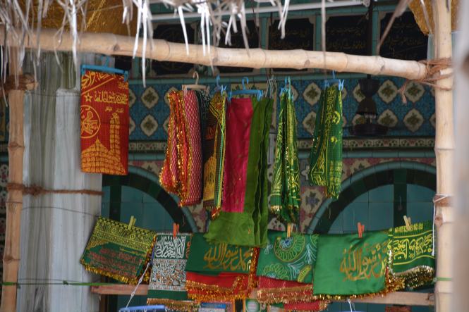
This Sehra is a major source of income for the traders in and around the Dargah compound.

DSC_6903

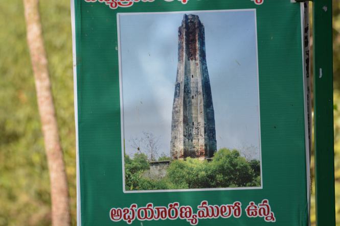
The site of the dargah has 4 minars the tallest of which stands at  40 meters and was financed by a Hindu king. This fact is told to you several times to drive home the ‘secular’ nature of the shrine. You will also be told that majority of the people visiting the Dargah are non-muslims. That , I believe, does not reduce the content of stupidity.

DSCN1865

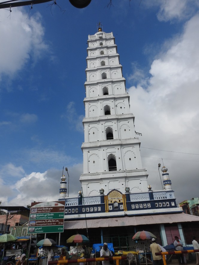
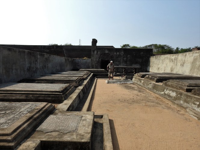
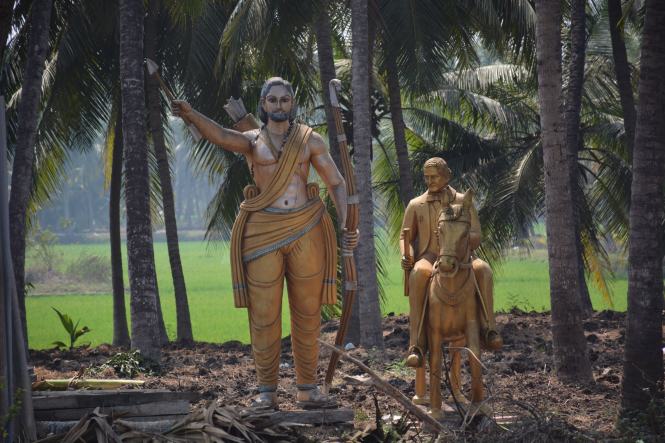
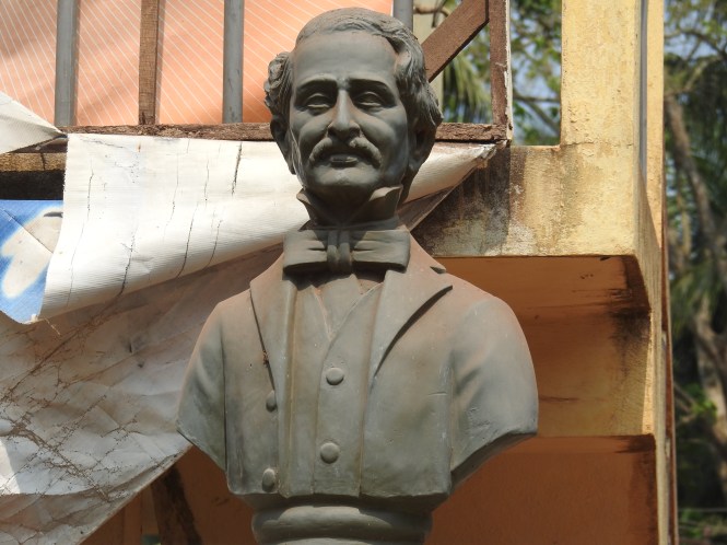
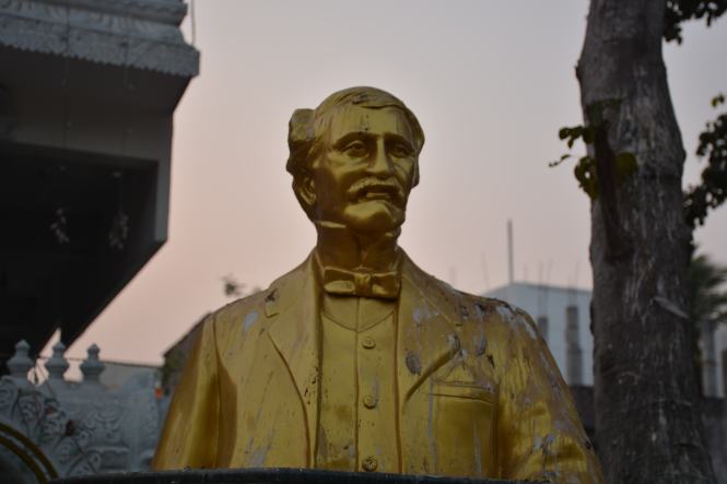
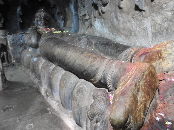
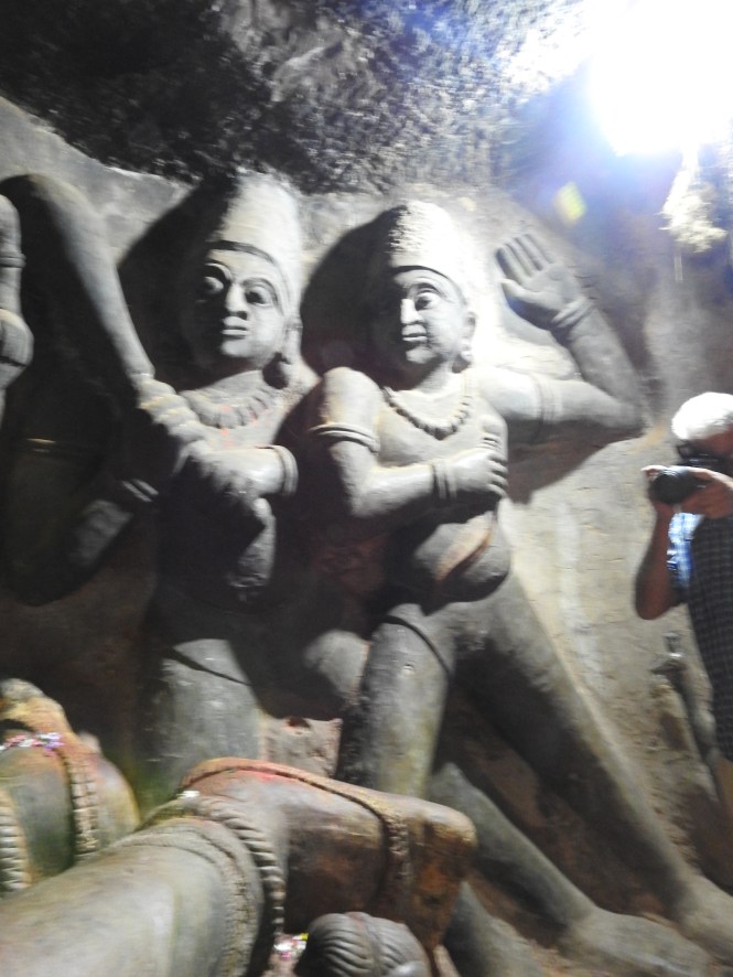
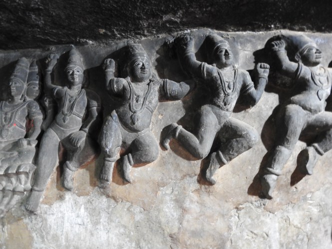
Some external pictures:

Let us have a look at the Holy Man who has been laid to rest here after performing innumerable miracles. he is variously known, according to the authoritative source quoted earlier. Nagore Rumi: (page 5).

  1. Abdul Qadir
  2. Qadir wali
  3. ganja sawai
  4. Ganja Baksh
  5. Nagore Meeran
  6. Meeran Sultan
  7. Shahul Hameed
  8. Nagore Andavar
  9. Nagore Andagai
  10. Baadusha Nayagam
  11. Nagore nayagam.

I am deeply suspicious of a person having more than two names. Only people with criminal records have large number of names.

Giving the benefit of doubt to this guy as the names were  given by others and not by himself as he was busy blessing queens and commoner women with children.

Let us go back and find out where he belonged to and I will again seek the help of Nagore Rumi. This is for a reason: this book is well-written in faultless English and in legible type and generally well presented as compared to all local Islamic literature in English that I have collected on my journey along India’s coast.

Kabir, the great Saint-poet, according to Nagore Rumi predicted this to Sultan Sikandar Lodhi:

‘In every century a true slave of God will appear. We all know this. This time we will come from the Islamic community and he will be born in the lineage of Prophet Muhammad. he will be born in Ajodhya , which was the ancient home of the Men of God India. many miracles will continue to happen around the baby to be born. he will be one of India’s greatest Saints. He will show the right path to those who go astray. Even after his physical disappearance, his shrine will be the last sanctum of those who aspire for knowledge’.

I know Kabir well. I can guarantee you Kabir never said this. Kabir was a wise man, not a commercial advertisement writer. And even if Kabir said this, he was totally wrong. His shrine is not ‘sanctum of those who aspire for knowledge’, it os the sanctum of those who aspire for children and wealth.

In any case there is no denying that this man was born, in the year 1504 AD to, according to Nagore Rumi to a couple described as:

Syed Hasan Guddus came in the 22nd generation of Prophet Mohammad …………….he married a woman named Fatima, the daughter of Hamiduddin who also came in the lineage of Prophet Mohammad’

This makes this saint all the more venerable.

Here is an important extract of the Wikipedia article about the administration of this dargah. This will give some indication about the financial importance of this shrine.

There is a hereditary Khalifa, from among the descendants of saint Yusuf. He performs all the religious duties of the dargah. A central parliamentary committee deputed to verify the implementation of the Wakf Act of 1995 was informed in 2008 that the Nagore Dargah was not administered as per the provisions of the Act. The committee found that it is against the spirit of the provisions of the Act as the dargah is a surveyed and notified body under the Tamil Nadu Wakf board. The administration and maintenance of the dargah was henceforth governed by a committee which operates under a scheme decreed by the Madras High Court.[24][33][34]

Now who are these ‘hereditary khalifa(s)? when the saint was celibate.  Again I am seeking help from Nagore Rumi. He throws a lot of light on this. The saint appointed an heir from a noble family from Lahore. Nooruddin ( a descendent of Hazrat Abu Bakr) and his wife Zohra (who was a descendent of Hazrat Husain ) were childless. The Saint agreed to bless the couple with children under the condition that the eldest one will be adopted by the Saint and will be his Heir. The couple agreed. The son was duly born and was named Syed Mohamad Yusuf. The descendents of Yusuf are now sitting on this treasure trove.

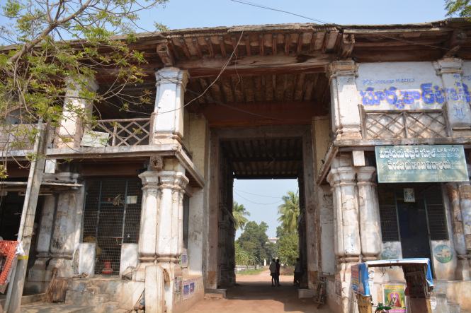
In the picture below you see a man keenly watching you. He is the one who will persuade you to go inside the Dargah even if you don’t want to:

DSC_6891

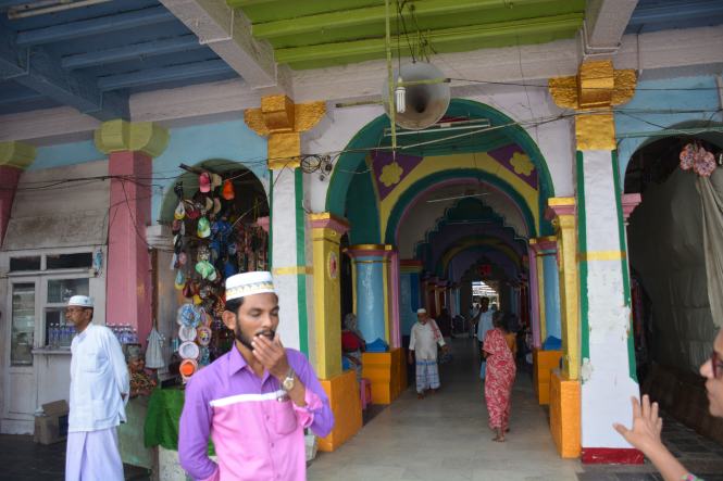
Once you are inside you will be subjected to various rituals -plenty of them and at each stage you will be asked ( virtually forced) to donate money for ‘feeding the poor’. They don’t ask in hundreds, they want the money in thousands. For each and everything there is a demand for money. It is shop, most certainly not a dargah.

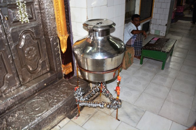
If you want to make a wish, you put in a lock here and put the key in the container.

DSC_6893

Here is a Coconut hanging which has a curious shape.I don’t know if this is a miracle attributed to the saint. I believe there is no mention of Coconuts in the Holy Koran.

DSCN1875

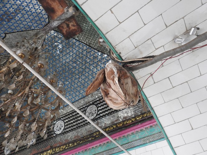
There are superstitious beliefs all over this country. There are superstition-supporting institutions in all major religions and they are making brisk business.  The USP of this shrine like many others in the country is that the saint helps you to beget children.

One interesting aside of this Dargah is that it has ‘branches’ in  Singapore and Malaysia. May I remind you that this place is a Dargah-the place where the Saint has his grave. This must be a rare instance of a grave having ‘branches’ like the banks have.

‘XXXXXXXXXXXX

KARAIKAL

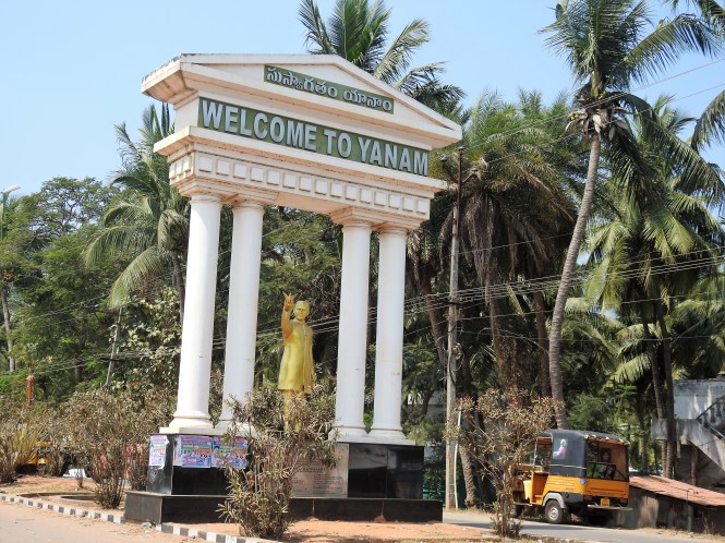
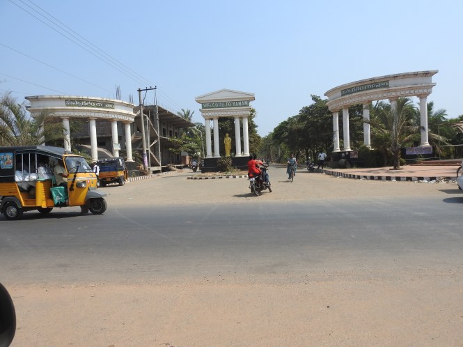
The French were given a drubbing by the English in their quest for the colonial possessions in India. They were badly defeated but still managed to cling on to small pockets on India’s shores. Very complex geographically, the four French ‘territories’ are located inside three different Indian states. Mahe in Kerala, as I have highlighted in an earlier post is practically a pub for the surrounding areas of Kerala which has imposed severe restrictions on alcohol. Karaikal is a very convenient drinking spot for the area I am talking about in this post. Pondicherry has some size and landmass and Yanam in Andhra Pradesh does not have any identity to separate it from the surrounding Telugu culture. Overall there is no distinction between these small parcels of land – of language or culture or any other factor except the history and even that is not very strong. We made it a point to spend at least one night in each of these ‘pockets’ to get a feel of the place. This Union Territory does not appear to have a reason to continue. The reorganization of the states was done on linguistic basis and if this criterion is applied to this Union Territory, it should cease to exist promptly.

During the travel which is the subject matter of this Blog I tried to ascertain factors and reasons which justifies the continuance of this fragmented ‘Union Territory’ over three states. I could find only one – Liquor Lobby. May be another one would be the IAS Lobby as these four pieces of land sustain quite a number of senior civil servants enjoying themselves.

I tried very hard to find the French Connection in all four places. Barring Pondicherry which (politically is a bastion of AIADMK which rules in Tamilnadu) has some weak French institutions, there is none. There is no influence on the language, culture, cuisine. At least I could not find any. Perhaps the last 60+ years have wiped out all the influences. The same applies to Daman & Diu. These places are merely drinking joints for the people of Gujarat. They involve an enormous cost to the Taxpayers.

There is another aspect of these territories which is intriguing. The French government considers many of the people in these territories as French citizens. Whenever there is a presidential election in France, these guys travel to the French consulate in Chennai to vote. I will not be surprised if the very same people come back and vote for the members to Indian parliament. Somewhere somehow some people in the Indian bureaucracy (apart from the liquor lobby) are benefitting from this fraud and are keen to continue it.

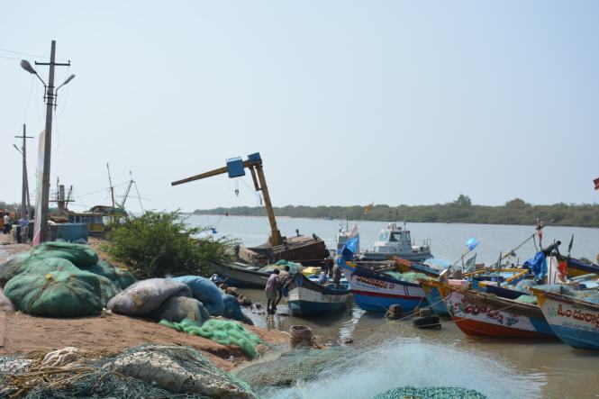
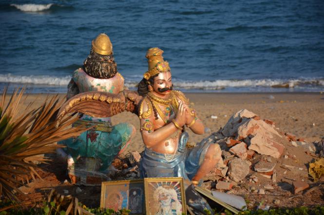
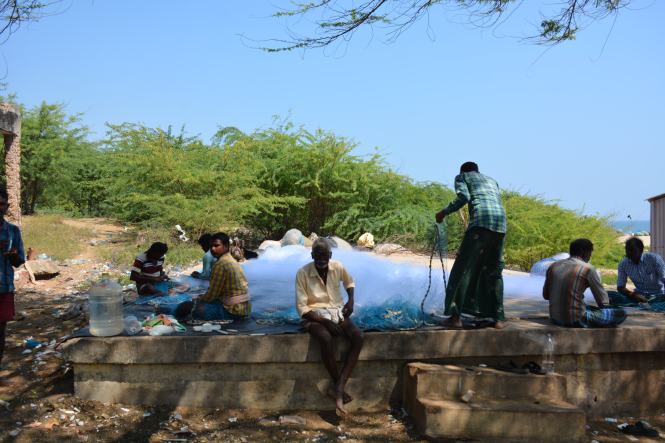
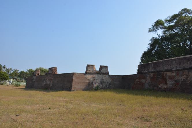
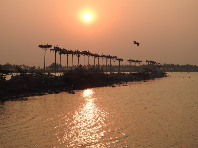
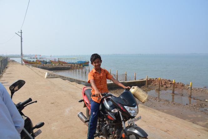
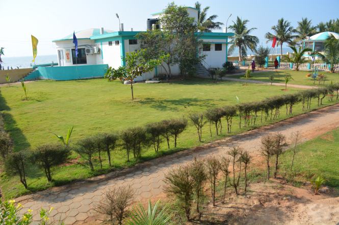
We need to have some photographs, dont we? Probably the only place where we could find some action is the Karaikal Beach and the adjoining harbour. I am ignoring all religious places irrespective of faith as I have developed a nausea for them- they are simply too many. ‘Faith’ is strangulating  the people of this country and nobody has faith in anyone.

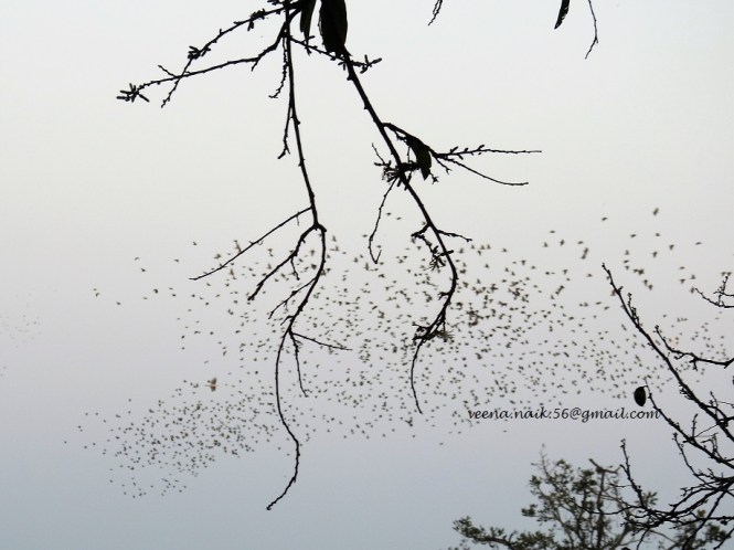
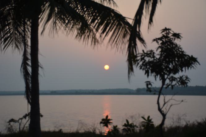
We found a beautiful sunset at the beach.

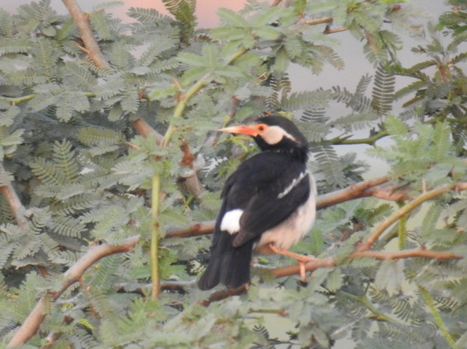
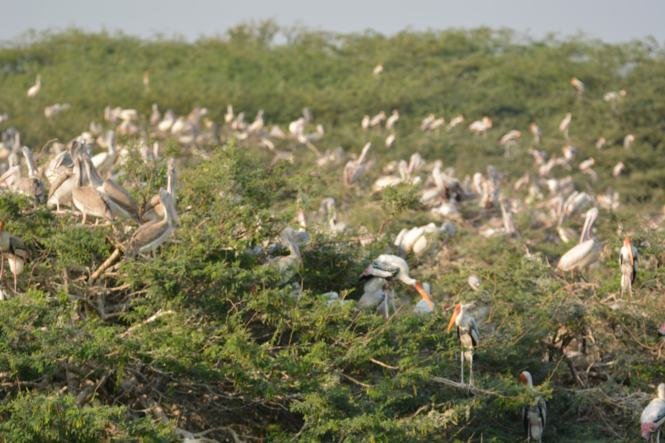
The sunset is accompanied by the music created by a huge flock of Rosy Pastors or Rosy Starlings who migrate from Europe. In this case, I will not be surprised if they have come from France.

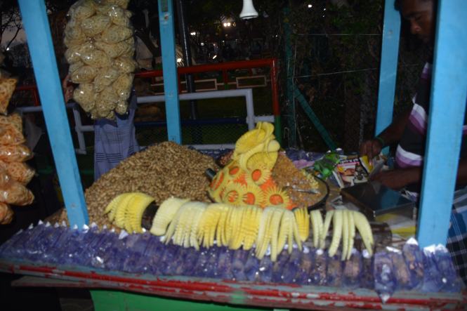
The decoration the vendors make out of vegetables and fruits on this beach is fantastic. ( We could see it bettered much later on Odisha coast).

DSC_6971

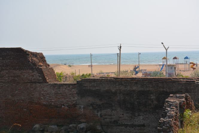
The beach has Lighthouse which we first thought was operational. As the sun set we realized that it was.

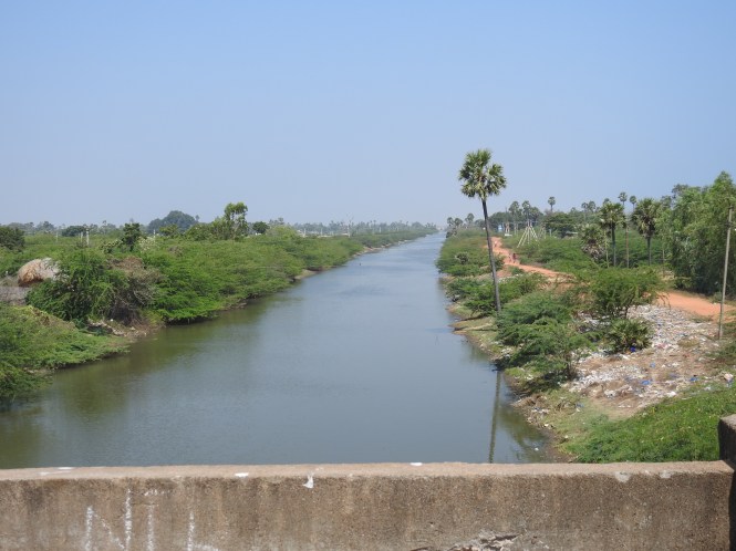
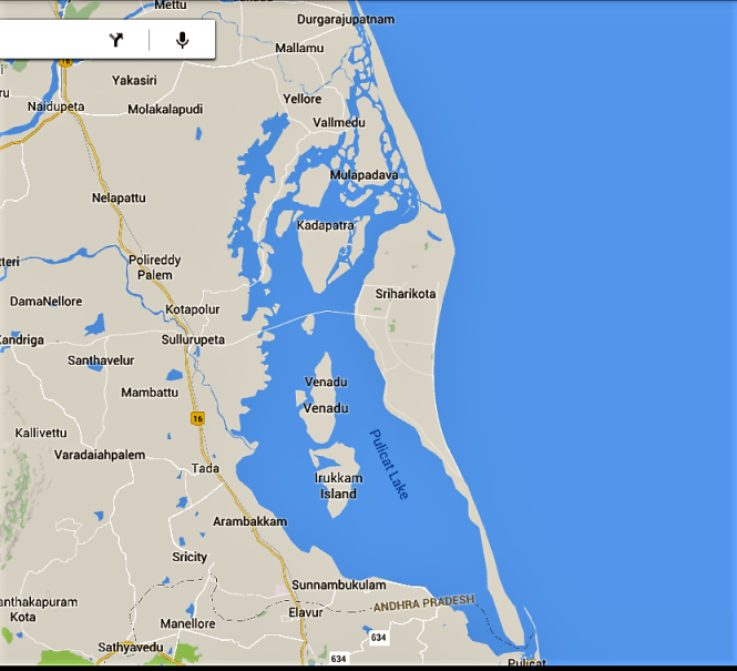
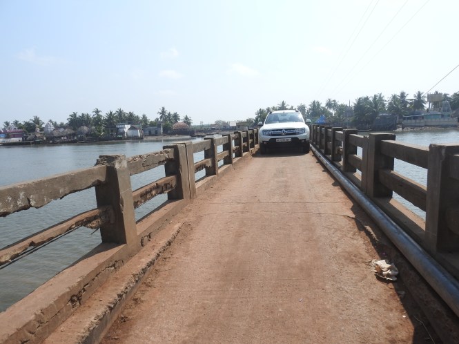
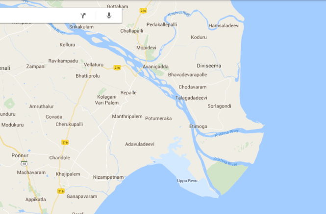
Karaikal is supposed to be separated from Tamilnadu by the river Arasalar. However if you have a look at the Google map of the region you will find a creek with a bridge on it and the dividing line running through it.  If you want to know where the real boundary lies, look for the liquor shops. They are profuse and blatant on the Karaikal side. I am sure nobody buys the stuff on the Tamiulnadu side. One can see the fishing harbour on the Karaikal side and I am just wondering if the other shore is in Tamilnadu or Karaikal.

DSCN1886

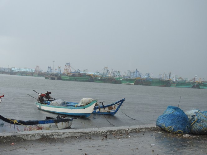
I guess it is Karaikal as the first bridge which is divided by a line on the Google map is a few hundred meters beyond. Anyway this does not matter except in one important aspect- Liquor prices.

Text by Suryakiran Naik

Pictures by Suryakiran Naik & Veena Naik

92.TAMILNADU (7). Pudukkottai, Sarabendrajanpattinam, Point Calimere, Velankanni.

Having done with the short visit to Chettinad region, we get back to our main programme of travel along Indian coast. Obviously, we need to get back to the seashore and for that we drive along the small coastline of two districts- Pudukkottai and Thanjavur. The latter is steeped in history. Most of this history is housed at Thanjavur which is not on the coast. We decide to skip it and stick to what is available on the coast.

DSC_6600

In the village at Arimalam-Keelanilakottai area in Pudukkottai district is an old fort in pretty bad condition. It has split into two, the middle portion being used for constructing a temple. There is not much information available about this fort and its significance. According to the Wikipedia article it was constructed in the 16th or 17th century. It is currently used for painting hoardings indicating that it is not within the control of the Archaeology department.

In between the two parts of the dilapidted fort one can see a colourful temple. Devotional music is played from the temple and is heard everywhere in the vicinity. It appears to be dedicated to God Vishnu.

Our next stop is the small seaside town of Sarabendrajanpattinam. Historically this used to be a part of the kingdom ruled by a Maratha dynasty based at Thanjavur or Tanjore. King Sarfoji II of this dynasty built a monument at this seaside place which is indicative of the way our pre-British rulers bent and knelt to please the British.

DSC_6623

This massive and beautiful monument was built in 1814 to commemorate the British victory over Napoleon!!!

Serfojee Rajah or Raja Serfoji II Bhonsle appear to have owed much to the British who were responsible for his education. Serfojee II was proficient in 4 Indian and 6 European languages including Latin. The 4 Indian languages did not include Marathi, the language of his forefathers.

The king is credited with widespread reforms and support to education and arts.

It has all the trappings of a fort including a moat and considerable money must have been spent to erect it as the construction is of high quality and the entire monument is fully intact 202 years later.

Mallipatnam lighthouse is in the vicinity of the monument and can be viewed from it.

DSC_6656

DSC_6638

The place is popularly known as Manora after the word used for this tower which in turn is derived from the Arabic word ‘Minar’, meaning tower. The king is reported to have started a shipyard at this place but nobody seems to be knowing about it now.

We drive on, on the narrow coastal road but in the beautiful countryside and make a brief stop at a Ayyanar shrine on the way.

DSC_6662

This part of  southern culture appears to be overrun by the Vedic gods and religion. These shrines now have only secondary importance and at many places have mixed up with the Vedic/Puranic deities creating huge confusion.

The icons of Dogs, Horses, snakes etc predominate at such shrines. Particularly visible are the clay horses which are offered to Ayyanar.

XXXXX

We intend to spend the night at Point Calimere which has a wildlife sanctuary. By the time we reach Thopputhurai ,we are tired and decide to stay here and go to Point Calimere early next morning. The distance is only 13 Kms.

Thopputhurai is a very small town and with difficulty we find a clean room to stay. Early next morning we drive to Point Calimere. The gate is closed and will open at 8 and actually opened close to 9. The Forest Departments in many states of India are insensitive to Birding and Birders. Birding is an early morning activity and I suppose they know it. Bureaucratic timings simply do not serve the intended purpose.

Good thing about this place is that one is allowed to drive through the sanctuary. The bad things is there is hardly anything to see here. The migratory birds seems to have returned back to their hometowns because of the excessive heat this year ( 2017). However  we can see some locals.

The sanctuary is also a home to several species of mammals, the most significant of whom is the majestic Blackbuck. It can be viewed very easily here.

The Wild Boar is another species seen.

DSCN1825

And the Mongoose, of course.

DSCN1831

One interesting feature of  this sanctuary is the presence of feral horses. Horses which escaped from some stables in the past have made this place their home and they have adapted well to the environment. I don’t know of any other wild place in the country where horses are found.

DSC_6715

The shallow waters of the small lakes within the sanctuary is home to a variety of shrimp, very pale in colour and people do some manual harvesting.

DSC_6724

A species of wild mushroom was also seen growing in the sanctuary.

DSCN1772

And then there are the lighthouses. This place boasts of three lighthouses, two within and one outside the sanctuary.

A lighthouse was built here by the Chola kings. The sanctuary information board at the gate says that it’s ruins exists within the sanctuary. We did not find them and as there are no guides in this sanctuary, there was no one who could tell us about it. Language is another serious barrier.

The existing lighthouse is a cute little one. It is called Point Calimere Lighthouse.

The one outside the sanctuary but very close by is called Kodikkarai Lighthouse.

DSCN1702

From the Sanctuary we drive straight to our next destination which is Velankanni. We return to Thopputhurai from where we have a choice of two roads. One is the East Coast Road and another one which is smaller but goes closer to the sea. We choose the smaller one with the hope of seeing the countryside.  It is nice to travel and see the ways of the people in the villages. On this stretch of this road we found this plant growing at a few places and we stopped at one to enquire about it. We were told that the small fruit is edible and is used in cooking. So far we have failed to identify its name.

We reach Velankanni for a late lunch. This small town was once a port having trade with ancient Greece and Rome. The port eventually got shifted to Nagapattinam to the north. Velankanni was compensated with the Basilica of Our Lady of Good Health. This is a major Christian shrine in the country and has over 20 million visitors in a year.


The 16th century church became a Basilica in 1962. The Church is credited with many miracles and has a wide following.

You get your wishes fulfilled if you cross a certain distance on your knees.


Velankanni was badly affected by the Indian Ocean Tsunami of 2004 despite the presence of the shrine. A memorial to the victims of the Tsunami has been erected outside the town and is attracting tourists.

DSC_6861


Text by Suryakiran Naik

Photographs by Veena Naik & Suryakiran Naik