64. MOCHEMAD, SHIRODA & REDI

We leave Vengurla for the last leg of our drive through Maharashtra. The end part of the journey through Maharashtra is through a familiar territory. I and my wife were born in Goa, just across the border, Colonial Portuguese subjects. Her parents were born in British India, mine in Portuguese Goa.

There are misconceptions about the region called ‘Konkan’. Generally, peoples’ understanding of Konkan is the coastal region starting somewhere near Ratnagiri. In fact, what starts with Ratnagiri district is the South Konkan which ends where the Canara coast starts. This implies that the Goa coast is a part of Konkan

Officially Konkan is divided in North and South. North Konkan means the districts of Thane (including the present Palghar), and Raigad in Maharashtra. The little place called Bombay or Mumbai is definitely a part of Konkan.

When you reach Ratnagiri, and assuming that you understand Marathi, you will find that your eardrums are being massaged by some strange but pleasing sounds. As you move southwards this noise becomes more perceptible and further down south becomes stranger to Marathi. Further down it becomes a full-fledged language. Welcome you to Konkani. This is not a language, it is a phenomenon, a culture in itself. With the handicap of this being my mother tongue, I am not allowed to praise it too much. Still I can claim that this is one of the most sweet, intelligent, variable, down-to-earth and, more importantly, irreverent of the languages. The four-letter words are common and are spoken with delicate nuances without hurting anyone’s testicles. The almighty God is on par with your bosom buddy as far as addressing Him is concerned. Women are not beyond the purview of profanity.

The problem with the language is the various forms that it assumes depending upon not only the places but also religious groups. The south Konkan version is generally referred to as Malvani, the one spoken in Goa (where it is the official language) has Portuguese influence in vocabulary, the one spoken in north Canara is called ‘Karwari’ (and also sometimes called Kukna) is influenced by Kannada, the Mangalorean Konkani (used primarily by the Mangalorean Christian community) is influenced by Tulu and would be unintelligible to the speakers of Malvani. The Muslims of Bhatkal speak Nawayath, supposed to be another version of Konkani heavily influenced by Arabic. I am sure I have missed out on many more versions. This chain extends up to the Kasaragod district of Kerala and even beyond.

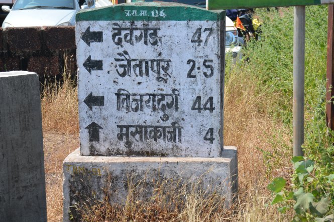
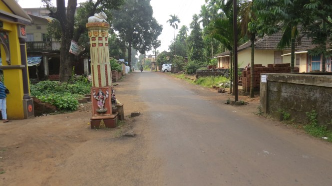
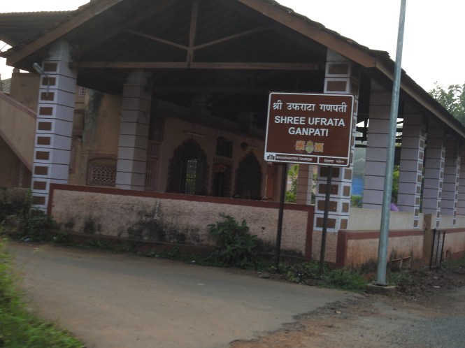
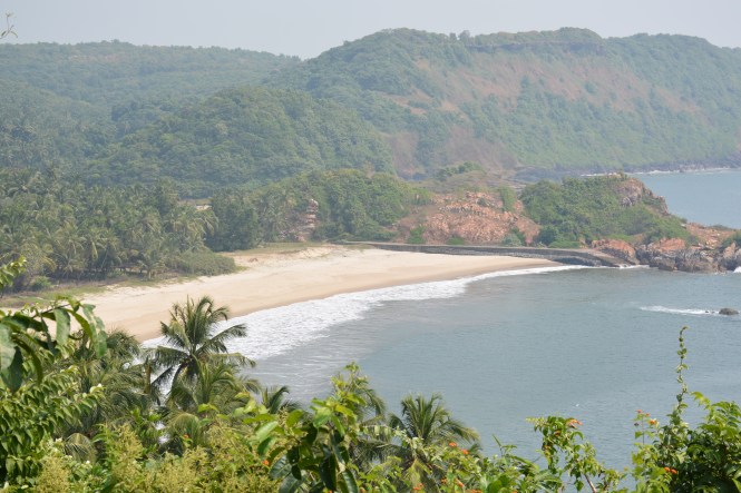
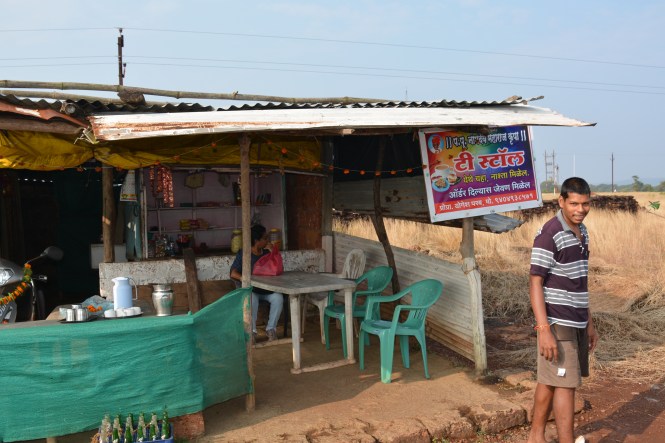
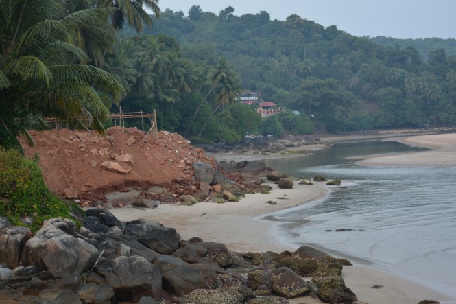
Right now, we are driving out of Vengurla southwards and come across a road sign proclaiming the presence of an ancient civilization called Mochemad on the seaside.

dscn0057

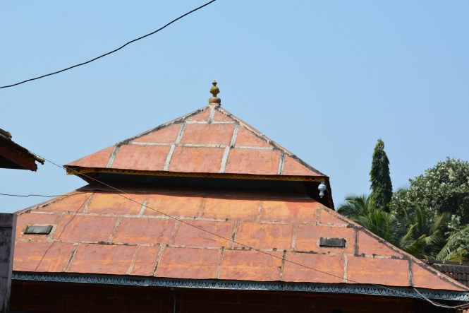
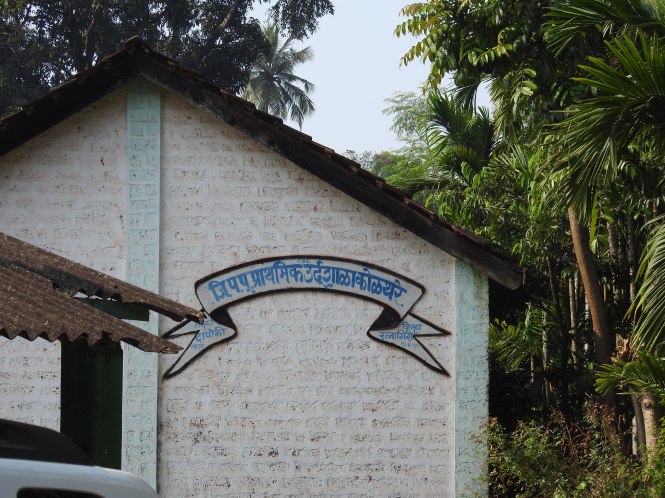
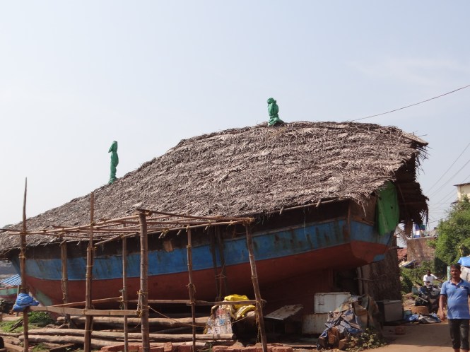
The Sindhudurg district of Maharashtra has a very popular institution called ‘Dashavatari Natak’  a theatre form in Malvani language. The episodes from the Dashavatars, the stories of the ten incarnations of Vishnu are enacted on the stage. This combination of the language and the ancient literature gives birth to a folk theatre with an inimitable charm and unmatched popularity. The most famous practitioners of this art form come from this village- all male including those enacting female characters.

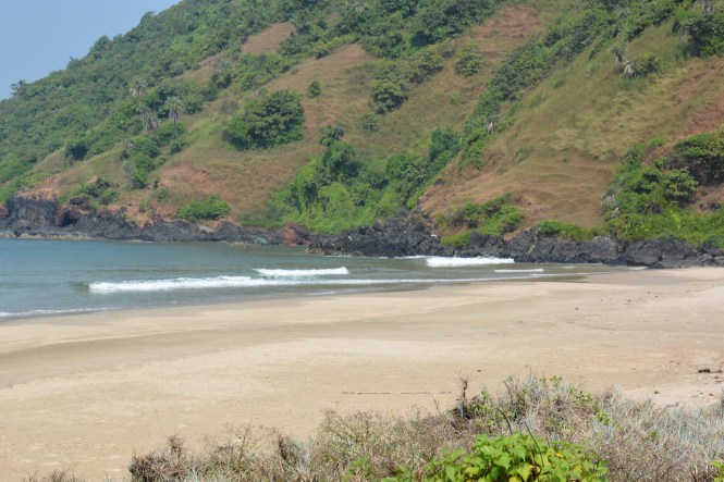
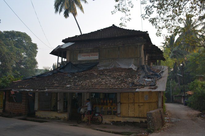
Beautiful place. Unfortunately, the people are not very keen on the theatre form for which they are famous- Mochemadkars. Only two ‘companies’ still survive. Even they have to get the artists from outside the village.

dscn0058

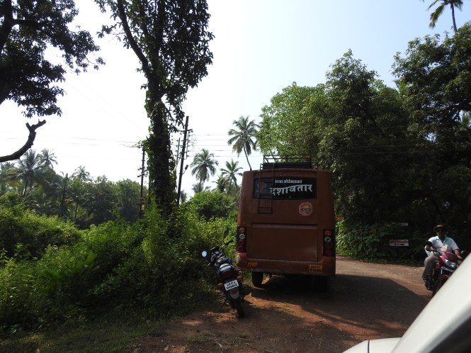
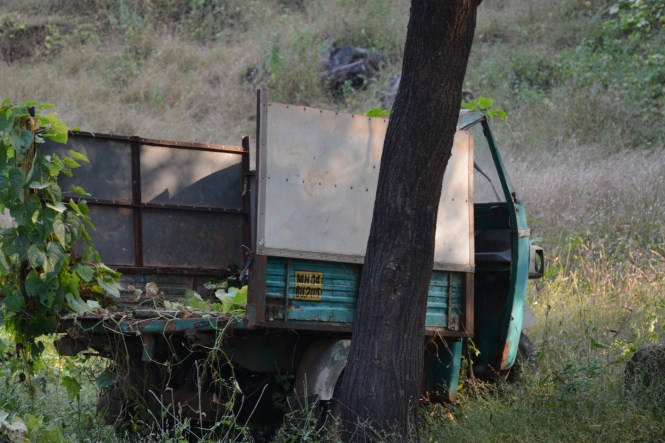
The bus above belongs to ‘Mama Mochemadkar’, the other one is called ‘Naik Mochemadkar’

I speak to a few people. They are considering developing the beach and attracting the tourists like Goa which is not far away. Not many are concerned about the ‘Dashavatari Natak’. This is not a threat to this theatre form. There are other places which are taking care of it. It is the ‘Mochemadkar Dashavataris’ who lend their name to this art, are on the decline.

dsc_5618

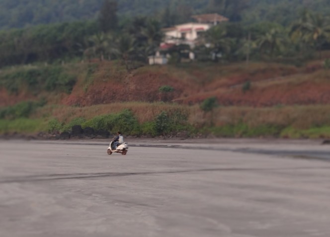
Here the boys are idling on the beach.

dsc_5616
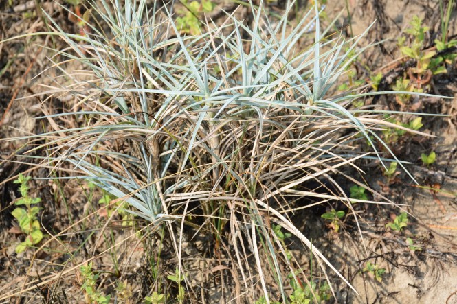
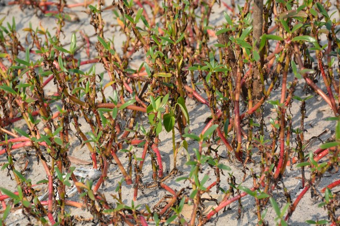
And this is a type of grass growing on the hot sand on the beach.

dsc_5624

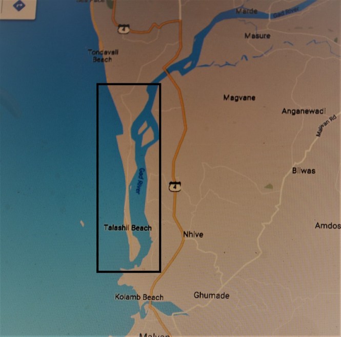
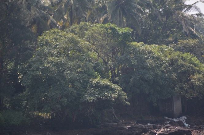
We return to the main road and proceed south towards Shiroda. After a while we cross the Mochemad river and reach Asoli. As you drive on the road which bisects a wetland, what strikes you is a field of million lotus flowers. This is about a square kilometer on either side of the road.

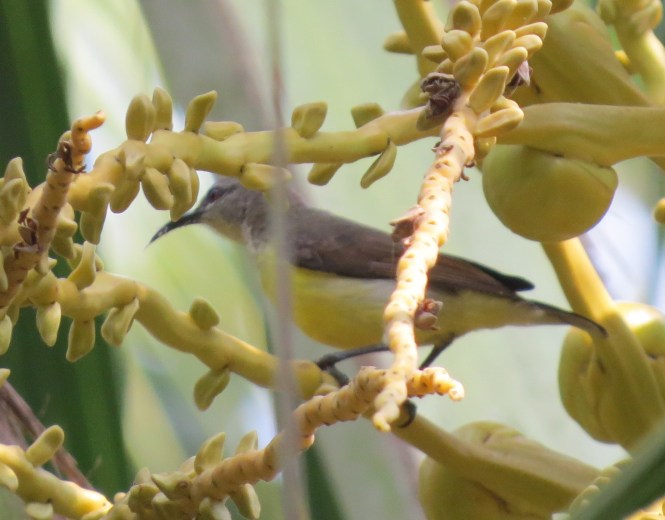
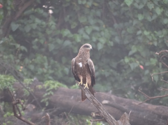
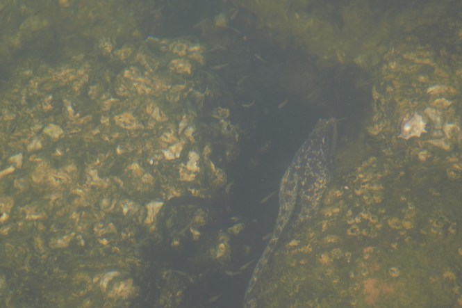
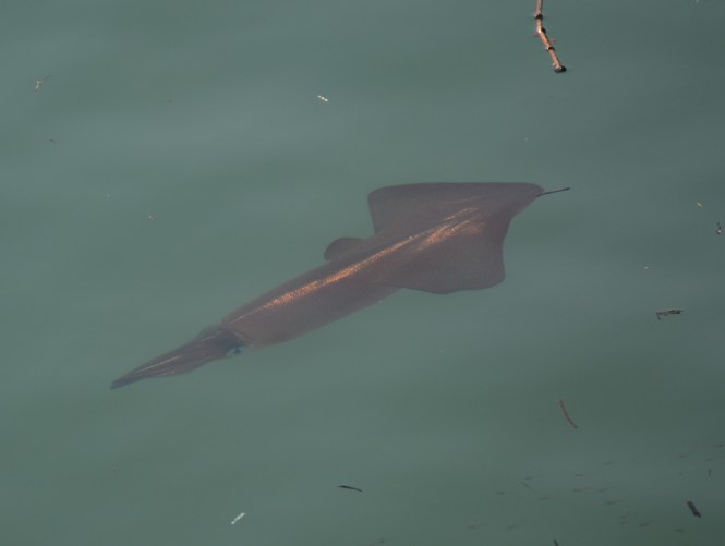
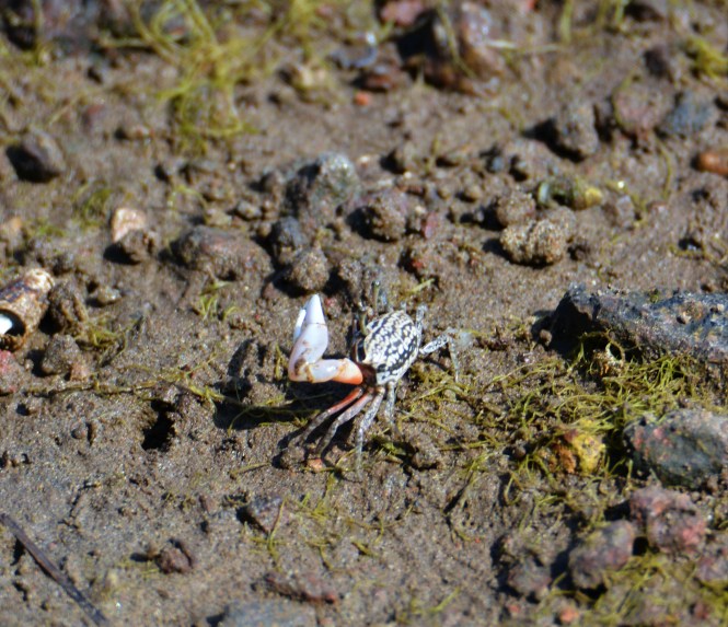
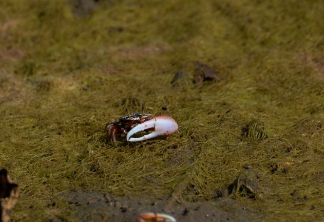
We stop. This wetland should definitely harbour a number of birds. We are proved right.The birdlife is varied in the water as well as the trees. we could see more than a dozen species within a short time.

The above are the Bronze-winged Jacana ( Top left), Golden Oriole (top right), Bronze-winged Jacana (immature, bottom right) and the Munia ( bottom left).

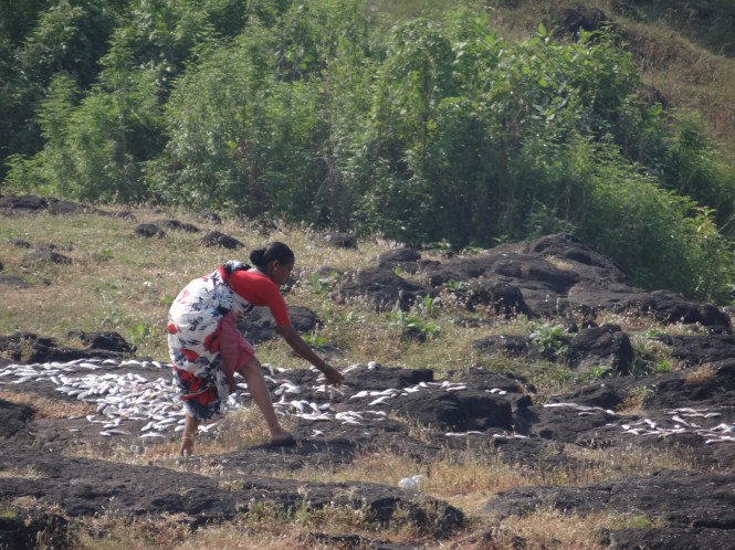
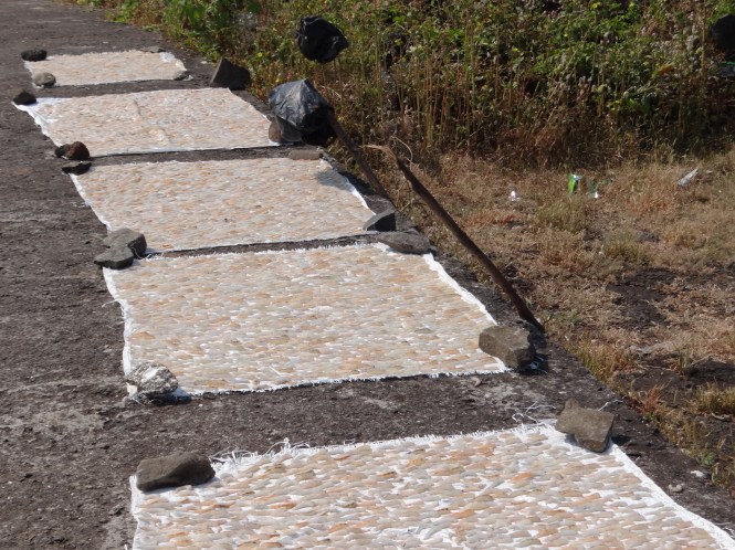
It rained last night and the paddies lying in the fileds got wet. The farmers have to dry them now, in the field and on the roadside.

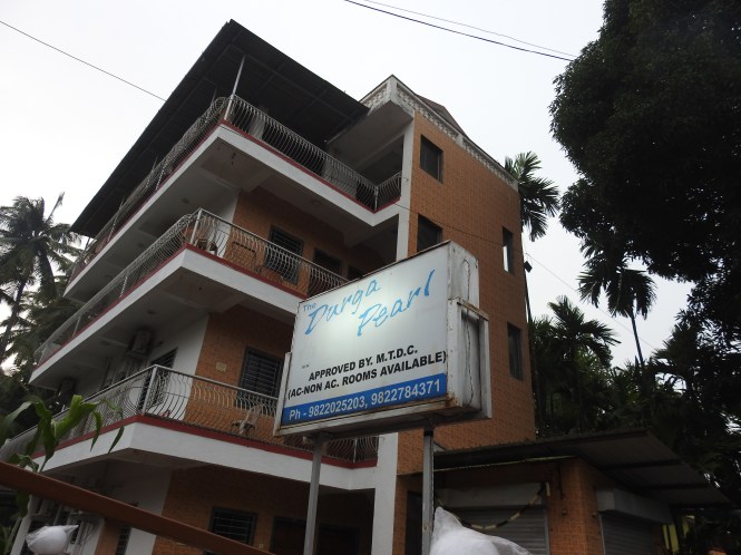
We make a halt at a small hotel called Maiboli, away from the seashore at Shiroda.There are a number of beaches around Shiroda. We intend to visit one or two to-morrow. Right now at Maiboli it is time to look at a riot of butterflies. In front of the hotel is a small bush and you can see at least 6 species of butterflies hovering around in the early afternoon sun, mingling with honeybees.

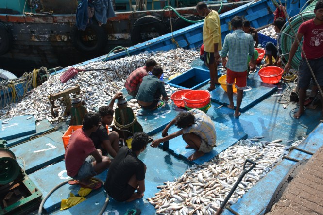
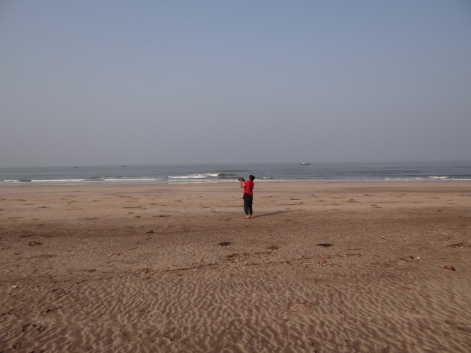
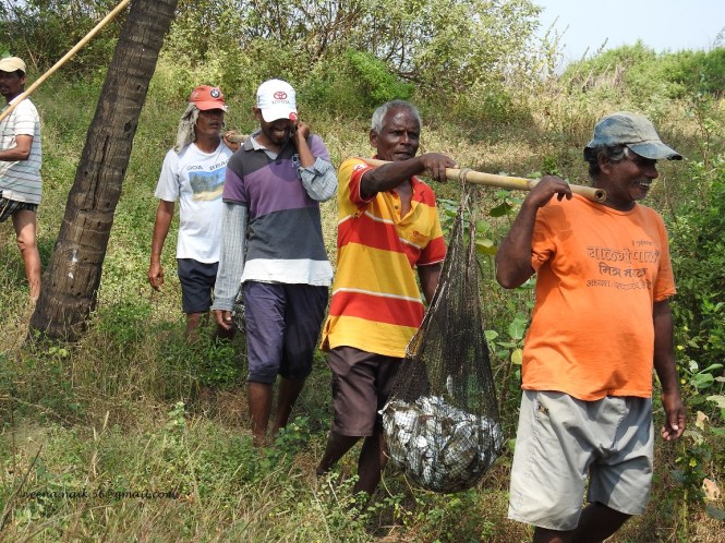
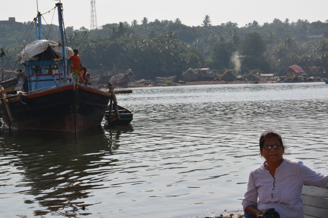
Aravali beach at Shiroda is quite a large beach and here this early morning we witness a commercial activity which was of considerable importance to the coastal region of India before the motorboats began to be used for fishing.

r1

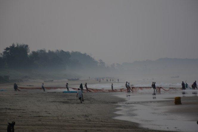
It is called Rampan or Rapan in Maharashtra and Goa. The term applies to this method of fishing and also to the net itself. It is a large size net cast near the seashore manually and pulled back to the shore again manually with the help of wooden poles. It is a laborious affair requiring the engagement of about 25 people at a time.

r3

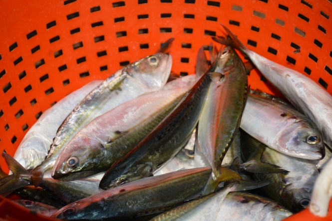
The net is pulled in from two ends bringing to the shore catch of fresh fish.

This process will be clearer if seen in the video. For the first time on this blog we are posting one.

One restaurant in Malvan is named after this net but unlike the Rampan it is fully airconditioned.

dscn9938

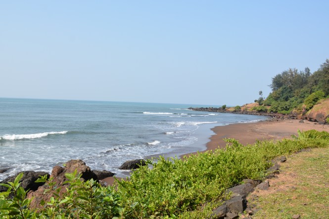
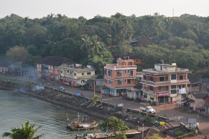
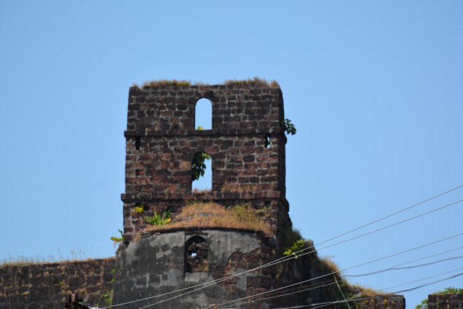
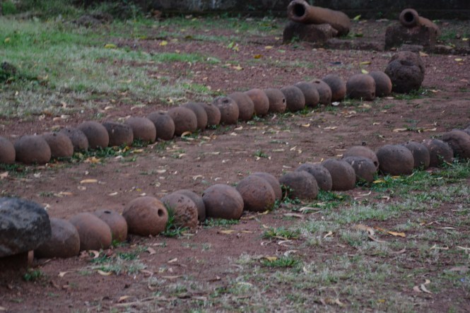
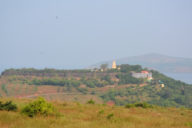
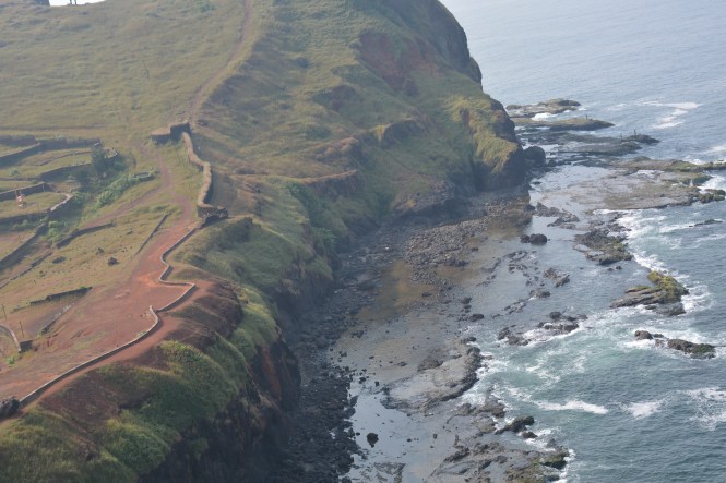
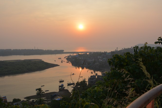
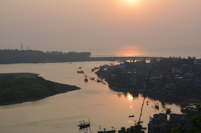
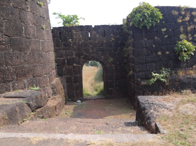
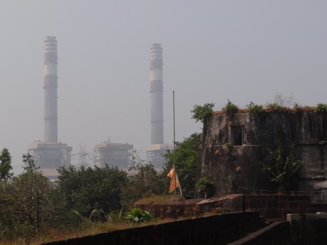
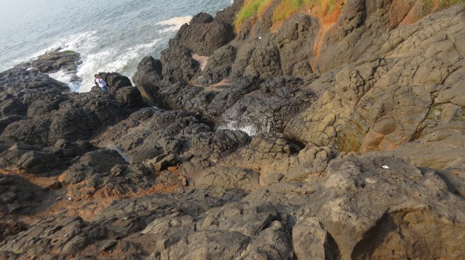
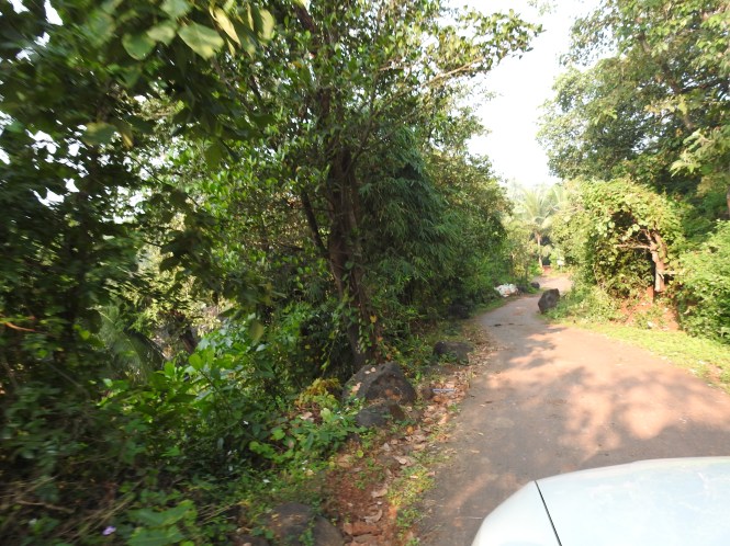
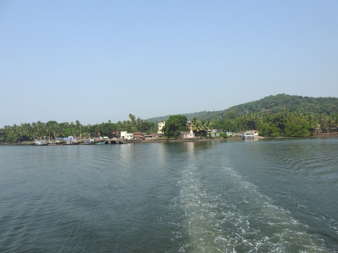
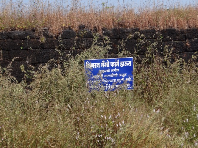
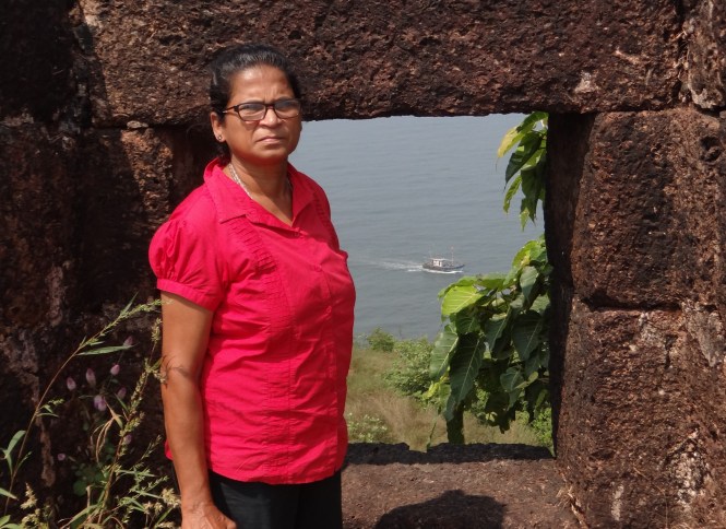
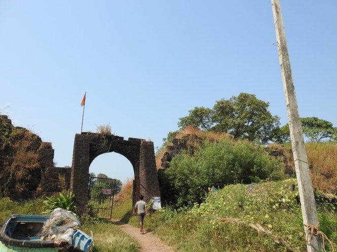
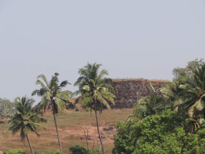
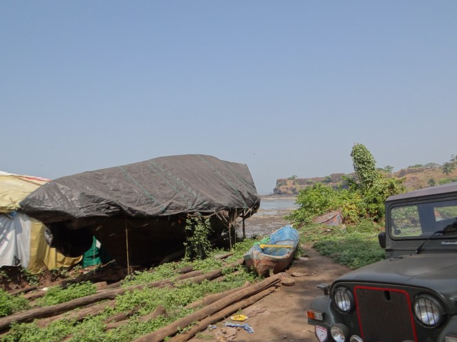
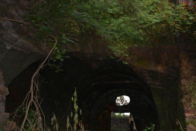
In the process of watching the Rampa, we have forgotten about the beach and it is time for us to move to Redi. This is the last palce we are visiting on Maharashtra coast. Redi has a fort called Yeshwantgad which is a sea fort.

We try to enter the fort throgh two different gates but fail to make much headway. There is nothing like maintenance here.

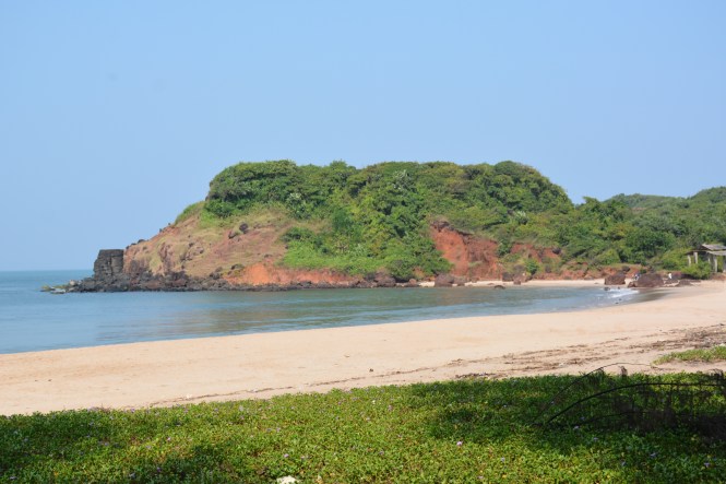
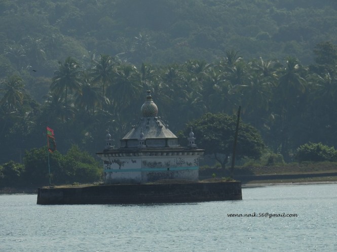
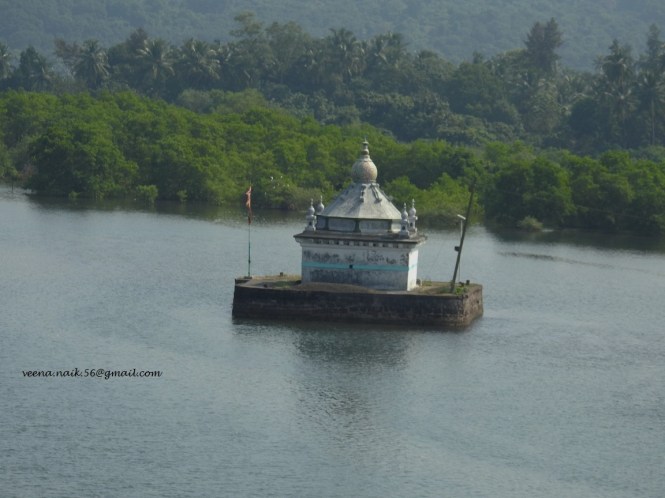
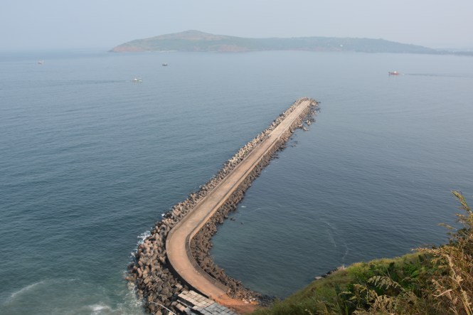
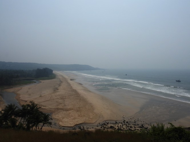
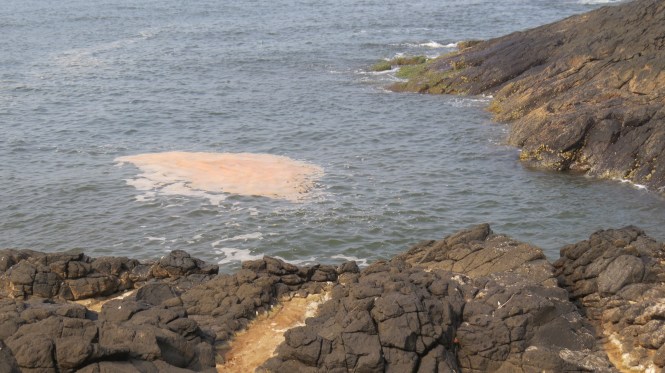
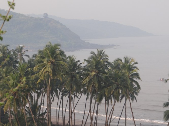
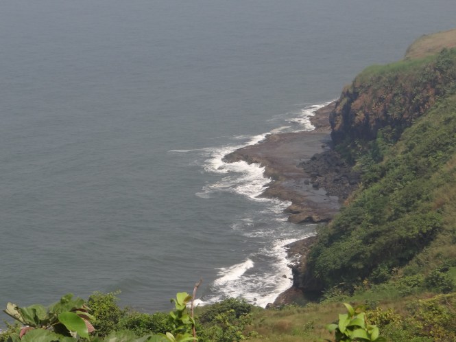
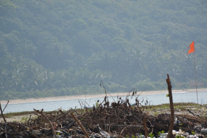
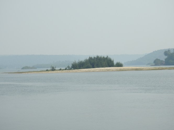
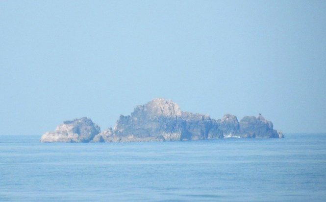
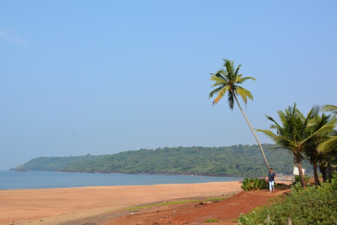
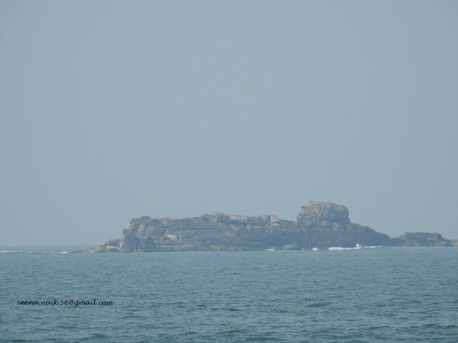
The beach nearby looks pretty. What you can see in the middle is a small islet called Ghangal. You can walk up there at low tide.

dsc_5934

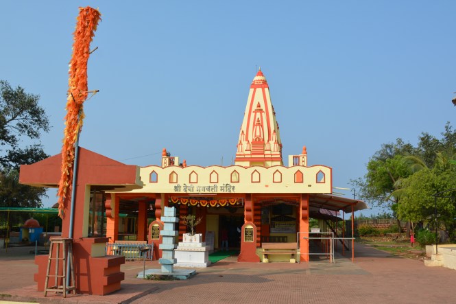
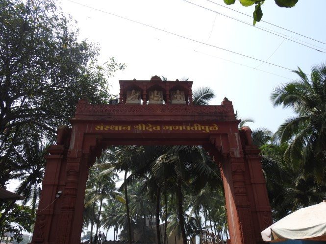
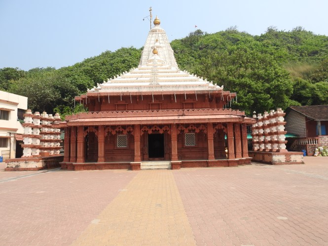
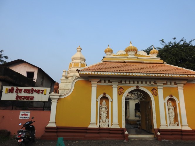
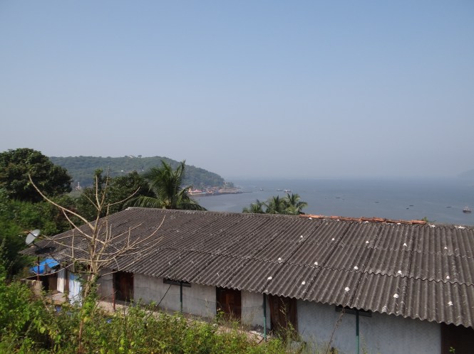
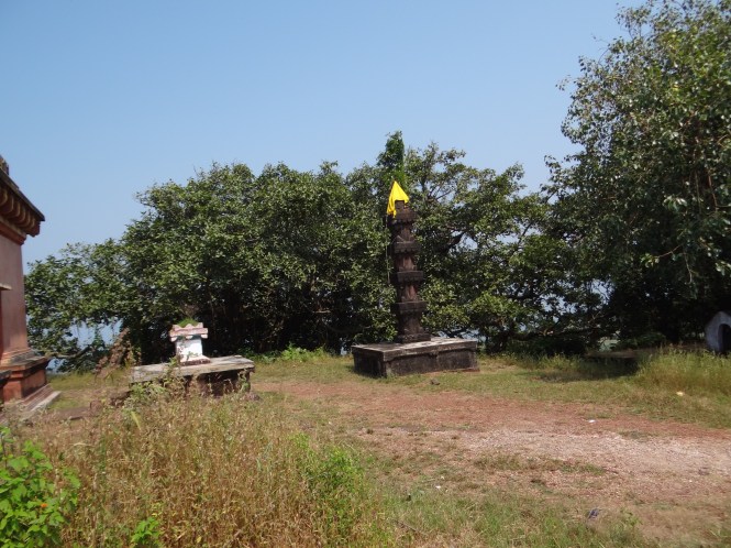
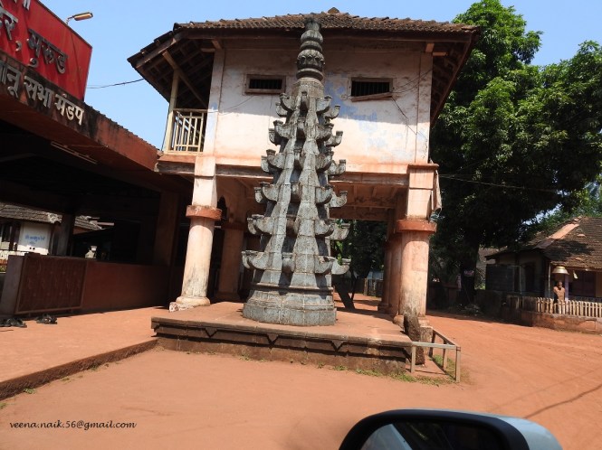
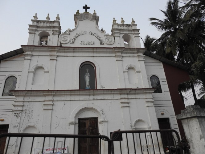
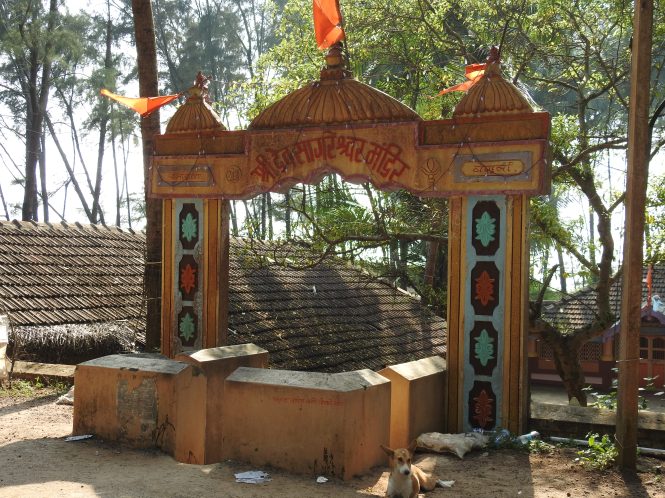
Redi is port, a minor one and the southernmost in Maharashtra. The activity centres around transportation of mineral ores.  Redi has a number of temples.

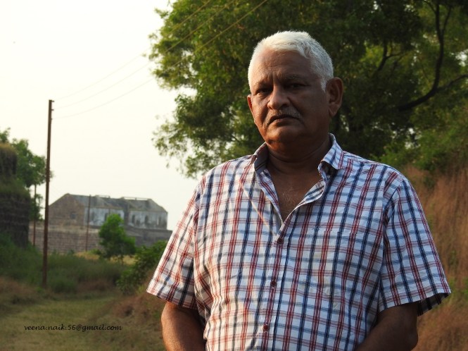
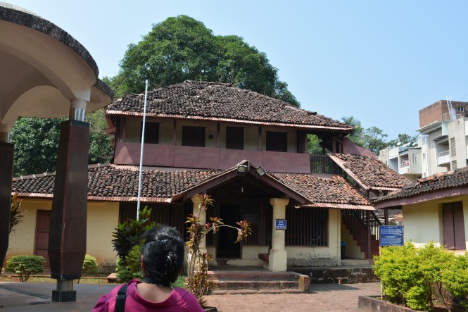
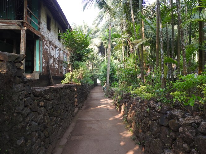
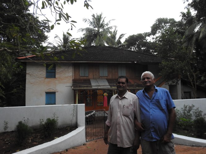
The vilage perhaps nearest to Goa across the creek is called Kanyale. We drop the visit as it is getting dark. The last visit of the day is made to the ancestral home of my late Father-In-law. Here it is. I am with his nephew.

dscn0238

With this we complete the Blue Drive in the state of Maharashtra. So far we have driven a coastline of 2300Kms in the states of Gujarat and Maharashtra. This is roughly one third of the total coastline of the country. We have driven 8390 Kms excluding the 1200 Kms journey to the starting point.

Text by Suryakiran Naik

Photographs by Suryakiran & Veena Naik

63. TARKARLI, DEVBAG, NIVATI,KELUS & VENGURLA.

Malvan beach spills over southwards and has many things to offer. A long sandy beach, water sports facilities of various types including scuba diving, boating, and a large number of establishments offering accommodation of all types. In short, the stretch from Malvan to Devbag with Tarkarli beach on the way is an activity place. This explains the large number of visitors.

Tarkarli means (river) crossing of Karli. Karli river flowing from the east towards the sea takes a southward turn and flows close to the sea for about 6 Kms forming a narrow  peninsula.

map

This natural phenomena is quite interesting. You get to see a narrow strip of land with a river on one side and the sea on the other. At some places the river  narrows down allowing the people on the mainland to see the peninsula and the sea together.

dsc_5488

And to add to the beauty of the whole thing is the presence of the islands in the river as well as in the sea. This one is in the river and you can see it on the google map.

dscn9967

And this one is in the sea.

island

We are told that there is an island formed in the sea by the action of the last Tsunami. The boat owners are making brisk business out of the people curious to see  island formed by the action of the Tsunami.However, someone has put up a signboard proclaiming that this is not true.The island is natural and has nothing to do with Tsunami. The message also advises people not to drink, wear proper clothes and otherwise lead a virtuous life. Whoever has put this up here on the beach must be extremely optimistic about the human race.

dsc_5480

We skip the boat ride to the so-called Tsunami island and walk up to the end of the peninsula.

This plant manages to grow in the salty sand and  hot sun on the beach.

dsc_5481

Devbag as also the entire peninsula is populated mainly by fishermen, Hindus and Christians. Devbag has church and an attached school.

c

It is time to leave this great place and move ahead. Our next station is Bhogwe and/or Nivati. These places are very close from the Devbag tip of the peninsula but that is where the river meets the sea. We need to get back to the main road across the Karli river creek over this bridge. It is a beautiful sight.

We have to return to the main road at Chipi, pass Parule and get back to the sea. We decide to skip Bhogwe and go for Nivti which is also a beach but with a fort thrown in.

The fort is a cluster of stone mounds. The late rains have kept the shrubs green and restricted the movement of people. Anyone will dismiss this as a place not worth a visit. History tells us otherwise. Built in the early 18th Century by the rulers of Sawantwadi, this fort was captured by Portuguese in 1748 for which they engaged the services of mercenary called Islam Khan. It is said that the Portuguese Viceroy actually resided here for some time.

The scene of the beach below is beautiful. It is a small but pretty beach but does not seem to be much in use because of the difficulty in access.

dsc_5521

dsc_5518

The whole cluster of villages are engaged in cultivation of the betelnuts and coconuts and toa lesser extent mangoes. The nice little village houses with tiled roofs nestled  by the side of the small hills near the sea make them look so romantic.

dscn9983

Here are the betelnuts (supari) being dried for the market.

dscn9984

Return and join the main road at Parule a busy town with a famous temple.

dscn9985

After Parule is Mhapan. Here we stop for some snacks and tea at this roadside place. Vada-Pav & tea.

dsc_5591

Before we reach Vengurla we make a brief stop at Kelus beach. Another nice beach, unspoilt, unexploited.

dsc_5600

The approach to Vengurla from the north is from a steep hill and from here one can see the Lighthouse as well as a large part  of the town.

In the 17th Century the Dutch established a warehouse or a trading post at Vengurla. It is Dutch Factory or Dutch Vakhar. This historical monument still exists and is under the state archaeology department.

Three years ago a Mumbai-based newspaper highlited its dilapdiated condition and the need to preserve the place. Three years down the line there is no change in the status. If it all it has deteriorated further.

http://www.dnaindia.com/mumbai/report-monumental-neglect-protected-dutch-factory-on-the-verge-of-a-collapse-1845565

The ‘department’ had done precious little. Even the warning board asking isitors not to enter is in bad condition.

dsc_5545

This was once a happening place. History has recorded  Queen of Golconda visiting here with 4000 people in tow as also the place being used as a supply base for the Dutch to support their expedition against the Portuguese in Goa.

It is a pity to see it in this condition.

dsc_5544

dsc_5556

dsc_5554

dsc_5547

Vengurla port is about a kilimeter ahead and has a small chapel, the origins of which I couldnot verify. Could be connected to the Dutch.

dscn9997

This is not maintained as compared to the Roman catholic church in the town.

dscn0006

There are numerous temples around the town.

dscn9988

The place where everyone converges in the evening is the Vengurla Bandar which is a rocky outcrop into the sea and has the Customs offices.It is the sunset point that you oftern see in the pictures of Vengurla. Among the activities people indulge in is angling. Dont think that there is no fish available in the market or that these people dont have thje money to buy it.

dsc_5568

Vengurla has a fairly long beach with some upmarket resorts. With Goa close by, the tourism industry is on the move. This is evidenced by the fact that someone is trying to  reclaim the Arabian Sea for building a hotel.

dsc_5582

Text by Suryakiran Naik

Pictures by Suryakiran Naik& Veena Naik

62. VAYANGINI, TALASHIL, MALVAN

After Achara we drive towards Malvan, the next sizable town. Achara has a long seaface extending up to Talashil and beyond. However, there are no proper roads connecting the sea. The nearest road is close to a kilometre and is called Malvan-Achara road.

We try to reach a beach called Tondavali and drive towards it. There is no access by car. One has to walk down the small cliff to reach the sea which is in continuity with the Achara beach.

Whilst we look for ways and means to reach the main road, we come across this phenomenon at Vayangani. It is called Vaingan.

2

You will find a number of villages with same or similar names in this region. It derives its name from the word ‘vaingan’. It means fields or crops not grown on the monsoon rains. This phenomenon occurs in the Konkan region where there are land depressions between the foothills of Sahyadris and the Arabian sea where water accumulates in the rains. These areas are used as water storage facilitie. Later on a crop, mainly rice paddy , is grown here as the water starts drying up. At this time the main cropping area is dried up.

dsc_5251

It is later October and in a normal year we could have seen ricegrowing here. This year there were later showes as later as early October and the wetland is still flooded.

dsc_5243

If you come here a couple of months later, you will find a differenmt picture.

The land use pattern has changed in many parts particularly in Goa where this was common once. At Vaiguinim in Sindhudurg district you can see this as perhaps it occurred a thousand years ago. Some important aspects of life go unnoticed or are ignored whilst some mounds of stones called Forts are celebrated as ‘historically important’.

Here is the other side ,the seaward western side. The excess water drains to the sea and may be used for farming on the way.

dsc_5238

The sea is not far away. The excess small fishes from there are dried here.

dsc_5247

The boys have just come back with some fresh squid which seem to be found on this part of the coast in abundance.

dsc_5250

After this we give a miss to the Tondavali beach as originally planned and look for Talashil  beach. For this we drive to a village called Hadi and ask for directions. This is a very interesting place.Look at the Google map below:

dsc_9325

Gad river comes flows from the east towards the sea, is obstructed by some hills on the way and takes a southward direction close to the sea and in the process forms a peninsula about 3 Kms long. At its lowest point it is about 50-60 meters enabling you to throw a stone at the sea from the river.The place is inhabitated and even has some places to stay. The beach is clean.

From the end of the peninsula one can see these roacks in the sea. We are told that they can be approached by a boat and young men do visit them.

dscn9776

The fishermen bring their fish from the sea on to the road in this manner.We have not seen this elsewhereso far.

dscn9782

dscn9783

OK, now get back to the main road and go south looking for a fort called Sarjekot. That brings us to the place by the sea on the opposite side of the peninsula. You can see the river and the end of the peninsula to the left.

dscn9790 
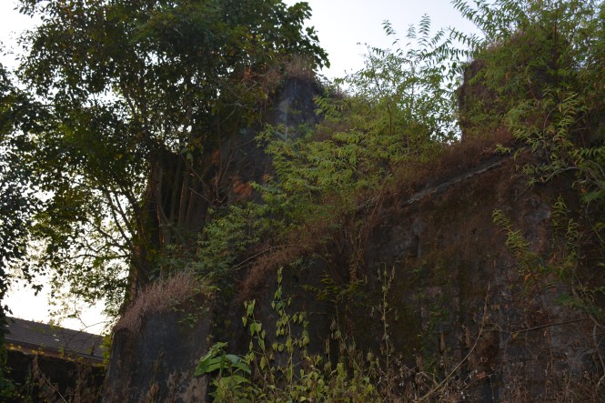
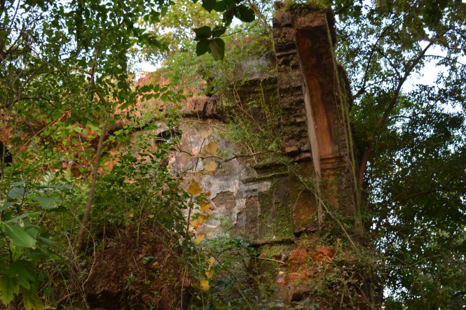
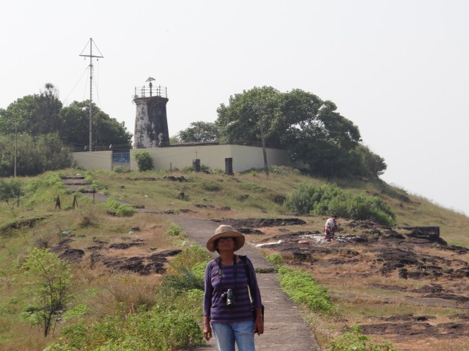
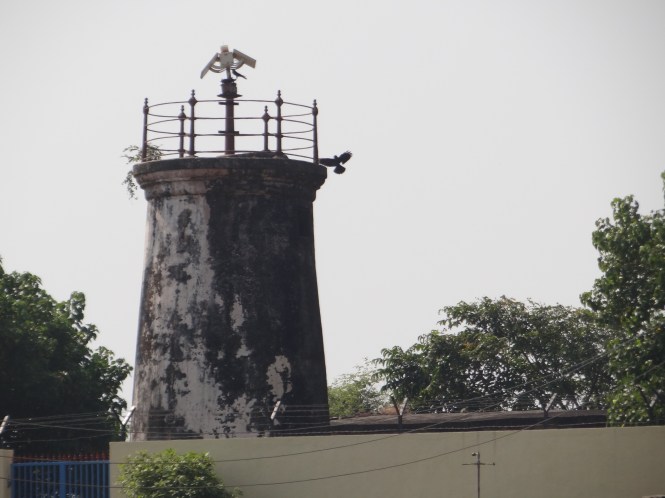
What about the fort?

‘Which fort? There are some rocks out there. Not worth going there. plants have grown and nothing can be seen’

dsc_5276

dsc_5277

I take the fishermen’s advice. I always do as they bring me my food. Speaking of food, we are now hungry and rush where we can find some. Malvan.

The whole town seems to be selling food. Most of them advertise ‘malvani’ but also sell all other kind of food to the travellers.

Malvan has given us two important things. The ‘malvani’ version of Konkani language and Malvani cuisine. We will look at the first one in another post later. First things first. Malvani food.

Look at the menu at the bottom of the bottom right picture. You will have some idea of what is cooking. There are 11 items of seafood and 3 types of meat. The 11 seafood items include 3 shell fishes (including a crab), a shark, one squid and 6 proper fishes.

‘Ghavan’ is a rice chapati that you see in the first picture ( with a dish of crab). For the Mumbai (and other cities) crowd there are the usual pomprets and Kingfish. These are the people who are yet to graduate into eating Mori (shark), kalve ( the small shellfish) and Mhakul ( squid) etc.

Kombadi-vade is an old favourite. It is a chicken ( free-range, not the ‘poultry’) and fried ‘vade’, made of rice.

The main ingredient of Malvani cuisine is of course, the seafood. The others being coconut, red chillies, onion and kokam. These are fairly common items but the trick is in how they cook, not what they cook. It is delicious all the time.

Probably the main reason, apart from the beaches, for the people to visit Malvan is  the Fort. The Sindhudurg Fort.

dsc_5321

This fort was built in 1668 by Shivaji Maharaj on a rocky island off Malvan. One has to take a motor boat to cross from Malvan. The sprawling fort has a small resident population but visiting are not allowed to spend the night there.

The fort has a temple where the deity is King Shivaji.

dsc_5325

What strikes the mind in this fort is the presence of sandstone on a large scale. Most of the ground is covered by this white or pinkish white stone.

There used to be a coconut palm on this fort which had a branch. Rare phenomena. It no longer exists. It was struck down by lightening. Only a picture exists.

dsc_5355

We return hurriedly to the mainland by the boat which allowed us only 45 minutes to see the fort. I think the purpose of taking people to the fort is to ensure business for the various shops selling all kind of drinks and eats.

The next morning we get up and are reminded that we have not been to Shri Brahmanand Swami’s Samadhi. We proceed there although we have to go backwards. We should have visited this place the previous day on our way to Malvan.

dsc_5392

I have visited a number of places where the Holy Men take their ‘samadhi’. I feel that these guys like the moist dark places like caves, devoid of sunlight or fresh air. I dont know why.

dsc_5394

This was later but before that we had to have a little breakfast. There is a restaurant, unnamed, near the main autorikshaw stand and we decide to have it there.

dsc_5377

Being a person interested in all things old and antique, I enquire of the owner about the age of the place. He refers me back to a photograph hanging on the wall. His grandfather -died a hundred years ago. He was the founder of this business.

dsc_5389

Going by the picture and the marble-top tables below, I put the age of this restaurant at 150 years. The glasses for tea are of recent origin and so are the plastic chairs. When this restaurant started plastic was not invented.

dsc_5390

Ghosts of some of the old customers are reported to be having tea here at night.

dsc_5388
Text By Suryakiran Naik

Pictures by Suryakiran Naik & Veena Naik.

61. DEVGAD, KANAKESHWAR, ACHARA

Today we are  going from one fort to another. Vijaydurg to Devgad. Next it would be Achara via Kanakeshar, not a fort.

The aficionados of the art of eating Alfonso mangoes will always argue on which is the best variety of that fruit, the Ratnagiri Hapus , Goa Mankurad or the Devgad Hapus. Devgad lends its name to the last one and in turn has been named after the eponymous fort.  Mangoes are not in season and therefore no pictures here.

Here is the picture of the jetty at Devgad, very close to the fort. Here the passenger boats docked for carrying the locals to Bombay. No, I dont intend to travel that way, I am just standing there as I liked the breeze.

a1

The cotton textile industry which flourished in Bombay from 1854 onwards was very labour intensive and drew workers from all over the Konkan region. Deogad port was one of the gateways for the people to make their way to the great city of Bombay. A large number of today’s Mumbai inhabitants of Marathi origins had their forefathers coming to Mumbai from here, not only to work in the textile mills but also to engage in various other activities including government jobs. Right now there are no such passages. Even if people want to travel they have the frequent buses and the Konkan Railway at their disposal.

a2

The creek waters near the jetty are unbelievably clear. It is about 10 am and I could take this pictures of the fish, eel and the Squids in the water  from the shore without any special equipment with an ordinary DSLR camera.

f1

f4

f2

The Fort, said to be put together by Kanhoji Angre in 1705 starts right at the creek where you can see its ruined walls.

dsc_4798

One can drive up in the fort, although the road is quite narrow. You come to a stone arch near the corner where the Lighthouse is located and has to stop. Difficult to pass through and moreover it is prohibited.

The Lighthouse at the Devgad fort is amazingly friendly. At other places that we have been to so far they behaved as if they were custodians of the nuclear bombs. Here they behaved as if they were in-charge of a Lighthouse.

dsc_4839

The Devgad creek is a place of scenic beauty that requires a better photographer to capture. I could not capture half of what I could see.

dsc_4837

dsc_4847

Deogad has a nice little beach which can be seen best as you are descending the fort. Seen beyond is the Windfarm.

dscn9527

The Deogad creek is a scenic beauty and can be observed from the Lighthouse in the fort. The fishing harbour is better seen from the shore, nestled in a cove with the background of a hill on two sides.

dsc_4787

It is time to leave Devgad. We have forgotten that tomorrow is the Diwali or Dipawali, the festival of lights.

This festival is related to post summer harvest in northern India when food is in abundance. Sikhs and some Buddhists also join in the festivities for different reasons. In the Konkan region including Goa (and some parts of Tamilnadu, I am told) this festival has a very different meaning.

The story goes back to the Puranas. There is a demon by the name Narakasur who is harassing the people big time. It befalls on Lord Krishna, as usual, to kill the demon. This guy takes the prize for killing all bad people.

Anyway. In Konkan, we  make an effigy of the demon Narakasura, dance around the villages with him and a finely decorated Lord Krishna who is usually an young active boy from the village. Very early in the morning     ( as the Lord Krishna kills the demon), the Dipawali starts. The lamps are lit, crackers are burst and people take  bath( even those who dont normally like to do that) wear new clothes etc.

This Narakasura is seen today as we drive in every village.  There was one where I did not see it. I stopped and made enquiries and was told that they are working on it and it will be in place well in time.

dscn9537

Satisfied with the clarification, we proceed. I cant stop explaining about this Diwali of ours.Give me a moment. These days we see the Diwali lamps, celebrations, gifts and everything else well before the Big day. 50 years back and I can remember it well in Goa, the lamps were not lit until the early morning and until then it was all darkness because of the havoc caused by Narakasura. Narakasur is burnt in the early morning.

dscn9466

The logic behind this festival makes sense to me against the background explained above. I am not happy with what they are doing these days in the cities where the celebrations start during the lifetime of Narakasura. I am happy with the fact that the tradition is alive here.

Life goes on. We move to a place called Kanakeshar. This is one more seaside temple. All these seaside temples will one day be overshadowed by seaside resorts. I strongly believe that once the temples were the centres of economic and social activity. This role is now being taken over by resorts. I dont want to make any comment on the propriety of it.

dscn9554


dscn9556

dscn9558

We drive on and reach the beach at Achara expecting to find accommodatin there. There is none. We find some signboards on the beach. We call up on the phone number on the board and are directed to a small island less than a kilometer away-Jamdul.

dsc_4992

Jamdul is a small island in the creek owned privately by a few families. The resort is owned by a Konkani-speaking Christain family. It is a nicely done friendly place with a restaurant called ‘Begina Ye’, meaning Come Soon.

dscn9594

It is low tide and one activitiy associated with this time is collection of stones on which a variety of shellfish grows.

Locally called ‘Kalve’, it is a delicious variety of shellfish. It cannot exist independently as it grows attached to stones which are exposed at low tide and allows the people to collect them. When they come to market for sale, they are pried open and taken off the stones.

At the creek surrounding the resort you can indulge in other activities like watching the birds or these Fiddler Crabs.

dsc_4897

Crabs have ten legs. Eight are used for locomotion and two for hunting. Not the Fiddlers. The big one you see is used only for display, for attracting females. It is a pleasure to watch them go about displaying the brightly coloured claw. They dont use it for any other purpose.

dsc_4887

The island and the creek is surrounded by mangroves which support all this variety of life. I could see some Otters early next morning. The mangroves look beautiful in the morning sun.

Achara has a nice beach with the inlet for the water entering the creek making ut picturesque.

dsc_4930 
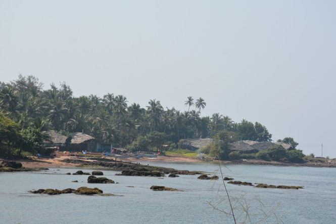
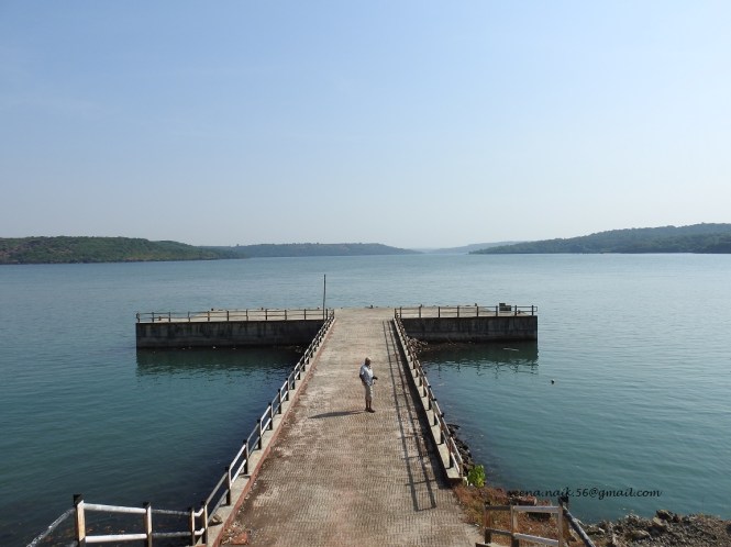
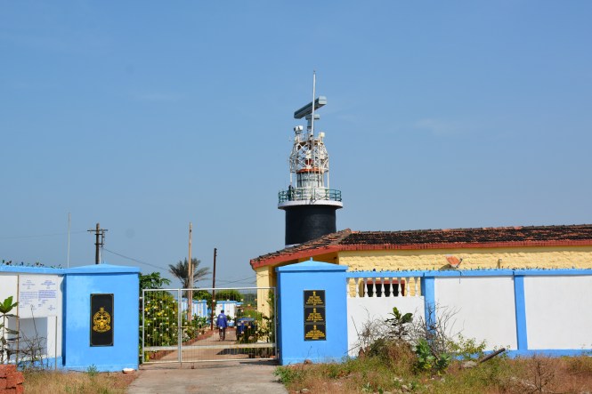
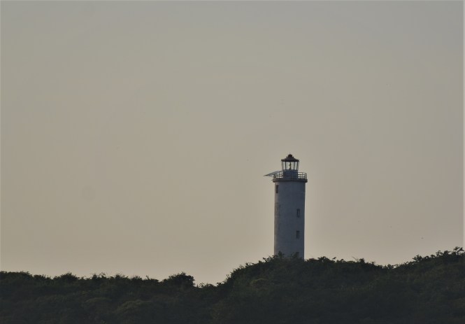
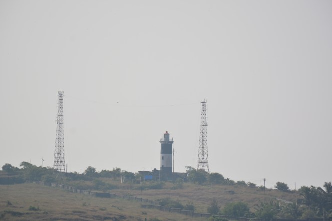
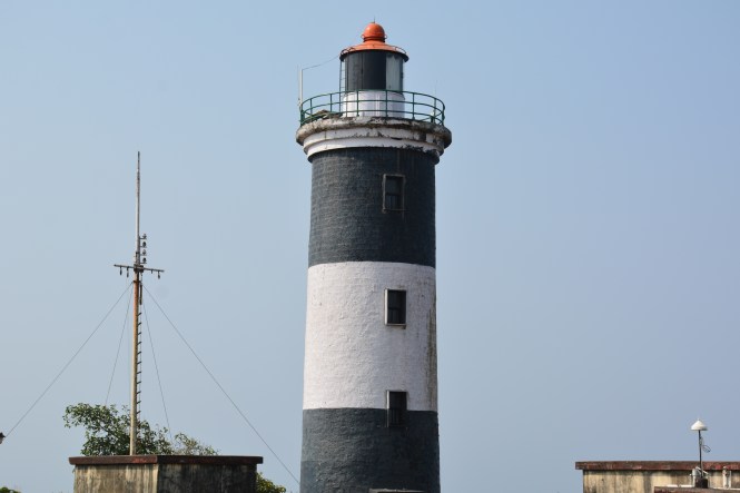
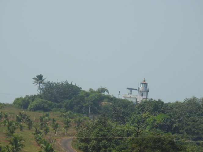
The lighthouse on the opposite hill makes it look idyllic.

dsc_4918

Unfortunately we found a number of dead fish and squid on the beach. I am not sure if this is due to some sort of pollution-related phenomena. There are no industries on the coast nearby.

dsc_4921

dsc_4920

Beach cricket is catching up.  Will this be a new sport?

dsc_4949

The sunset at Achara beach was glorious as the clouds on the horizon were not many.

This post is becoming too long and I am yet to comment on the birding at Achara. I will stop here and combine that with the next post.

Thanks for reading.

Text by Suryakiran Naik

Pictures by Suryakiran Naik & Veena Naik

60. PURNAGADH, KASHELI, VIJAYDURG

We leave Ratnagiri and drive southwards early in the morning. We pass by Ranpar and other places including Pawas in the hills overlooking the sea to the west. It is late October now and the grass is no longer green. The winter is knocking at the door. The Deepawali or the Diwali festival is within the week. People all around are busy making the preparations for the big day.

We intend to spend the night at Vijaydurg which is in the Sindhudurg district. But before we cross the Vaghotan river which is the border between Ratnagiri and Sindhudurg, we have a couple of things to look at including a fort, a 1000-year-old temple and a raging political controversy. We also have to cross another river called Muchkundi which has a Dargah in It.

The first signboard is for Purnagadh Fort on the north bank of Muchkundi. Most political powers in the past, local or foreign made it a point to have a fort built on a strategic point of each of the river mouths in Konkan. Without them they could not think of establishing control over the region.

Near the bridge we take a left and drive past the village and along the seaside path towards the fort. After about a kilometre we realize that the road is not designed for our car. It needs a 4-Wheel drive especially after the post-monsoon scrub growth and it is not the time of the day to climb a fort. After a few photographs we withdraw.

dsc_4494

dsc_4499

We come around the hill and back on to the main road and cross the bridge.

dsc_4498

When you are crossing the structure that you see under the third span of the bridge in the above picture becomes more prominent . It is the dargah of Haji Sayyad Fakhru.

dscn9216

This is for the first time I am seeing a Dargah in the middle of a river. It is tempting to go and see it but it is high tide now.

dscn9222

We move on, cross the bridge over the river and come to another signboard to our right indicating a beach. It is the Gavkhadi beach. The Maharashtra state tourism departmnt seems to be a conducting a survey here for the number of tourists visiting the place. An ‘Authorized Person’ makes a note of our visit which will be of immense importance to the researchers in History from the University of Ratnagiri in the 26th century.

For us Gavkhadi is a miracle. First we go to the beach and see the remains of the fort which we could not visit.

dscn9228

And then we witness another phenomena. A large number of butterflies breed on this beach. I do not know if this was one-off or a regular thing. The number is huge-in hundreds.

dsc_4581

 We drive along and come up on another hill and see a signboard for the village Kasheli which has the temple of Kanakaditya among other temples in the vicinity. We go off the main road towards west and reach the temple.

dsc_4649

There are other temples in the vicinity but this one is the main draw.

There are some features of the temple which are worth noting. The legend says that the idol here was brought from Prabhas Patan in Gujarat which has been covered in an earlier post of this Blog. The idol of Sun God was brought here a 1000 years ago and the temple was built by Kanakabai, a sun-worshipper. In terms of the lay-out  this temple resembles the temples of Kerala.

Another feature of the temple complex is the presence of an unusually  large number of Tulsi Vrindavans.

dsc_4634

The roof of the main temple is made of metal. One of the temple committee person we met says that nobody knows what metal it is.

dsc_4661

The complex appears to have been renovated recently with new laterite masonry work. Laterite is not a stone for doing carvings but here an attempt has been made in that direction.

It is time to move and proceed towards our destination which is Vijaydurg and it ias still far away.We across this sign at Nate.

dsc_4665

The name Jaitapur at 2.5 Kms brings up 5 year-old newpaper headlines to my mind. Jaitapur is the prposed site for a nuclear power station. The project was opposed by some locals ( as most new projects are). During the protest demonstrations the police resorted tofiring whihc resulted in death of one young man then 30. Tabrej Sayekar has now been designated  a ‘shahid’, martyr.

dsc_4663

The square is named after him. I am not sure if it is official.

dsc_4664

The actual project site is quite far away from this spot and is across the creek. The milestone shows Devgadh at 47Kms, Vijayudurg at 44 Kms ( they are in different directions), Jaitapur at 2.5 and Musakazi at 4 kms.We want to go straight and see the remains of a fort near Musakazi. A learned local person opines that it is not worth the effort as there is very little to see there. We take his word.

The 44 Kms drive from here to Vijaydurg is quite interesting. It is the very dry plateau on the foothills of Sahyadris, almost touching the sea. This topography- barren dry land and presence of sea nearby – was the most likley reason for selecting this place for the nuclear power project. This kind of landscape is found in many parts of Maharashtra , Goa and Karnataka coast but here it appears to be very extensive. You can see the golden drying grass as far as your eyes can see. Agriculture is ruled out. The forest department appears to be trying out the Subabool at some places successfully. We could see some attempts at developing Mango plantations. Hope they succeed.

It takes us almost two hours on the winding roads to reach the Vijaydurg fort at the mouth of 40 Kms long Vaghotan at which the old Ratnagiri district was devided into Ratnagiri and Sindhudurg.

We find accomodation at the MTDC cottages very close to the fort and a nice little restaurant opposite for lunch with a lot of fish. The owner promises us fresher fish for the dinner. He keeps his promise. This place, Hotel Suruchi is the first building to the right  in the picture below. The signboard is in Marathi.

dsc_4693

Food assured, it leaves us to explore the fort. This is among the oldest fort in the region.It was completed in 1205 and has seen many rulers, probably all the dynasties that ruled this region.

dsc_4666

The original construction is attributed to Shilahars. The fort was once covered on all four sides by water. In course of time the eastern side was filled up and road constructed – where the buildings in the above picture stand.

As you enter youwill find a disused Police Station which has the walkway lined up with Canon Balls.

dsc_4782

 The fort is worth visiting if you understand its status as an impregnable fort on which the British spent a lot of money and effort. The effort included the construction of a large naval ship at Bombay especialy to capture the fort from the the-then owners, the Marathas.

Some years back, someone had a brilliant idea that the gas Helium was discovered from within this Fort by an Englishman.I saw a poster at the gate of the fort declaring the fort as the ‘birthplace’ of Helium and 18th August being celeberated here as the World Helium day. There is an official-looking signboard in Marathi in the fort which is now pulled down  which had proclaimed this discovery.

The facts are now emerging after a bit of reading. On 18th August 1868, this gas was indeed discovered from India but not from Vijaydurg but from Guntur in Andhra, not by an Englishman as claimed but by a Frenchman by the name  Pierre Jules Cesar Janssen whilst  observing a total solar eclipse. The Englishman in question also found this gas in the month of October the same year through a dense fog in London.  His name is Sir J Norman Lockyer.The only commonality is that it was found in the Sun. The sun temple of Kasheli is not far from here but that does not mean the local politicians should make capital out of this unrelated fact.I dont want to be a part of a possible fraud but there is nothing wrong in taking a photograph at a place which ‘could have been’ of historical importance.

dscn9417

The fort was built in the year 1205 and many dynasties and rulers controlled it. The Shilahars, The Decan Sultanates, The Marathas, Kanhoji Angre and his successors, the Peshwas , the British etc. After careful and extensive research I have come to the conclusion that the equipment in the photographs below was not brought here by any of the above rulers.

dsc_4696

Text by Suryakiran Naik

Photographs by Suryakiran Naik & Veena Naik


59. RANAGIRI

I had visited Ratnagiri a number of times in the past but had never found time for anything other than the official work related places. This time it was a different world. The purpose of your being to a place appears to determine what the place has to offer. From Lawyers’ offices and Petrochemical plant to a fort, a palace and an aquarium is a huge difference.

In the territories that the British ruled, among other things, the Brits seem to have had perfected the art of deposing the local royalty and banishing them to faraway places for fear of the reversal of their actions on account of public backlash. The Kabaka of the landlocked Buganda kingdom (now part of Republic of Uganda) was held in captivity in the Seychelles islands. The Sultan of Zanzibar was banished to Bombay, the last Mughal Emperor of India spent his last days as a prisoner in Mandalay, Burma and as if to reciprocate the last king of Burma’s Konbaung dynasty spent his last days at Ratnagiri. This story is part of the memorable novel ‘The Glass Palace’ by Amitav Ghosh.

Thibau Palace was the residence of the king and named after him , provided courtesy the British. Located close to a cliff overlooking the sea, it is a nice place to stay but not under duress and thousands of miles away from your people.

Ratnadurg or Bhagawati Fort is among the main attractions of the town. A largish fort houses a temple to Goddess Bhagavati. It is in an excellent condition but the most of the masonry appears to be new, thanks to Tourism department.

dsc_4237

dsc_4305

The fort has a couple of statues. Kanhoji Angre, probably the only major naval warfare personality from India in the pre-independence history and his mentor King Shivaji .

dsc_4236

dsc_4238

This is the famous or infamous kadelot point. For those who do not know Marathi, Kadelot means ‘pushing from a cliff’ or ‘throwing from the cliff’, among the favourite punishments particularly for those who betrayed the King or the Kingdom.

dsc_4280

The views from the top of the fort are quite nice and pretty.

dsc_4244

dsc_4276dsc_4303

To the opposite side of the fort is located the Lighthouse. It can be approached by a narrow tarmac road on a steep climb. No, it is not the time for the visitors. Come later.

dsc_4295

dsc_4313

There is another tower related to the lighthouse. There is a hunting bird seated on the tower. Do you see it. Enlarge the picture and see, it is a Kestrel.

dsc_4322

It is time to move on to my favourite place on earth. The fish market. Here we do not intend to buy fish.Not all hotels allows you bring your own fish and then this is a wholesale market. Here you buy by the truckloads.

This boat has brought a huge load of fish and sorting is on. It will not help. They caught a shoal of what is locally called ‘dhodi’, a low value fish with not much of a market. Nobody is enthusiastic about the catch. Selling this off is going to be a problem.

dsc_4359

A few steps away  an auction is going on.

dsc_4347

There is a feverish bidding for the ‘A’ grade Mackerel, 8 pieces per Kg. A lot of 32 Kgs goes for INR 3700/- , less 10% trade discount. Still very expensive but there is demand for this type.

dsc_4352

I would prefer the smaller and tastier ones although a bit difficult to clean and eat. The smaller ones are in a lot of 20 Kgs and would be much cheaper. Incidentaly a large number of the labourers here and on the boats are Hindi-speaking northerners, not the traditional Konkani fisherfolks. They are not conversant with the fish varieties.

dsc_4339

These are the young ones of the Tuna, not a popular fish in India. The Japanese would kill for this.

dsc_4348

I found this black coloured fish for the first time. I had not seen it earlier. There were only two pieces . No information came forth.

dsc_4335

Now, how about this fish? Do you like it?

And how about this?

dsc_4408

dsc_4403

The first ( set of three) is called Lion Fish and the latter two are called FLOWER HORNS.The one below is called Sea Horse.

dsc_4383

Before you misunderstand this, let me clarify that the last three are not the fish brought for sale in the market. They are found in the Aquarium at Ratnagiri. A small but commendable place escpecially for the young ones. Not that older ones are any wiser in these matters.

Lokmany Bal Gangadnhar Tilak was born in Ratnagiri. He made a large contribution to India’s freedom struggle in the early days. He also contributed extensively to pre-independence Indian journalism. The house in which he was born has been preserved very nicely here.

dsc_4411

dsc_4412

Very close to the Thibau palace , on the cliff , the municipality has constructed a small park. In the evenings thr Ratnagirians throng there. It is worth going there for the sheer beauty of the sunsets.

dsc_4439

dsc_4438

dsc_4434

Text & Pictures : Suryakiran Naik

suryakiran.naik@gmail.com


58. JAIGADH & GANAPATIPULE.

We leave Bamanghal we saw in the last post and drive to Tavsal which is a Ferry point to cross the Shasri River and the creek to reach Jaigadh. We skip the smaller places-  Narvan, Rohile, Tavsal- on the way.

This is the third time on this expedition we are crossing a creek by a ferry. To the credit of this company which runs the ferry services at three places in Raigad-Ratnagiri distrcts that the servicesare  very well organized and punctual.

dsc09264

Entering a car into a ferry and getting out of there requires some driving expertise especially if you are disembarking in the reverse gear. Mattees are a bit more difficult when the tide is low and the ferry cannot be broght in line with the height of the ramp on the shore.

The ferry crossing to Jaigadh is different compared to others. Here the boat goes upstream and across the river, not straight across. In the process you can see this sandbar. If you walk on this you will end up in Narvan village which we have skipped on our way.

dsc09569

The mosques at Jaigadh are very visible from the ferry so is the fishing harbour. In the background of the first picture one can see the JSW Power plant located on the hill.

dsc09573

One can drive straight to the gate of the Jaigad fort, the highlight of the town.

dsc09578

The 16th century sea fort is attributed to the Bijapur Sultans who ruled the area at that time. It was subsequently captured by Marathas and Kanhoji Angre. By 1818 it fell into the British hands.

It is a well-maintained fort although the post-monsoon clean up was overdue at the time of our visit. The views from the top are nice. The temple in the picture below is still in use.


Here is a snap of the Present which has overshadowed the Past. The fort was important in the past, the power plant is the need of the present.

dsc09606

The stretch of the coast between Jaigadh and Ratnagiri has a number of beaches. They are all pretty, to say the least. Among the more famous is the beach at the temple town of Ganapatipule. The temple is among the most-visited in the region. It is well maintained and surroundings are well-organized. You dont have to fight for parking space.

dscn9010

Photography is not permitted inside this 400 years old temple. The idol of this Ganesha is facing west unlike in other temples where it faces east. Perhaps He likes the sea.

dscn9013

The beaches continue after Ganapatipule as well. After leaving this place you climb a hill towards Ratnagiri and can see this hauntingly beautiful part of earth.

dscn9019

Text by Suryakiran Naik

Pictures by Veena Naik & Suryakiran Naik.


57. GUHAGAR, VELANESHWAR, HEDAVI, BAMANGHAL.

Guhagar is a typical seaside town. It has a beach, in fact two beaches.


Accommodation facilities, temples and probably more important, the orchards. Mangoes, Coconuts, Betelnuts (Supari) is grown extensively in the area. There is no change in the geography. It continues to be the narrow strip of land between the Western Ghats and the Arabian Sea that we have seen in the earlier posts of this blog in the northern parts of Maharashtra along the sea.

We have been recommended to stay at Duga Pearl owned by Akshay Khare and we did. Thank you, Sudhir Joshi.


2

It has many advantages: Homely informal atmosphere ( we could buy our own fish and have it cooked the way we like), central location with everything within a short distance and the most important, presence of  Khare brothers. If you are a nature lover and particularly if you are a birder, this stop is very helpful. Akshay knows the birds of the region by their first names and was very generous with his help in identifying many of the birds we had photographed in the region earlier. He offered us a trip to his farm up in the hills so that we could have a glimpse of the Orchards at higher elevations. In southern Konkan orchards are more prevalent on the flatland between the sea and the hills. Here it is done at a higher altitude and the trees are doing well. Our intention was also  to catch up with our birding. It was not very successful because of the timing. We did see some birds out there like this cute little sunbird nibbling at the coconut flowers.

img_4729

Comparatively we could find a lot of life behind the Durga Mata temple and the hill which also doubles up as a nice little trek.

img_4719

There are four or so temples in Guhagar. The one of Durga Devi and its ‘Stambh’ deserves special attention. It is very close to ‘Durga Pearl Hotel’. The temple itself is at a decent distance from the road but the ’Stambh’ is right on the road, or to put it another way, the road was built by keeping it in it’s middle.

img_4723

The distance between the ‘stambh’ and the electrical pole on the oppoiste side diagonally is not more than 5 meters. The ST bus drivers, I can assure you. find this space pretty tricky, to put it mildly.

img_4724

The ‘Stambh’ has some inscriptions of some women who look very sexy. I do not know if they were intended to look this way or the artist used his ‘poetic license’. Have a closer look and decide.

Two other temples are on the main road One is dedicated to  Ganapati and is called ‘Ufrata Ganapati’,  the opposite side and the other is to Vyadeshwar which is a Mahadev avatar.

dscn8864dscn8866

When done with Guhagar, we proceed south for Velaneshwar another famous temple town along the sea.

The village also has a nice little beach but no infrastructure.

img_4758

After visiting the temple and a vada-pav breakfast at the little eatery at the beach, we proceed to Hedavi. This place is not far from the sea and along the coastal road. The highlight of the place is a nearby seashore which is a phenomenon. It is called Bamanghal.

This is a rock formation along the sea. The rocky cliff slides from the hillside towards the sea. Over the ages the waves crashing into the rocks have eroded the rocks making them hollow from the bottom.

img_4793

From top to the seashore it should be around 50 meters. What makes it special is the fact that seawater enters from under the rocks with the force of the waves and then spurts up through the crevices in the rock.

img_4773

This phenomenon must be much more attractive during the windy months when the force of the waves would be much stonger. Not that it was bad in late October.

Bamanghal has to be approached from the main road by a narrow village road along the hill. You reach a place where you can see a small beach of about 100 meters and a temple. You pass by the temple and walk about 200 meters to reach the exact spot where this phenomena occurs.

img_4803

There is one more related phenomena that you would see here. This place is a hillside with a forest on top of the hill and has streams of freshwater flowing towards the sea. You can drink this clean water at the temple. Now have a look at the picture below;

img_4798

You can see a patch of pinkish brown colour. It is salt, floating. Why here? Because the heavy freshwater from the stream is concentrated here and the lighter saltwater meets it causing the salts to be separated which then float. At least this is the explanation given to me by a knowledgeable local person.

What strikes me most other than the two above is the presence of three species of wildflowers growing on the rocky hillside.

All three are purple-blue.

It is very rare for nature to offer wonders in three-in-one packages.

Text by Suryakiran Naik

Photographs by Suryakiran Naik & Veena Naik

( delayed by about  3 weeks.)

56. LADGHAR,KOLTHARE,DABHOL, GOPALGADH & ANJANVEL.

We leave Karde for the next place which is Ladghar. There is a road along the coast from Karde to Ladghar but we are advised not to use the same as it is in a bad condition. We have to return to Murud and drive past this office building of Darya Samaj Mitra Mandal , an attractive structure and then to Dapoli through thick greenery and winding roads.

dscn8675

Dapoli is an education centre with an Agricultural University. It is early in the morning and we see a lot of students around. The ride back to the seashore is pleasant.

Ladghar beach is one of those places where the seashore is very close to the cliffs, leaving very little space for any other activity. Whatever accommodation is available , is on the hillsides. One has to climb down to the beach making the spot unpopular for tourists and travellers.

dsc09491-copy


From here the road goes away from the sea for some time and we cross the villages of Tamastirth and Burondi. After Burondi, there is small road going towards the sea again. It is a narrow, deserted road going alternatively through Mango orchards and wilderness. We take that one as against the main road going to Dabhol.

dscn8694

The tough drive brings us to another village called Kolthar. It is located on the seashore with the hills right behind. People grow Arecanuts and Mangoes in whatever space is available. There is no possibility of agriculture. A few fishermen families have their own litleplace by the sea. A small river called Panchanadi meets the sea here.

This narow lane takes us to the beach. A nice little beach which gets some local tourists in the holiday season.

dscn8697


dsc09496-copy

Among the schools in the town is an Urdu primary school which is not functional.

dscn8706

We have our breakfast at a small tea shop in the village and chat with the owner. He is Mr. Mayekar. His family migrated from some generations from Mayem in Goa. You will find this kind of migrations from Goa during Portuguese rule with people migrating to neighbouring places in what are now the states of Maharashtra and Karnataka.

Another long, winding and off-the coast road takes us to the port town of Dabhol. A large tract of coast between Kolthare and Dabhol does not appear to be accessible by any motorable road.

The river Vashisti flows from the western ghats through the town of Chiplun and meets the sea here.

dscn8725

Dabhol is a town with history. Also known as Dabul it was a flourishing port and was known to European merchants and colonizers . It was a part of the Karnataka based Muslim Sultanates.  The rivalry betwen them and the Portuguese led to the latter sacking and razing the port  and the town in 1506. Dabul or Dabhol does not seem to have overcome this disaster.

The Muslim past has the footprints in the form of these mosques. There are no signs of the Portuguese past.

dsc09572

Dabhol jumped onto the front pages of newspapers when Enron Corporation announced a mega power plant here in early 1990s. What followed was a saga of allegations of large-scale bribery in India and the United States,Human Rights violations at the plant site, and ultimately a small disaster at the NYSC when the share prices of the parent Enron fell from USD 98 to USD 1. This saga also saw one of the world’s most respected accounting firm, Arthur Anderson biting the dust in what is called a monumental failure in the auditing profession. All this may not be entirely attributable to Dabhol.

In India Dabhol became synonymous with corruption until other scandals took over. It is unfortunate that the name of Dabhol was spoilt. The plant has nothing to do with Dabhol. It is located at another place called Anjanvel across the river.

dsc09509

I asked a local the reasons for naming the company after Dabhol. His  explanation was that it was only because Dabhol was a historically famous place.

dsc09510

The ferry crossing is short and swift. This is the second ferry crossing for TheBlueDrive.

dsc09515

The Veldur village seen from hill across the ferry landing.

dsc09519

dsc09527

We have a small mishap when climbing up the hill. An young man riding a motorcycle  in neutral gear came hurtling down and brushed our car and then fell in a ditch. he had an young girl on the pillion. After providing them First Aid we proceed to a place called Anjanvel,

Anjanvel is the access point village for the Gopalgadh fort. This is another 17th century seaside fort atop a hill. The surprising part is that it is privately owned. At least the sign board at the main gate entrance says so.

dsc09545

It is owned by Simran Agro Farm House. It would be interesting to to know how a historical monument can be privately owned.

Most of the fort is in a state of neglect but some parts are found in good condition.

dsc09539

From the privately owned fort we proceed to a Lighthouse , hopefuly this is not privately owned.

dscn8753

This is called Anjanvel Lighthouse.

A few meters before the Lighthouse is the temple of Talakeshwar. A decent temple with a largish Deepstambh.

dsc09548

Given the remoteness of the place, the temple is well-maintained.

Walk a few steps behind the temple and you will be served with some breathtaking views of the ocanbelow.

dsc09555


From here we get back to the main road leading from the jetty, procedings to Guhagar, our next halt.

Text by Suryakiran Naik suryakiran.naik@gmail.com

Photographs by Suryakiran Naik & Veena Naik

55. HARNE, MURUD & KARDE

Harne is an interesting place. Very rarely do you find a place claiming within its precincts four forts, however small. This has been made possible by historical events. It is beyond the scope of this blog to go into the historical details but I will make an attempt to explain what is found on the ground with some photographs, of course.

As you enter the complex from the eastern side towards the fishing harbour, you will first find a fort called Goa. I don’t know anyone who can explain this name but it is certain that this place is not related to its namesake territory down south. The origins of this fort are shrouded in mystery but we do know that the Dutch were among the European powers that was associated with this fort. The others were Kanhoji Angre, the British, Marathas and Peshwas. It was ruled from 1818 onwards by the British and the accommodation for the soldiers was found intact until recently. In fact, about 15 years back a part of this fort was occupied as a Hotel run by Maharashtra Tourism Development Corporation. I have spent a night here then. Today it is in ruins, used mostly as a public toilet by the locals. There is no way one can enter and look around. The vegetation is thick and the place is smelling bad.

dscn8524

dscn8525

The rear side is in a slightly better condition.

dsc09402

We move on and proceed to Kanakdurg, the smallest of the four. It is said to have been constructed ( along with Fatehgadh) by the Siddhi of Janjira, Khairatkhan in 1700s. This is too small a place to be militarily important but must have been used like a watch-tower to keep a tab on the other three forts.

dsc09369

 It has a functional lighthouse. Apart from this it is used mostly for drying fish and mending nets.

dsc09371

 dsc09375

dsc09366

From a photographer’s perspective, this is an important place. One can see all the activities in the fishing harbour comfortably from here.

dscn8442

You must have thought that the Bullock cart is a land vehicle. No it is not, at least not here.

dsc09344

dsc09347

 Lower still is infested with crabs and birds. They co-exist, don’t eat each other.


Fattedurg or Fatehdurg is the third fort in the complex. It is totally and completely occupied by the fishermen. One cannot even believe it is a fort.

dsc09348

The last and probably the best of the four is the Suvarnadurg, This is a sea fort and can be accessed by boat. There are no dedicated boats. The fishermen take you there when they are otherwise free. Right now, they are not. The boats have arrived in the harbour and have to be offloaded.

The last picture above gives you an idea about the distance between the Goa fort and Suvarnadurg.It is quite small.

Built in the early 18th century many structures in the fort are said to have survived, largely due to the fact that the access is not easy.On the harbour side you can see this roof made of coconut palms.

dsc09403

It is a shed for the fishing boats. This is the traditional way. The modern way is to use plastic.

dsc09404

dsc09405

The next village is Murud,the native place of the great social reformer and founder of SNDT University, D. K. Karve.

dscn8528

Next to this statue is a temple of Durga Devi. Curiously, the bell in the temple is made in Portugal.

dscn8529

To end the day we had the option of stay at any of the three places. We did not find Murid very interesting and moved on to the vilage at the end of the road called Karde.

Karde beach, surprises us. It has a large number of hotels and lodges and the beach is quite good with very little waste dumped on.


It has some rocky patches on which this moss grows.

dsc09457

The beach is a narrow strip between the ocean and the gren hills opposite. This situation creates a good birding opportunity. We could hear Peacocks at our hotel in addition to several other birds. On the beach side one can see a number of waders and a small group of Black Kites active in the morning.

dsc09434

At Karde one is alowed to ride scooter on the beach, at least for now.

dsc09421

Text: Suryakiran Naik

Photographs : Suryakiran Naik & Veena Naik