54. BANKOT, KELSHI, ANJARLE.

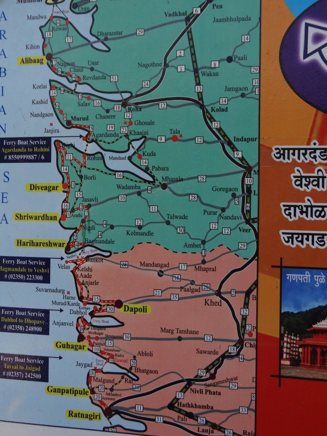
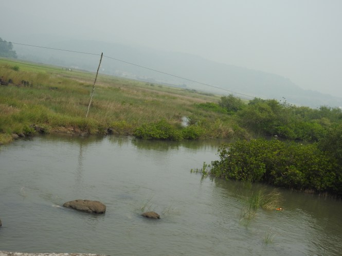
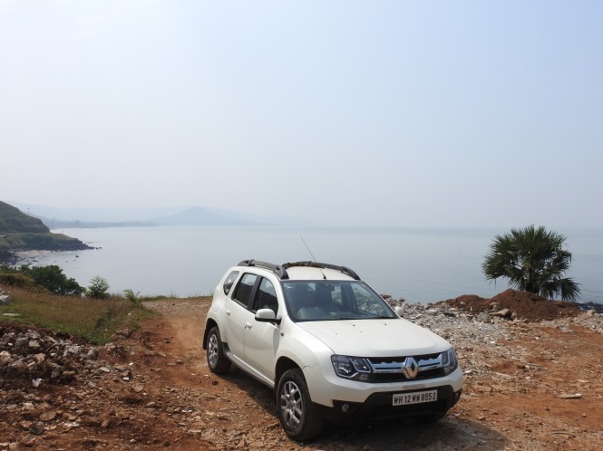
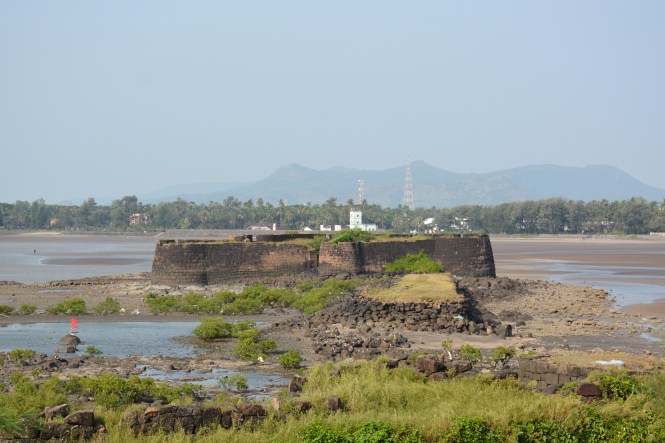
We cross over into Ratnagiri district leaving behind Raigad by crossing the ferry at Bagmandla to Velas. What we are crossing is river Savitri which looks more like a creek and is called Bankot Creek.This happens to almost all the rivers in the Konkan. As the seawater enters through the river mouth upstream at high tide it is difficult to say which part is the river and which is the creek. From Velas it is a short distance to Bankot fort.

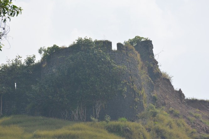
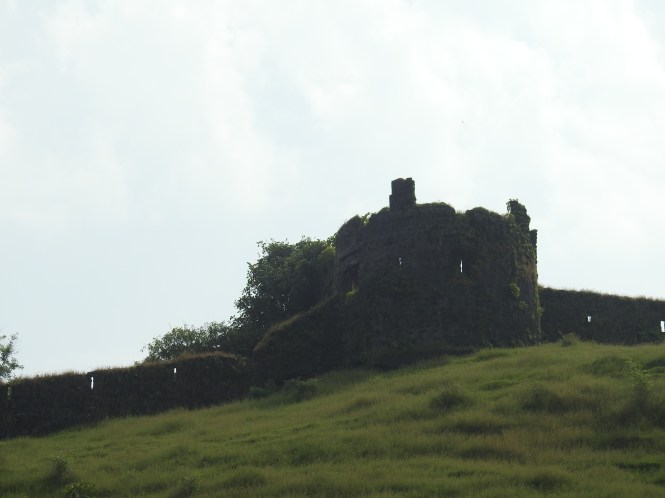
Experts do not agree on who constructed many of the forts in Maharashtra. Bankot is one of them although a strong claim is laid on behalf of the Shilahar Dynasty  who ruled South Konkan from 765 to  1029 AD.

Whoever buit this fort a few hundred years ago had great foresight. He could foresee crazy old retired couples driving their cars up to the gate of the fort. He made the fort in such a way that they can drive up comfortably.  Thank you, sir.

2

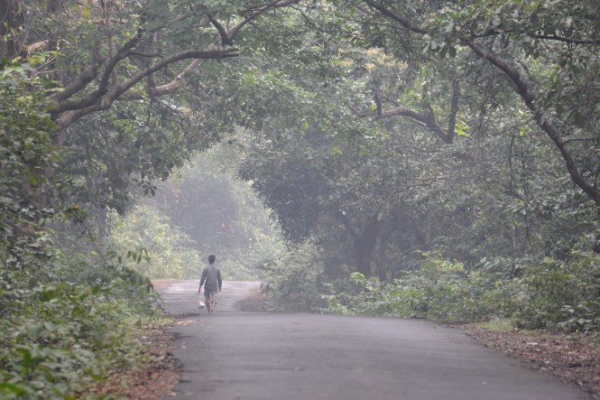
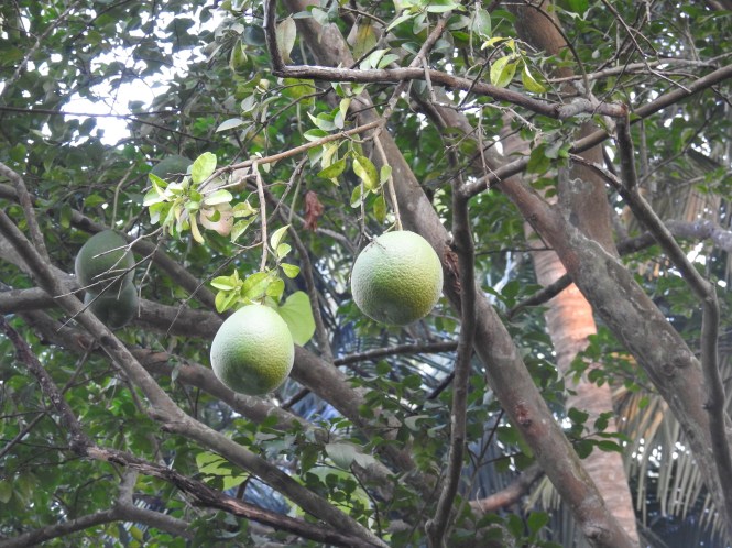
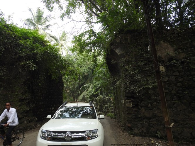
The road upto the fort is steep but not very difficult and passes throgh vegatation including Mango orchards.

a

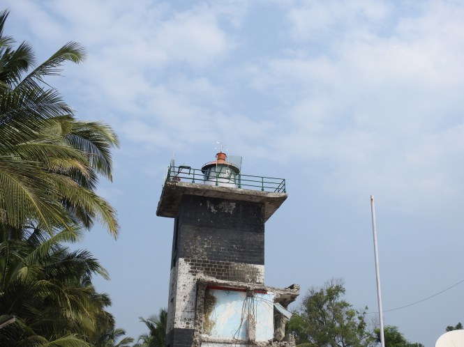
This fort is also known as Himmatgadh and , Fort Victoria during its possession by the British.

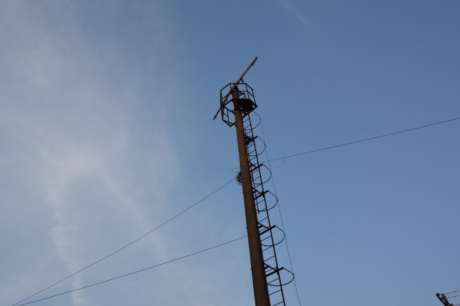
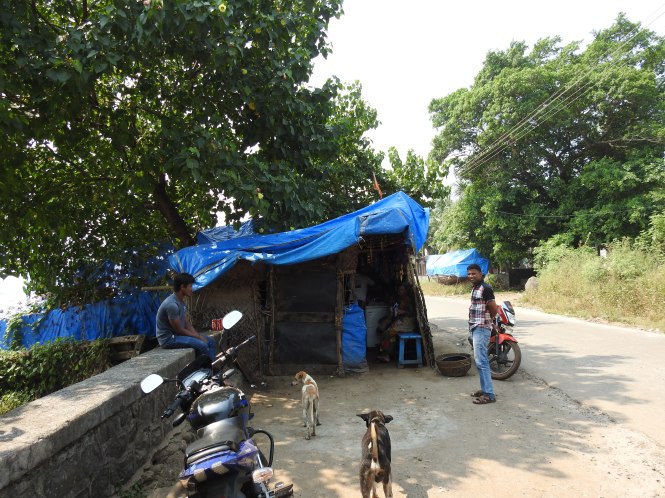
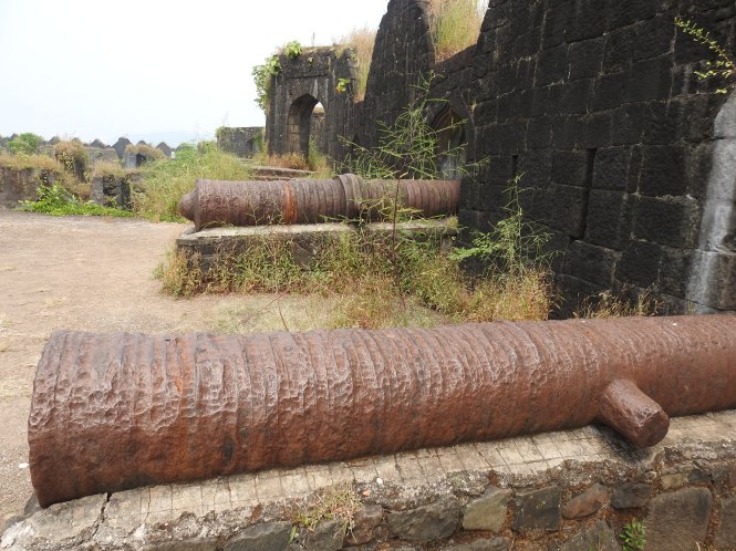
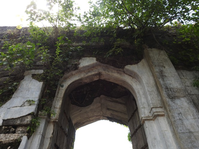
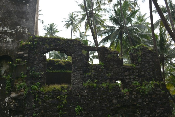
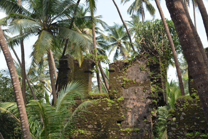
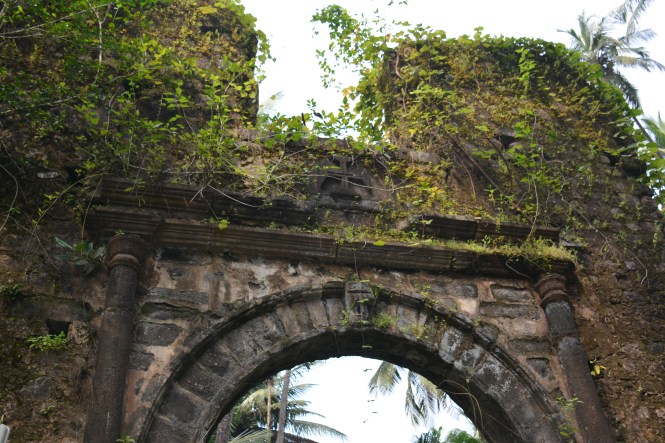
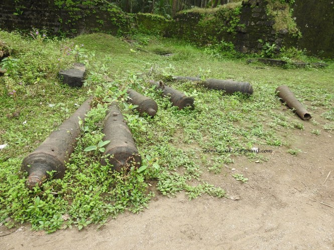
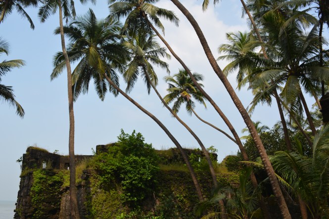
The fort is not a big one. Whatever remains of it is not in good shape. For most part the lower parts of the fort are inhabited and hence the road going up is in good condition. As usual there is no information of any type about the fort.


This was the first British Residency in South Konkan and had a British officer in residence. There is a memorial erected by Sir Arthur Mallet. These are two structures. One is a visble column and another structure to its right is not clearly visible. Sir Arthur erected these in memory of his wife and daughter who had drown in the Savitri river  in a boat accident. This is the same person who built a house at what came to be known as Arthur’s Seat at Mahabaleshwar. It is said that Sir Arthur used to sit and stare down at the origin of the Savitri river at Mahabaleshwar.

6

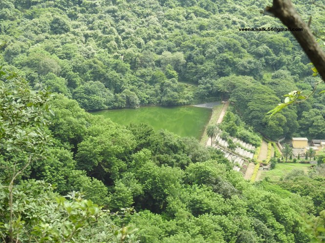
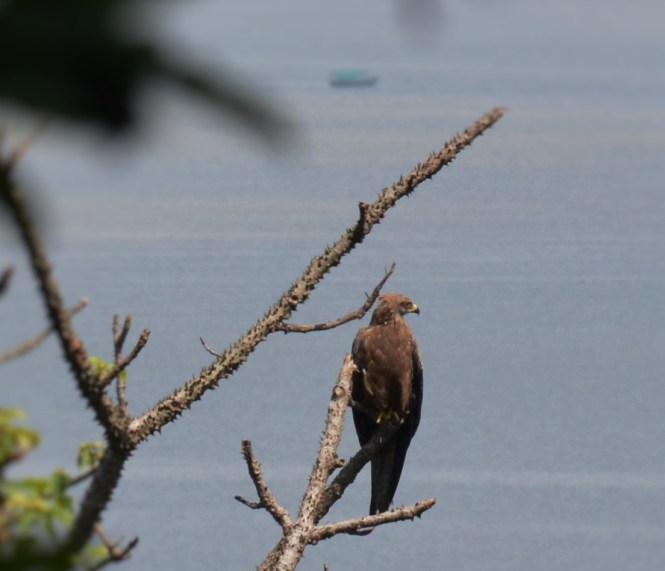
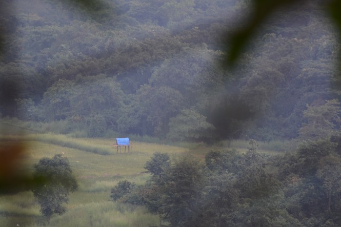
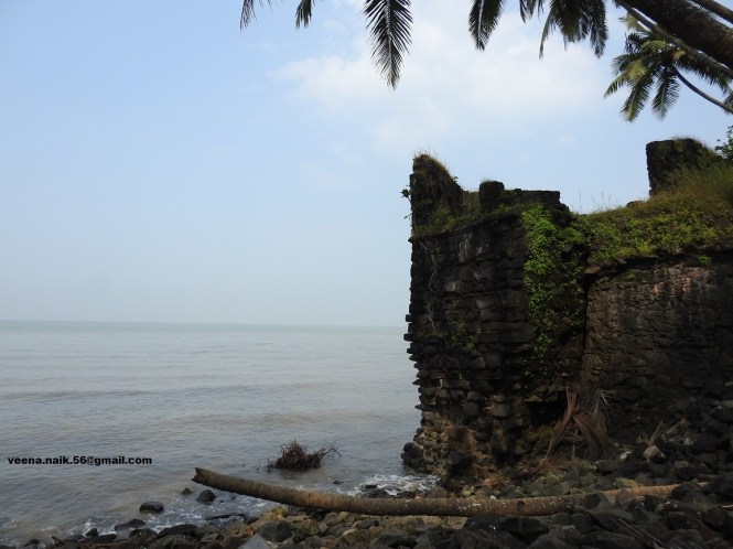
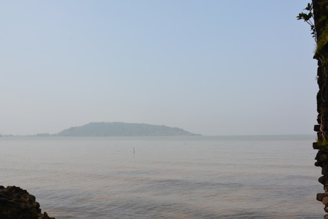
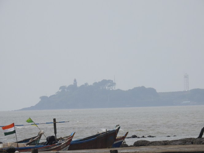
The views from the fort are awesome.

7

The coastal road from Bankot to Kelshi is a nightmare. It takes several hours of tiring driving on roads which do not exist in most parts. The roads are being laid as this is a part of the ambitious coastal highway. A bridge is also being constructed a short distance away from where we crossed the creek. It will take time.

8

The beach at Kelshi often appears in the tourism promotion literature of Maharashtra government. There are absolutely no facilities at this beach. We could not find anything to eat. May be the tourist season has not started. People are expected after Dipawali which is a week away.

9

10

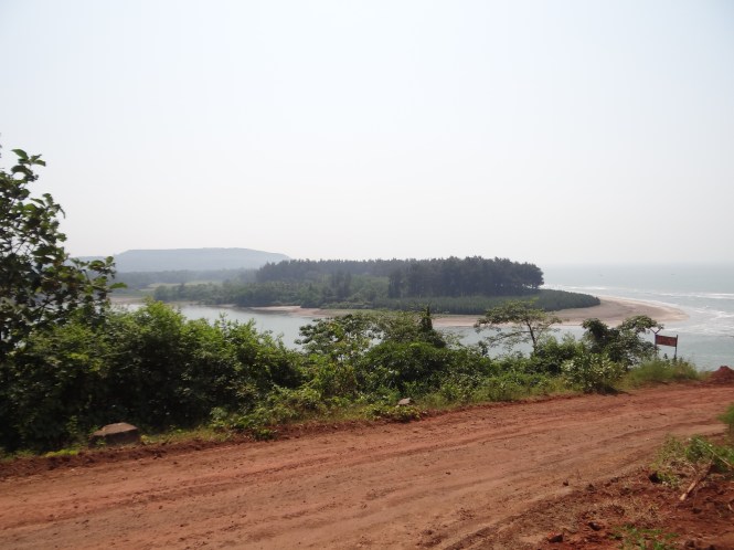
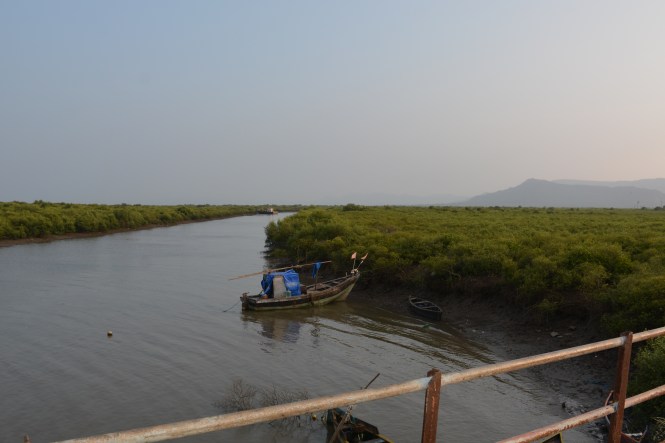
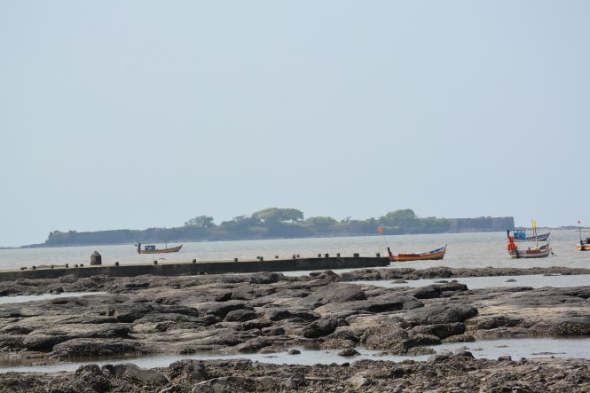
The creek system here is quite complicated and the hills are almost on the seashore making movement along the coast difficult.

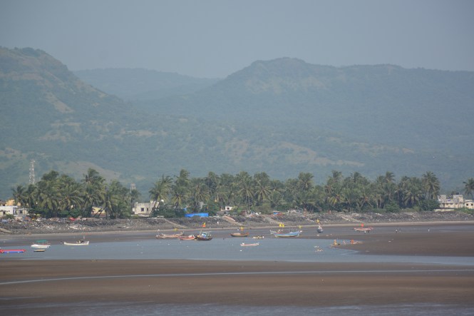
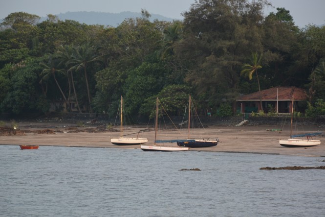
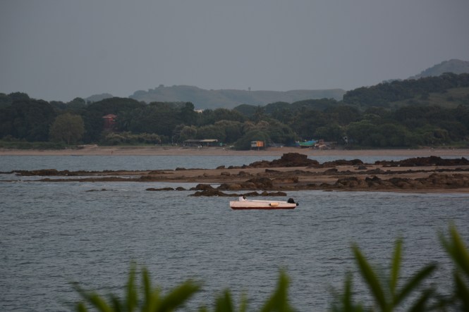
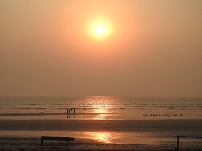
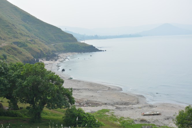
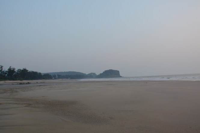
We drive on and make a stopover at Anjarle.  This place has a beach which I would rate among the best in Maharashtra. The quality of the sand, the cleanliness and the ambience make it a place to stay at although the hostelry is very basic. This picture of Anjarle beach was taken the next day from the hill opposite, across the creek.

11

& this is from the bridge across the creek.

12

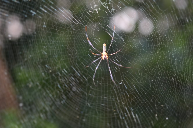
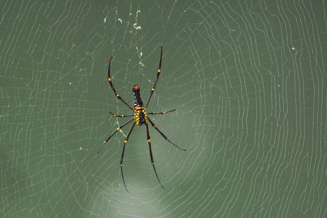
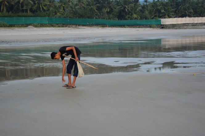
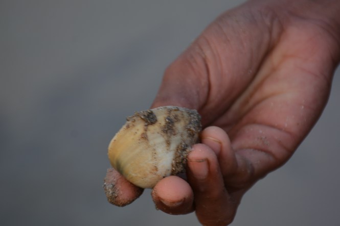
We found this large Jellyfish on the beach besides many species of bivalve molluscs.

16

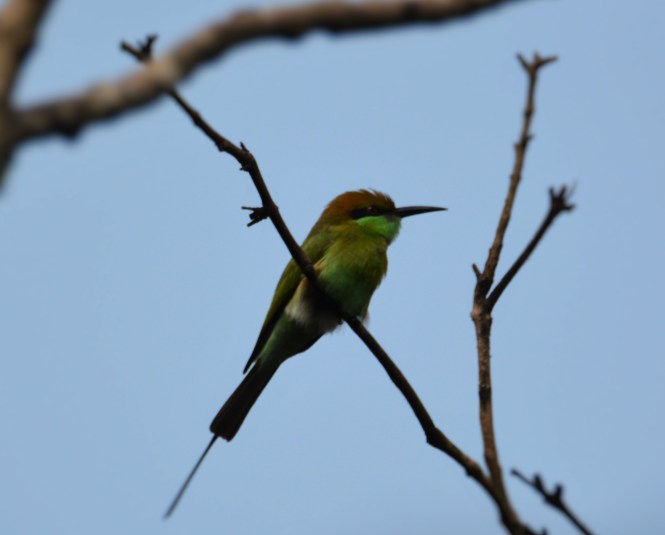
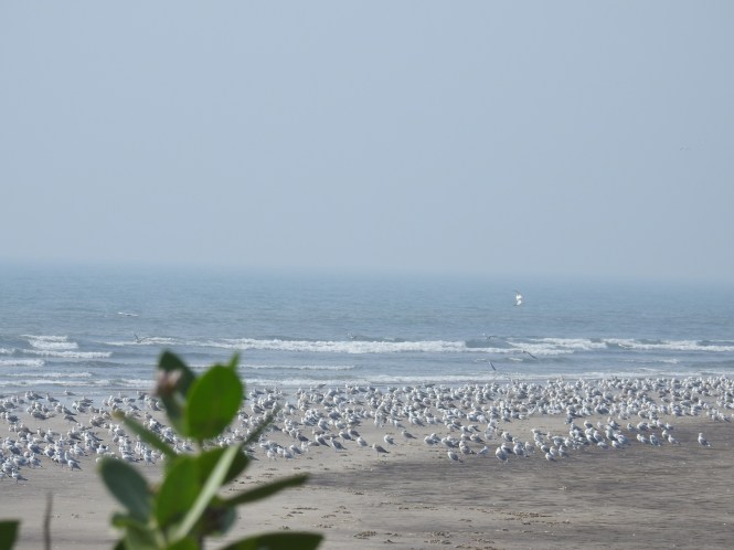
Not exactly at Anjarle but on a nearby place we found these migratory seagulls.

15

Some new hotels are coming up like the two that you see on the hillside in the picture below. There are two, one very close to the creek and another one on top of the hill.

14

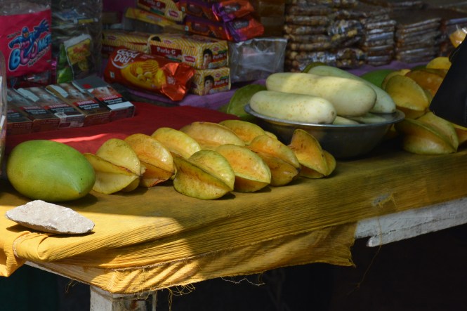
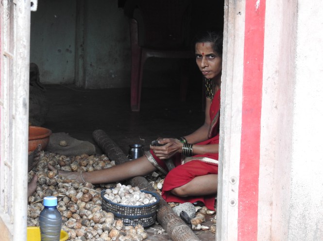
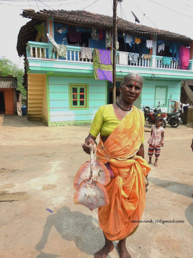
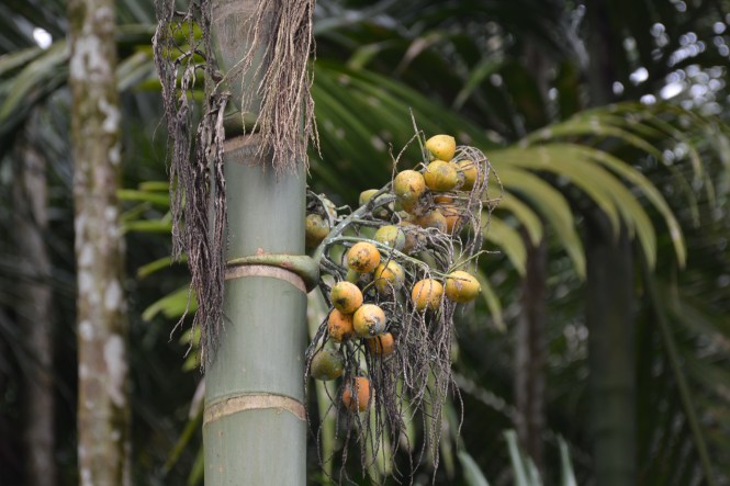
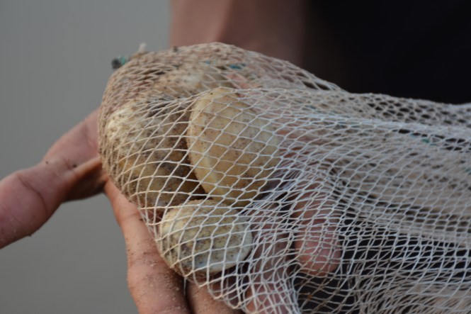
Apart from Tourism the locals main source of income appears to be coconuts and Arecanuts. Here is a lady de-shelling the nuts and making them ready for the market.

17

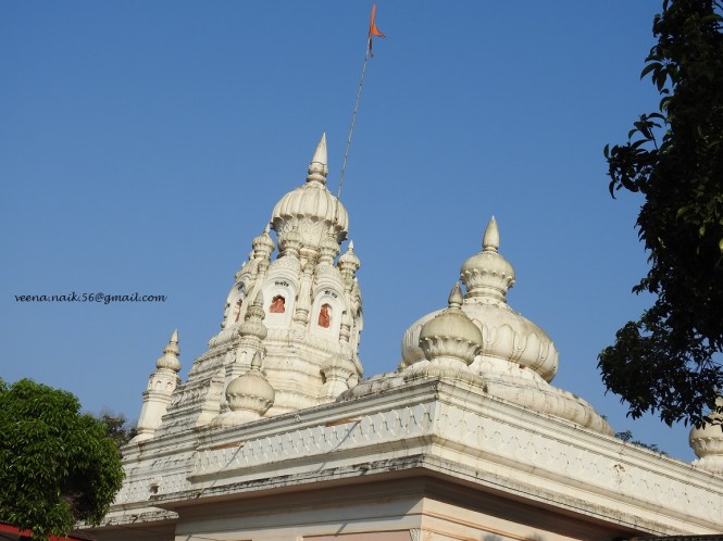
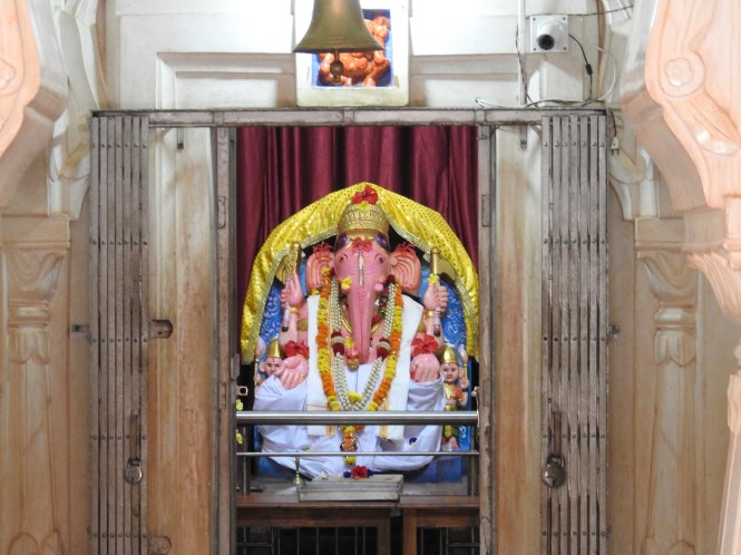
There is a famous Ganapati temple on hills south of the village. It is called ‘Kadyavarcha Ganapati’ or Ganapati on the Cliff. I like the idea of a God being on the cliff. He will be more alert and customer service will be better.

18

19

In the compound of the temple is this tree of Bakul.  I don’t know what it is called by the Botanists. Its flowers smell very strong and nice and the fruit is edible. The people around claim that it is 300 years old. It had to cut down to size to avoid danger to the temple structures.

20

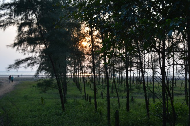
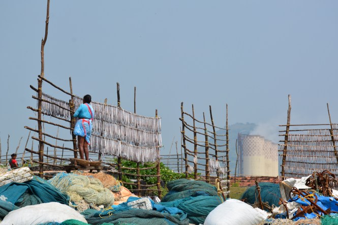
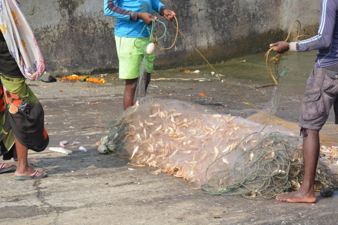
From Anjarle the next place in the south is called Harne. The approach is through a narrow road passing throgh a fishing village.dscn8430

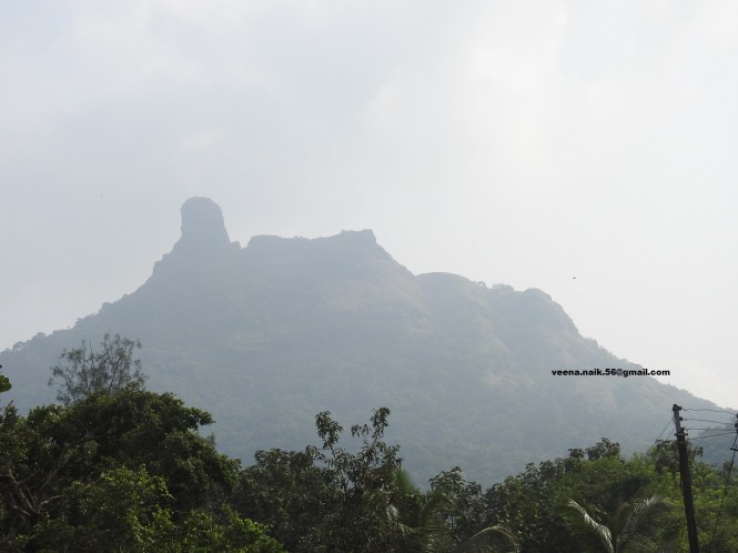
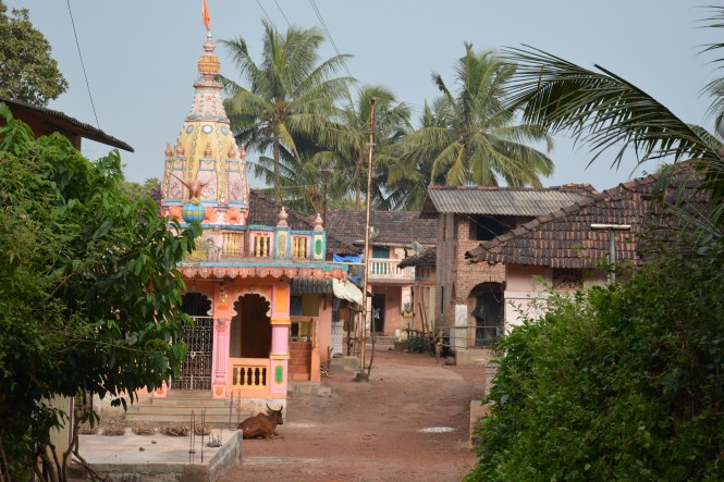
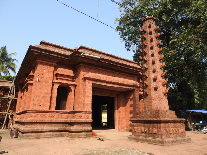
We pass this temple towards the Harne village which is having not two, not three but four Forts within a radius of a kilometer, a record of sorts.

Text by Suryakiran Naik

Pictures by Suryakiran Naik & Veena Naik.

NOTE: In this Blog you will come across notes on the coastal forts all over the county. Many of these places do not have any records as to their origins and whoconstructed them. Very little literature dedicated to this subject appears to be available. We are using, for reference, three Marathi booklets authored by Sachin V Joshi and published by Bookmark Publications , Pune. There are three booklets , one each for for Raigad, Ratnagiri and Sindhudurg districts , the districts in which many of the forts are located. They are quite useful for the area in question.

sachinjoshi200@gmail.com

bookmarkpublications@gmail.com


53. DIGHI, ADGAON, DIVEAGAR,HARIHARESHWAR, BAGMANDLA

The media used by TheBlueDrive blog is created by us and not copied from elsewhere. Therefore, we have not used any maps etc. which would have been helpful in understanding the progression. Without compromising on this principle, I can show you a map because it is a photograph taken by me. Human beings go to any extent to justify their own actions.

1

In the last post (no. 52) we have reached the beautiful beach of Shriwardhan. In keeping with the Charter of TheBlueDrive, we should have crossed from Agardanda to Dighi and then driven to Shriwardhan. Now that this is a violation of the Charter, we need to make amends and cover the omitted area.

The starting point is Dighi.

2

Dighi is a privately managed port with facilities for storage of liquid cargo. The Rajpuri creek looks beautiful from here and one can also see in it’s entirety the Murud Janjira fort. Apart from the port it has several other landing facilities one of which was used in 1993 by Dawoodbhai and his associates for landing RDX which was used for 1993 Mumbai bomb blasts.

4

3

On the way back we come across this Picture Postcard village. It is called Aadgaon.  The fishing boats have returned and an auction is in progress.


We buy these fishes and prawns. It is about 2 Kgs and we are going to have them for the lunch.

dscn8128

But how? There are no restaurants here. We find this small roadside place and the owner agrees to cook the fish for us and also provide us some rice and curry.

dscn8182

We are grateful to the family of Navanath for the delicious meal with very fresh fish.. His wife refuses to be photographed.

dscn8179

We proceed towards the next village, Diveagar or  Dive Aagar but on the way we come across these migratory birds. We could identify 4 different species of Gulls in adiition to some waders.

The whole area is exquisitely beautiful.

Between the hills which are the foothills of Sahyadri range, there is very little land between the hills and the sea. Therefore there is hardly any agriculture. However the people do grow something within the land available.

This is the ’til’, Sesame seeds. They are being dried on the roadside. The whole plant is uprooted and dried and then the pods are separated.

This flower grows wild in the area.

dscn8060

Diveagar itself has along beach and lot of facilities for tourist. It also has a famous temple of Suvarna Ganesh Mandir. It had attained fame after the original gold idol was subject matter of an armed robbery.

dscn8089

We return to Shriwardhan for the night halt. We start in the morning and visit the memorial to Balaji Vishwanath, the 1st Peshwa.

dscn8203

And then proceed to Harihareshwar where the family deity of the Peshwas is located.

dscn8219

We did not find anything interesting at Harihareshwar. It has two beaches and a lot of people visit the place for religious and leisure purposes.

We proceed to Bagmandla, the last place in Raigadh district to cross the ferry into  Ratnagiri district.

In the ferry we find this motorcycle with this message. Tu 13 Dekh, loosely translated means ‘mind your own business’.

dsc09272

Text : Suryakiran Naik

Photographs : Suryakiran Naik & Veena Naik.


52. AGARDANDA,KUDE,MHASLA, SRIVARDHAN

On leaving Rajapuri or the more commonly known nearby place Murud-Janjira, if you want to travel towards south on the Maharashtra coast the best option probably is to cross the Rajapuri creek at Agardanda and land at Dighi port on the opposite side of the creek. From there it is an easy ride to Srivardhan.

We go to this place. What do you see there?

1

It’s a Launch to take you across the Rajpuri Creek. This creek was the place where the RDX for the 1993 Mumbai Blasts was landed.

2

We decide not to take this easy option. I don’t remember the exact reason. There is nothing in the Charter of TheBlueDrive against taking a ferry when it takes your car. One possible reason is that the creek is quite wide and taking the short cut would have robbed us of beautiful sights around a part of the wide creek. And then there are those Buddhist caves near Kude to see. To reach Kude you need to cross this bridge across the Rajapuri Creek.

3

But a few kilometers before that we pass through beautiful countryside and wetlands.

img_4659

We could see some uncommon birds like this Snipe.

img_4578

And this Ashy Drongo.

img_4591

It is time to harvest the rice paddies.

2a

The villages around are pretty.

2b

After crossing and driving a bit we reach the place where we need to stop for the caves. There is no signpost, no indication whatsoever that one can walk and see some of the most beautiful Buddhist caves. The indifference of the ASI, apathy of Maharashtra Tourism and the ignorance of the rest of the government machinery have conspired to keep this place away from the public gaze. From the main tarmac road, one has to walk a Kilometre or so to reach this unprotected place.

The caves are in fairly good condition compared to many others.

Even the inscriptions are legible.

10

The caves have some nice frogs.

wl3

wl2

We leave the caves behind and proced towards Srivardhan. On the way to our let we can see this little fort called Tala Fort. No, we dont want to climb it. Just say hello toit from the roadside.

14

13

We reach Mhasla around lunchtime and decide to stop at Srivardhan for the lunch and for the night. We visit the beautiful beach in the evening to see a cricket match in progress.

img_4671

The sunset is beautiful.

dscn7981

This plant is growing wild near the beach.

img_4667

& this citrus fruit

dscn7976

On the beach it is difficult to know which girl is the most beautiful as manyof them are in burkha.

img_4674

Text by Suryakiran Naik

Pictures by Suryakiran Naik & Veena Naik

51. NANDGAON, MORE, MURUD, RAJAPURI.

If you stay at Kashid beach and want to have a beer, you have a problem. They don’t sell any alcoholic substance in Kashid. What do you do? Simple, drive 3 Kms to Nandgaon and buy your stuff. But that 0may not be the only reason to visit Nandgaon. It is a beautiful little small town on the seashore which can be seen from the top of the hill as you drive from Kashid. It has its own beach. The speciality of the place is that the seawater passes through a small creek and the mangroves which are very close to the village.   It is also the nearest town to the Phansad Wildlife Sanctuary covered earlier in this Blog.

nandgaon

Our destination today is the famous town of Murud or Murud-Janjira as some people call it to distinguish it from another town of the same name and associate it with one of the most famous sea-forts in the Arabian sea.

Even as we approach the destination, we take a small detour prompted by the roadside sign. There is a small village called More (pronounced Mor-ye) priding itself on a temple. We descend the hill towards the seashore to the small little village.

The temple is nothing great but kept neat and clean and very colourful.

more3

This lady in the village square has bought this pair of ray-fish and was displaying them to the envy of the neighbours and posed for the photograph after tidying her saree.

more1

Can you go to the seashore from here? Sure, please take the left turn and proceed.

Will this car pass?

May be. Try.

No thanks. We decide to return to the main road. I have driven through so many narrow roads in the last 80 days, I am having nightmares. I am serious. This is not a joke.

I met this man in the village square. He did not look like a local and he greeted me in Hindi. He wanted to find out who the person in-charge of the temple is.

‘I am not and I don’t intend to be one. Where are you from?

Delhi.

What are you doing here?

I am a salesman.

Selling what?

Cleaning Products!!!!!!!!

I have not seen a cleaner temple than this one in the last few years. If he succeeds in selling something here, it would be like selling ice to the Eskimo. You never know. To start with I am surprised this man from Delhi has reached all the way here. I wish him success.

more2

We move on. The road passes the seaside with greenery all around and then after some time we see the palace of the last ruler of Janjira , the Nawab, inheritor of a bizarre part of Indian history wherein the slaves brought in from eastern African coast ruled a part of India.

This palace is occupied and vistors are not encouraged.

There is no way one can blame the Nawab for his destiny. It was created for him by the previous Muslim rulers of the Sub-Continent. The Bahamani sultans of Deccan broke away with the Moguls in the year 1437 CE. They then brought in slaves from Ethiopia (or  what was called Abyssinia) more probably that part of Ethiopia which is now an independent country called Eritrea.

These slaves spread, in course of time, in the armed forces of the Muslim rulers and became important part of it.

The Bijapur sultan entrusted his most important fort the ‘Jal-Janjira’- the water fort to the Habshi (meaning Slave ) governor, In the year 1621, Siddi Ambar the governor declared himself the ruler of the place. This was the foundationnof the the Siddi dynasty.  This situation continued under the British rule and until the independence of India when the ‘subsidiary ruler’ relationships with the British Crown where ended by the government of Independent India.

The palace overlooking the sea and at an aesthetically selected location was built much later and I am told, much of the material in the old fort was transported here laying the palace in the fort desolate. I appreciate the foresight of the Nawab. He could foresee that his being in the Fort at a huge expense was not a viable option in the future. The Patels of this world would not allow it.

The present day Murud is a seaside place for the people in the cities to come and help themselves to the fresh air of the sea. It has a number of establishments catering to the tourists and there is one on the hillside before reaching the town where we stayed a night. Brilliant views and sunsets. Bad food. To make things worse a Muslim place with no beer allowed. the view from the hotel.

sunset

To escape Allah’s wrath, we go and stay the next night at a place owned by a couple both of whom are teachers and would not mind if we drink. Not that we ask them. They have not displayed any pre-conditions at the Reception. The man is a drawing teacher. He has hung many of his drawings and oils on the walls of this small lodging. Nice people but the place needs improvements.

We spend some time looking for places other than the main draw- the Fort. There are not many of them. There is a place called Garambhi, made famous by a celebrated Marathi novel ‘Garambhicha Bapu’ published in the year 1952 authored by S N Pendse. It was also adapted as a Play and made into a film in Marathi. Half way down people advise us that there is nothing there, just the name. You can go and see the irrigation Dam instead. We heed the advice. We don’t photograph strategic places which are not allowed to be photographed by regulations. So we avoid taking pictures of such places although the regulations are sometimes ridiculous.

dam

On our way back to Murud we wander and take a left turn instead of right. After a short drive we are rewarded with the sight and site of what is called Khokari Tombs. There are many of these around apart from the three or four which are large and dominate the landscape. These are the tombs of the Siddi dynasty rulers of the past.

One interesting part of this place is the presence of three large Baobab trees. This tree is mostly associated with the Portuguese who have brought it to India. There is no record of Portuguese rule over this area but then Korlai-Revdanada-Chaul is not far away.

baobab1

baobab2

We drive past these and towards north to reach Murud but no, we are passing a different place which we intended to see the next day. Rajapuri. This is a fishing harbour from where one is supposed to visit the Jal-Janjira or Murud-Janjira, the Fort much talked about.  So be it.

You park the car near the road leading to the village from where you take the boat. It is not necessary but somebody has to earn Rs.40/- per car. We need to cross the fort by a boat to be provided by the villagers. Everything is ‘fixed’. The to-and-fro fair is Rs. 80/- ( 40 passengers in a boat) for the 100-150 meters’ distance and 45 minutes’ wait. Once you board the boat an announcement is made that you will not be able to see the fort without the services of a ‘Guide’, you will be lost, eaten by wild animals, bitten by the snakes, will not be able to board the boat in time and may go mad etc. etc. Please hire a guide who is already on the boat and charges only Rs 200/- per person, 250% of the boat fair. At Rs. 200/- per person for 45 minutes, this is among the country’s highest paying jobs. Mind you they carry 40 persons in a boat.

For fear of life people shell out the money. I had visited this place some 20 years ago. This extortion racket did not exist then. You could go by one boat and return by another paying them separately. Now it is not so. You have to return by the same boat and within 45 minutes. They hold you to ransom.

The fort is separated by a narrow channel which has a history. I mean the channel.

It has many things to show starting from the Dargah of a Peer.  The Rs. 200/- for 45 minutes guide blares out the history, geography, mythology, religion etc. in long sermon lasting about 10 minutes. Then he challenges the younger part of the crowd to climb a steep part of the fort and return in 5 minutes. They take about 20 minutes which he uses to talk to his 4 wives and a dozen children. By the time the youngsters return panting and sweating, it is time to return. Thank you.

dscn7784

The fort has a lot to see. One of the country’s largest cannons.

dscn7776 Large halls overlooking the sea.

dscn7787

and other things that you generally find in a fort.

dscn7774

A dargah at the entrance.

dscn7767

dscn7766

And this family of the Leser Whistling Ducks swimming in the tank in water covered with green algae with the young ones.

dscn7822

Text by Suryakiran Naik

Pictures by Suryakiran Naik & Veena Naik

50. CHAUL REVDANDA KORLAI & KASHID

When you leave Alibaug and Nagaon you don’t really leave them. There are two things that will follow you from here for quite a distance. One is history and the other one is bad roads. On history there is a lot of confusion about the times and names etc. About the roads there is no confusion. They are bad, very bad. Having travelled from Gujarat coast very recently we can vouch for the fact that Maharashtra is lagging behind in Roads and electrical supply by about a couple of decades. It would perhaps score better than Gujarat on the cleanliness front.

Chaul, Revdanda and Korlai should perhaps be seen as one complex because of its past although they are separated by a distance and a creek. Chaul almost does not exist. On the map it is seen as a bit away from the sea although it is supposed to be a seaside Portuguese settlement at least as important as Goa in the 17th century. The history of these places is complex and important – as important as that of Bombay. My lament is that we do not preserve our past and consequently do not remember it. George Santayana said ‘Those who don’t remember their past are condemned to repeat it’.

Most of the Forts in Maharashtra are now occupied and shared by the locals as private properties. One man has the audacity to put up a board at the entrance of a fort claiming that it is ‘private property’. We will come across him one or two posts later.

Revdanda and its fort have a physical presence. This fort must have been a large settlement as even to-day it has a large area and population.

dsc_3730

dsc_3734

dsc_3740

The road down south goes through the Fort.

dsc_3714

dscn7442

Many of these forts have Canons strewn around. They are present almost in every fort waiting for some enterprising thieves to carry them away.

dscn7451


The sea-facing side of the Fort has a crumbled entrance. The Portuguese and their successors on the sea route must have been using this as the entry point.

dscn7461-copy

Across the creek one can see the Korlai fort which we will visit presently.

dsc_3747

The region is reported to be having a population speaking a Portuguese creole with a lot of Marathi words. I guess this phenomenon is found in Korlai as we found the Revdanda population mostly local Marathi-speaking Hindu although this cute little Church outside the Revdanda fort appears to be in use.

The Marathi signage reads ‘ Mai de Deus’, mother of God. ‘Mai’ for mother is used in Marathi as well as Konkani.

dsc_3712

dsc_3709

Irrespective of the history and the religious affiliations, these seaside places are very peaceful charming and beautiful. People are friendly and helpful.

 One can see everywhere the Coconut and Betelnut or Arecanut  (supari) palms. These are the cash crops. For sustenance, it is Rice and Fish.

dsc_3739

dsc_3719

Korlai is a historical place. Its geography seems to have made its history. The creek is long and protected from the vagaries of the seas. No wonder the Portuguese, the master mariners, chose it as one of the places for their landings, the others being Goa, Daman, Diu, Cochin & Vasai.

To be very frank we are not aware of the existence of the historical Korlai fort ourselves. We are aware of the Korlai Lighthouse. We look for it, get directions, lose the way twice and ultimately are on the way – a treacherous, narrow road, if you can call it a road. On your right is the hill and to your left is the creek. You don’t have a choice- either way, bad driving will land you in water.

dsc_3782

At the end of the road we enquired as to what happens if another vehicle appears on the opposite side.

‘Not many vehicles come here’

‘when they come , it is a Sunday. We engage a person on the other side who communicates on mobile phone and manages the traffic one way.’  He charges Rs. 50/-. Worth it.

Thats from the person at the Lighthouse. It is scary but beautiful.

dscn7501-copy


dscn7499-copy

It is nearing noon and it is hot. The fort up there is enticing. We decide not to climb. We thought we could get some good pictures from the lighthouse area. because of the intense light and the heat. Even that was not to be. Here are some pictures, not very good.

dsc_3815-copy

dsc_3811-copy

dscn7507

dsc_3791-copy 
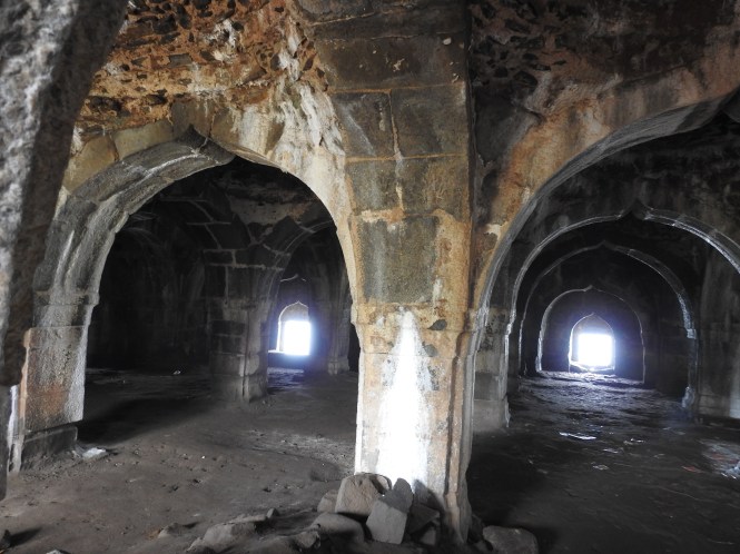
We drive back to Korlai village and its market and forget completely to take pictures of them. Our minds were still on the scary ride up the hill and the narrow lanes through the village.

From Alibaug we have not covered not much of a distance but still feel tired and want to have lunch and rest for a while. The most convenient place for the same is Kashid.

This must be one of the most vivited beaches in Raigad district. One can make out from the number of lodges around and the watersports facilities available.

We take a walk around the beach in the evening. It is beautiful beach with white sand and ample space from the shore to the waterline.

dsc_3860-copy

Another beach, another village starts from beyond the rocks

dsc_3847-copy

On the beach we find three boys harvesting large edible clams.

dsc_3841-copy

You just pick them up from the wet sand. The stick has no function here. It is for style. How does noe know where the clams are? there is a technique involved here.

Wherever the shell is the colour on the surface changes to a light green.

dsc_3844-copy

You just insert a finger or two and pull out the delicious clam, wash it and carry it home. I envy the boys.

dsc_3846-copy

dsc_3840-copy

On our way back we find this little boy playing with the ghost crabs. Most children are frightened by these creatures but not this one. He finds them, collects them, stores them in holes in the sand  plays with them at his sweet will. Very shy boy, we could not make him talk more about his hobby or what one might like to call a sport.

dsc_3877


27.10.2016


49 ALIBAUG (2)- Kihim, Thal-Vaishet, Alibaug, Aksa , & Nagaon.

In the last post we travelled up to Sasawane on the Alibaug coast. There are a couple of interesting seaside places before we reach the Alibaug town. The first one is the Kihim beach. This spot is very popular with the week-end crowd revelling. The next is Thal. Generally known for its fertilizer plant which used to be called Thal-Vaishet project. Of late, Vaishet has been dropped. So be it.

We go to Thal looking for a boat to visit the twin islands offshore called Khanderi (also called Kanhoji Angre island and currently under the jurisdiction of Indian Navy)  and Underi ( also called Jaidurg) Out of the two Underi is very close but is inconsequential, abandoned and un-inhabitated. Khanderi is partly fortified and has a lighthouse.  and some naval presence. It has a small resident population as well to attend to the temple of Sri Betal.

dsc_3509-copy

There are no specialized boats available to visit the islands. The fishermen spare their boats and the personnel as and when they are free or when they are engaged well in advance mostly on Sundays. The day we visit the fish catch is extremely good and everyone is busy.  ‘Come on Sunday’, They don’t have time now.

dscn7298

dscn7288

We walk towards the islands with a view to catch a closer glimpse. There is a long, concrete slipway for the fishing boats to dock. From the end of this slipway Underi is hardly 100 meters. The area around the slipway has a good amount of Mangroves and we see this phenomenon here.

dsc_3503-copy

dsc_3504-copy

These are the plastic and cloth shreds of evey shape , size and colour rejected by the ocean and brought ashore by the waters of high tide. Here they get entangled in the mangroves and make them look bizzare.


You can see a number of crabs and a few wading birds here at low tide. The crabs in the picture are not an edible species.

dscn7321

dsc_3545

Here is a fisherwoman drying Ribbonfish and in the background is the Thal-Vaishet RCF fertlizer plant.

dsc_3567-copy

The next place to the south is Varsoli. This is a beach, a fishing harbour and has  this bridge to nowhere. It is not new and it is not connected on either side.

dsc_3457

This golden fishis caled Mandeli.

dsc_3452

This very small watery low-value shrimp is found in large quantities in some parts of the ocean. Very rarely sold fresh, most of the catch is dried and sold, localled called ‘jawala’.

dsc_3460 
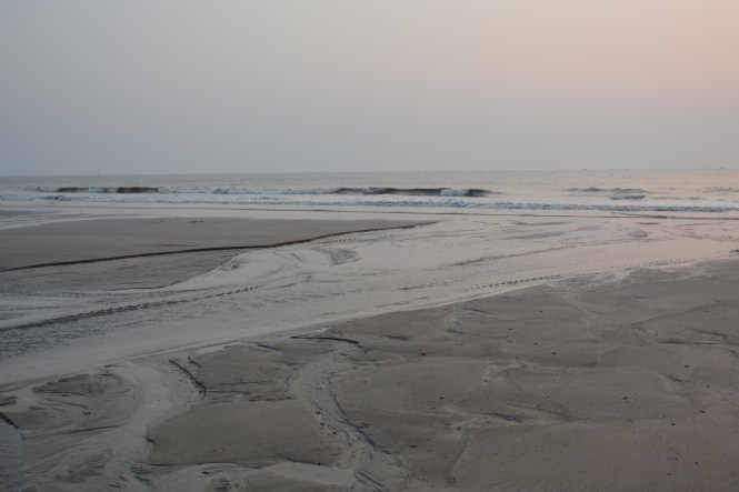
It is time to move on to Alibaug proper.

Alibaug was founded in the 17th Century and is named after one Mr.Ali who was not a muslim but a Bene Israeli  and a rich man owning large tracts of orchards. Kanhoji Angre, Shivaji’s admiral is credited with the founing of the town or in any case bringing it importance and fame. He has his memorial in the centre of the town.

dscn7406

In the background is a statue of King Shivaji.

Another monument in the town is a sculpture of a fisherwoman, very appropriate given the importance of fisheries to this district.

dscn7400

The city had a sizable population of Bene Israeli jews in the past. They  occupied parts of Alibaug and a vilage caled Nagaon across a small creek to the south. A street in the town is still known as Israeli Lane and has a Synagogue maingtained in good condition.

dscn7412

dscn7409

The main draw at least for the tourists is the Kolaba fort. It is a costal fort meaning it is not a sea fort or a fort on an island. However at high tide it is a sea fort. At low tide one can walk to it, making it a coastal fort.

dsc_3606

Nobody seems to know much about the origins of the fort and who constructed it. The information provided by the ASI is from the time of its occupation y Shivaji or on behalf of him.

dsc_3570

The fort could hold 1000 foot and 700 Horse of the Maratha army. This will give us some idea of its size.

Some parts of the fort particularly the two temples are in good shape to-day largely due to they being is use. The water in the tank is not in use and hence is in bad shape.

A portion of the fort is disjointed with a gap from the main fort.

dsc_3601

The approach to the fort and walking around is a simple matter not requiring an exertion.

dscn7363

An image of Ganapati in the front seem to have remained intact during the British regime.

dsc_3569 The view of the town from the fort is beautiful with the foothills of the Sahyadris in the background.

dsc_3594

We have found accommodation at a place called Nagaon which is about 6 kms from Alibaug. Nagaon has a beach but not a great one but between Alibaug and Nagaon is the Aksa beach which is quite good.

dsc_3701

One can see new mangrove plants taking roots on the beach which is enviornmentally a good sign but may suggest a doom to the beach.

24.10.16

Delayed by 8 days.


48. AROUND ALIBAUG (1)

If you cross the creek from Mumbai southwards, you are in the adjoining district of Raigad with its headquarters at Alibaug. The ‘u’ in Alibaug is an English mystery and that ‘u’ appears in many names without much justification. The entire district was earlier known as Alibaug. This part of Maharashtra has seen a lot of history with rulers from within as well as the Europeans. At least in one case the rulers claim African ancestry as we will see as we go along.

There are a few places having regular ferry service from Mumbai to this district. Revas is the northernmost but does not connect to Mumbai. It is used mainly for the areas adjoining Navi Mumbai and other places south of Thane Creek. You can see below the jetty and the places across the creek

1

The mangrove here are healthy and thick. Did not see much of plastic menace here.

3

4

Consequently, this area appears to be a major spawning ground for shrimps, prawns and crabs.

What you see below are chicken legs. Not the ones that you eat. What you eat are the thighs, not the legs. These are the legs proper on which the chicken run. The chicken shop in your neighbourhood would be having a problem in disposing off these discards. Not here. They are an excellent bait for Mud Crabs.

crab1

The preparations are under way for a crabbing expedition, the most professional that I have seen.

crab2

The boats seen below will be used. On a smaller scale one can even use the shore at high tide.

crab-3

The Revas port is approached through a swath of mixed wetland and mangrove. The area produces a wise variety of fruits, nuts, tubers and other produce typical of Konkan region. A smpling of those itms isfound here on the jetty for sale.

The next one is the jetty at Mandva. It is reflective of the Mumbai culture. The resturant on the jetty serves this and that says it all.

dsc_3436

Mandva is in the Sasawane village panchayat and a about 15 Kms from Alibaug town.

dsc_3446

It has a rudimentary Lighthouse.

dsc_3429

And this structure up on the hill, looking like a water tank which it is not.

dsc_3430

You will see a number of sailing and motor boats around here. Most of Mumbai’s moneybags have holiday homes and their boats here. They go incognito. Dont expect to meet them on the passenger ferry, you silly.

dsc_3443

dsc_3444

On your way from Mandva to Alibaug you can take diversion and visit the village of one of India’s topmost sculptor- Vinayak Pandurang Karmarkar and have a look at the private museum maintained by his descendents.  The place is called Awas, Sasawane.

dsc_3502

dsc_3486

Gandhiji himself is claimed to have sat for this portrait.

dsc_3481

Many Englishmen and the Indian royalty are seen among the works of art.

dsc_3484

When you come out you might find this buffalo in the compound eating grass.

dsc_3501

No. It cannot eat. It is one of the sculptures in stone.

PART  II OF ‘AROUND ALIBAUG’ FOLLOWS.

23.10.16


47. ELEPHANTA ISLAND

If you go to Gateway of India, you will find a number of boats ferrying people across. They are of several types : some take you around the harbour for half an hour. The others take you to places across the creek to a few places on the adjoining district of Raigad with its headquarters at Alibag. The logical route for TheBlueDrive to follow is this one. However as are driving and these ferries do not take cars on board, we follow a longer route.

The ferries in the Gateway are engaged in a more important and lucrative venture: ferrying people, mostly tourists, to and from Elephanta Island also known as Gharapuri Island which houses ancient rock-cut caves.  We decide to this bit whilst we are in Mumbai. My old friend J G Redkar residing in Mumbai and his wife joined us for the day.

1

As you sail towards the island you go through the busy sea traffic of both Mumbai Port and the Jawaharlal Nehru port across the harbour.

dsc_2622

dsc_2610dsc_2610dsc_2620


The local Village Panchayat is called Gharapuri and they charge you to enter the place

dscn6763

The caves are located up the hill and one needs to make his way through a long lane of shops selling a wide variety of wares. One wonders if you have come to see ancient monuments or for supporting Chinese economy.

dscn6767

dsc_2750

The Caves themselves are on top of the hill and and occupy a considerable portion of the island.

The period during which the carvings were made is in dispute with the generally accepted time as the 8th century AD. The caves depict Hindu themes and not Buddhist as is the case with most other caves in Maharashtra.

Some details. One sculpture from here now rests in the museum at Mumbai. Most of the images carved here are in bad shape.


The island has a resident population of its own. Some agriculture is practiced but most people appear to be busy in trading or providing food to the visitors. The island does not have electricity. Diesel generators are used.

To the south of the island was used a military garrison by the British for some time. A gun still exists here.

dscn6820

So does an artificial lake.

dscn6819

On the other side on can see the Bhaba Atomic Research Centre and the boat landing jetty for the island are seen in a single frame here.

dsc_2686

The island has plenty of Black Kites, which are a brown species of bird.

dsc_2720

The MTDC Restaurant provides excellent views. Cant say the same about the food.

dscn6811

Among other things sold on the island to the visitors is the Starfruit, the Carambolas fruit. This is another item which was brought by the Portuguese to India. The person selling this told me that it is grown on the island.

dsc_2755

22.10.2016

Delayed by 10 days.


46. KARNALA & PHANSAD

TheBlueDrive has been following the straight route north – south, geography permitting. The above two places are not physically connected but have a common theme. Karnala is a bird sanctuary and Phansad is a general kind of sanctuary, both under the Thane division of Maharashtra Forest department. Our stay at these locations was separated by a two-day stay elsewhere which will be covered in the next post. The places themselves are separated by a distance of say 80 -100 Kms  by road.

Karnala has dual importance. It has a history as capital of a region under the pre-Maratha Muslim rulers. It has a fort and is now a Bird sanctuary hosting close to 200 avian species.

1

This is the proof that I am alive to some of my friends who have doubts about my continued existence on this planet.

2

TheBlueDrive has been on bad luck as far as wildlife is concerned despite the fact that ‘nature’   was planned as the major theme of the travel. The reasons are various. The time of the year being the major one.

‘There have been late rains and the foliage is thick. You won’t be able to see many birds. Please come later in December’

No, we want to spend time here as this is a continuous travel programme. It is not possible to come and go up and down.’ OK, you can stay at the cottage’ inaugurated by Chief Minister of Maharashtra Mr. Vasantrao Naik long time back.

In the event, the advice about the birds given by the forest department guy turns out to be correct. The foliage is too thick to see or identify anything although Veena manages to capture a few species and I chip in with some. Allow me to skip the ornithological details.3

(black-headed Oriole)

4

(a species of sunbird)

5 6

( a bee-eater)

6a

I worked on the spiders. This place must be breeding a huge quantity of flying insects justifying the presence of large number of spider webs and species of spiders. They don’t spin these architectural marvels for fun. Unfortunately, I am totally ignorant of morphology of these creatures but I respect them for their ability to spin those architectural marvels.

7

This one looks for food on the underside of the leaves.

8

9

10

Veena found this one on the ground.

11

The park is close to the National Highway connecting Mumbai and Goa, a stretch of more than 600 Kms. through three costal districts of Maharashtra. One can hear the sounds of heavy vehicle passing on the road well inside the sanctuary which is spread on both sides of the road. This could be one of the reasons for paucity of birds on the lower reaches of the hilly sanctuary.

We decided not to climb the Fort as it would a bit difficult for us and then it is not exactly within the scope of TheBlueDrive adventure, being away from the sea.

14

15

To the credit of the forest department, this place has been maintained well without any major incursion on the nature despite the presence of the Highway. The only regret is the caged birds. The ‘ Forest department’ knows better than to keep caged birds on the premises of a sanctuary including the imported lovebirds. I don’t want to post any pictures of caged birds.

16

PHANSAD is a hidden gem. Recommended to us by an old friend Mr. Sudhir Joshi from Pune who is also a nature lover and a marvellous photographer.  One should look at the Google map and the green patch would be immediately noticed south of the Korlai fort.

This is an extensive green patch and a part of it is now the Phansad Wildlife Sanctuary.

The Rajas, Maharajas and the Nawabs of the princely India had their own ‘hunting reserves’, exclusive places for royal hunts where they killed a variety of wildlife assisted by armies of servants and trained ‘shikaris’. Phansad was the royal hunting reserve of the Nawab of Murud-Janjira. About this place you will hear more from me later on. Right now let me confine myself to the Sanctuary. It qualifies to be a part of the TheBlueDrive as it is less than 30 Kms as the crow flies.

dsc_4108

dsc_3974

Sudhir sent a text message saying that this is the butterfly season at Phansad. I change the lens accordingly and off we go:

dsc_4165

dsc_4123

dsc_4216

dsc_4209

dsc_3990

Birding was not very fruitful the culprit being the late rains and the overgrown foliage. However, we could manage to view a few but failedto photograph.

The forest has a number of fungi growing on dead wood.

& this one on a living plant.


We could click some interesting frogs though.

dsc_3951

Phansad has a road passing right through it connecting the seaside villages to Roha town on the Highway. Supegaon village is the sanctuary headquarters and the only village within it. The Sanctuary has tented accommodation which was not yet ready foir use after the rains. There are two ‘Home Stay’ places authorized by the Tourism department. We stay the night in one of those in the village

dsc_4062

The villagers grow rice and are saddled with a serious problem of animals destroying their crop. By the day it is the monkeys and at night the wild boar. All the paddy fields have to be guarded around the clock. This requirement has produced this beautiful ‘machan’ architecture.

dsc_4063

dsc_4070

dsc_4075

dsc_4077

45. BOMBAY

I know it is now called Mumbai but I will always call it Bombay. That is the name I know it by.

At first I had decided to skip Mumbai as it is a subject in itself, a place in itself and too much of a subject to be covered in this blog.

As this Blog is about Costal India, it would have been an anomaly to skip Mumbai. Nobody can ignore Mumbai be it the MNCs of New York or the terrorists from Pakistan. All of them find something to do with this place. The problem for THEBLUEDRIVE is of time and choice of what do look for. Ultimately I decided to do  a very selective note on South Mumbai.

South Bombay invoked nearly four decades of personal memories of various types.

The walks from Churchgate to VT in hot afternoons. The business meetings in congested offices and equally congested restaurants.

 Spending time in South Mumbai on a Saturday evening made a huge difference. For once South Bombay and I saw each other, relaxed.

My alma mater. She gave me three degrees between 1978 and 1983.

The stretch from VT to Handloom House, the opposite side where I hunted for my philatelic material bargaining with the Mukhis and Slatewallas of India’s philatelic world. The old Mr. M M Mukhi selling me my first stockbook is a memory which is almost 40  years old now. I still have the stockbook. In many cases stamps I can even now tell where I bought the piece and at what price. I wish this hobby had continued but it now appears that is heading rapidly to its demise. I will however continue to collect and perhaps will buy something from this very place.

This same stretch also housed the General Insurance Employees Union of which I was a member.

1

The visits to BNHS as a student member is another memory still strong. I cannot forget the strong smell of naphthalene balls in the wooden drawers at the Hornbill House which stored the specimen of bird species many of whom had been shot by Dr. Salim Ali himself.

I still remember the admonition from Mr. Humayun Abdulali to rush back to Goa and stop people from hunting the frog- Rana tigrina instead of spending time with dead birds. I also remember the friendly advice from Mr. Ulhas Rane at the early stages of my interest in birds.

 There are also those memories of a few minutes spent on the Queen’s Necklace late in the evening whilst staying at the Guest House of my employer United India Insurance Co. located close to Express Towers.

The Churchgate station and the cinema opposite. India’s first Revolving Restaurant, a place never visited but in memory.

dsc_2841

dsc_2849

The examinations of Chartered Insurance Institute, London, which I appeared for somewhere in this area will always be in my memory although I cant remember the exact building.

dscn6661

The Taj Mahal hotel where I appeared for an exit interview by the CEO of my last employer (so far) in India. It was early 2009 and the hotel had just started functioning after the terrorist attack.

dsc_2603

Let me cut short the nostalgia part now although there are many more memories.

TheBlueDrive has been tracking the Lighthouses and we cannot default here. Mumbai seems to have one new and one dysfunctional lighthouse. There are some other structures resembling lighthouses. They are located in the Navy’s domain but can be photographed from a distance. The first one is certainly not a Lighthouse. The first one does not look like a lighthouse.


Mumbai docks and the harbour had a glorious past. Everything has its day. The importance of the port declined substantially after the JNPT across the harbour became operational with a container port. Mumbai would have been an impossible town at today’s volume of cargo traffic.

Mumbai’s Parsee landmarks are something which all visitors must have a look at although non-Parsees don’t have access to them. This includes the leafy area of Malabar Hills where the Tower of Silence is located. I wish every town in India had a green place like this.
p1

p2

 p3

Not far from here is the world’s most expensive residence.

dsc_2770

And then probably the most famous Dargah in the world. Haji Ali. A large number of Bollywood movies have shown this for one reason or the other. Currently it is in the news because some women want to enter the part of the place where women are not allowed. You are right. Women are not reasonable.

dsc_2778

The other such popular appearances in Indian cinema are for the Sun & Sand Hotel at Juhu and the Gateway of India.  Every leading lady of Indian cinema in the 1960s, 70s and to a lesser extent 1980s has dirtied the waters of the swimming pool at Sun & Sand.

Whenever the destitute hero from UP or Bihar lands penniless in Mumbai, he finds solace in the groundnuts sold in paper cones at the Gateway. Later on he manages to buy the expensive properties at Juhu and Bandra. VT has been the favourite destination station of the Indian hero. Most of the time he landed here. A few times he also landed at Churchgate and Mumbai Central and did not make it big. Of late they come by air from Lucknow and Patna and land at Santa Cruz.

Bombay or Mumbai if you want me to relent, is an endless place and the space for me is limited. Thank you for reading.

21.10.2016

Delayed by non-availability of Internet.