110. ODISHA. (4) Konark & Around.

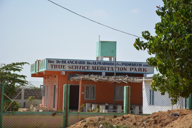
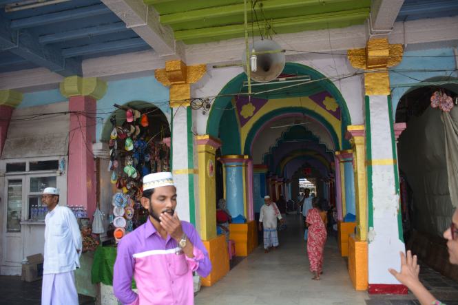
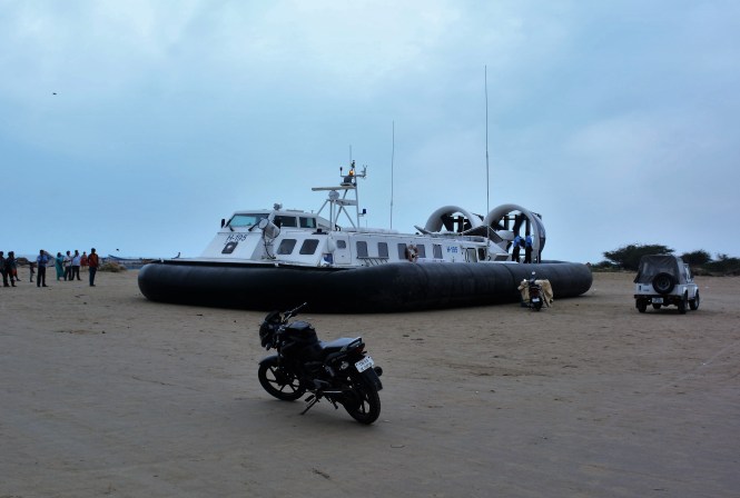
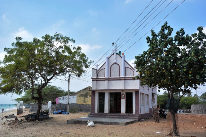
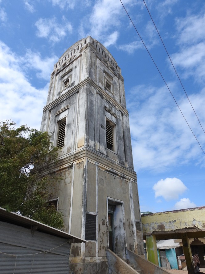
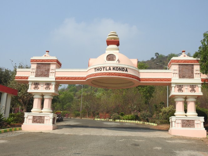
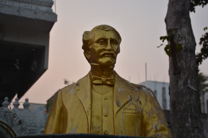
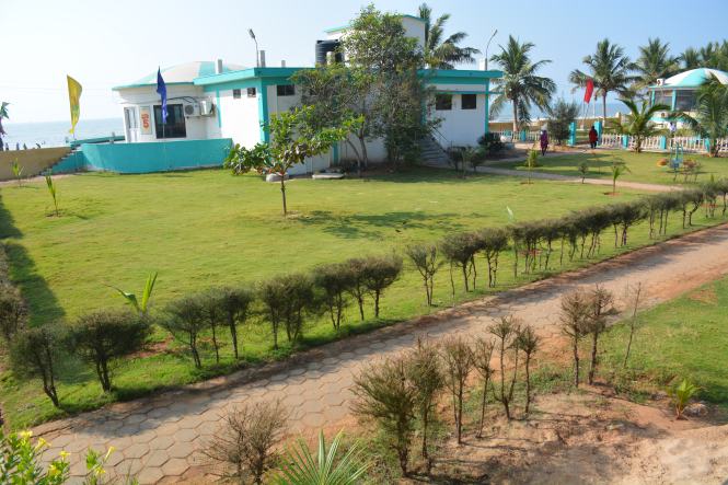
In the last post, we had stopped at Chandrabhaga, on the outskirts of Konark. It is now the time to enter Konark town. In fact, Konark is a small village. Despite the large number of visitors there are not many hotels here. Most of the people stay at Puri (36 kms) or the state capital Bhubaneshwar 65 Kms. away. We stayed at the OTDC property very close to the temple. Whilst in Odisha we used the Odisha Tourism Development Authority’s lodgings wherever possible. They were very helpful, despite being a government organization, in making us comfortable. They accommodated our requests for change of booking dates and last-minute bookings from their office at Bhubaneshwar.

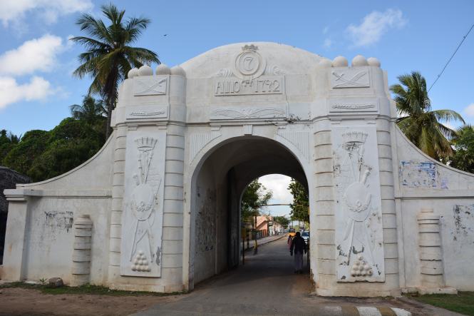
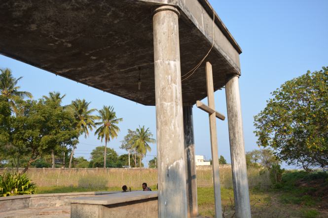
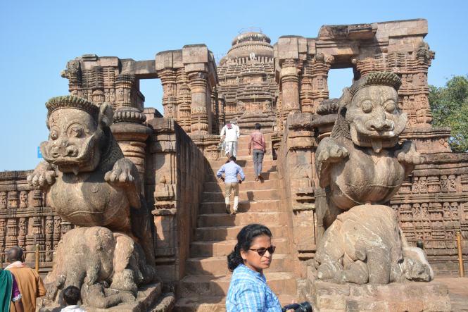
The highlight of the place is of course the Sun Temple or what remains of a glorious 13th century structure. The ruins do not appear to represent more than quarter of the original complex.

This temple dedicated to the Sun God was constructed by Narasimha Deva of Eastern Ganga dynasty. Eastern Ganga dynasty was not in the league of the richest dynasties of Indian history but it created this grand monument disproportionate to its power. It is unfortunate that it did not survive longer.

DSCN5283

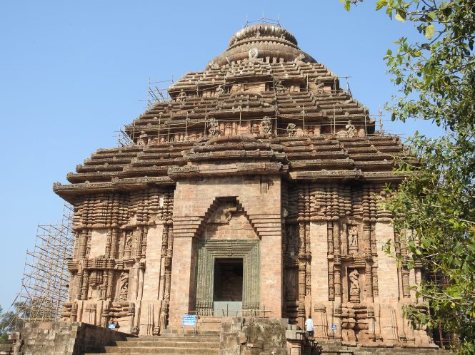
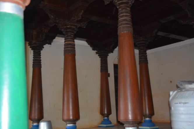
The temple was constructed in the shape of a huge chariot with 12 pairs of wheels, three meters in diameter. The main sanctum of the temple 70 meters in height crashed in 1837 about 500 years after its completion.

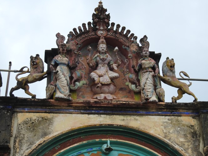
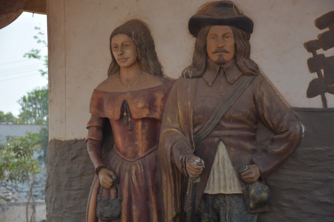
What distinguishes this temple from the innumerable others in India is the carvings all around its exteriors depicting explicit sexual acts. This feature attracts all kinds of travelers – scholars, artists etc. There have been numerous interpretations about these carvings and there are numerous theories about the collapse of the main temple but no firm knowledge of the cause of the former and the reason for the latter.

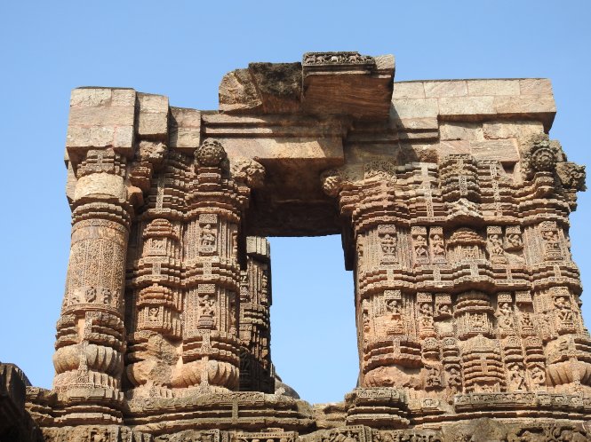
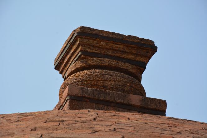
The temple complex used Khondalite stone and iron. The stones perhaps from the collapsed portion of the temple are seen everywhere in the compound. Some of them have been moved to a museum compound behind the temple.

DSCN5290

The local guides sometimes inform you that these explicit sexual scenes were intended at promoting sexuality with a view to increase population which had been decimated by the notorious Kalinga war. This is blatant misinformation. The great Kalinga war was fought in 261 BC, about 1500 years before the temple was constructed.All in all, this is a beautiful piece of architecture even the quarter of it which survives and has the unique (with some others) feature of the erotic scenes being carved on the wall. It would make things simpler if we accept this.

DSC_2073

Here are some more erotic sculptures:

XXXXXXXXXXX

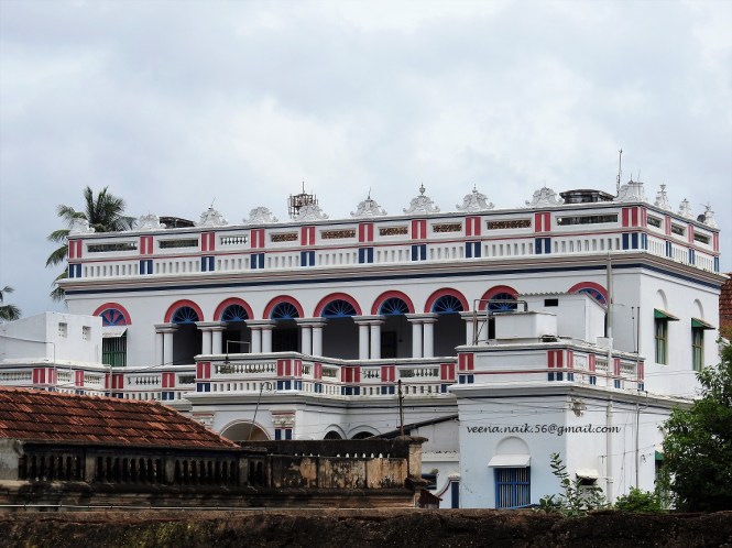
From Konark as per the original plan we need to move in the northerly direction to the port city of Paradip. However, we decide on a detour to visit two small villages on the western side to have a look at two different art forms being practiced there.

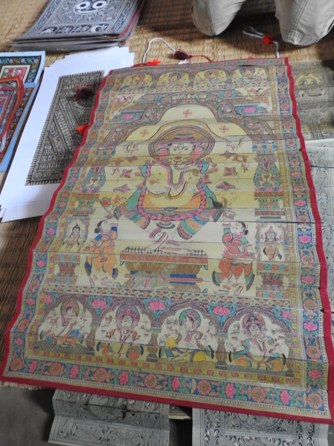
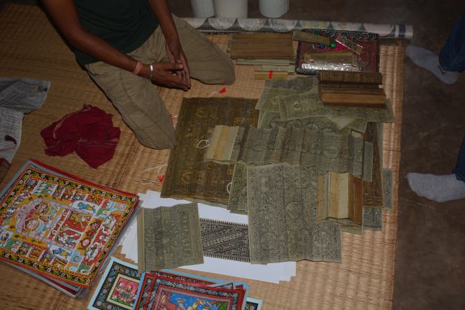
The first one is called Raghurajpur. This village of 100+ houses seems to be inhabited entirely by artists – painters, sculptors, engravers, dancers etc. But what brings fame to the village is the ancient art of ‘Pattachitra’. Patta in this context means the leaf of the fond of the Borassic palm, flattened and dried. Chitra means picture. The artisans have been creating paintings on single palm leaves or more commonly on a combined set of leaves, using organic colours of vegetable origins. It is said that this has been going on for more than 2000 years.

This art form has also inspired another form wherein multiple leaves stuck over one another are used to cut designs and pictures using knives.

Painting on Tussar silk is also practiced in the village apart from carving stone idols in the locally available stone.

DSCN5158

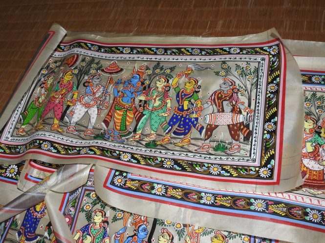
The themes in all the three art forms is either the members of Hindu pantheon, the scenes from the ancient texts and, on the secular side, the immediate environment or a combination of these three.

DSCN5141

DSC_1829

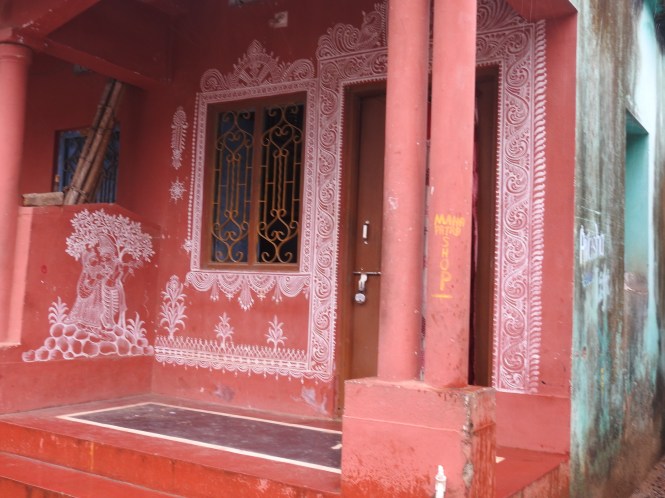
In the year 2000 the village was declared a Heritage Village and perhaps at this time the village received a fresh coat of paint or rather (mural) paintings which continues till now.

DSCN5168

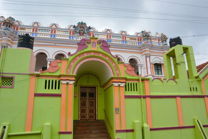
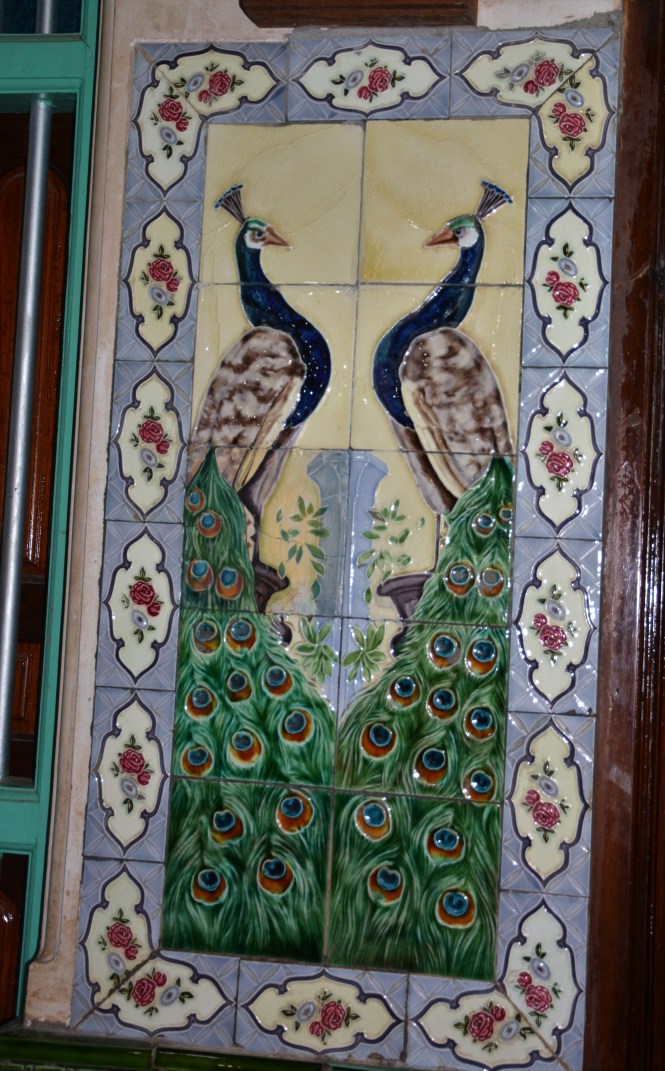
A short 27 Kms. north of Raghurajpur is located another village or a small town called Pipili.. This small place has carved an admirable niche for itself in a commercial art form. The town specializes in applique art on fabric. The streets are a riot of attractive colours and designs.

This art form is supposed to have started in the 12th century mainly for decorating the ‘Raths’ or chariots and the ceremonial umbrellas for the annual ‘yatra’ of Lord Jagannath at Puri. This tradition continues but the art form has spread to other applications like pillow covers, decorative wall hangings etc.

DSCN5104

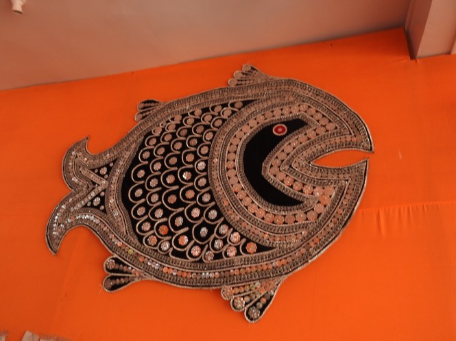
Traditionally the motives of Peacocks and Elephants are the dominant themes. Other themes are also seen. Also seen is the use of mirrors which is a variation on the traditional cloth and stitch regimen.

Here are some more of the creations:

XXXXXXXXXXXXXXXX

We return to OTDC Konark for the night halt and prepare ourselves for the next leg of the journey. On the way back we come across this procession of a deity being carried in a palanquins and are reminded that tomorrow is the festival of Holi, the festival of colours.

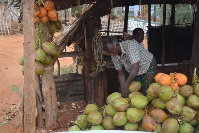
We also found these fresh mushrooms being sold on the roadside. They are in a different and colour and shape from what we get as Button Mushrooms in the cities. Perhaps they are a wild variety.

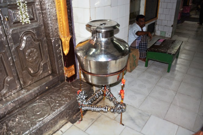
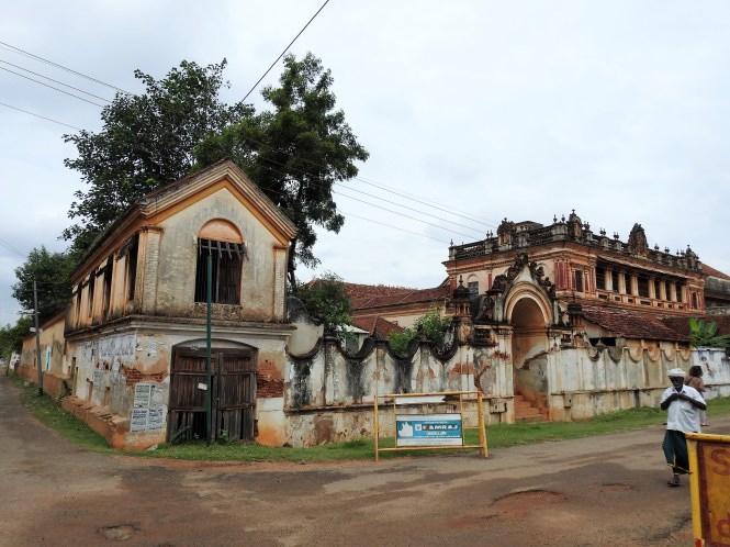
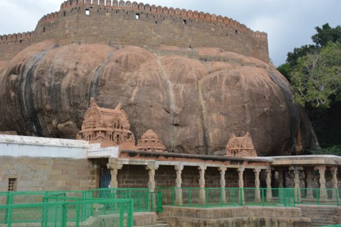
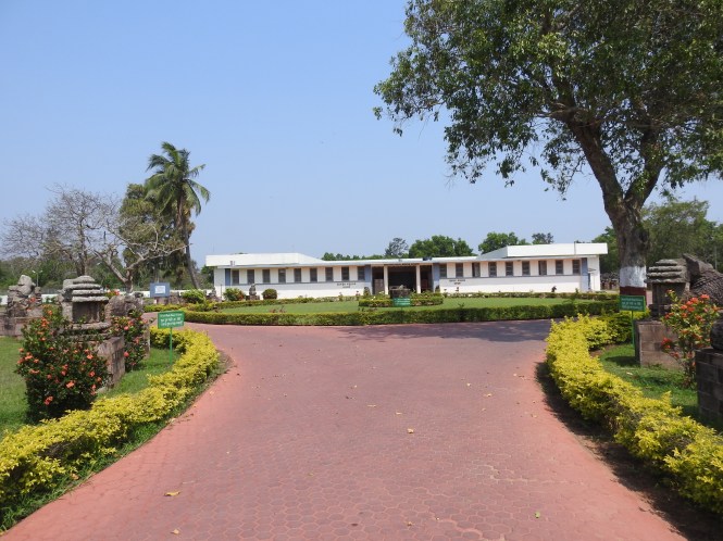
We start the next day with a visit to the Archaeological Museum located next to the OTDC complex and just behind the Sun Temple. The museum appears to have been set up to preserve the ancient artifacts of Odisha with particular emphasis on the Sun Temple. Many of the stones forming part of the temple are stored in the compound of the museum.

DSCN5377


XXXXXXXX

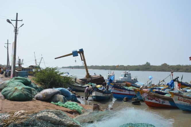
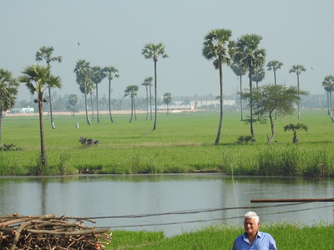
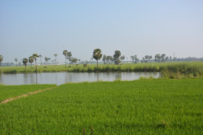
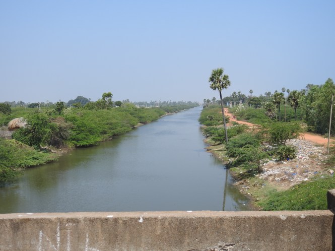
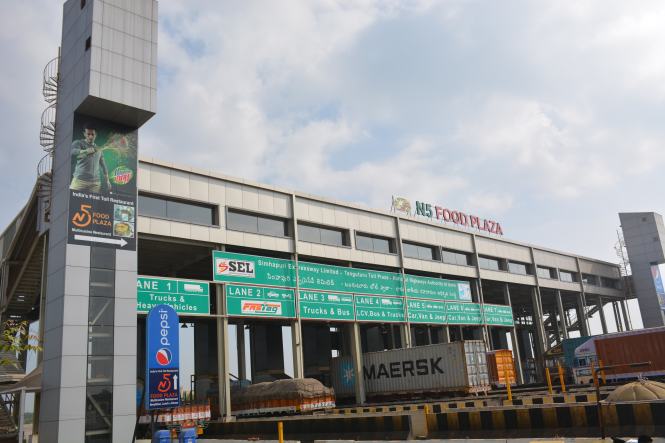
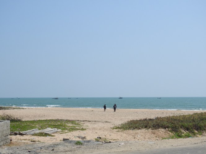
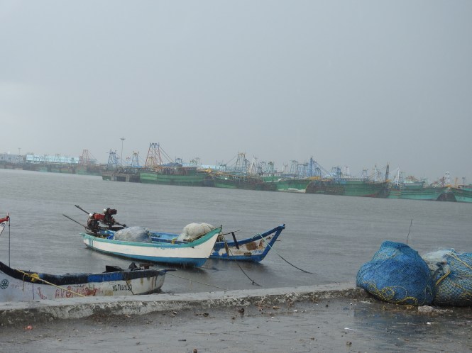
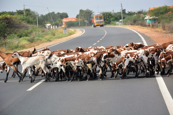
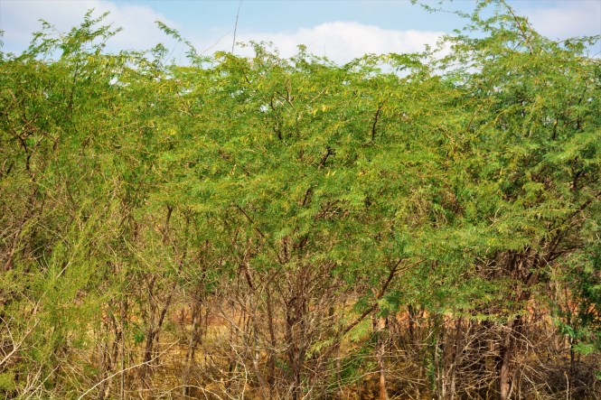
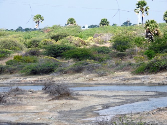
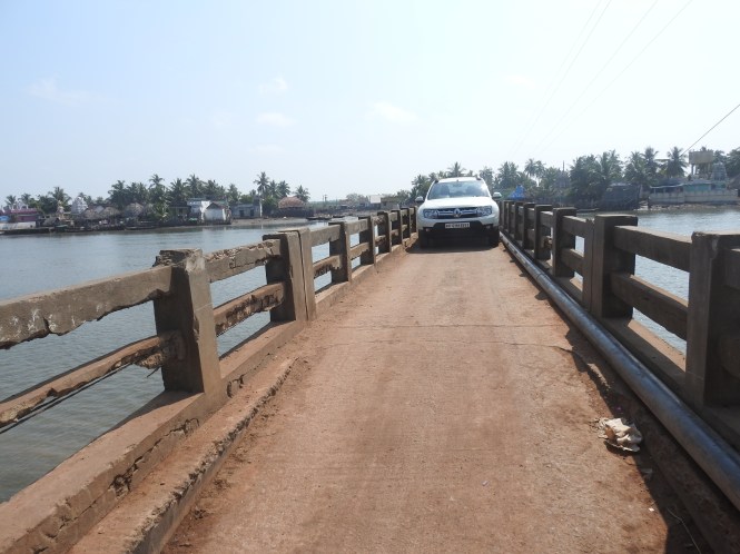
The drive from Konark to Paradip is 105 Kms long and is not along the coast. The coastline here appears to be undeveloped. The only place worth visiting appears to be the Jagatsinghpur Reserve Forest. We decide to skip this because of concerns about availability of accommodation.

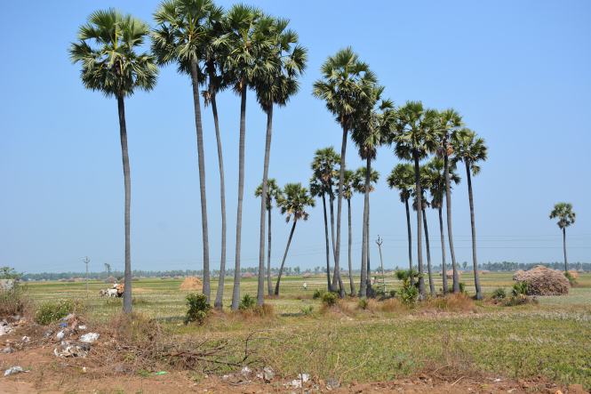
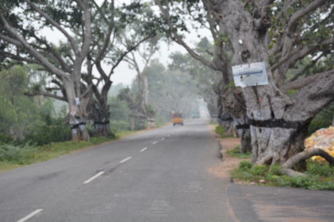
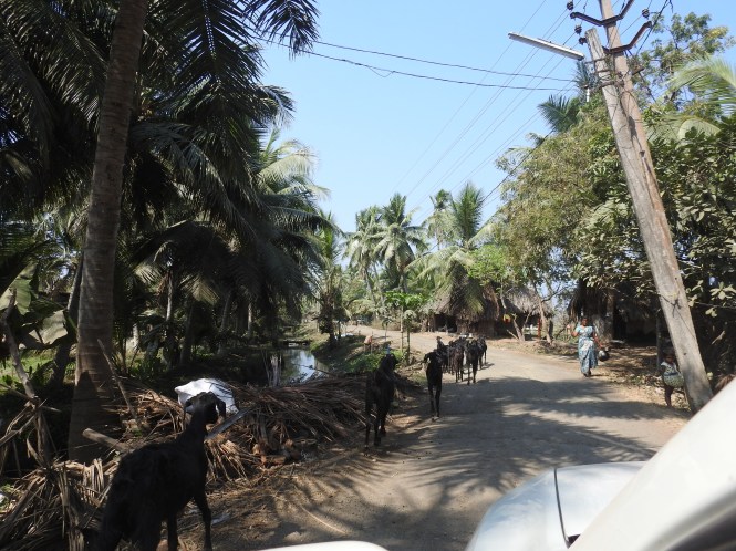
We choose the road which passes through a number of villages and plantations. Among the crops grown in the area is the famous paan- the betel leaf. This crop is grown fully covered on all sides to protect is from sunlight which appears to be detrimental to its grown.

DSCN5321

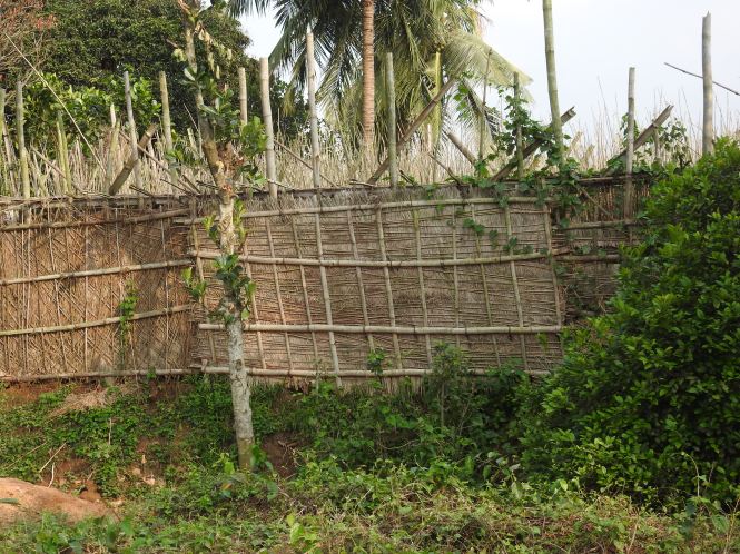
The stems of the Jute plant are used extensively in making these structures. the variety of Paan grown in western India is a climber which prefers the tall trees to cling on. Here the variety grown ( generally called Calcutta Paan) is a vine growing about 2 meters tall.


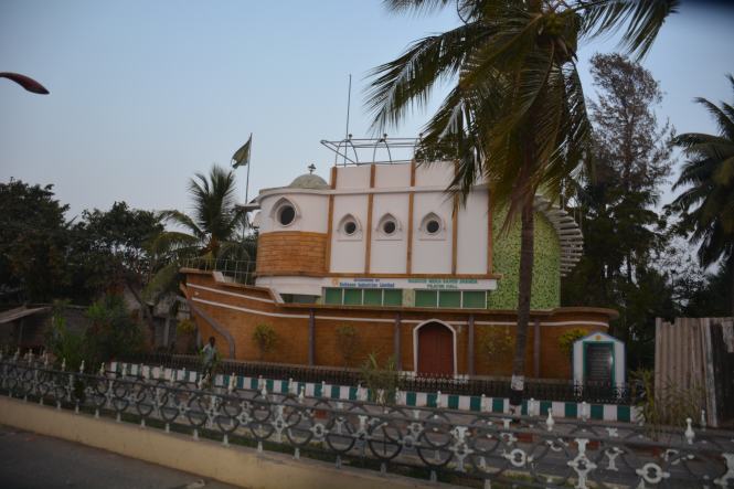
The place where we make a stopover is the shrine of Maa Sarala at Sarala Peeth, Kanakpur. This is a major shrine in the area and is close to the junction where the small country road joins the Cuttack- Paradip Highway.

Goddess Sarala is also known as Vak Devi, the goddess of knowledge and wisdom in which case she competes with Goddess Saraswati for the honour.

Another version places her as a Vaishnavite icon in the form of an aunt to Lord Krishna.

DSC_2112

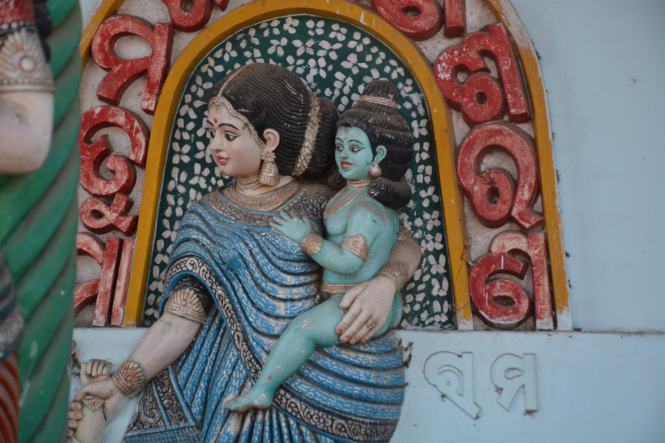
Another version depicted at several places within the temple complex is the Mahishasurmardini,  the Maata in the  Shakti or Shakta traditions.

The iconography gets more confusing when you see a depiction of the Goddess as a consort of Lord Shiva, thus spanning the Shiva-Vishnu divide. This is almost sacrilegious.  We are told that both Bilva Patra and the Tulsi Patra are used in the temple.

DSC_2115

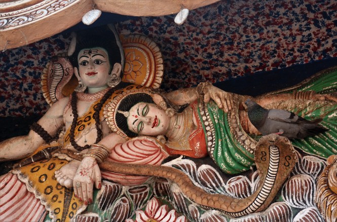
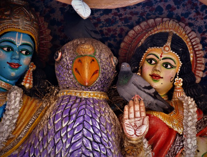
Sarala Maa is represented in the temple complex in two, four and eight armed versions and is also claimed by the Tantrik traditions. It does not make any difference to the Feral Rock Dove who is equally comfortable with Shaivite (above) and Vaishnavite (below) incarnations of the goddess.

DSC_2109

A massive dose of confusion is added with the suggestion that Sarala Maa represents a Mahayana Buddhist deity. This claim is supported by the fact that in the 8-arm version the goddess holds three unmistakable items associated with tantrik Mahayana Buddhism – Book, Veena and Bell.

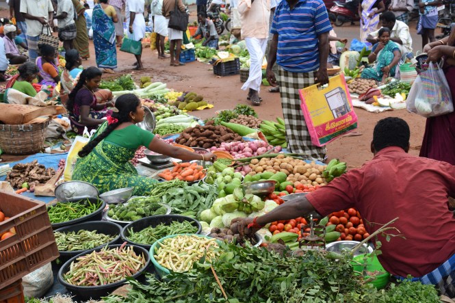
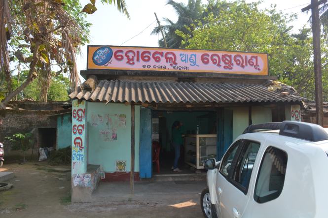
We leave Sarala Ma to her destiny or destinies and make our way out of the town and towards the road to Paradip. On joining the highway, we stop at a small roadside eatery for lunch.

DSC_2153

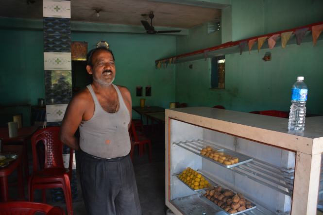
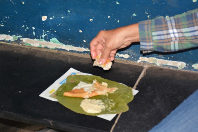
We have rice and fish and then the owner insists that we should some of his delicious sweets made of milk and sugar.

DSC_2154

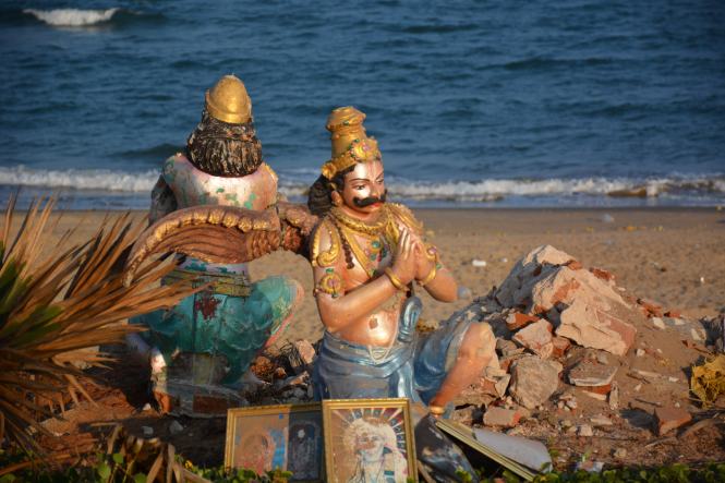
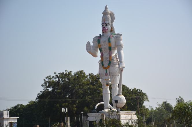
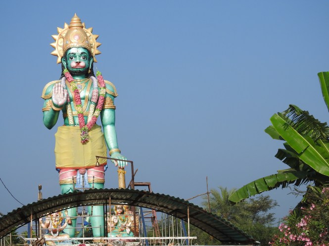
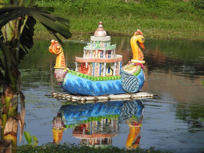
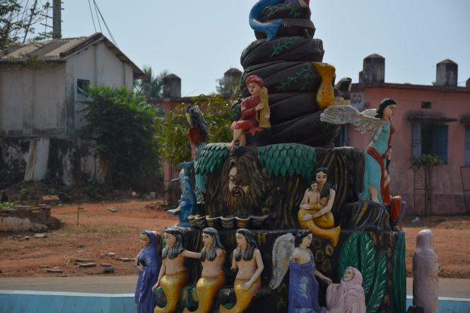
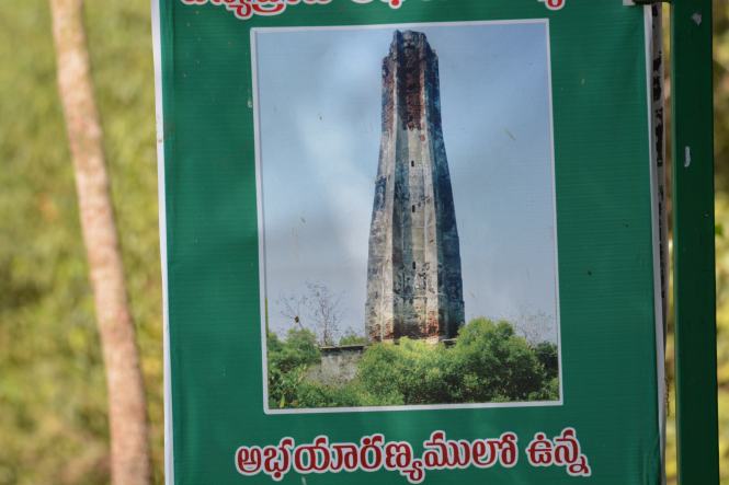
Before we reach Paradip we come across this beautiful sculpture in water by the side of the highway. We  have not been able to ascertain its significance until now. Hope to be enlightened soon.

DSCN5408

Text by Suryakiran Naik

Pictures by Suryakiran Naik & Veena Naik

For more pictures please visit the Facebook page- The Blue Drive.

105.ANDHRA PRADESH. (9) Visakhapatnam , Thotlakonda,Bheemili, Bheemunipatnam.

The Visakhapatnam Metropolitan Region starts almost immediately after one leaves Anakapalle. A large hill appears from nowhere on the sea coast. In fact the Eastern Ghats are located much further to the west. The hills of Vizag appear to be the foothills of the eastern ghats somehow detached from the main range to create a city in between.

The city and the region around is an ancient settlement. The history goes back to the days of Kalinga Kingdom in Odisha of which it was a part. In the subsequent centuries it was ruled by the Cholas from Tamilnadu and some local kings until it fell into the hands of the French in the 18th century. The British wrested control from the French in the early part of 19th century and ruled till the Indian independence.

Vizag as the town is also known as  is a great natural harbour, a major port and an important naval base of Indian Navy. The combination of these gives the metropolitan region a population of over five million, the largest in the state of Andhra Pradesh. Kailasgiri Park on the northern side of the town is a standard tourist attraction with road access as well as a ropeway. The views of the beach and the sea below justifies the climb.

We just pass through the Zoological park which occupies quite a large area on the side of a hill close to the sea.


The War Memorial on the beach is another place we visit as probably everyone does when he is in Vizag.

10

We have not lined up many places to see in the city. There is a famous lighthouse of course and a couple of other hills which we would see to get a view of the town from the top.

Dolphin’s Nose Lighthouse must rank among the most visited lighthouses in the country. It is on the tour operators itinerary. To reach the Dolphin’s Nose is quite difficult. One has to take a round of the entire town and climb a hill from the south side to reach it. The shorter roads are in the Naval area and not open to public.

The lighthouse is not a great structure but the views from the lighthouse are.

5

There is a Dargah close to the lighthouse. We skip it.

9

The next day we start early and continue along the road north of the city towards Beemunipatnam with the Rushikonda beach as the first halt.

The development of the city is in the narrow space north to south with the hills forming the obstruction towards the west. This continues throughout till Beemunipatnam.

Not far from Rushikonda are several hills in which ancient Buddhist sites have been found, some of them are quite well preserved despite their age of 2000 years+.  Bavikonda and Thotlakonda hills are the ones we decide to visit.

We visit both the places in quick succession. For someone not conversant with the Buddhist architecture they look the same- the Viaharas and the Stupas etc.


At Bavikonda ( which means Hill of Wells), we find a number of water cisterns created to collect rainwater which would perhaps last the monks a whole year as it would be difficult to find alternative source of water on the hill.

The Yellow-whattled lapwing breeds well in the hills keeping company and providing background sounds to the Buddhist stupas.

19

The entrance arch to the   Thotlakonda    site built by the Andhra Pradesh government is more grandiose that anything the Buddhist monks might have thought of constructing 2000+years ago.

24

Thotlakonda entrance gate

About 15 Kms north of Rushikonda the river Gosthnai meets the sea after encircling the hills which form the backdrop to Vishakhapatnam town. Bheemili beach is next stop. What distinguishes the beach is the large number of sculptures and statues in concrete depicting various religious themes.


Bhimili beach has a lighthouse, arguably the shortest one in the country. It is called Bheeminipatnam Lighthouse and is about 10 meters in height, overall.

DSC_0535

The Lighthouse

Gandhiji’s statue looks strange, probably the walking stick has been taken away it.

DSC_0553

Gandhi and the Lighthouse.

The Telugu love for statues and sculptures does not end here. It continues to the Bhimunipatnam town and beyond into the hills.

DSCN4094

Naracimha  on the Hill

In the town square itself there are a couple of sculptures, quite prominent.

DSC_0569

Mermaids by the dozen

DSC_0575

From the scriptures


The major one and worth looking at in detail is depicting various facets of the life of the town and probably the region.

Fisherwoman. (The birds are real, not a part of the sculpture.

Men at sea, catching fish.

DSC_0567

The townsfolk.

DSC_0559

And the white man who spent time here, not in the very distant past.

DSC_0560


Text by Suryakiran Naik  suryakiran.naik@gmail.com

Pictures by Suryakiran Naik & Veena Naik

102.ANDHRA PRADESH. (6) Sacramento, Yanam, Coringa.

Between Antarvedi in the south to Yanam in the north the river Godavari meets the Bay of Bengal by means of 4 distributaries, forming a classic river delta, rich with soil brought in by the river. This is the rice bowl of India made all the more useful and productive by an intricate network of canals and waterways. The irrigation system is credited to the British administration and more specifically to an irrigation engineer who has become a legend by the name of Sir Arthur Thomas Cotton. The importance of the irrigation system built by Sir Cotton is of immense importance to the region and is so acknowledged by the people benefited by it. You will see the statues raised to the memory of Sir Cotton everywhere competing for space with the post-independence political leaders. In 2015 a ‘Pindaparidhanam’ ceremony was conducted on the banks of Godavari to the memory of Sir Cotton, a honour reserved for one’s departed ancestors. That gives us an idea about the degree of reverence the people have for this irrigation engineer.

DSC_9783

Sir Cotton on Horseback at a village square.

DSC_9677

Sir Cotton with Lord Parashurama for company.


3

Bust at a village in West Godavari district


4

Among the statues at Yanam


Starting from Dindi on the banks of Godavari we decide to make a stopover at Yanam (which is a part of the Union Territory of Puducherry) but before we do that we have another spot to visit, a lighthouse in fact.

DSC_9951

The new Lighthouse (L) and the old one (R)


 One has to pass through Bojjavaripeta and Kandikuppa in the Amalapuram Taluk to reach a fishing village called Pora to find a lighthouse named Sacramento Lighthouse. Is the name not a contrast to the surrounding places? Does it not sound very foreign? The lighthouse got it’s name from a ship that floundered and perished in the sands near the coast. The sand bars formed along the coast in this area of east Godavari district are notoriously treacherous. To ensure safety of the ships the Sacramento Lighthouse was completed in the year 1895.

DSCN3544

The orignal 1895 lighthouse, now discarded.


 The picture below shows the lighthouse compound with the staff quarters bearing the imprint of colonial administration.


 Sacramento Lighthouse is difficult to reach. It is not the distance but the terrain. One has to drive through a maze of village roads, cross a number of fish and prawn culture ponds, cross a couple of mangroves and at last a bridge so narrow, a car can barely pass. This must be one of the narrowest motorable bridges anywhere!!

DSCN3554

village on the way.


DSCN3550

A Bridge Too Narrow


 The striking part of the region indeed the whole of Andhra Pradesh is the existence of large number of statues at every conceivable place.


XXXXXXXX  YANAM

DSCN3575

Yanam Entrance


DSCN3576

The trademark gates of Puducherry at all the 4 places


When you cross the last distributary of the mighty Godavari, you drive into the former French territory of Yanam. Yanam which is now a part of the Union Territory of Puducherry and the surrounding areas of Andhra Pradesh have nothing to distinguish between them. One can walk from one to the other without knowing. The only differentiating factor perhaps is the price of fuel and liquor which is lower on the Yanam side.

We try to find some ‘French’ past- architecture, art, food, monument etc. There is none or next to nothing. Yes, there are a couple of government buildings and a Church. Surprising? Or we were not properly guided.


 What dominates the town is the post-independence riverside beach and recreation area on the north Bank of Godavari, replete with statues of politicians and the large plaques indicating which politician inaugurated the statues.


Yanam has a couple of good restaurants purely local and do not indicate even remotely any French influence. Culturally the place is pure Andhrite. We could witness the procession of Virabhadra right in the centre of the town.

DSC_9940

 Yanam is now shaping up in a different way. It is the hub for the KG-2. The Krishna-Godavari Gasfields. Reliance group is quite active here.


DSC_9837

XXXXXXXXXXXXXx Coringa.

The area north of the mouth of Godavari where there is considerable drilling activity for natural gas is also a bilogical hotspot. The dense mangrove forest has prompted the Andhra government to declare a sizable area as a wildlife Sanctuary. Coringa is located between Yanam and the port town of Kakinada to the north.


This sanctuary will not survive long despite the dense mangrove cover. It is under threat from all directions. To to the south are the gas drilling activities. To the west are the prawn culture ponds which are almost inside the sanctuary. The overall picture of the sanctuary indicates that it is being turned into a picnic spot. A road  inside is even named. To add to the problem are the huge number of students who make the sanctuary a lovers lane.

DSC_9913

Nobody seems to be bothered about the wildlife for which the place was set up.


At low tide the mudskippers are quite active in the mangroves.

DSCN3524

The extensive wetlands facing the Bay of Bengal and the meeting of the Godavari made this area economically important during the British regime. This is born out by the fact that there used to be extensive shipping activity along this part of the coast. In spite of the wetlands and the mangrove cover the area boasted two lighthouses. We have seen one at Sacramento and another one was supposed to be functional at a place in the mangroves in the past. It is no longer functional and cannot be reached by road. There is a possibility of reaching the place by a boat journey of four hours as indicated by the boat operators. We decided to pass it and be satisfied with a pictureof it found in the sanctuary.

DSC_9868

Text by Suryakiran Naik. suryakiran.naik@gmail.com

Photographed by Veena Naik & Suryakiran Naik

99.ANDHRA PRADESH. (3) BAPATLA-SURYALANKA, NIZAMAPATNAM.

Our original plan to stay at Chirala beach has gone haywire as no accommodation was available that Sunday afternoon. The nearby beach of Vodareru did not welcome us either and we were advised to go and find accommodation at Bapatla. Bapatla is a typical small town which has an engineering college.

As you enter the place various models of manual bicycle/tricycle vehicles attract your attention, a feature that will continue till the end of our tour in West Bengal. Here is a goods carrier which can comfortably double up as passenger carrier. I don’t know how they manage in the rains.

What do we do in Bapatla? The Engineering college is not likely to admit us. There are not many things to be seen here. Right? Wrong. Every place in this world seem to have something to offer as its own.

Here is a hearth, a cooking place which uses the rice husk very effectively. In fact, rice husk (and groundnut husk) can provide a lot of fuel for the rural people. The rice husk is commercially available in bags.

Probably that is the reason the Rikshaw puller we saw above is able to get a good meal at an affordable price at such places. We, coming from Pune found the breakfast ridiculously cheap. And it is GOOD and fresh, and it is not using any fancy plastics- this leaf is good enough. In Andhra they rarely serve Masala Dosa, most of the time it is the plain Dosa with Chuttney.

DSC_8881

The serving leaves under the paper, usually yesterday’s newpaper but the application forms for mobile phone connection serves the purpose better.

We had, whilst checking on the places of in this part of the world on the internet come across a place called Suryalanka or Surya Lanka. We thought we will drive down from Bapatla for a few minutes and continue on our way. When we actually land at Suryalanka, we change our mind. The beach is quite good. When we say, a beach is good, please also consider the fact that both of us are born and brought up in Goa.

We make a reservation at the APTDC’s Haritha Beach Resort for the next day and return to Bapatla for the night halt as we have already booked at a hotel there, but not before we see this fried-fish market at the beach.

A variety of fish is available on the beach, ready to eat and at fiercely competitive prices.

The next day we return to Suryalanka. The Haritha beach resort is as close to the beach as possible. If it is any nearer water will enter the rooms at high tides. That is the reason probably they are built on stilts. Just in case.

DSC_8898

DSC_8910

If you are a keen observer you will, late in the evening, find the lights from two different lighthouses from the middle of the Suryalanka beach- to your right (which is south) is the Vodarevu lighthouse we visited yesterday and to your left (the north) you see the lights of Nizamapatnam lighthouse. This is made possible by the crescent-shaped beach starting from north of Chirala and ending south of Nizamapatnam.

The beach is quite a busy place during the day but later in the evening as people return to Bapatla and other places.

The beach is sandy but the colour of the sand is not white. It is yellowish and a lot of black.

The seawater is pumped from the beach to the private ponds in which prawns and shrimp are grown. Here you can the pipelines going across the beach. At first glance they look like fishing nets which they are not.

The RED GHOST CRAB, a creature so famous in Odisha and West Bengal coast makes its first appearance in this area. It is a fabulous creature, very shy though.

DSCN2923

The Crabs that we ate here are a different species. They are the Mud Crabs which were caught in the estuary a mile away from the beach. This is the freshest seafood one can have. Mud Crabs live a couple of days out of water, very sturdy creatures!

DSC_8904

And here is how they are cooked at the Suryalanka Beach.

DSC_8908

There is a method of cleaning fish- removing the scales which we observed here. The fish are rubbed on a stone. This would require some skill to make sure that you remove only the scales.

The Statue Culture of Andhra Pradesh starts appearing near Bapatla with some force. Between Bapatla and Suryalanka you will find this statue of Mrs. Indira Gandhi modelled on her grand-daughter.

At Suryalanka beach and the Haritha resort you can’t fail to see the Rose-Ringed Parakeets. They are in large numbers.

Our next port of call is Nizamapatnam. As the crow flies Nizamapatnam is hardly 15Kms from Suryalanka. As I mentioned earlier the light from the lighthouse there can be seen from Suryalanka. However, there are two creeks in-between and therefore no road to connect the two places. The shortest road is via Bapatla and is 40 Kms.

We first gothrough Bapatla and then branch off on a country road. Driving through the countryside is a pleasure. We skip the Nizamapatnam town and head for the coast.

The fishing harbour and market are located on the mouth of a creak. It is a sizable and busy fishing harbour.

DSC_8954

The harbour has a ice-loading bay whereby the fishing boats can get the ice directly into the hold.  This is a labour saving innovations which many of the fishing ports in India have not adopted. The process is done manually and it is quite tedious. At times the loaders have to rally across several boats to get to the target hold. Unfortunately at the time of our visit it was not operational.

The warehouses/ Cold Storage are is quite extensive giving an idea about the importance of this harbour.

DSC_8960

The fishing harbour are seems to have expanded in the near past at the cost of the Mangrove forest surrounding it. One can easily see the encroachment on the Mangrove habitat.  If this continues on a large scale there will be the harbour and no fish.

The entire fishing port area is dominated by the trade in dry fish. Fish of the low value not commanding good price at the retail market is dried. The deciding factor is the transport cost and the cost of ice.  You can’t spend money on transport and face a situation wherein there are no buyers at the end.

The dried fish has two end users. The major one in terms of quantity are the manufacturers of fishmeal used extensively as protein-rich poultry feed. This is the low quality , high volume and high weight catch. It makes sense to dry it. It is sold in bulk.

And then there is the edible dry fish which commands good price depending on where you sell it. The Ribbonfish and the Bombay Duck can make you rich if you get the right market.

DSCN2967

And if you have the time, inclination and knowledge, you can make ‘premium’ dry fish. It needs the efforts to clean, remove the innards and then dry. This lasts longer and as I said is a premium product.

DSC_8963

The cheap  bagged dry fish mostly meant for the factories with ready money will continue to dominate the market until some value addition is cleverly done.

Nizamapatnam has a lighthouse. I am not sure if it serves any useful purpose other than providing employment to a few people. This applies not only to this lighthouse but to all of them in these times of GPS etc. This one is very close to the harbour and not a problem in reaching.

We are done with Nizamapatnam, named after the Nizam of Hyderabad the erstwhile ruler.

Dont you want to visit the town?

No, Thank you. We are tired and have to drive quite a bit before we stop for the day.

We come back to the main road and see these ladies selling something off their aluminium pots.

It is Toddy ( will convert into an alcoholic beverage if fermented). It is a healthy drink rich in nutrients before fermentation. We taste some.

It is the sap of this palm tree. We use the sign language to confirm the source.

DSC_8989

We continue, leaving behind a fish-rich place.

Text by Suryakiran Naik

Pictures by Suryakiran Naik & Veena Naik.

98.ANDHRA PRADESH. (2) NELLORE To CHIRALA.

From Armagaon we drive to Nellore for the night halt. Geographically we should have first touched Krishnapatanam first as it is to the south of Nellore.For logistical reasons, we come to Guntur first, check in a hotel, arrange for servicing of the car next morning and take some rest.

Nellore  is a commercial town and except for a couple of old temples there is nothing of interest to be visited. We decide to take some rest.

The car is delivered back after servicing in the early afternoon next day and we drive to Krishnapatnam. The port appears to be used mainly for imported coal meant for use in the thermal power stations. The long conveyor belts bear this out.

There are a number of power stations in the area and the landscape is almost completely dominated by them.

4

3

The lighthouse is unremarkable but has a pretty garden in the compound. It has a Relay Station as well.

The beach is quite good but do not seem to have many visitors. Firstly, it a bit far from Guntur the nearest town, then one has to cross the port area to reach it.

The main purpose of the beach appears to be for immersion of idols. Or have these idols come from another place, thrown ashore by the sea?

6

We return to Nellore for the night halt and start early morning next day for Kavali which we decide to make our next stop. There is not much to be explored here except the Lighthouse at Ramayapatnam.

The highway up north is a beauty. You drive through the rich green landscape for miles and miles:

DSCN2865

DSC_8784

You cant miss the Hanumans- Anjaneya, on the way. there are a number of them- in all shapes, sizes and colours. I think there is a competition in Andhra Pradesh to build these statues- bigger, taller and colourful.

DSC_8794

h

Thinly veiled Christian evangelism is in competition:

DSC_8813

Ramayapatnam is a small village. You cross the Buckingham Canal and enter it. This is the second time Iam referring to this canal and I will have to defer the expalanation a bit to the next post. In the meatime you can have a look at it as we enter the village:

DSCN2872

This fishing village has a lovely beach.

The Lighthouse is the highlight of the village.

As we move around the village and the beach we across these fishermen mending their nests in the village square:

DSC_8817

There is a small temple as well just opposite the Christian ‘ Meditation Park’. It has a number of megaphones mounted on it, in all direction. A brilliant recipe for a communal riots. If the village folks manage without it, they are great.

DSC_8807

And then my attention is attracted by a solitary man sitting in a corner and working quietly on something. As I approach closer I realize that it is something close to my heart- Shellfish. They find a species of it here which I am seeing forthe first time:

It is difficult to separate the edible portion without breaking the shell. They break the shell and recover the edible flesh. very tedious and very time-consuming. I guess they cook it after separating ( as is done with some types on the Karnataka coast) or the flesh is dried for storage. The language barrier is huge and I am not able to communicate with the person and he does not appear to be very happy doing what he is. It is like forced labour to him.

This area also happens to the groundnut growing area. You will find the groundnut shells being used as fuel for cooking- in large quantities:

We drive through the villages for quite some time and see a rich agricultural region. Watermelons are one of the fruits grown in large quantities here. We stop at a farm to buy some fresh fruit.

We retire to Kavali for the night halt but not before a flat tyre in a remote village. A couple of young guys were very helpful in getting us out of the trouble and make sure that we reached Kavali in time for dinner.

The next day early morning we start from Kavali for Vodarevu Lighthouse and with the intention of  staying at Chirala, probably the best and the most famous beach in Andhra Pradesh after Vizag.

We start very early without breakfast and with the intention that we will have breakfast at one of those small roadside eateries who serve fresh home-made south Indian items. That was not to be.

We are a Tanguturu Toll Plaza and find a ‘Food Plaza’ on top of the Toll Plaza. This is novelty for us:

DSC_8843

We park and take a lift up. The view is good and the food is not bad either.

We proceed towards Chirala bypassing the large town of Ongole on the way. The distance we cover today is about 130 Kms which is not we intended initially but there was nothing much to be seen on the way. Ongole could have been made a stop but that being not on the seashore we decided in favour of Chirala.

Before we reach Chirala we stop at a small village for some coconut water and witness this phenomena.

A small Pick Up parked by the roadside attracts my attention as some people have gathered around it. As I go closer I realize that fish is being sold from the Pick-Up.

DSC_8844

Fish is sold on the roadside on Sunday morning. What is the big deal?

The big deal is that the fishes are alive,in water in the load body of the Pick-Up.

DSC_8845

And to keep them alive an Oxygen cylinders are carried in  the vehicle to keep the water oxygenated.

The fish variety is from freshwater ponds and seems to be in great demand here on this Sunday morning. It is expensive but people are willing to pay for the live fish dressed in front of them.

The cleaning involves ‘skinning’, removing the skin off a living fish. Look at this video:


After this new experience we reach Chirala after midday to find that there is no accommodation available anywhere. The hotels and resorts are full for the week-end. What is the option? try Vodarevu beach six kilometers away.

Vodarevu is an extension of Chirala, the only difference is that Vodarevu is a fishing harbour and Chirala is an upmarket beach destination. Vodarevu does not have many places to stay at but the beach appears to be quite nice although a bit smelly because of the fishing activities.

DSCN2888

One resort agrees to provide us a room but the same is not ready. Some people who checked in on Saturday are likely to vacate. When? the manager is uncertain.

Which is the nearest other place where we can rest? The unanimous advice is -Bapatla.

We turn towards Bapatla but after having a look at the Lighthouse at Vodarevu.

The Indian Roller has been keeping us company from the time we touched eastern coast of India. He shows up every day from the telephone or electrical wires.Here we find him close by on a mound of paddy straw.

We move on to Bapatla.


Text & Video by Suryakiran Naik

Pictures Suryakiran Naik & Veena Naik


94.TAMILNADU (9).TRANQEBAR & CUDDALORE

We leave behind Karaikal with a French past and move towards Tharangambadi with a Danish history. It is only 15 or so kilometres drive and we encounter this on the road.

A man is herding ducklings, very young, on the road as if they were goats. Normally such young chicks are carried in baskets. This looks very strange and we follow this procession for quite some time but could not communicate with the person. The language barrier was impregnable. This scene will remain in our memory for long.

The plight of the ducklings will be clearer in this video:


Error
This video doesn’t exist


As we enter the Tharangabadi town which is within the district of Nagapattinam, we see a memorial column erected on the main street. The first reaction is that it should be a Danish monument. No. it is not. It is a column erected in honour of Rao Bahadur Ratnaswamy Nadar by his friends and admirers. This guy must have been a merchant and the inscription omits to mention debtors and creditors.


DSC_6987

Rao Bahadur Ratnaswamy Nadar Memorial Column.

We move on after withdrawing money from the Indian Bank branch near this monument. The bank has a huge crowd. Most of the people are here to borrow money against gold and not exchanging the old notes for the new.

Tharamgabadi earlier known as Tranquebar was a Danish Colony or Trading Post depending upon how you interpret it. The Danes (from Denmark, not to be confused with Dutch from Holland, as many people do) were never a major colonial power but they had small enclaves on all the continents. The Asian venture was mainly for the spice trade. They appeared at this place headed by a naval commander by the name of Ove Gjedde in the year 1620 and made a deal with the local ruler Raghunatha Nayak of the Thanjavur Nayak Kingdom. This lasted for 225 years when in 1845 the Danes ‘sold’ the place to the British. The colonial history of India is replete with such incidences wherein the Europeans bought and sold ‘colonial possessions’. Apart from the trade the Danes brought the Lutherans here to compete with other Christian denominations.

To their credit the Danes have not forgotten their tryst with the colonial history and are maintaining the Tranquebar heritage town in Independent India.

DSC_6996

Entrance to Tranquebar

 The picture below will give an indication that someone drove a truck through this narrow gate and damaged the 18th century masonry.

DSC_6990

The small settlement with a small fort and church have been well maintained. The renovation work is still going on and a museum has been set up.

DSC_7036

The main street leading to the Fort and the beach.

Tranquebar has a pretty beach as well, although the port and the harbour where the Danes landed is not to be seen.

At many places on the Tamilnadu coast one can see these ’embankments’ against the sea eroding the land. I hope the sea does not enter from and here and come out somewhere on the Karnataka coast on the east.

We are a bit early to reach the place. The Museum has not opened. We move around the settlement and return for the opening of the Museum. This place is maintained by the Archaeology Department of Tamil Nadu State. It provides useful information about the trading activities of the Danes. All of their ships visiting the place are duly recorded.

Here are the exterior views of the Fort:

And some of the displays inside:

The fort appears to have been well planned, even a room was provided for storing Wines and Beers. Very thoughtful of the Danes.

DSC_7097

Anna is checking the room to see if any bottles have been left behind.

DSC_7102

 On the wildlife side the fort is the bastion of Rose-ringed Parakeets who roam freely.theynhave made appropriate holes in the walls for their activities.

 There is something to be said about the Lutheran missionary who was active in this place as he is credited with many ‘firsts’. They were the first Protestant Missionaries in Inda.In 1713 they produced the first Almanac in India and to top it all they produced the first book in English language to be printed in India in 1716.

DSC_7020

 Bartholomaeus Ziegenbalg headed the first Protestant Mission in India and was active at Tranquebar from 1706 to 1719 when he died there.

DSC_7058

 The church built by him is well designed interiors with the congregation divided into three segments all facing the pulpit which appears to be an improvement on the ‘theatre’ type of sitting arrangement.

 Good Bye Tranquebar. We are moving on to another part of history.

X    X   X  X

 Our travel plan for this and the next was a bit flawed. We missed something on the way which we will always regret. We missed the Pichavaram Mangroves, one of the world’s largest mangrove forests.

We pass the towns of Sirkazhi and Chidambaram on the way to reach Cuddalore another historical costal town. We put up at a hotel with Air-Conditional rooms.

DSC_8321

In the field of complexities of the colonial world this place takes the cake. It had English Slave Traders, Dutch, French, British, Marathas, Muslim kings from Mysore and just about everybody in the fray at various times. It had its share of naval battles as well. The rivalry of English and French related to Pondicherry also spilled over into Cuddalore which is just 23 Kms. away.

Elihu Yale a Christian slave trader operated from here from here from 1653 AD. He made enormous amount of money some of which was spent in creating the famous Yale University in the United States. Surprised?

Shivaji the Maratha King acquired the fort at Gingee, 90Kms by road now (I don’t know the distance on horseback at that time). Cuddalore fort was also within the ambit of Ginjee fort and became a part of Maratha empire. In 1690 after Shivaji’s death his son Rajaram fought the Moguls from Gingee and it even the capital of Maratha empire for a few months. The Moguls laid a long 7-year siege of the territory but ultimately Chattrapati Rajaram escaped. During this siege, C Rajaram wanted to sell the fort at Cuddalore to the highest (European) bidder. Here the slave trader Yale who was by then the Governor of Madras skilfully negotiated the purchase. In a bizarre agreement, it was agreed that the sale would be inclusive of ‘surrounding villages’. To decide the ‘surrounding villages’, it was agreed that the British would fire cannons in all directions and the boundary will be decided on the basis of where the cannonballs landed!!!!!. This is how the British empire was built.

 For all this history, there is hardly anything left behind in material terms. The fort seems to have been raised by the French when they came into possession. There is a structure which can hardly be called a Fort.

Here is the front view:

And the garden along the riverside. The cross is artistic, should be French.

DSC_8329

The river (or the creak) flowing by the side.

The rear-side looks more respectable though not quite for the kind of history it has.

The Silver Beach not far from the Fort is another feature of the town whoch otherwise has many industries.

A Church on the way to the fort is worth having a look at.

There are temples of course but we are late for the visit after all this history and tired after driving, so we retreat to our Air-conditional room. Tomorrow we have to in Pondicherry.

Text by Suryakiran Naik

Photographs :Suryakiran Naik & Veena Naik

suryakiran.naik@gmail.com

93.TAMILNADU (8). NAGAPATTINAM, NAGORE & KARAIKAL


Velankanni to Nagapattinam is a short distance. Nagapattinam to Nagore is shorter still. They in fact are twin towns. From Nagore people go to Karaikal to have their drink. That makes the entire belt from Velankanni to Karaikal one single continuous stretch of coast, closely interlinked.

Velankanni has Christian miracles, Nagore has Islamic miracles and in-between there are plenty of Hindu miracles. No miracle worked when thousands of people died in the 2004 Tsunami. Probably the only real miracle in the area is the difference in the prices of liquor. Just cross the bridge from Nagore into Karaikal and it is reduced by almost 50%. Thank the French for this miracle. We will look at this ‘French Connection’ a little later.

The port town of Nagapattinam was badly affected by the Tsunami. It is trying to get back to its earlier position. It is quite interesting to note that if a port loses its pre-eminence another one quickly jumps in and takes the place. Velankanni was a great port before Nagapattinam gained importance and so one.

Nagapattinam looks like a shrunk town. Something which was important once but no longer. The Tamil Nadu Hotel, the government run property is no longer functional. We drive up north and find a reasonable place to stay between Nagapattinam and Nagore. The seaside is separated from the town by a railway line which runs close to the sea and runs into the port.

There is a Lighthouse at Nagapattinam which perhaps was very important once when the trade was brisk.

The beach is somewhere between Nagapattinam and Nagore. They charge you Rs. 50/- to park a car. The beach is one of the dirtiest I have seen and has more plastic waste accumulated than sand. Otherwise it is a pretty good beach.

There is not much else to do in the town. We go back from the beach and sleep. Early next day morning we visit the dargah at Nagore. Before that we have breakfast at this roadside eatery somewhere on the Nagapattinam- Nagore road.

I am making a note of this  eatery as a representative sample of such places all over coastal Tamilnadu and Rayalseema in Andhra Pradesh where this ‘tiffin’ cuisine is served. Probably the dough/batter is made at home by one of the elderly ladies and that makes it different. It is probably the tastiest and safest food in the world at the price it is sold. Only thing these guys should imporove on is the cleanliness. That would not cost them a great deal to affect the prices.

Our post-breakfast encounter is with a Dargah and I wish I should have had a heavier breakfast of eggs and meat to face the onslaught of this place on my senses.

The Dargah at Nagore is a miracle by itself.  It is said that Saint whose resting place this is performed numerous miracles during his lifetime and continues to help people with miracles even now. The principal set of miracles performed here at this time is blessing childless women with child/children.  In effect Nagore Dargah is India’s biggest Infertility Clinic.

DSCN1862

The Saint who came from the North blessed many a women with children. Among them were Kings. I am quoting here from a book written by a prominent authority on the subject Dr. A S Mohamed Rafee (Nagore Rumi) in his book The Ocean of Miracles: Life of Qadir Wali’,  (Kathavugal, Chennai, 2014).

‘The Queen became very happy over the recovery of the king. She bent down and touched the feet of the saint in gratitude. And she was wise enough to request the saint to bless her for a child’ ,

which the saint promptly did.

The saint seems to have performed this miracle quite often in this area. He was a celibate.  According to the Wikipedia article :

Since Shahul Hamid was a celibate, he is offered a Sehra (head dress), and not the customary flowers as at other dargahs.

This Sehra is a major source of income for the traders in and around the Dargah compound.

DSC_6903

The site of the dargah has 4 minars the tallest of which stands at  40 meters and was financed by a Hindu king. This fact is told to you several times to drive home the ‘secular’ nature of the shrine. You will also be told that majority of the people visiting the Dargah are non-muslims. That , I believe, does not reduce the content of stupidity.

DSCN1865

Some external pictures:

Let us have a look at the Holy Man who has been laid to rest here after performing innumerable miracles. he is variously known, according to the authoritative source quoted earlier. Nagore Rumi: (page 5).

  1. Abdul Qadir
  2. Qadir wali
  3. ganja sawai
  4. Ganja Baksh
  5. Nagore Meeran
  6. Meeran Sultan
  7. Shahul Hameed
  8. Nagore Andavar
  9. Nagore Andagai
  10. Baadusha Nayagam
  11. Nagore nayagam.

I am deeply suspicious of a person having more than two names. Only people with criminal records have large number of names.

Giving the benefit of doubt to this guy as the names were  given by others and not by himself as he was busy blessing queens and commoner women with children.

Let us go back and find out where he belonged to and I will again seek the help of Nagore Rumi. This is for a reason: this book is well-written in faultless English and in legible type and generally well presented as compared to all local Islamic literature in English that I have collected on my journey along India’s coast.

Kabir, the great Saint-poet, according to Nagore Rumi predicted this to Sultan Sikandar Lodhi:

‘In every century a true slave of God will appear. We all know this. This time we will come from the Islamic community and he will be born in the lineage of Prophet Muhammad. he will be born in Ajodhya , which was the ancient home of the Men of God India. many miracles will continue to happen around the baby to be born. he will be one of India’s greatest Saints. He will show the right path to those who go astray. Even after his physical disappearance, his shrine will be the last sanctum of those who aspire for knowledge’.

I know Kabir well. I can guarantee you Kabir never said this. Kabir was a wise man, not a commercial advertisement writer. And even if Kabir said this, he was totally wrong. His shrine is not ‘sanctum of those who aspire for knowledge’, it os the sanctum of those who aspire for children and wealth.

In any case there is no denying that this man was born, in the year 1504 AD to, according to Nagore Rumi to a couple described as:

Syed Hasan Guddus came in the 22nd generation of Prophet Mohammad …………….he married a woman named Fatima, the daughter of Hamiduddin who also came in the lineage of Prophet Mohammad’

This makes this saint all the more venerable.

Here is an important extract of the Wikipedia article about the administration of this dargah. This will give some indication about the financial importance of this shrine.

There is a hereditary Khalifa, from among the descendants of saint Yusuf. He performs all the religious duties of the dargah. A central parliamentary committee deputed to verify the implementation of the Wakf Act of 1995 was informed in 2008 that the Nagore Dargah was not administered as per the provisions of the Act. The committee found that it is against the spirit of the provisions of the Act as the dargah is a surveyed and notified body under the Tamil Nadu Wakf board. The administration and maintenance of the dargah was henceforth governed by a committee which operates under a scheme decreed by the Madras High Court.[24][33][34]

Now who are these ‘hereditary khalifa(s)? when the saint was celibate.  Again I am seeking help from Nagore Rumi. He throws a lot of light on this. The saint appointed an heir from a noble family from Lahore. Nooruddin ( a descendent of Hazrat Abu Bakr) and his wife Zohra (who was a descendent of Hazrat Husain ) were childless. The Saint agreed to bless the couple with children under the condition that the eldest one will be adopted by the Saint and will be his Heir. The couple agreed. The son was duly born and was named Syed Mohamad Yusuf. The descendents of Yusuf are now sitting on this treasure trove.

In the picture below you see a man keenly watching you. He is the one who will persuade you to go inside the Dargah even if you don’t want to:

DSC_6891

Once you are inside you will be subjected to various rituals -plenty of them and at each stage you will be asked ( virtually forced) to donate money for ‘feeding the poor’. They don’t ask in hundreds, they want the money in thousands. For each and everything there is a demand for money. It is shop, most certainly not a dargah.

If you want to make a wish, you put in a lock here and put the key in the container.

DSC_6893

Here is a Coconut hanging which has a curious shape.I don’t know if this is a miracle attributed to the saint. I believe there is no mention of Coconuts in the Holy Koran.

DSCN1875

There are superstitious beliefs all over this country. There are superstition-supporting institutions in all major religions and they are making brisk business.  The USP of this shrine like many others in the country is that the saint helps you to beget children.

One interesting aside of this Dargah is that it has ‘branches’ in  Singapore and Malaysia. May I remind you that this place is a Dargah-the place where the Saint has his grave. This must be a rare instance of a grave having ‘branches’ like the banks have.

‘XXXXXXXXXXXX

KARAIKAL

The French were given a drubbing by the English in their quest for the colonial possessions in India. They were badly defeated but still managed to cling on to small pockets on India’s shores. Very complex geographically, the four French ‘territories’ are located inside three different Indian states. Mahe in Kerala, as I have highlighted in an earlier post is practically a pub for the surrounding areas of Kerala which has imposed severe restrictions on alcohol. Karaikal is a very convenient drinking spot for the area I am talking about in this post. Pondicherry has some size and landmass and Yanam in Andhra Pradesh does not have any identity to separate it from the surrounding Telugu culture. Overall there is no distinction between these small parcels of land – of language or culture or any other factor except the history and even that is not very strong. We made it a point to spend at least one night in each of these ‘pockets’ to get a feel of the place. This Union Territory does not appear to have a reason to continue. The reorganization of the states was done on linguistic basis and if this criterion is applied to this Union Territory, it should cease to exist promptly.

During the travel which is the subject matter of this Blog I tried to ascertain factors and reasons which justifies the continuance of this fragmented ‘Union Territory’ over three states. I could find only one – Liquor Lobby. May be another one would be the IAS Lobby as these four pieces of land sustain quite a number of senior civil servants enjoying themselves.

I tried very hard to find the French Connection in all four places. Barring Pondicherry which (politically is a bastion of AIADMK which rules in Tamilnadu) has some weak French institutions, there is none. There is no influence on the language, culture, cuisine. At least I could not find any. Perhaps the last 60+ years have wiped out all the influences. The same applies to Daman & Diu. These places are merely drinking joints for the people of Gujarat. They involve an enormous cost to the Taxpayers.

There is another aspect of these territories which is intriguing. The French government considers many of the people in these territories as French citizens. Whenever there is a presidential election in France, these guys travel to the French consulate in Chennai to vote. I will not be surprised if the very same people come back and vote for the members to Indian parliament. Somewhere somehow some people in the Indian bureaucracy (apart from the liquor lobby) are benefitting from this fraud and are keen to continue it.

We need to have some photographs, dont we? Probably the only place where we could find some action is the Karaikal Beach and the adjoining harbour. I am ignoring all religious places irrespective of faith as I have developed a nausea for them- they are simply too many. ‘Faith’ is strangulating  the people of this country and nobody has faith in anyone.

We found a beautiful sunset at the beach.

The sunset is accompanied by the music created by a huge flock of Rosy Pastors or Rosy Starlings who migrate from Europe. In this case, I will not be surprised if they have come from France.

The decoration the vendors make out of vegetables and fruits on this beach is fantastic. ( We could see it bettered much later on Odisha coast).

DSC_6971

The beach has Lighthouse which we first thought was operational. As the sun set we realized that it was.

Karaikal is supposed to be separated from Tamilnadu by the river Arasalar. However if you have a look at the Google map of the region you will find a creek with a bridge on it and the dividing line running through it.  If you want to know where the real boundary lies, look for the liquor shops. They are profuse and blatant on the Karaikal side. I am sure nobody buys the stuff on the Tamiulnadu side. One can see the fishing harbour on the Karaikal side and I am just wondering if the other shore is in Tamilnadu or Karaikal.

DSCN1886

I guess it is Karaikal as the first bridge which is divided by a line on the Google map is a few hundred meters beyond. Anyway this does not matter except in one important aspect- Liquor prices.

Text by Suryakiran Naik

Pictures by Suryakiran Naik & Veena Naik

91.TAMILNADU (6). Devipattinam, Ammapattinam and CHETTINAD.

We start from Ramanathapuram with two items on the agenda. One is in line with the TheBlueDrive charter which is touring Coastal India and the first two places are within its ambit. Chettinad is not exactly a coastal region but we decide to visit it for the importance the place has.

First thing first. We drive to Devipattinam on the coast of what is called the Palk Strait which separates India and Sri Lanka. The only major attraction of Devipattinam is the ‘Navagraha’ Temple which is located in the sea but connected to the mainland. This appears to be a popular religious destination with the pilgrims to Rameswaram making a stopover here. Nothing spectacular. Just a small temple but of ‘Navagrahas’, the nine planets with sun being demoted to the status of a planet and moon promoted.

We are visiting Ammapattinam as it is a coastal place and it also has a lighthouse. This lighthouse is not on the seashore. It must be among those which are furthest away from the sea. I will update later on this. This also appears to be among the tallest lighthouses in India.

Now we turn north-westwards and towards Karaikudi, the heart of Chettinad. The 75 Kms or so give us some idea of the region.

The road has a number of trees cut down to size as they were encroaching on the road.The roadside tree species need to be selected carefully.

DSC_6399

As you drive you cannot miss the large number of Tamarind trees in the region. That perhaps explains the presence of quantity of this fruit in the Tamil cuisine and particularly in the Chettinad cuisine. By the time, we reach Karaikudi it is past lunch time and we look for authentic Chettinad restaurants. We are shocked to know that there are not many. We locate one in the old part of the town and they are sold out on most of the non-veg items. We need to make do with whatever is available. We don’t blame them as we are late. The best place in the world for Chettinad food is Chennai, I know it by experience of 38 years.

What do we do in Karaikudi town? Not much and we are already tired driving all the way from Ramanathapuram with two stops in-between. Most of the attractions of Chettinad are around Karaikudi and not in Karaikudi. All the same this is a well-planned town with broad streets. When the future historians find the buried remnants of this place, they will be all praise for it.

The local vegetable market has a rich variety of greens. Fresh and lovely.

v1

We get up early and move on towards the ‘tourist’ places. We start with the temple of Muruganswami at Kundrakudi. Interesting place and temple. One has to climb up the stairs to meet God which I avoid, not on medical but on moral grounds. Having declared myself an atheist, I have no right (or obligation) to exert myself to meet the God. If the God is found by the way I can allow Him to meet me. My wife is very keen to photograph Muruganswami and his abode here. She also needs exercise. I am having other interests. Here we go.

The Muruganswami Temple pictures by Veena Naik:

The interiors. Photography is not prohibited here.

The idea of Mannequins was conceptualized here.

The landscape from the temple.k5

I am loitering around and find this lovely artwork.

I am not looking for any medicines but I find this Herbal Doctor here offering cure for all diseases, past, present and future. He also displays all the herbs (mostly green in colour) from which he extracts his remedies. I find it very difficult to communicate with him but I manage to gather that he has oils that can be applied to all parts of the body. This fact is communicated to me by gestures made at various parts of the anatomy. My biggest failure is to connect the ‘oils’ extracted to the vegetables displayed.

After this we become more serious and move towards Athangudi. This is the essence of Royal Chettinad, the Heritage place.

DSCN1628

Chettinad – Sivagangai-Ramnad-Pudukottai – area of Tamilnadu gave rise to a unparalleled    Merchand-Banker class of people. They carved out a niche for themselves, not only in the financial world of South India but also in other countries like Sri Lanka, Burma, Malaysia, Vietnam, Singapore and others between the 8th and 17th centuries.

As a consequence of their financial acumen the region of some 96 villages became rich as no other part of the country. The palatial houses bear testimony to this part of India’s history and its riches.

DSC_6578

Chettinad House 1


Some  are maintained well as above and some are not. Most of them charge an entrance fee.

DSCN1625

DSC_6447

It is worth paying the entrance fee to see the rich interiors. There are two things that will strike you inside these houses- the use of teak and the tiles. Let us look at the teak wood first:

DSC_6531

Single-piece Teakwod Pillars

This is a very expensive affair in today’s money. Quite possibly the famous Burma Teak, the best of the Teak . This is explained by the presence of the Merchants/Bankers from this region in Burma under the British regime.

The doors of solid teakwood and the carvings on them are amazing:

Some of these palatial houses have very intricate wooden carvings on the beams and  columns which could be subject matter of  a detailed study.

Let us have a look at the artwork on the exteriors.

DSCN1670

Most of the icons are religious, Lakshmi or Laxmi, the Hindu goddess of Wealth is very prominent everywhere. Given the fact that the Chettiyars were and are rich merchants, this is not surprising. Look at the various depictions of the Goddess in the pictures below at different houses.

Allow me take you back  to the interiors of these houses once again to look at another aspect of Chettinad.

t1

Athangudi Decorative Tile set.

Athangudi tiles is obviously a fall out of the construction of the palatial houses. These tiles were once handmade and used a locally available clay. They are still being made. We even met an architect from Bangalore who had come all the way to select tiles for her clients’ new house.

Here is a set of designs which were used. I am sure most Indians have come across these. The images used here are of the actual tiles used in these houses and they are not ‘new’

Would you mind stepping out and have a look at the tiles on the roof, sir?

The roof tiles are very basic. Surprising. I was expecting some of these houses to have the improved Mangalore tiles. May be it was a time mismatch.

Apart from the houses, the cuisine,the tiles this region also honours another Indian tradition. It is the Saree, of course. There is a handloom industry here or perhaps they bring the sarees from Chennai and sell them here. Does not matter.

It is time to leave Chettinad and drive down south towards the Palk Strait again. There is a small fort we need to attend to on the way.

Thirumaiyan Fort. The 1687  fort built by  the Raja of Ramnad in the Pudukottai district. A lovely 40 acre complex with confusing gates and temples and narrow streets.

DSC_6493

What catches your attention is that the fortress is built on solid granite rocks and has still survived. The foundations need to be investigated.

And here I am wandering in the past, hoping I inherit one of those properties by way of an old will found accidentally in one of those lawyers chambers………………yes. the telephone is ringing. Let me attend to it.

Thanks for reading.

text by Suryakiran Naik

Pictures by Suryakiran Naik & Veena Naik

89.TAMILNADU (4). Tuticorin, Vembar,Periyakulam,Ervadi & Kilakarai

We had stopped at Thiruchendur in the last post. We now drive towards Thoothukodi or what is better known as the port town of Tuticorin.
The coastal road from Thiruchendur to Tuticorin is about 38 Kms. and the area is sparsely populated. Perhaps because of the uncertainty caused by the cyclonic weather. It also appears to be low lying and unsuitable for agriculture as there is ingress of seawater. This makes it suitable for the salt pans and perhaps for some fisheries. One can see a number of salt pans on the road. Salt manufacturers here include Gandhi and Irwin of Gandhi-Irwin Pact fame. Google for more details.


Tuticorin is a port of considerable importance as it is the only major port between Kochi on the west coast and Chennai on the east. It also has some beaches. We landed at the harbour beach to watch the landing of a Naval Hovercraft.

4

The port has spawned a number of industries including a power plant with imposing view on the horizon.

The area around Tuticorin has two light houses within the vicinity of each other. They can be seen together and photographed in one frame. I guess this is not a very common occurrence anywhere.

8

Our day in Tuticorin was a Sunday and without much activity except the visit to another beach. The Shrine Basilica of Our Lady of Snow is an imposing and good-looking monument in the town.

We resume travel the next day morning towards Ramanathapuram.
The first stop is a brief one caused by a large herd of goats crossing the road. The area we are driving through is arid and sandy with hardly any agricultural activity. Goat rearing is viable in the presence of a widespread growth of salt-tolerant species of Acasia shrubs.
15

15a

The next stop is to see how this same species of Acasia is burnt down to make coal.

The next stop is at a Tamil shrine, probably pre-Aryan. In the absence of any inscriptions that I can read, I can only make a guess. There was no one to explain what it is and even if I found someone, there would be the problem of finding a language understood by both.

We move on and stop again at this small village on the roadside to witness this practice of using highways to process grain. Here the farmers are using the road which happens to have a cleaner and smoother surface than any in the villages. This practice prevails in many parts of India. At many places the harvest is laid on the road for the passing vehicles to do the process of chaffing. The grain is a coarse millet.


Our next stop is a planned one. It is called Vembar. It is planned because it has a lighthouse. We turn right on the state highway at Surangudi and approach the seaside. The road is a beauty. If you are in the area, please drive along it. Vembar has a beach, a Lighthouse and a nice little Church on the seaside. There could be more in the town which we do not visit.
It is not the visitor’s time at the Lighthouse. Thank you.

Here is the church.
26

And here is the newly built fish auction place.

After a brief stopover, we return back to the road and after a nice little drive return to the seashore again. This time in search of an island called Nallatanni which appears on the google map. The place is called Periyakulam.

80

Periyakulam  fish market

We make inquiries if we can hire a boat and make a landing on Nallatanni.
‘Yes, you can’.
‘Is it inhabited?’
‘No. It is barren’
‘Can you help us with a boat?’
‘Sure, but you will have to get the permit’
‘Permit? From whom?’
‘Forest Department’
‘From where?’
‘Madurai’
‘No, Thank you’.
The above is a transcript of a conversation which involved a few languages and a large number of gestures in sign language.
I know to get that permission will take several months and I will have to fill up forms in Tamil.
I fail to understand what the Forest Department is doing on this island. There is no way one can argue with Government. The grey hair in the picture below are mine.

30

From the looks of it, the island should be a beautiful place. I will not be far off the mark if  I say that this is used as a private picnic spots by the politicians and bureaucracy. That explains the need for the permit. As we go around the beachfront and among the fisher folks, we find that this is a Christian community. The names of the boats make it clear.

And then something strikes me with great force. There are no fishing nets around as one would expect. There are the boats of course, the people are obviously fishermen but then where are the nets?
The island brought us here. Something else is keeping us here. Serendipity is the English word invented for this.
Closer scrutiny of the fishermen’s activities reveal a different method of fishing and one extremely Eco-friendly and viable in the long term. It eliminates waste and catching of very young fish.
This perhaps is not the only place where this method of fishing is practiced. We have done more than half of India’s coast by now but I did not notice is elsewhere. I am sure it is being practiced elsewhere. I sincerely hope so.
What these fishermen do is as follows.
They take long fishing lines and attach hooks of large size (size 14). Baits of large pieces of neatly cut fish are attached to the hooks.

This is a laborious and time-consuming process.
The results are spectacular. All fish caught is of large size. There is no wastage and wanton killing of young fish. The catch brought to shore was uniformly of large fishes-nothing less than 250-400 gms apiece.

Periyakulam experience will always remain in my memory. I am sure it is sustainable and economical otherwise the folks have no reason to adopt it. It can succeed only when all of them in the community adopt it.

Ervadi.

After we are done with this place we take another beautiful road up north-east and join the highway to drive to Ervadi.
Ervadi is known for its ‘Dargah’. Dargah is an institution which is generally reserved for Muslim , more particularly Sufi, saints. Dargah and Tombs need to be distinguished. Dargah has a spiritual-religious connotation. Ervadi is a place which is out and out political. It has nothing to do with saints but the place is still called a ‘Dargah’
Al Qutbul Hamid wal Gausul Majid Badhusha Sultan Syed Ibrahim Shaheed is said to the ruler of Madina in Saudi Arabia and the 18th direct descendant of Prophet Mohammed. He left Arabia somewhere in the 12th century and came to Erwadi. Erwadi was then ruled by the kings or princes from the nearby place called Ramanathapuram. The Sultan demanded that the ruler of the place embrace Islam which the king declined to do. Following the Islamic tradition, the Sultan waged a war and killed the King and established his own kingdom. The descendants of the king in course of time come back and kill the descendant of Sultan, making him a Martyr and Shaheed. This Middle-eastern concept of ‘martyr’ and ‘shahid’ being foreign to the rulers of Ramanathapuram, there are no such entities and monuments at their place. The complexities of history are not something that can be handled in this humble travel blog. Some pictures, however, would not be out of place.

This place is said to cure mentally deranged people. Highly unlikely. It should be creating a lot of people in that class. Until 2001 they used to chain people of unsound mind here ( I guess they were ‘believers’) who died after a fire broke out, most probably caused by a person of ‘sound mind’.

We now drive on to another Islamic place with a very different character and history. If you can look at this place and compare it with the last one we saw, you will find that the unnecessary violence of the former was not at all necessary.
It is not surprising that Islam had reached the eastern coast of India during the lifetime of Prophet Mohammad. This is thanks largely to the commercial contacts between the people of Arabia and India during the pre-Islamic days. The merchants brought Islam to southern parts of India about 500 years before the conquerors came with it in the northern parts of the sub-continent.
Kilakarai or Keelakarai. Does it ring a bell? The claim to hosting the first mosque in India is successfully defended by the Cheraman Juma Palli at Kodungalur in Kerala. We had a brief look at it in an earlier post on this Blog. The generally accepted date of establishment of this Mosque in Kerala is 629 AD. However, it is quite possible and probable that an year before this, in 628 AD a mosque was functional at Kilakarai in Tamilnadu. The Palaiya Juma Palli built in the Dravidian architectural style and almost resembling the south Indian temples in their interiors, still exists in this small seaside town. There are doubts about its continued functioning as a mosque since then but the structure has stood here continuously over the centuries. The Kodungalur mosque was built in the Kerala style of architecture. The Kilakarai mosque was built in the Tamilian temple architecture style. To-day nothing short of the Arabic style would do. Islam has reached its intolerant best.
Arabian merchants, mostly of Yemeni origins have been trading with Indian coast throughout recorded history. They appear to have had a settlement at Kilakarai or whatever name the place was known by at that time, in the Pandian kingdom. They adopted Islam as everyone did those days in Arabia (which includes Yemen). It was logical that they brought it to India and established a mosque here. This was a good 5 centuries before the ‘Dargah’ we saw earlier.
Here are some pictures I took of the place.

The history of the mosque is shrouded in mystery but the generally accepted story is that Bazan ibn Sasan the governor of Yemen ordered its construction. Plausible theory given the fact the place had long standing trade relationship with Yemen and that there was a settler Arab trading population here. The graves of some of the Arabs associated with the Mosque are in the forecourt as seen in the above pictures. The interiors with the Dravidian influence are seen herebelow:

Kilakarai also has a small fishing harbour and a Lighthouse.

We move on towards Ramanathapuram but intend to skip the place. We want to cross the Pamban bridge and get into Rameshwaram for the night halt.
We again take a smaller and narrower road towards our destination keeping close to the seashore and avoiding the better roads away from the coast.
In the process, we come to see some interesting places in the countryside. First we see a cluster of villages very prosperous and a lot of water around. We see the village ponds with a lot of greenery, signifying a lot of water resources.

And then we come to places, closer to Ramanathapuram and the highway which look green but have a significant problem of lack of potable water. We could see a number of women with plastic containers walking long distances to fetch water.

This has been a long post and covering a longer distance than the normal. Allow me to stop it here and resume with Pamban in the next.

Text by Suryakiran Naik
Pictures by Suryakiran Naik & Veena Naik.

88.TAMILNADU (3). Thiruchendur

With the sweet combined smell of various flowers at Thovalai flower market still in our nostrils we proceed towards Thiruchendur. This place’s claim to fame is on the basis of an old temple to Lord Murugan. That makes it a major Hindu pilgrimage place in Tamilnadu. I say Tamilnadu and not India because Lord Murugan has not manged to have a large following outside the state of Tamilnadu. His brother Lord Ganesha’s marketing department has been more successful, giving him an all-India presence and penetration. One should always learn from one’s brothers. Or, perhaps the brothers had an agreement not to compete in each other’s territory. Who knows?

Before we reach Lord Murugan’s abode by the seaside, we come across a few other interesting places.

We cross Ponnarkulam with its famous Restaurant ‘4 Idlys & 1 Vadai’

1

We come to Kundakulam. As we do not have any expertise in the field of Nuclear Power, we are refused entry to the power plant.

We gulp down the insult with sweet green coconut water at the road junction and continue on our way.Anna selects the best coconuts for us considering the fact that we have come from far-away place.

2

As I mention the green coconuts, let me make a couple of observations here. Between the Green Coconuts of the various states of India there are important differences, the main one being one of retail pricing. In Gujarat, the price ranges from Rs 10 to Rs. 40/- and on this I, have commented in an earlier post. In Kerala there is a remarkable consistency in pricing. Here there is a clear case of price-fixing. This would have invoked the Anti-Trust laws in US. The price of the green coconut at all places in the God’s Own Country is Rs. 30/- as if fixed by God himself. I could not find anyone charging more or less. And we consumed this every day and sometimes twice a day as we travelled. In Tamilnadu, there is no unity among those selling. The price varies from Rs. 20/- to Rs. 30/- . The range becomes wider in Andhra Pradesh, but about that later.

The other difference is the blade, the instrument for cutting the coconut changes. Here is the Tamilnadu version of it. You will find something different in Kerala. Unfortunately, I do not have a picture.

3

We find the bridge below with the Ashokan Pillar, the official emblem of Republic of India on both sides of the bridge. This appears to be a practice in South India. We noticed this in Karnataka and here in Tamilnadu but not in Kerala.

dscn1226

Ashok Stambha on bridge

Manapad -Kulasekharapatnam are a couple of place where make a brief halt. I don’t know which is which. These are seaside towns with an illustrious history of trading, in the distant past, with the Arabs as well as Europeans, not to speak of the next door neighbour Ceylon, now Sri Lanka. Marco Polo the famous Venetian traveller has recorded this town in his writings. I need not add that he visited the place although he has not left any traces behind.

The approach to the town is in a bad condition. Plastic waste burning all around. Marco Polo would not have approved of this.

We head to the famous Holy Cross Church at Manapadu which is very visible form the highway. To reach this place we had to pass a narrow road and one of the homes was preparing for a marriage ceremony later on in the day. We had to drive through the ‘Mandap’ prepared for the wedding. I am sure Marco Polo had also to go through this situation, the only difference being Marco Polo did not have a car. I wonder how he managed his travels.

dscn1237

At the turning to the church we could see this curious structure.

dscn1230

On a closer look at the inscription we come to know that this used to be a radio Station started in the year 1946, by the British of course.I guess the Radio  Station was used to warn the fisher folks of the cyclones after they had passed by.

dscn1231

Not much activity at the church. There is not much activity in the town ( or village) either. We return back to the highway after taking some photographs. I understand that there are a couple of temples around here. We did not see them. The biggest problem for us in the southern states was the fact that in the smaller villages only the local language (Tamil in this case) is spoken. Even the secondary school students we tried to engage in conversation could not progress much with English.

We move on. The landscape is pretty particularly as you approach Thiruchendur.

dscn1229

We reach Thiruchendur for a late lunch. We book a room at Hotel Tamilnadu trusting the state government enterprise. The good thing about these old hotels owned by the tourism establishments of the States is that they are very spacious unlike the new hotels which tend to have very small rooms.

The afternoon is for the Temple and the beach. The temple of Lord Murugan is an impressive structure befitting the dignity of the son of Lord Shiva.

dsc_5907

Thiruchendur Murugan Temple


It is marred only by the irreverence and bad behaviour of the Rose-ringed Parakeets who use the upper parts of the temple building for their amorous activities which requires holes to be made in the holy temple.

It is a picturesque atmosphere inside the temple complex as in many other temples of south India.

The beach is only so-so. The Borassic palms provide some relief.

The official vehicle allotted to Lord Murugan is a Peacock and there are plenty of them around the temple, ready to provide service to their master at short notice.

dscn1285

The places around the temple are infested with fortune-tellers of all kinds including those using parrots to decide your future.

dsc_5882

I always thought that this profession is a male monopoly, No, at least not here. These women badger you with the offers of their services. The only way to avoid them is to say ‘Tamil teri ille’- don’t know Tamil. They go away as they do not speak any other language.I fail to understand the qualification requirements for fortune-tellers. They need to be regulated.

dsc_5904

Starfish appear to be found in the sea off this coast very easily. I found many of them being dried for sale and that too on the temple premises. I am sure Lord Murugan would not approve of this.

15

We also visit a Church at Thiruchendur. South of the town near another beach is located this church.

The church compound has the idols of many saints.

Thiruchendur town appears to be quite old with those typical narrow streets of the old towns. We also drive around outside the town and have a look at this temple. The scenes depicted here are not within by knowledge and I will be thankful if someone helps me with interpretation.

Text by Suryakiran Naik

Pictures by Suryakiran Naik & Veena Naik