112. WEST BENGAL. (1) Digha, Haldia & Diamond Harbour, Sagar Island.

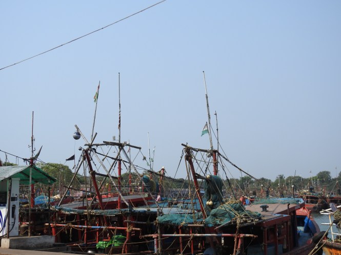
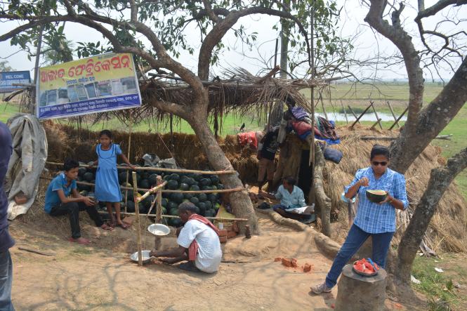
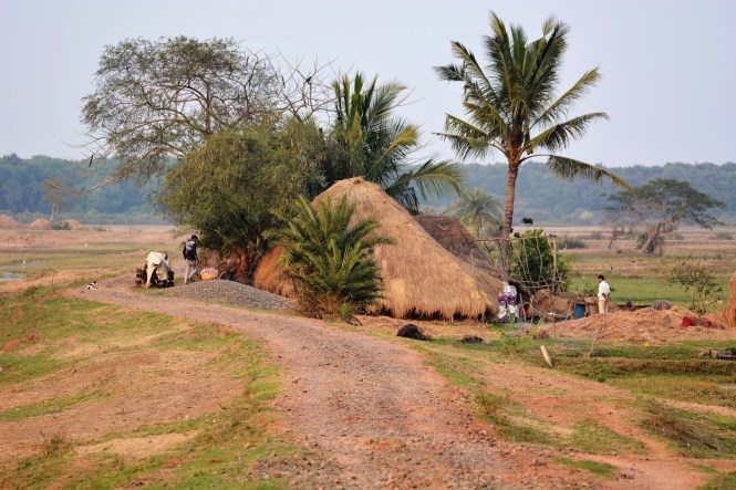
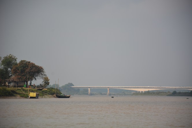
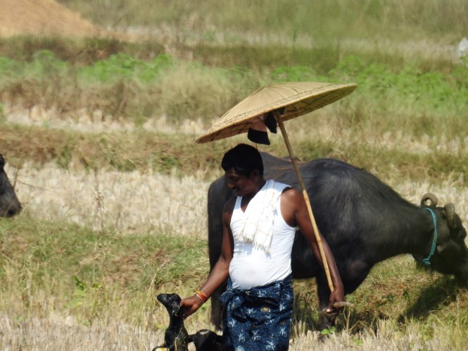
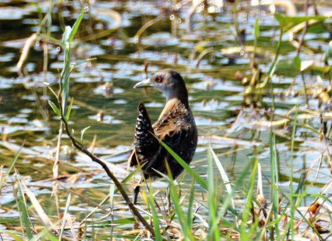
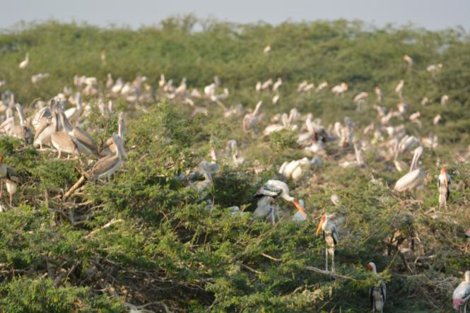
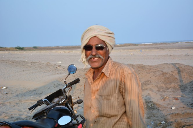
The last state of our coastal journey also turned out to be the most difficult. The taste of the things to come is received at the Mahanadi delta in northern Odisha. The same terrain type continues and becomes more muddy and hostile as we proceed to the deltas formed by the Hoogli which meets the sea at various places all along the coastline of the state. Our journey is road based and self-driven. This does not suit the coast of this State. It could better be done using a boat.

Our first stop is Digha, probably the only full-fledged beach holiday location in West Bengal. It is just across the Odisha border and the locals do not seem to be making any distinction between the two states.

DSCN6221

Digha is connected to Kolkata by a railway line and that largely explains the large number of tourists flocking here. The 190 Kms rail distance is covered in less than four hours from Howrah Junction. It also explains the presence of large number of hotels and lodges.

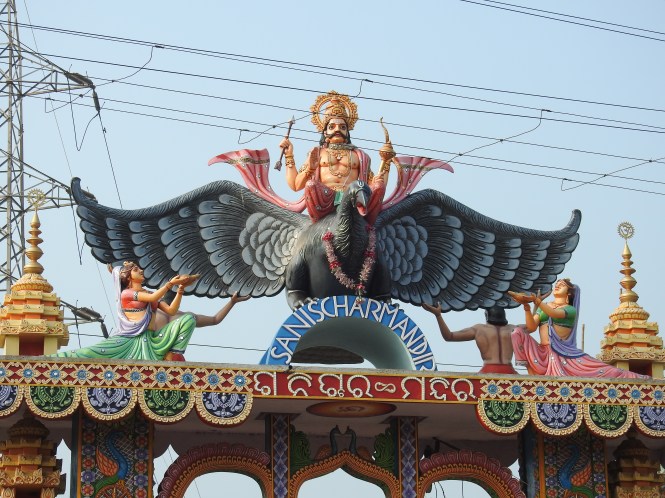
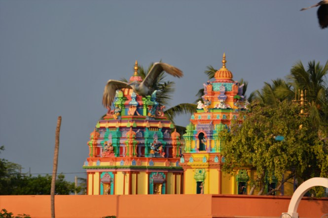
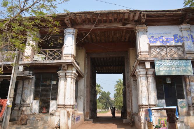
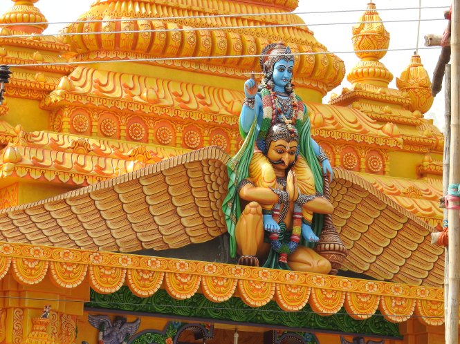
We pass this last temple on the Odisha side and cross into the West Bengal. This is the ‘Garuda’, bird ‘vahan’ of Lord Vishnu carrying his master on his wing. This species has now become extinct, in case you are wondering why we are not using this mode of transport now.

DSCN6222

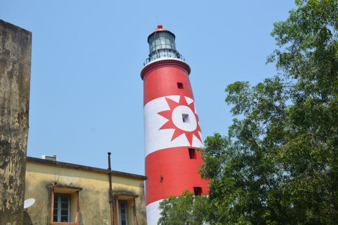
There is nothing special about the town and the beach except that they give you a taste of Kolkata. The seashore especially at the Old Digha beach seems to be shored up by pouring concrete. It is being attacked by the sea and would have been eroded without this effort.

DSC_3248

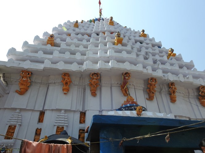
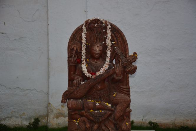
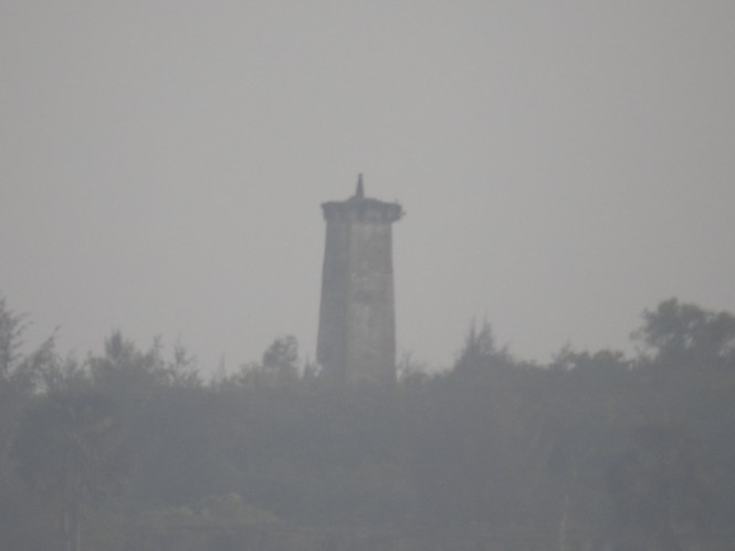
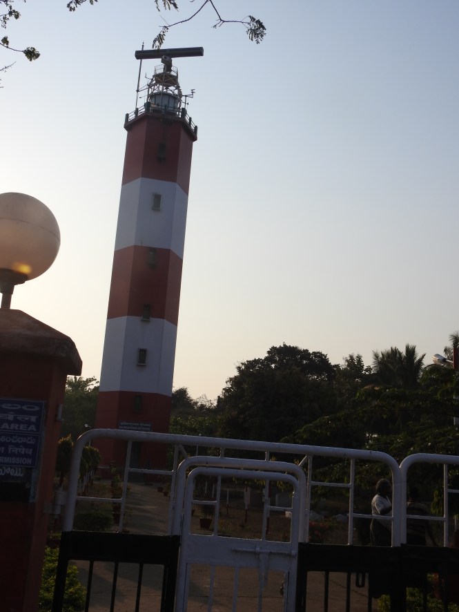
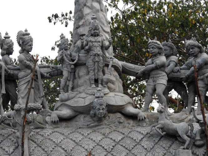
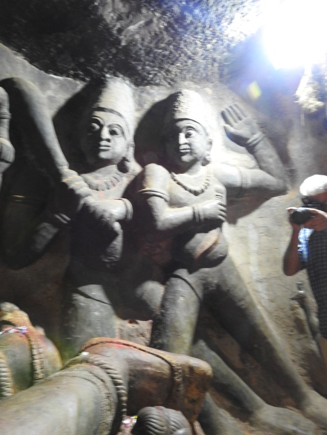
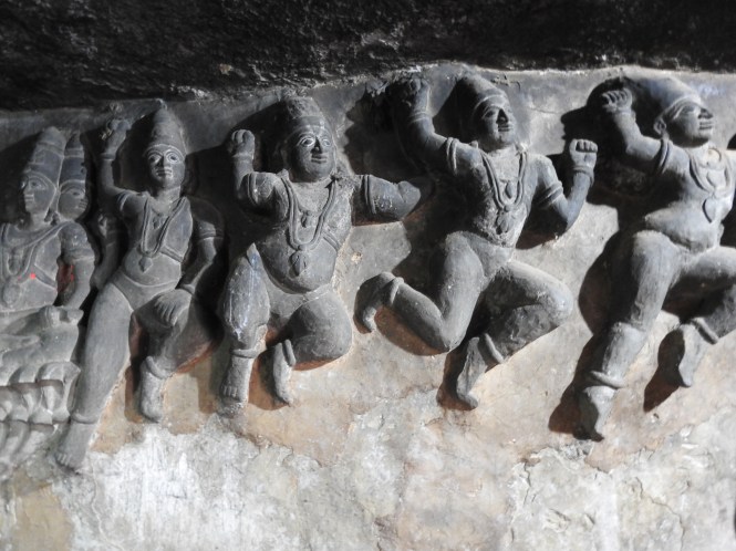
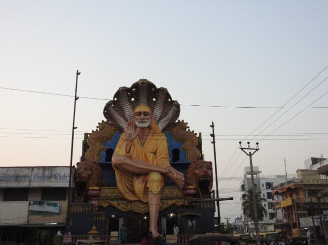
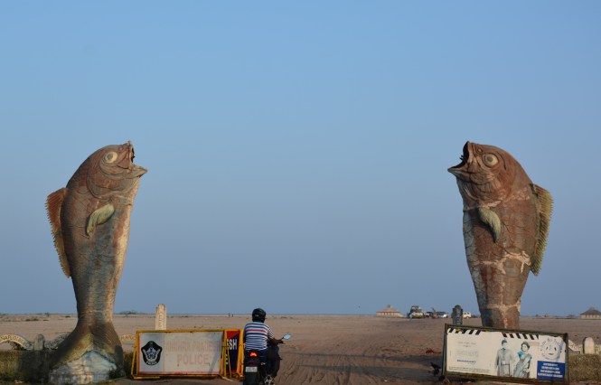
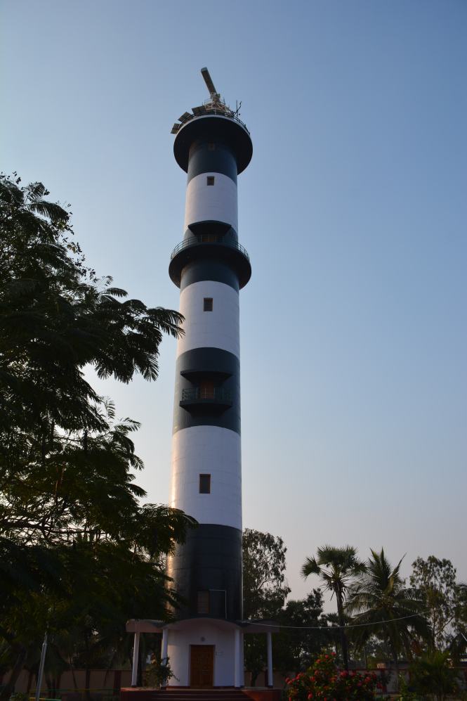
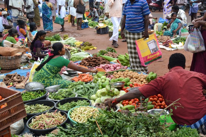
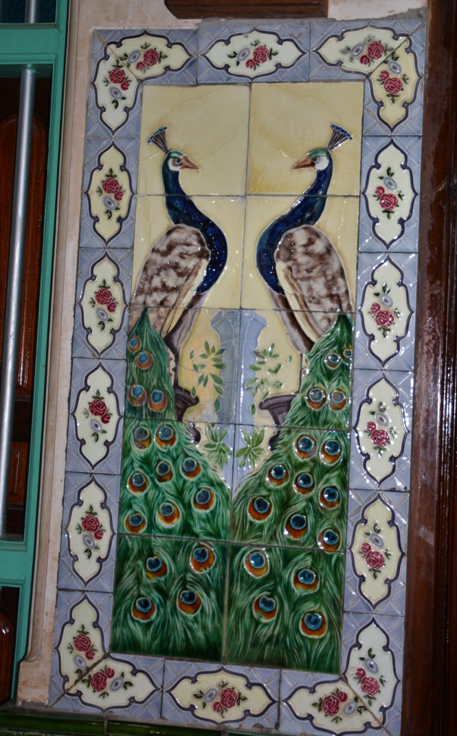
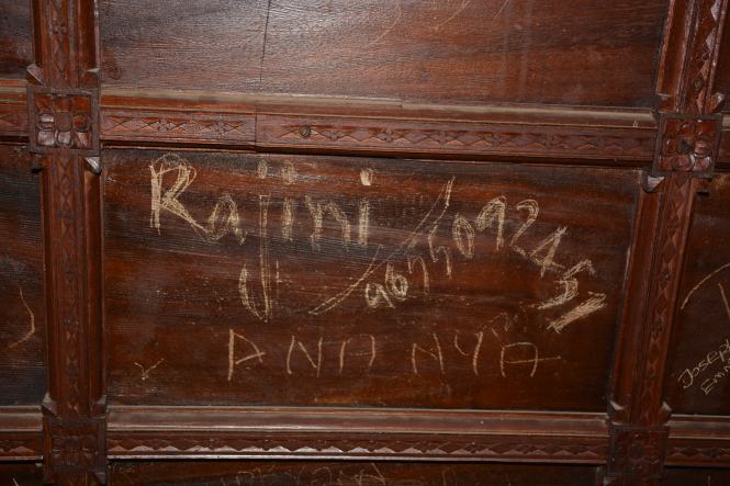
The beach is otherwise well maintained and clean and has a lot of monuments:

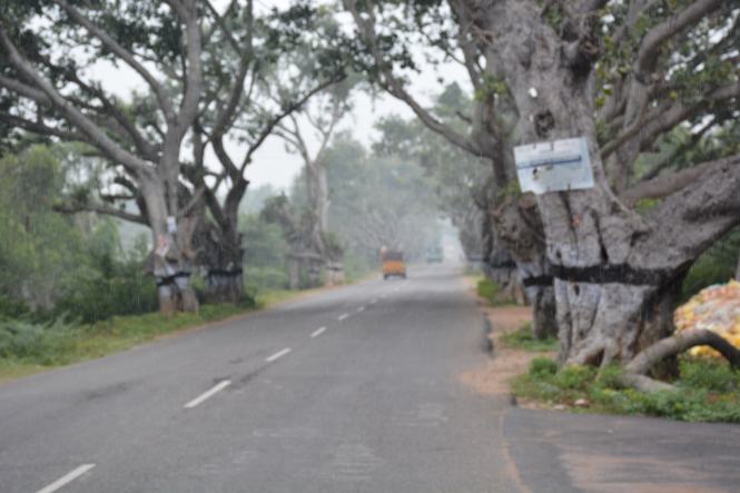
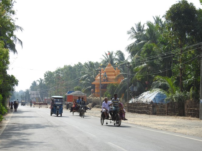
After a night’s halt and moving around the resort town, we decide to continue into West Bengal. The next town for us to visit is the port city of Haldia. There is no ‘coastal’ road to reach the place. It is 108 Kms. away by the typically narrow roads of West Bengal. It could be shorter if you use a route with a ferry crossing which we avoid. The reasons will be clearer as we proceed with this post. Here is the road out of Digha.

DSC_3258

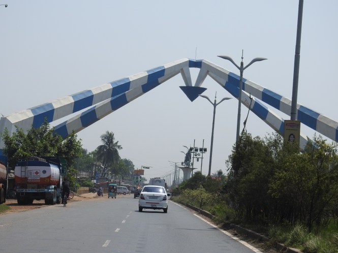
Raising arches seems to be a Bengali obsession as much as raising statues is a Andhraite vice.

DSCN6237

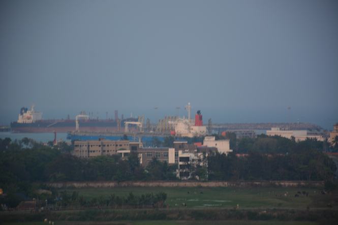
Haldia is out and out a commercial town, typical of the new port towns with the numerous heavy industries which have come up because of the port facilities. It was only after we left the place that we realized that we had not taken any pictures at Haldia. It is mid-march and it is getting hotter by the day and tiring.

From Haldia we are heading for Diamond Harbour, across the Hooghli, 62 Kms away but through very dense traffic of what are the outlying areas of the great city of Kolkata. Before we reach Diamond Harbour we have two historical places to visit on the way, neither is very far from the highway leading to Kolkata.

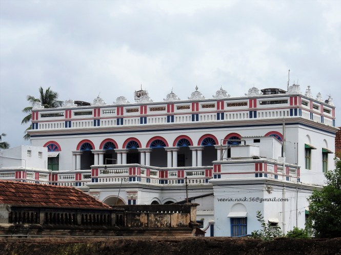
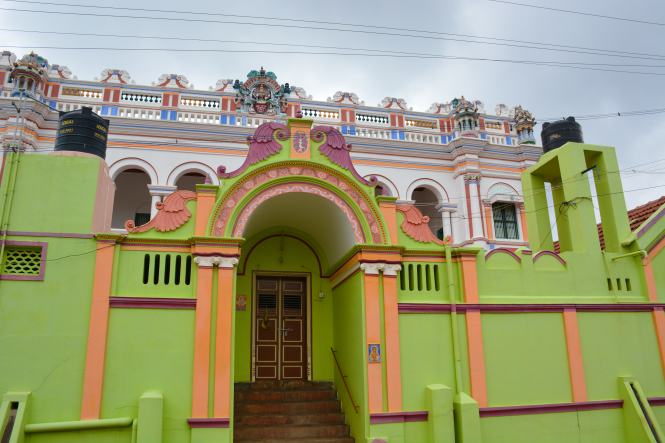
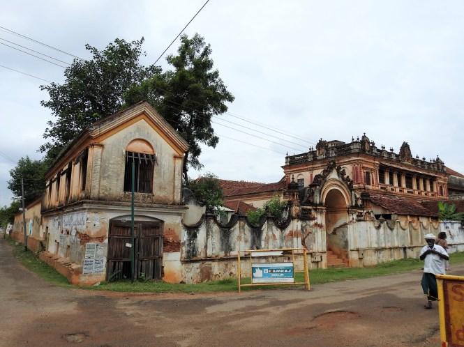
The first one is called Mahishadal Rajbari. Mahishadal is name of a place. Rajbari, I presume with good reason, is a palace or a place occupied by a ruler. This particular Rajbari’s available history states that it is an estate established by a North Indian Businessman with a view to establish a ‘Zamindari’.  The businessman, presumably a merchant, with 16th century antiquity is known by the name of Janardhan Upadhyay Garg. What strikes me here is the realization that a ‘Zamindari’ could be ‘established’ by whoever had the means to do so. It was not an evolved, hereditary institution. If true, I don’t blame the English in colonizing India. They just enlarged the concept of the Zamindari into a larger Zamindari.

DSC_3264

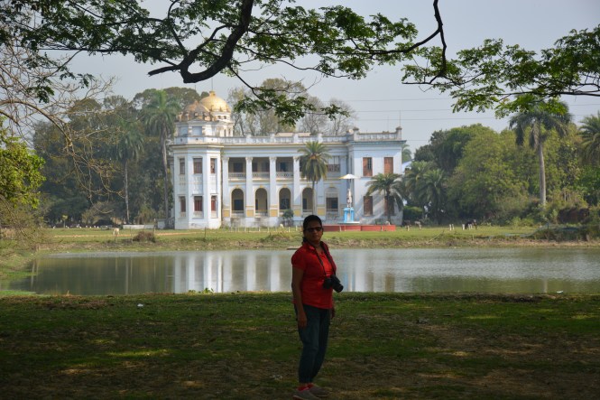
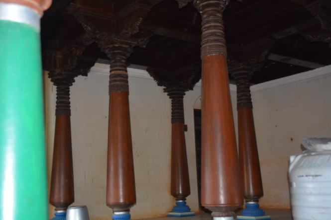
History apart, this is a beautiful place. I wonder who owns it now. There are two palaces and many other smaller structures on the grounds and beyond is a place where the boys are training themselves to be cricketers. The one attended to and for which one has to pay an admission fee is in the front and has a nice view. It has some old furniture and some stuffed animals which will rot in the near future. Some old guns used in hunting the animals are hanging on the walls. Photography is not allowed inside.

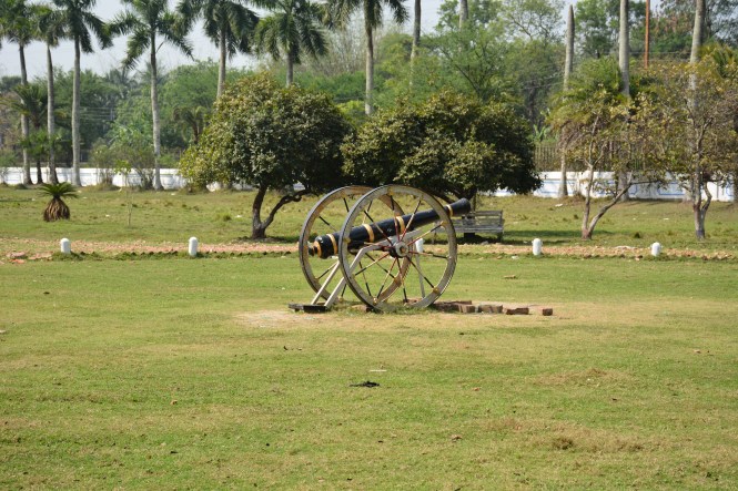
Here are the grounds facing the palace:
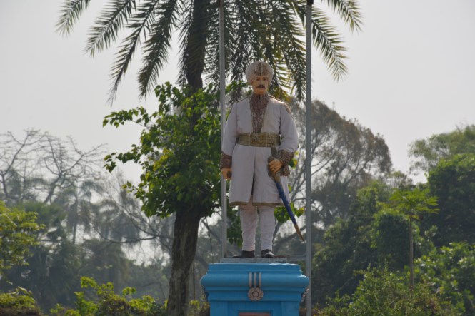
DSC_3284

The Zamindar:

DSC_3277

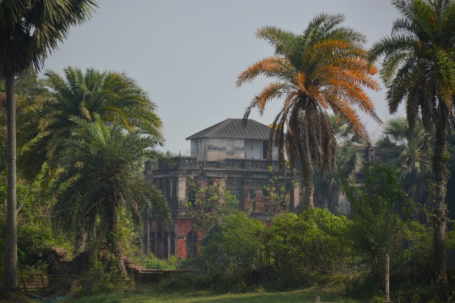
The old Rajbari at the backside of the one above is not maintained the same way as the new one.

DSC_3267

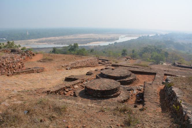
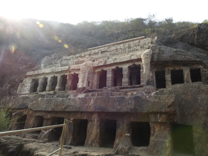
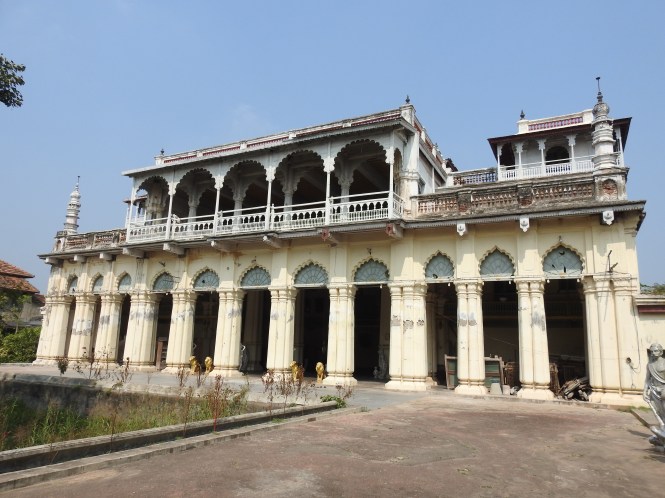
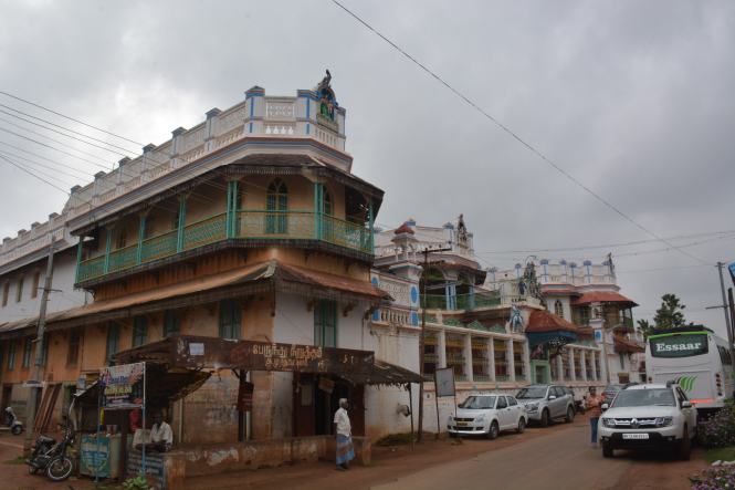
Done with the Rajbari we drive in the opposite direction along a canal and reach the highway at some distance where we had entered and continue north to see another Rajbari, much more interesting than the one we just left. The past of Tamluk Rajbari is not as modest as that of Mahishadal Rajbari.

We pass through very narrow streets of an old town and at one point decide to stop somewhere and take a autorikshaw.  Driving through narrow lanes is scary.

DSC_3285

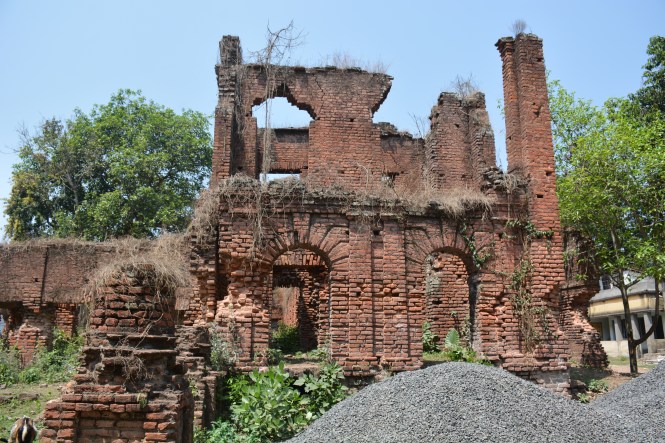
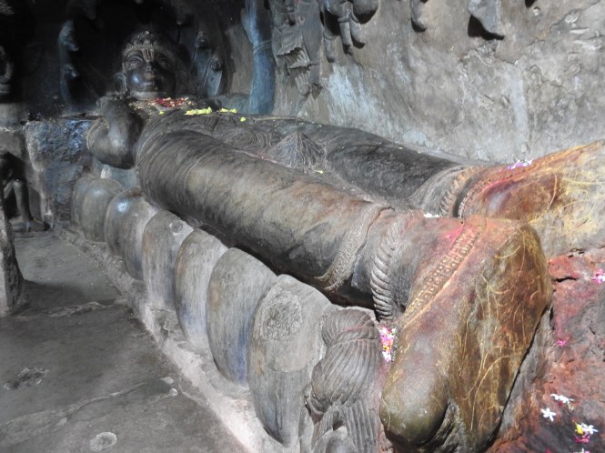
Before, during and after the visit to this place I tried desperately to find out something credible about it on the internet . What I have come across is incredible, unbelievable and insulting to intelligence.

The Wikipedia article informs me that this place has been referred to in Puranas and Mahabharata. It is an ancient port, now silted.

‘archaeological remains show continuous settlement from about 3rd century BC’

It is silent on the subject of the Rajbari which is the only major surviving monument. Is the place or the ruins of the building are 2500 years old?

DSC_3300

A brilliant piece of information is provided by Holidayfy.com :

‘ …… these ancient ruins of the Tamluk Palace are a brilliant spectacle of architectural brilliance. The temple is believed to be 2500 years old and was inhabited by a West Bengal King’.

This is absolutely brilliant. To my knowledge Palace and temple are two different things. The writer for the website does not make such silly distinctions.  West Bengal came into existence with the partition of Bengal by the British and no kings were allowed to exist here (except of course the British monarchs) by them or by the later Communist rulers of the state.  Even now the place does not have a King. Having a Queen is a different matter altogether.

We move on to Haldiatourism.gov.in. This is a website maintained at the taxpayers’ cost. It is a government website which states that this place is :

‘……a quiet witness to a glorious history of over 2500 years. Tamluk Rajbari houses rich culture, heritage and legacy’

The only thing this place houses is stray cows and goats. Auto rickshaws drive through it. It does not even have a compound.

The writer continues (and I am sure he has never visited the place. He is sitting somewhere in Kolkata in an air-conditioned room):

‘Believed to be built in the 5th century (BC) by the Mayuradha dynasty, the then king was believed to be present in the Swayambhar Sabha of Draupadi of Mahabharata’

‘the magnificent palace leaves the visitors spellbound’,

perhaps by the smell of urine and cow dung’.

It continues:

‘during Freedom Struggle Mahatma Gandhi and Netaji Subhash Chandra Bose visited the place’

Agreeing to visit this place appears to be among the very few things these two great men agreed upon. Even then, I am sure they visited the place at two different times.

The website Holidayiq.com has reworded the above information by someone perhaps sitting in Mumbai or Delhi. The major and exceptionally brilliant change made in the text is to refer to Draupadi  as ‘Lady Draupadi’, stopping just short of calling her Mademoiselle  Draupadi or ‘Draupadi Didi’ to keep in line with the  more recent political climate.

I am frustrated. I am aware of Indians’ disregard and apathy to history and I am shocked that the British sources do not throw much light on this either. They were here. The White Man was very much in this area. The clergy was here, in fact it is said that this place, Midnapore district , is where the Christian conversions started on the sub-continent outside of the Portuguese influence.

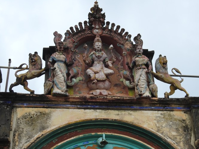
I am no Historian or archaeologist by any stretch of  imagination but when I see an arch and when I see a brick I can very well decide if those items are 2500 years old or not. The brickwork and the arches suggest European influence.

Assuming that this ‘Rajbari’ is 2500 old, why are the not ASI here. They are guarding places much younger. What happens to the state Archaeology department. If they don’t do much else they should at least object to the articles on the internet which are misguiding the public.

Not satisfied with what I saw and what I read, I am sceptical. I start talking to the people, including the guy who brought us here in an autorickshaw as we could not locate the place on the narrow road.

‘is this the Rajbari?’

‘Yes’

‘is this the only Rajbari here?’

‘yes, this is the only rajbari’

‘is there any other old, historical place around here?’

‘No, there is none.’

This guy looked educated and could speak Hindi (which is not to be taken for granted in Bengal) and even a smattering of English. He was very sure. I spoke to another person in the town for confirmation. And if you check on the images available on the internet, they are the same as I have posted. I want to rule out the possibility that I drove into a wrong place which my wife always say I do.

My conclusion: This  is a fraud caused by ignorance.There is no significant commercial activity suggesting an attempt to divert tourist traffic here.

The Tamluk Rajbari will remain a mystery to me until I find better sources of information about it. The seeds of doubt about what appears on the internet has been sown in my mind very firmly now.

We drive through the urban areas surrounding Kolkata city with a view to stop at Diamond Harbour, avoiding the inner city.  Our next stop is to be the islands in the Bay of Bengal which are on the western side of the Sundarbans.

Views of the Hooghli from the riverside hotel we stayed at Diamond Harbour:

Diamond Harbour was only a technical halt to reach Sagar Island and places beyond to the southernmost areas facing the Bay of Bengal. I think I decided on Diamond Harbour because the name was ingrained on my mind.In my childhood I used to follow politics and elections. The name ‘Diamond Harbour’ came up every once in a while as the constituency from where Jyoti Basu won with a such and such huge margin of votes.

We actually tried for the Sagar Island on our way back from Bakkali but for the sake of geographical continuity let me take that up first.

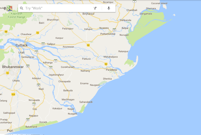
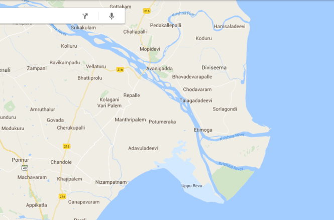
The 80 Kms. drive from Diamond Harbour to Bakhali through the lovely Bengali villages is something one should not miss. I heard you saying it would take about 2 hours. Did I?  It could take about 5 times as much. But that is for the next post. Right now we are at a place called Kakdwip which is the gateway to the Sagar island. You can see these places on the map below:

Screenshot_2017-04-17-18-19-56

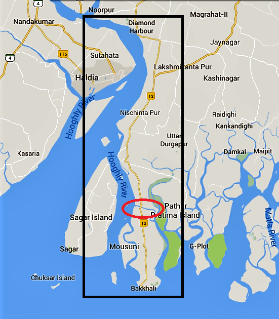
The red circle in the map above is where you are required to cross a ferry. It will appear in the next blog post.

Our objective is to visit the western side of the Sagar Island so that we sort of connect to Haldia on the other side of the river where we have already been.

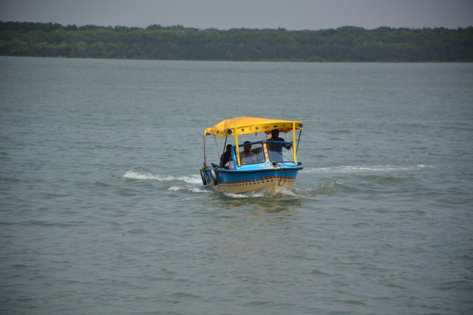
Kakdwip is a difficult place, believe me. I have seen many of them on this coastal tour. Finding a place to stay is only a minor problem. When it comes to visiting Sagar, the problems just multiply. There are only two crossing points. One ferry takes only passengers and the other one takes vehicles. The latter one makes only one trip a day. It carries the food supply lorries and one might have to wait in the Q for up to a week.

We park our car in the compound of the lodge where we have put up and go around the town exploring the ways and means of visiting Sagar Island. The obvious places to go to are the ferry points.

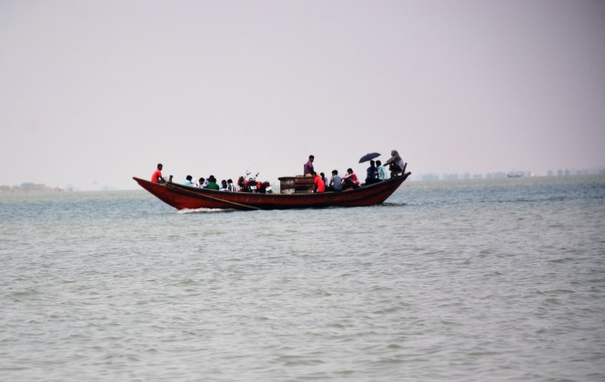
We first go to the place from where the passenger ferry operates. There has been some problem. One trip was cancelled and it has resulted in a large number of passengers stranded on the jetty. It is late afternoon and the people have to get across to their homes on the island.

From this point one reaches a place called Kakuberia and then make a road journey of 32 Kms. to reach the main town in the island called Gangasagar.

The main religious attraction of the island is the Kapilmuni Temple. This pilgrimage centre is visited by large number of Hindu pilgrims on the 14th of January every year. This is the day they bathe in the waters of the Holy Ganges ( Hoogli here) at it’s confluence with the Bay of Bengal. In fact this is considered as the end-point of the great and holy Ganga. To think of it, all the sins dissolved in the waters of the Holy river by the Hindus living upstream come up to here to be dumped into the Bay of Bengal and make the river free to bring in more sins in the next season from the northern and eastern India. The waters of the Bay of Bengal further east have a high concentration of sins on which the Royal Bengal Tiger feeds.

It was later afternoon when we reached the jetty where the passengers were waiting for the ferry. There was no possibility of visiting the island and returning that day. We decide to try to cross by the car ferry the next day and go to the car ferry point which is at a different place.

DSCN6461

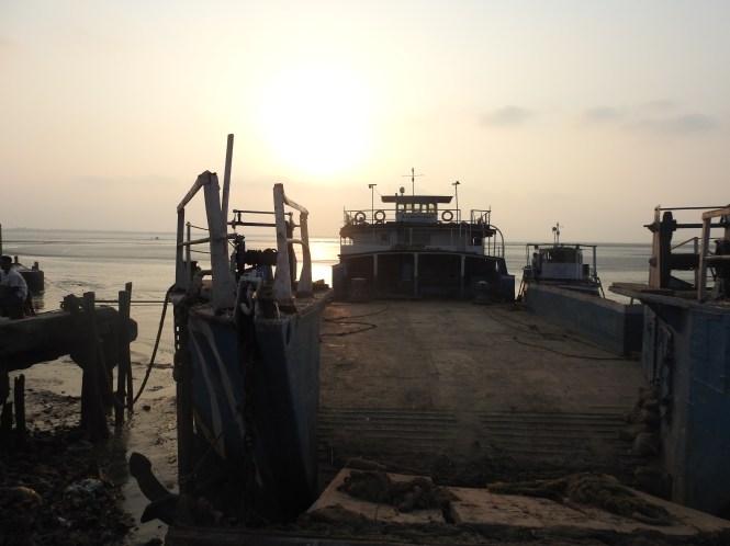
The ferry operations are possible only at high tide and hence there can be only two trips to and from the island. We roughly calculate the number of vehicles the ferry can take and the number of vehicles queued up for the next trip. We might have to stay in the queue around two days if we park the car in the queue at that point in time. We are not able to calculate the time needed to return.  After considering all aspects we drop the idea of visiting the island. We just enjoy the sunset and return to the lodge for the night halt.

DSCN6457

Text by Suryakiran Naik

Pictures by Suryakiran Naik & Veena Naik.

111.ODISHA. (5) Paradip, Bhitarkanika & Chandbali

The river Mahanadi starts splitting into distributaries west of Cuttack and meets the sea at several points with Puri at the southern end and Paradip at the northern. This forms a huge delta perhaps as big as the Godavari basin but smaller than the Sundarbans.

Screenshot_2017-07-02-19-32-59

In terms of economic activity and the consequent prosperity however the two northern deltas are far behind their southern cousin. The road distance between Puri and Cuttack is currently 160 Kms. A direct coastal road would reduce the distance by about 40% but will entail considerable expenditure to bridge the various distributaries of the great Mahanadi. After travelling through the region extensively I strongly felt that this huge region could be developed much faster with better road connectivity. Right now, the entire region appears to be grossly underdeveloped.

Paradip or Paradeep is an artificial harbour and has considerable importance in bulk cargo trade, especially in iron or from the India’s eastern region and the petroleum products imports. Coal and Fertilizers are other important items.  The dust of the imported coal lying around in the town is processed in pallets by the locals and used as cooking fuel. This is certainly a take on our age-old cow dung. People have merely substituted the coal dust for the cow dung.

DSCN5446

There being no significant historical or religious places the commercial activity dominates the town. But there is always something if you look for it. Not ancient but from the recent past is found. A romantic place housing a famous lighthouse called FALSE POINT LIGHTHOUSE built by the British and a cemetery for the Englishmen who worked there. This lighthouse seems to have been an institution by itself. Upon inquiry, you will come to know that this place was equipped with even a small hospital for the inhabitants who were employed in connection with the lighthouse. I will not be surprised if someone tells me that they had a priest to preside over the frequent funerals.

The major question is: how to reach the place. The place is shrouded in mystery and there being no Tourism Industry in Paradip, is seldom explored. An attempt has been made by an employee of the Lighthouse administration to throw some light on the history of the place. One can easily access it here:

http://www.dgll.nic.in/WriteReadData/Publication/Publication_Pdf_File/FalsepointLightHouse(2).pdf

It is difficult to locate this place on the Google map. One can see a place called Batigraha- lighthouse which is quite far from the sea and the map does not show a connecting waterway. The lighthouse may be (now, after silting for more than 150 years) far from the sea but the access is by boat through a navigable channel which you don’t see on the map. During this coastal drive we have had several problems with the Google map.

There are three sources to reach the place:

1 There is a boat service to and from the villages around which runs a ferry- looks quite dangerous. It is a schedule service and is dependent on the tide timings. And if you enlarge the picture you will see more motorcycles being carried.

DSC_2175

2 The Lighthouse has contracted a boat for supplies which makes a trip every day. You (and me) are not entitled to this service but I guess one can talk to ‘right people’

3 Look for a private operator who can hire a motorboat.

DSC_2167

We get up very early in the morning. Our objective is to prove the manager at the OTDC Resort wrong. He has told us that it is impossible to go to False Point and return alive the same day. We wander around on extremely bad roads, damaged by the very heavy vehicles plying in the port area and reach a beach from which the boats are supposed to be plying. There is nobody around here. We return towards the town and, on the way, take a diversion to the Fishing Harbour.

DSCN5443

All fishing harbours in this country look alike. The difference may be in the numbers.

We make inquiries at the fishing harbour.

‘How do we go to False Point from here?’

‘No, this is not the place from which you can reach your destination. The fishing boats do not offer that kind of service’

‘What’s the alternative?’

After a brief thought the man suggested that we should perhaps hire a private boat.

‘Where do we find one?’

‘There are not many but there is one owned by Sahoo. Go across the fishing harbour, drive on the road along the waterside and look for a Restaurant visited by the fishing-trawler operators. We follow the instructions and reach the place.

DSC_2255

Pradipto Kumar Sahoo is more helpful than expected. He opens up even more when we describe to him our mission of the coastal travel. Pradipto is in his middle age, owns a few businesses- a restaurant, a motorboat, perhaps a fishing trawler and a distribution business in Chemicals and hardware.

Yes, he has an 8- seat motorboat but has no other customers for the day. He is trying to develop a tourism business in the Mahanadi estuary. He has problems created by the port authorities who do not want traffic in the approach channels in the port crossing the river. And then there are private parties operating dedicated private jetty operations in the area who might not like the disturbance in the channels.  He has plans for ‘Kerala-style’ houseboat operations in the Mahanadi. Ambitious, to say the least but a very practical and forward-looking person. We don’t find many of them easily.

The private boat tour works out quite expensive as there is none to share the cost of the 8-seater.  We discuss and Pradipta is very understanding and considerate. We agree on a mutually acceptable figure for the boat ride of nearly four hours excluding the waiting time. We agree to come back and have lunch at his restaurant for which we select a bunch of  fresh Blue Crabs at the harbour.

DSC_2162

The licensed boat operator takes his own time to arrive. He has just returned from his native place in Andhra Pradesh last night and reported for work late and then had to go to the jetty with a plastic can to bring the diesel. In the event the boat was very efficient. We were comfortable despite the fact that we were sailing upstream.

To the left above is the storage facility for the imported Phosphates. Right Up is a barge in the estuary and at the bottom is one of the industrial establishments upstream on Mahanadi.

It is a great experience to go upstream through inhabited channel banks although they are not anywhere near the population density of the Kerala backwaters. The construction of the large huts needs to be studied if not already done. They look very sturdy. Unfortunately we did not have an opportunity to land and have a look.

The scenes from the backwaters look pretty at this time. Life should be much more difficult in the wet monsoon days.

The picture at the bottom with the hanging pots is still a mystery for me. I showed to to several people on the mainland and nobody could explain what it is all about.

We miss the way (waterway) once and have to return back and take the correct route, losing half an hour in the process. We manage to reach the landing site which is about 200 meters from the Lighthouse.

DSC_2212

The lighthouse is a massive structure like no other we have seen in India so far. The huge plinth and the bottom, the painting and the surroundings are like no other we have seen.

DSC_2228

DSC_2223

The area surrounding the lighthouse is huge. The In-charge of the lighthouse is a very helpful gentleman who has grown up here when his father was working at the lighthouse. We are offered a climb up the lighthouse. This is unlike at other lighthouses where the suggestion would have been resisted. The people at most of the Indian lighthouses consider the visitors a nuisance. Here it was different. We turn down the offer as we have been given a total time frame by Pradipta and we need to return to the mainland in time for the lunch. The Blue Crabs are calling. In the process, we miss out on some views from the top of the lighthouse.

DSC_2234

The area surrounding the lighthouse have many monuments of the past including the old utility and the residential buildings and the cemetery. Here are some of the structures in the compound.

Top Right is the cemetery, bottom left is the hospital and the right is the drinking water well.

The return journey is quite frightening and takes much longer. There is high tide now, water is rising and there is heavy wind in the opposite direction. We sail quite a distance upstream to make it to the fishing harbour at Paradip.

After feasting on the crabs, we move on to the resort and after some rest move to see another Lighthouse, the one serving Paradip. Yesterday we had been sent off from the gate of this lighthouse as were about 90 seconds late for the schedule timings. They try to send us off again today. The people at this lighthouse do not want visitors. The person in charge at this place in Mid-March 2017 is a particularly vicious, extremely arrogant and unfriendly bureaucrat who thinks the lighthouse and the surrounding property is his private preserve. They try to persuade us not to climb up the lighthouse despite the fact that it is officially permitted on payment of a prescribed fee.

Despite all the efforts made by the keeper to keep us away, we decide to climb. The person assigned to us inform us that we do not have a right to visit. We can be denied an entry without assigning any reason. This is downright insulting and the motive is by now clear. That prompts us to be adamant.

DSC_2258

As a last attempt, the man tells us that we are too old to climb. We insist that we can and do.

It turns out to be worth the effort, climbing and fighting the petty officialdom.

Here are the scenes from the top of the Lighthouse.

The beach:

The grazing grounds for cattle:

DSC_2308

The harbour side:

DSC_2289

The residential part of the town which is very neat and clean- the modern town:

DSC_2298

A little out of the town is this Shani temple with the ferocious ‘Shani’ right on the gate.

DSCN5528

We are done with Paradip and have to move to the next place which happens to be Bhitarkanika. We now need to cross the distributary of Mahanadi which we crossed yesterday the previous day to reach the False Point but much upstream. This part of the river is used for massive sand-mining operations, highly mechanized.

We stop on the way fro breakfast at a junction off the highway and come across a Musical Instruments shop:

DSC_2327

The Mrudang and a wide variety of Indian percussion instruments are here to see and buy, mostly for the religious functions.

We do not find our daily dose of green coconut here and settle down for a nice watermelon:

DSC_2339

This is not an easy ride. We drive along the narrow country roads connecting villages and small towns to reach the mangrove forests which is called Bhitarkanika. ‘Kanika’ is a largely inaccessible island on the mouth of one of the distributaries of Mahanadi and the portion of the mangrove-infested estuary upstream is known as Bhitarkanika- Inner Kanika.

We take the Pattamundai-Aul-Rajkanika route to reach the place called Khola Gate in the Bhitarkanika Wildlife Sanctuary.

We have booked our stay at an expensive lodge as there are not many places to stay available in the area. W arrive in the late afternoon and take a short walk around the village and the riverside. The shape of the huts here is peculiar. The roof comes right up to the ground.

DSC_2430

The place is promising as far as birds are concerned. We are instantly rewarded with the sighting of a Lesser Adjutant Stork.

DSC_2390

The real fun begins the next day morning. We get very early and get on to a motorboat with a well-trained guide and boatman. In the first 15 minutes of the early morning ride we spot five species of Kingfishers, a record of sorts, at least for us.

The first one to make his appearance is the Brown-Winged Kingfisher.

DSC_2523

The Black-Capped Kingfisher followed:

A pair of  Collared Kingfisher came along:

DSCN5743

And then there was the Pied Kingfisher:

DSCN5765

And then there was the Common Kingfisher and the White-breasted Kingfisher.

Bhitarkanika is mini Sundarbans. In fact, it has crocodiles in more abundance than the Sundarbans. Even birdlife is much more profuse. The only thing absent here is the Tiger and the huge Bengali crowd. In my understanding tigers don’t like noisy people and that is the reason they have become man-eaters in the Sundarbans.

And also the other bird species like the White-breasted Waterhen which is quite common all over the country but here in the mangroves she looks very bright, clean and fresh:

DSC_2565

And here is the father of all chicken we eat- the Red Junglefowl- Gallus gallus. (apologies for a bad picture)

DSC_2578

The Mudskippers are a delight to watch at the low tide when they dominate the mud between the water and the dry land:

DSCN5655

And here is an eagle and the photographer taking rest after the early morning efforts:

This estuary extends further upstream up to Chandbali and beyond. In fact, there is a tourist boat service run by OTDC from Chandbali to the sanctuary. The boat service would take about two hours but reaching Chandbali by the road takes considerable effort and time.

We take the Pattamundai-Aul-Rajkanika road to reach the banks of Baitarana river and cross the bridge into Chandbali.

At Aul we stop to buy some fruits and we are told by the locals that Aul used to have a palace which is now not accessible as we should proceed to Rajkanika and visit the palace there. When you say (or I say) ‘palace’ it implies kings have stayed in this little hut. And this one is highly rated.The Telegraph, the prestigious newspaper on Saturday 9th April 2011 said that this palace is ‘ poised to become a major hub for overseas tourists’ Six years down the line the palace is closed and waiting for the overseas tourists to come and open it. This palace is said to be housing the ‘largest crocodile skull’. Does this imply that it is the skull belonged to the largest crocodile? I doubt. In any case this palace looks pretty with open grounds inside and outside the gates. There were tell-tale empty ice-cream cups on the outer grounds (from where the pictures below were taken) to indicate a recent evening of festivities.

One need to cross this bridge on Baitarna river to reach Chandbali from the south side.

DSC_2871

Chandbali was an important riverine port in the early part of the last century. It connected the agricultural hinterland of this part of Odisha with Calcutta by the river and the sea. Hardly any signs of the past glory of the port are visible to-day. The town is used by the people who intend visiting Bhitarkanika and those visiting the temple at Aardi. The Aardi shrine is easier to visit by boat from here rather than by road from the north. Chandbali has an OTDC Aranyanivas. The term Aranyanivas is used for the hotels and resorts which were earlier Forest Department guest houses.

As we not find anything interesting around and we decide to take a boat upstream on the Baitarana to a place called Aaradi. This place is famous for its temple of Akhandalamani. It is a Shaivate temple and has a legend about its origins. It is too long a story to be dealt with here.

DSCN5911

What assaults your senses here is this crass depiction of sexual acts on the walls of the temple. This appears to be a peculiarity of Odisha temples. I am not sure if anyone has an explanation for this feature which is not found in other Shiva temples or at least not found in such explicit manner.

The Baitarana upstream from Chandbali is otherwise an interesting boat ride. The major economic activity perhaps is sand-mining.

The mode of transportation around the area is the country boat.

Coastal Odisha journey will continue in the next post.


Text by Suryakiran Naik

Photographs by Suryakiran Naik & Veena Naik


106.ANDHRA PRADESH. (10) Vizianagaram, Srikakulam, Baruva.

The two northernmost districts of Andhra Pradesh, Vizianagaram and Srikakulam are bordered by Odisha state on the western side and the history of these two districts intermingle with that of adjoining districts of Odisha, meaning they have had common ruling dynasties in history. This is quite common among the modern Indian States.

Vizianagaram is not to be confused with Vijayanagar empire although the empire ruled over this place briefly. Vizianagaram is not exactly a seaside town but is 18 kms form the seashore and qualify to be visited by TheBlueDrive which has a 30 Kms range from the seashore permitted.

As we drive towards Vizianagaram, my mind is trying to recollect why this place sounds familiar to me. Vizianagaram………. Late that night I remember it. Rajah of Vizianagaram Vs Commissioner of Income-tax, a landmark case related to the principal of Heads of Income being not interchangeable. That was in 1980, 37 years ago (not the case, my reading of it), when I was in the second year of my law degree.

It is small town. We reach late in the afternoon and intend to spend only one night. The town is typical of the erstwhile principalities ruled by the princes who succeeded to smaller geographies at the demise of the larger empires and ruled till the White Man appeared at their doorsteps and fleeced them. The rulers of this small principality are known to have erected a fountain in the middle of London, England.

This is not a spectacular place and hence there are no spectacular pictures and then there is the short time allocated to this place. We decide on two places to visit. One is the Fort, a modest one which happens to be in the middle of the town, and a temple to Goddess Sarasvati, a rare thing. We do a round of the fort on the day of our arrival and the temple the next day morning before we proceed to Srikakulam.

DSC_0610

The fort and the modest palace within it are now flush with educational institutions of various kinds. Hats off to the Rajus, the erstwhile rulers who have donated a huge amount of space to these institutions. The fort has among it’s deities the Goddess Sarasvati. The rulers seem to have given her the due importance. The last ruler is duly honoured within the precincts of the fort.

DSC_0594

Statue of Shri P V G Raju


The Goddess of learning is honoured in the fort precincts.

DSC_0600

Sarasvati carved in stone, Vizianagaram Fort.


The flag of the erstwhile principality is still raised in the fort.

DSC_0603

Vizianagaram State Standard


The next morning stopover before we proceed to Srikakulam is the Gyan Sarasvati temple. It is not easy to find. It is not very old and temples to Sarasvati are not common either. People have been building temples to all kinds of Gods and Goddesses from the Hindu pantheon but very few of them have found it necessary to similarly honour the Goddess of Knowledge. This temple is perhaps a fallout of the dedication to the Goddess by the erstwhile rules of the principality.


From the perspective of an atheist who considers the attainment of knowledge as the supreme human endeavour, paying obeisance to the symbolic manifestation of knowledge does not surely amount to idolatry. Consequently, I enter and fold my hands at the temple with conviction and without remorse.


The new students who start their schooling are given a sanctified slate before they start attending the school. With great difficulty I convince the temple trustee to part with one for me. Yes, I am willing to make a small donation. I will preserve this.

DSCN4124

Off we go after a roadside breakfast towards Srikakulam, through the farmland on both sides of the road, greenery all over even at the onset of the summer.

We stop at the sight of this man to make enquiries about what he is carrying and where. He is carrying food for the farm workers who have been working there since the morning. Going by the timings the people may have been working in the fields since the first hints of light.

DSC_0621

Carrying lunch to the farm.


And here is a type of small umbrella the farmers in coastal Andhra use to protect themselves from the scorching sun. It reminds one of Vietnam and neighbouring places where such equipment is in use. Here the raw material seems to be the leaves of the ubiquitous Tada palm.

DSCN4238

The Sunshield, Andhra style.


X X X X X X

Three rivers flowing down from the Eastern Ghats meet the Bay of Bengal in Srikakulam district, the northernmost of the Andhra Pradesh districts. River Nagavali hosts Srikakulam town on it’s banks. Vamsadhara forms a sandy beach at Kalingapatnam and Mahindra Tanaya forms a spectacular land & seascape at Baruva. This is coastal region in its truest sense.

We find a hotel overlooking the Nagavali in the old part of the town and begin with the Kalingapatnam area. Kalingaptnam is an ancient city and a major port through which the east coast of India was trading with the countries of the south-east Asia. There are no remnants of it to be seen. Incidentally Kalingapatnam is not related to Kalinga kingdom or the Kalinga war. That place is located in present day Odisha near Bhubaneshwar.

Kalingapatnam is a huge sandy beach and here we discover a culinary invention- Bamboo Chicken. Spiced chicken pieces are cooked in a Bamboo on open fire. The bamboo piece is a single use item. We are tempted to taste it but that was the last order he was delivering as he had run out of chicken. The boys who bought the last order are also carrying Tadi, the sap of the palm tree which when heated would turn into a liquor or perhaps that is what they are carrying. It goes well with the Bamboo Chicken, they tell us. We don’t get to taste either.

Beyond Vamsadhara one can see an old Lighthouse. Can we go and see it? ‘ Yes, but not from here as there is no bridge on the river. You will have to go to Srikakulam and comeback from the other side’. We drop the idea and make do with pictures from a distance.

DSCN4142

The current operational lighthouse is closer to the village and far off from the seashore. Perhaps the sand has accumulated since the lighthouse was constructed increasing its distance from the sea.

DSCN4131

The area along the river is a major sand mining area. One can see the tractor trolleys collecting sand, a sight repeated on a large scale on Mahanadi in Odisha.

Apart from rice the farmers here grow a black lentil like Moong but not exactly like the popular green moong.

Salihundan is a hill overlooking Vamsadhara from the south and on which are found relics of a Buddhist monastery. Not much is known about the place except that it would have been active from the 2nd century BC to 12th Century AD. This could have used for the spreading Buddhism to the South East Asia through the Kalingapatnam port. The site is accessible by a good road up to about half a kilometre to the top of the hill. A place worth visiting even if you are as ignorant about the Buddhist architecture as I am.

The view of the river is spectacular from the top of the hill.

DSC_0710

On the way back we come across this temple to the Kurma avatar of Lord Vishnu.

DSCN4163

Srikakulam is more famous for it’s Suryanarayan Temple. No photography is allowed inside and we satisfy ourselves with the outsides.

Srikakulam makes its ladders from the round poles.

DSC_0673

Our last stop in the state of Andhra Pradesh is at Baruva on the banks of river Rushikulya, 105 Kms. from Srikakulam. We drive along the coastal road which goes through a major salt manufacturing area and picturesque countryside. One gets to witness this only if one sticks to the coastal road and avoid the temptation to take the highway which is further west, away from the sea.

We have booked a room at the APTDC’s Haritha Beach Resort. The APTDC has found the most beautiful locations for their properties but they appear to be grossly underutilized and poorly maintained. The areas along the northern coast of the sea does not have any major population centre and that explains the fact there are not many visitors to these beautiful beaches. This is the view of the Mahendra Tanaya river as it meets the see , as seen from the top of the lighthouse.

DSC_0880

Here is a tower which one can see from the Lighthouse at Baruva. We could not find any information about it. Is it an abandoned Lighthouse?

Here is the landside view. The little road is the one leading to the Haritha resort.

DSCN4399

The lighthouse is next door to Haritha resort and we climb up to see the surroundings. Worth the climb.

The life on the beach is very active in the absence of many visitors. One can see a number of live seashells.

In Baruva village we make a discovery. The village has a lake just on the outskirts and a pond near the Hanuman statue on the road leading to Somepeta. Between them these water bodies hold a large number of bird species. They are not just the ordinary species. We could find a rare Baillon’s Crake here!!

DSC_0841

Baillon’s Crake

And here are the lesser avian mortals.


Somepeta is the small town, bigger than Baruva where we had breakfast on two consecutive mornings. The roadside eatery serves delicious and fresh south Indian snacks at unbelievable prices. The two of us could eat Idlis and Vadas and Dosas and were asked to pay only Rs. 35/-. We felt guilty. Tea however is not served at the same place. We had to cross the road to find the teamaker.

DSC_0762

The cinema poster between these two eateries is alluring.

DSC_0768

With Somepeta we end our journey through Andhra Pradesh and make our way to Odisha.

Text by Suryakiran Naik

Pictures by Suryakiran Naik & Veena Naik

suryakiran.naik@gmail.com


100.ANDHRA PRADESH. (4) Guntur-Uppalapadu,Undavalli, Machilipatnam, Challapalli, Kuchipudi.

We leave Nizamapatnam and decide to drive to Guntur although it is not on the coast. The idea was to see the Chili growing region and the sight of red Chilies being dried in large quantities. Added to this was the desire to see Vijayawada-Amaravati. and how the new capital of the state shaping up.

Looking back, it was a disastrous decision. We missed a lot of coast, a Sanctuary and a Lighthouse in the Krishna river delta. In fact, we missed out on the entire Krishna river basin. However, there was the possibility that we would not have made it at all if we had tried to drive in the area. Krishna meets the Bay of Bengal using three different distributaries creating the delta which is marshy and wet. There are hardly any roads in the region. We were warned by an engineer at one of other lighthouses that it would be difficult for us to reach the Lighthouse as it requires a journey of 3 hours by country boat in addition to long road journey.

1

If you look at the map above it clearly shows the absence of habitation in the Delta. I am not yet sure if made a major mistake by going up the Krishna and coming back to join the coast at Machilipatnam. One thing is sure, we missed some coastal places and also the bridge across Krishna.

The trip to Guntur was a disaster. There was no scene of drying chilies. It was not the season. We could not manage to get a reasonable accommodation and when we found one it had a horrible parking underground with an incline of more than 180 degrees.

Having come all the way to Guntur we decided to visit Uppalapadu a bird sanctuary located not far from the town. In fact, it is a largish Pond facing a temple which many birds find it convenient to breed.

It is managed by Forest department and they charge an entrance fee. The birds are the usual Spot-billed Pelicans, the Jacanas and a few others.

DSC_9022

DSC_9164

DSCN3059

Spot-billed Pelican

In short this is the Beginners Guide to birds. I hope the Guntur residents make good use of it.

We have now to get back to the coast and continue with our travel programme. We have to either get back to near to Nizamapatnam and cross Krishna downstream  or cross Krishna at Vijayawada and go south- eastwards. Our destination is Machilipatnam. We decide on the latter.

We decide to visit Undavalli Caves on the way.

DSCN3129

Undavalli caves are dated to 4th and 5th Century. Initially started as a Buddhist Viharas carved into the hill by Buddhist monks, the place was taken over by Hindus later on. It appears to be as a result to change of royal mind of the local kings who initially supported the Buddhist but later on favoured Hindus.

The exteriors:

Some scenes of the interiors:

Most of the statues, idols and images are now Hindu.The reclining Vishnu on serpent is the highlight.

DSCN3107DSCN3109DSCN3110DSCN3105

A part of the cave is a functional temple where Puja is conducted. The carvings are numerous and are in pretty good condition. Lovers graffiti is conspicuous by it’s absence. The place being a functional temple appears to dissuades the lovers-cum-artists.

The surrounding part of the countryside is green and beautiful. The Krishna is not far from here.

As you drive through this part of Andhra you will notice that the grass /hay generated by the paddy is stored in  the fields. In other parts of the country it is carried and stored near the place of farmer’s residence. The cattle who consume the hay is generally kept nearer the residences rather than the farms.

———–

We pass through Vijayawada but do not stop. Here is the Prakasam in the town. Krishna has a large number of islands in its stream, big and small.

We reach Machilipatnam late in the day to find that all hotels in the town are fully booked till the next day. A big man’s son is getting married and a large number of guests have arrived from other places. The bride or bridegroom seem to be studying or working in US or Europe as we see a number of young white men and women around, most certainly wedding guests.

We make another round of the hotels and lodges trying our luck and at the same time considering other possibilities like getting back on to the highway and look for accommodation. At last we come to a hotel where the receptionist says that they don’t have any rooms but they can offer a suit. This is OK by us. We need to take some rest urgently. They have a basement parking like most hotels in the area do and the entrance to the parking is a steep incline.

Machilipatnam has been a French colony which was subsequently taken over by the British. There appears to be no signs of the French presence left behind. At least they are not known. Before that it also used to be the principal port of the Golconda Kingdom and a major centre for the production and export of the famed muslin cloth.

The people here seem to be big fans of Saibaba of Shirdi, not the one nearer home.

DSCN3155

There is not much to be seen in the town but there is a beach and a Lighthouse about 12 Kms away. We go for it. It is called Manginapudi beach. The stretch nearer the beach is a very pleasant drive.

The beach has an ‘entrance’. Beaches should not have entrances and exits. It is a huge beach both lengthwise (seashore) as well the breadth from the sea to the ordinary land.

DSC_9318

entrance


DSC_9319

Religious icons add colour to the flat beach.

One of the visitors to the beach:

DSC_9324

The Lighthouse at the beach is quite tall, among the tallest in India and according to the keeper, people are not allowed to climb it. Every lighthouse has its own rules. Taking pictures? No problem.

DSC_9306

Next day morning we take off from Machilipatnam to visit two small towns. Challapalli and Kuchipudi.

On the way, we again come across a canal. These canals are the lifeline of coastal Andhra.

DSC_9339

Freshwater canal used for irrigation And fishing.

Between Machilipatnam and Challapalli we come across this depiction of Lord Krishna drinking fresh milk straight from the udders of the cow.

Challapalli is the closest that we approached the Krishna river on the Diviseema Island where the last northern distributary of  the river separates the other two parts of the peninsula. We do not reach the river banks.

Challapalli was the headquarters of  Yarlagadda Jamindars who rules this place and the surrounding countryside in the 16th to the 20th centuries. In the 19th century the ruling Jamindar constructed a palace which is the purpose of our visit.

DSCN3161

The Palace or Fort


The palace is not seen easily from the main road outside which is lined up with motor mechanics. There is an outer gate. As you enter, a couple of people materialize from nowhere demanding , what else, money. They say there are the caretakers. By the time we return they have disappeared.

The palace grounds seem to start at this entrance but there are some educational institutions inside which can be accessed through this gate.

DSC_9350

Main entrance

The palace, referred to here as Fort’, is a modest building with a few artefacts and portraits in the ground floor hall. The upper floor is not open to public. All in all is not a must-see place.

The palace compound has a number of fruiting trees which invite a number of birds including parrots feeding on the bananas. The descendents of the Jamindars do not seem to mind.

DSCN3175

The next stop is Kuchipudi which gave the name to a famous dance form. The town displays the artistic inclinations of its residents.  The entrance gate to the town has been done artistically:

The town Bus Stand has a small garden!!. The Bus Stand is miraculously clean.

DSC_9400

We make a brief visit to the school where the Kuchipudi dance is taught. It is a residential academy.


Text by Suryakiran Naik

Pictures by Suryakiran Naik & Veena Naik

91.TAMILNADU (6). Devipattinam, Ammapattinam and CHETTINAD.

We start from Ramanathapuram with two items on the agenda. One is in line with the TheBlueDrive charter which is touring Coastal India and the first two places are within its ambit. Chettinad is not exactly a coastal region but we decide to visit it for the importance the place has.

First thing first. We drive to Devipattinam on the coast of what is called the Palk Strait which separates India and Sri Lanka. The only major attraction of Devipattinam is the ‘Navagraha’ Temple which is located in the sea but connected to the mainland. This appears to be a popular religious destination with the pilgrims to Rameswaram making a stopover here. Nothing spectacular. Just a small temple but of ‘Navagrahas’, the nine planets with sun being demoted to the status of a planet and moon promoted.

We are visiting Ammapattinam as it is a coastal place and it also has a lighthouse. This lighthouse is not on the seashore. It must be among those which are furthest away from the sea. I will update later on this. This also appears to be among the tallest lighthouses in India.

Now we turn north-westwards and towards Karaikudi, the heart of Chettinad. The 75 Kms or so give us some idea of the region.

The road has a number of trees cut down to size as they were encroaching on the road.The roadside tree species need to be selected carefully.

DSC_6399

As you drive you cannot miss the large number of Tamarind trees in the region. That perhaps explains the presence of quantity of this fruit in the Tamil cuisine and particularly in the Chettinad cuisine. By the time, we reach Karaikudi it is past lunch time and we look for authentic Chettinad restaurants. We are shocked to know that there are not many. We locate one in the old part of the town and they are sold out on most of the non-veg items. We need to make do with whatever is available. We don’t blame them as we are late. The best place in the world for Chettinad food is Chennai, I know it by experience of 38 years.

What do we do in Karaikudi town? Not much and we are already tired driving all the way from Ramanathapuram with two stops in-between. Most of the attractions of Chettinad are around Karaikudi and not in Karaikudi. All the same this is a well-planned town with broad streets. When the future historians find the buried remnants of this place, they will be all praise for it.

The local vegetable market has a rich variety of greens. Fresh and lovely.

v1

We get up early and move on towards the ‘tourist’ places. We start with the temple of Muruganswami at Kundrakudi. Interesting place and temple. One has to climb up the stairs to meet God which I avoid, not on medical but on moral grounds. Having declared myself an atheist, I have no right (or obligation) to exert myself to meet the God. If the God is found by the way I can allow Him to meet me. My wife is very keen to photograph Muruganswami and his abode here. She also needs exercise. I am having other interests. Here we go.

The Muruganswami Temple pictures by Veena Naik:

The interiors. Photography is not prohibited here.

The idea of Mannequins was conceptualized here.

The landscape from the temple.k5

I am loitering around and find this lovely artwork.

I am not looking for any medicines but I find this Herbal Doctor here offering cure for all diseases, past, present and future. He also displays all the herbs (mostly green in colour) from which he extracts his remedies. I find it very difficult to communicate with him but I manage to gather that he has oils that can be applied to all parts of the body. This fact is communicated to me by gestures made at various parts of the anatomy. My biggest failure is to connect the ‘oils’ extracted to the vegetables displayed.

After this we become more serious and move towards Athangudi. This is the essence of Royal Chettinad, the Heritage place.

DSCN1628

Chettinad – Sivagangai-Ramnad-Pudukottai – area of Tamilnadu gave rise to a unparalleled    Merchand-Banker class of people. They carved out a niche for themselves, not only in the financial world of South India but also in other countries like Sri Lanka, Burma, Malaysia, Vietnam, Singapore and others between the 8th and 17th centuries.

As a consequence of their financial acumen the region of some 96 villages became rich as no other part of the country. The palatial houses bear testimony to this part of India’s history and its riches.

DSC_6578

Chettinad House 1


Some  are maintained well as above and some are not. Most of them charge an entrance fee.

DSCN1625

DSC_6447

It is worth paying the entrance fee to see the rich interiors. There are two things that will strike you inside these houses- the use of teak and the tiles. Let us look at the teak wood first:

DSC_6531

Single-piece Teakwod Pillars

This is a very expensive affair in today’s money. Quite possibly the famous Burma Teak, the best of the Teak . This is explained by the presence of the Merchants/Bankers from this region in Burma under the British regime.

The doors of solid teakwood and the carvings on them are amazing:

Some of these palatial houses have very intricate wooden carvings on the beams and  columns which could be subject matter of  a detailed study.

Let us have a look at the artwork on the exteriors.

DSCN1670

Most of the icons are religious, Lakshmi or Laxmi, the Hindu goddess of Wealth is very prominent everywhere. Given the fact that the Chettiyars were and are rich merchants, this is not surprising. Look at the various depictions of the Goddess in the pictures below at different houses.

Allow me take you back  to the interiors of these houses once again to look at another aspect of Chettinad.

t1

Athangudi Decorative Tile set.

Athangudi tiles is obviously a fall out of the construction of the palatial houses. These tiles were once handmade and used a locally available clay. They are still being made. We even met an architect from Bangalore who had come all the way to select tiles for her clients’ new house.

Here is a set of designs which were used. I am sure most Indians have come across these. The images used here are of the actual tiles used in these houses and they are not ‘new’

Would you mind stepping out and have a look at the tiles on the roof, sir?

The roof tiles are very basic. Surprising. I was expecting some of these houses to have the improved Mangalore tiles. May be it was a time mismatch.

Apart from the houses, the cuisine,the tiles this region also honours another Indian tradition. It is the Saree, of course. There is a handloom industry here or perhaps they bring the sarees from Chennai and sell them here. Does not matter.

It is time to leave Chettinad and drive down south towards the Palk Strait again. There is a small fort we need to attend to on the way.

Thirumaiyan Fort. The 1687  fort built by  the Raja of Ramnad in the Pudukottai district. A lovely 40 acre complex with confusing gates and temples and narrow streets.

DSC_6493

What catches your attention is that the fortress is built on solid granite rocks and has still survived. The foundations need to be investigated.

And here I am wandering in the past, hoping I inherit one of those properties by way of an old will found accidentally in one of those lawyers chambers………………yes. the telephone is ringing. Let me attend to it.

Thanks for reading.

text by Suryakiran Naik

Pictures by Suryakiran Naik & Veena Naik

86.TAMILNADU. Nagarkovil, Padmanabhapuram & Udaygiri Fort.

The last place we visit in Kerala is not Kovalam. It is Poovar which is coming up as a competitor to Kovalam with a lot of water sports facilities and boating on the backwaters. Watch that place.

We have planned our first overnight stop in Tamilnadu at Nagercoil or Nagarkovil the district headquarters of the first district abutting Kerala from the southern end. Tamilnadu has as many as 12 districts facing the seas, excluding the city of Chennai. Tamilnadu also has the longest coastline among Indian states after Gujarat.

The distance from Kovalam to Nagercoil is only 66 Kms. by the nearest route but in keeping with TheBlueDrive charter we take the coastal road and spend the entire day to reach Nagercoil of Nagarkovil.

The day is well spent. Poovar came in as a by-product.The Churches and the related statuary here and in other parts of the region are very impressive as we will see as we move along the coast. This is the sample at Poovar.

 The next place we enter is a massive seaside confusion for a visitor. The Google map that my wife and Navigator to the expedition is using shows us to be in Kerala whereas the signboards are declaring the places as Tamil territory. The boundary runs in one direction and the road in another, causing the confusion. The locals, however are not bothered. They can always buy their whiskey from Tamilnadu and drink it in Kerala where it is not legal. Language? I suppose they speak both. Religion? Don’t ask me. It is a big jumble of temples, mosques and Churches. In the event the Churches come out the winners,at least visually.
img_4817

img_4822

Kollemcode is the name of the place. It is spelt differently at a local Christian establishment. The churches above are within a range of about 15-20 Kms, not exactly in this village.

dscn0897

The proposed Kasargod-Kolachel National Waterway passes through here. It would be nice to see people and goods moving cheaply through these channels as in the good old times. Before we reach here there is a massive cemetary on the roadside.

dscn0895

Cementary at the Kerala-Tamilnadu border, near the sea.

 We don’t stop to make enquiries and drive on with the help of the Google map. This map seems to ignore the fact that roads can be washed away completely in these coastal areas by cyclones and Tsunamis. We face this scene and have to return back to take another road, losing an hour or so in the process.

Back on the road, it is all pleasure once again to drive through the countryside. In one roadside village we see a crowd and stop to see what is happening.

img_4824

Fishing in the village pond.


It happens to be the day for picking the  fish from the village pond. Pretty site.

We also come across a village engaged in the extraction of coir from the coconut husk using the traditional methods which involves soaking  the husk in water.

We are not yet in Nagercoil as planned and we are hungry. We have lunch served on coconut leaves at a roadside restaurant. It is delicious. At the end we are asked to fold the coconut leaves and put them in a container before washing our hands. You should have manners.

We move on towards Nagercoil and come across a water body which has a large number of birds even at this late afternoon time. We stop to have a look and decide to return the next day morning.It is winter time and such congregations are expected.

Nagercoil or Nagarkovil is a big Railway junction and southernmost large commercial town of Tamilnadu if we consider Tuticorin as an Eastern town.

By way of places to be visited in the town, we did not find many. W were directed to this temple of the Nagadevata, the Serpent God.

1

Nagaraja Temple, Nagercoil, Entrance.


The deities worshipped here are Lord Krishna and Vasuki the serpent king.

This local young man has bought a new scooter just now, The first stopover is at the temple. A lemon is crushed under the front wheel to ward of bad things happening. Insurance is not required.

dsc_5184

The worship of Nagas, the serpents is a part of the pre-Aryan traditions in the peninsular India.It is a part of ‘Nature Worship’ culture. Snakes are important to the agricultural communities. They control the vermin rat populations that can wipe out crops if not controlled. The Gods from the north are imposters in these temples.

XXXXXXXXXXXXXXXX

The next day we move out of the town and visit two places. The first one is a Palace and the second one is a fort.

The Western Ghats come to an end around this part of Tamilnadu. The foothills seem around here are called Veli Hills.

dsc_5570

Veli Hills

Nestled in the Veli Hills is a palace complex called Padmanabhapuram Palace. The palace was built by Venad’s king Iravi Varma Kulasekhara Perumal. His kingdom became more famous later as Travancore. The palace, at least the first part was built at the beginning of the 17th century and rebuilt later in the 18th. Although the location of the palace is in Tamilnadu, the Kerala government maintains this complex for historical reasons.

The palace is worth visiting. The exteriors are typical Kerala architecture with the tiled roofs.

Some European influence is also seen. The kings here did have European connections including a Dutchman leading the Army. We will come to that a little later. Here is the colonnade.

dsc_5572

The interiors are done in teak wood. The artistry is simple but adorable.

Use of  Oyster Shells in the window panes is seen here. Probably an European influence.

dsc_5532

Window panes done with Oyster shells.

The palace complex is in a granite fort. Not much is left of the fort, but the palace is well-maintained.

There are some artefacts displayed in the palace itself and many more in the Museum at the back. The museum does not have much to write home about. The Malayalis are fond of Museums. We have mentioned one earlier in this blog which ends as you enter and count five.

One notable part of the palace complex is the Oottupura. This is a single -storeyed structure where the king dispensed food to 2000 people every day, a 1000 on the ground and another thousand on the first floor.

dsc_5516

Oottupuram- dining hall

You can see some equipment is preparing and storage of food on such a large scale.On top right side are the pickle jars.

The king sat in the niche below to watch the processions on the road below. The women had their own enclosure.

dsc_5562

King’s observation place.

Whoever has done what is in picture below deserves to be shot. He has left his phone number behind, or of someone else he wants to be shot.

dsc_5554

XXXXXXXXXXXXXXXXX

When the Padmanabhapuram where the above palace is located served as the capital for the Travancore kings, the military establishment was located about 16 Kms. away at a place called Thuckalay.  A mud fort was built here in the 17th century and rebuilt in the 18th century in masonry under the supervision of an European who is subject matter of an interesting story. First have a look at the picture of the fort which is not very impressive.

Here is a brief summary of the Fort’s history.

dsc_5628

The fort is currently occupied as a Bio-Diversity Park. In a few minutes you can tell that it is a misconceived venture of the Tamilnadu Forest Department. Some mammals and birds are kept here in enclosures and cages, respectively. They are certainly not enjoying the confinement under unhealthy conditions.

The fort is spacious and partly occupied by the Archaeology department. It is said that it contains the remnants of a foundry used for casting guns. I could not see any.

Now the story of the European.Eustachius Benoit De Lanoy was a Belgian man employed by the Dutch East India Company. He was defeated in a battle by the army of Travancore then ruled by Maharaja Marthand Verma. This battle happened at a place called Colachel, now in Tamilnadu State and it happened in the year 1741.  In a very rare occurrence of this type, the captured commander was employed by the Travancore king as his Commander In Chief. He seems to have contributed substantially to the new job with his knowledge of European warfare techniques. He died in the service of Travancore kingdom and his tomb as well as those of his close family are found in the Udaygiri fort, well maintained.

dsc_5630

Here are the graves or the tombs.

The huge grounds within the fort appear to be used for various purposes.Do you see a man on the tree? Can you guess what he is doing?

dsc_5648

He is cutting down the ripe tamarind, which are collected for sale by his wife standing down below.

dsc_5647

Text by Suryakiran Naik suryakiran.naik@gmail.com

Photographs by Suryakiran Naik & Veena Naik