111.ODISHA. (5) Paradip, Bhitarkanika & Chandbali

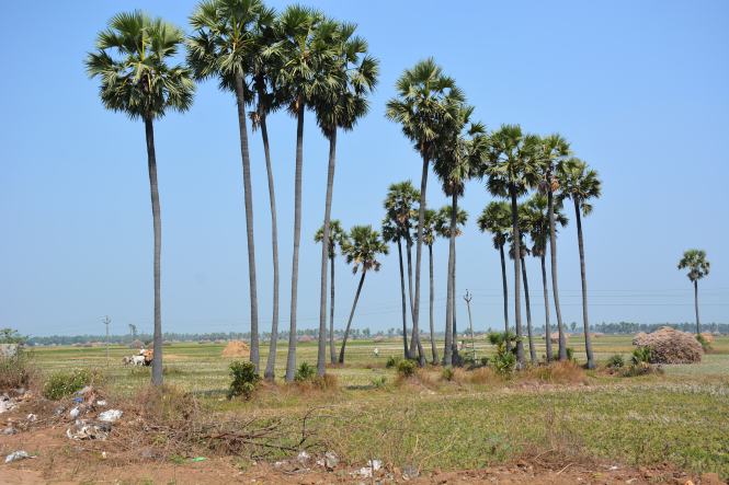
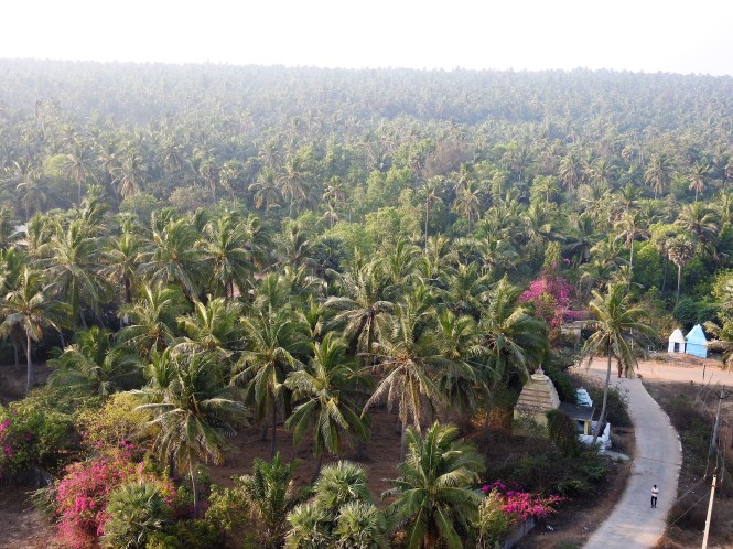
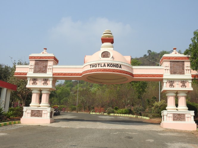
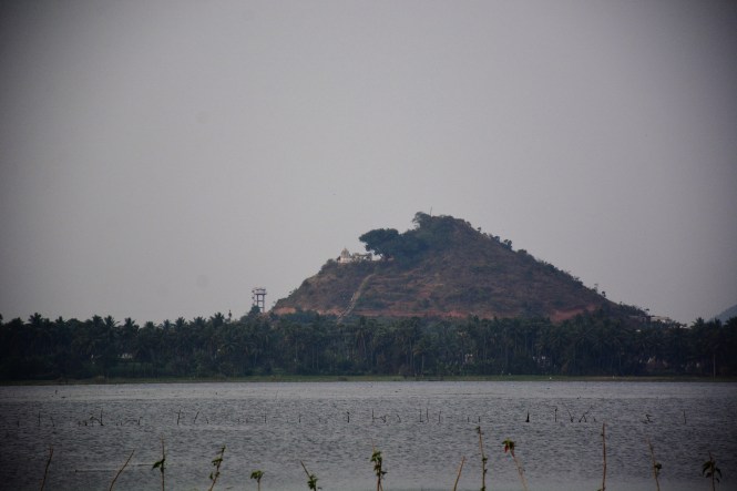
The river Mahanadi starts splitting into distributaries west of Cuttack and meets the sea at several points with Puri at the southern end and Paradip at the northern. This forms a huge delta perhaps as big as the Godavari basin but smaller than the Sundarbans.

Screenshot_2017-07-02-19-32-59

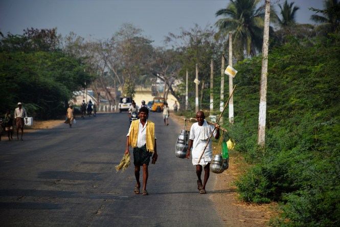
In terms of economic activity and the consequent prosperity however the two northern deltas are far behind their southern cousin. The road distance between Puri and Cuttack is currently 160 Kms. A direct coastal road would reduce the distance by about 40% but will entail considerable expenditure to bridge the various distributaries of the great Mahanadi. After travelling through the region extensively I strongly felt that this huge region could be developed much faster with better road connectivity. Right now, the entire region appears to be grossly underdeveloped.

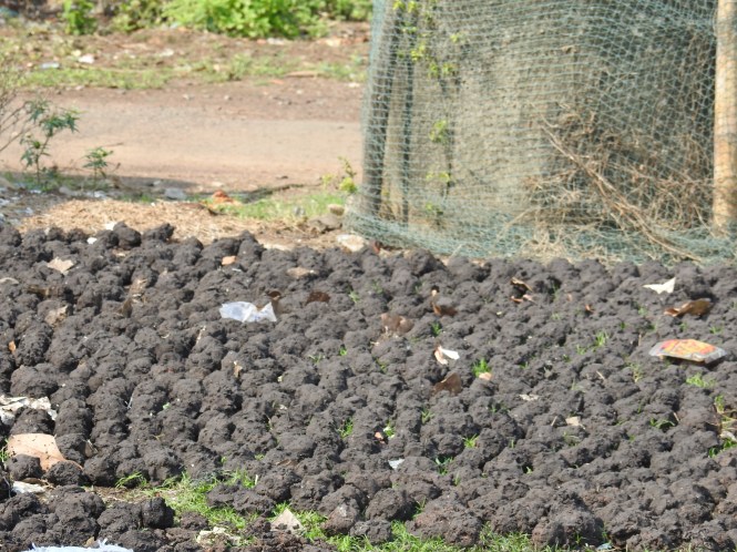
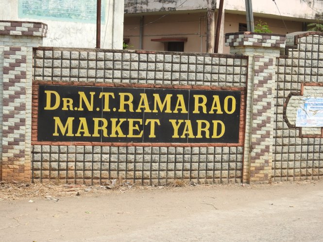
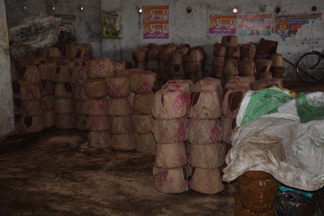
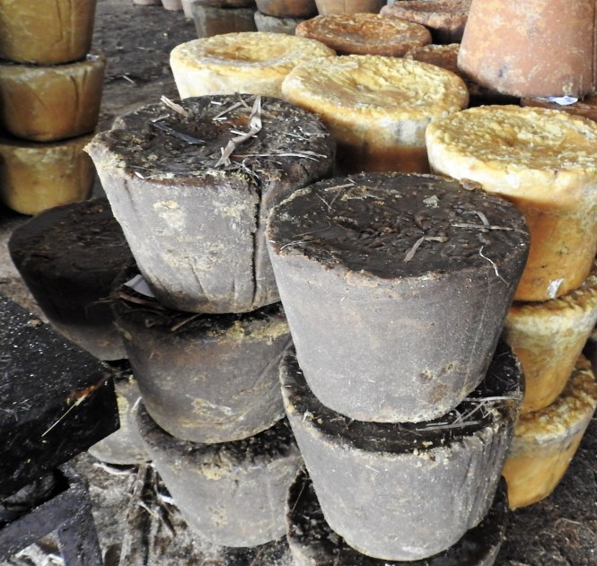
Paradip or Paradeep is an artificial harbour and has considerable importance in bulk cargo trade, especially in iron or from the India’s eastern region and the petroleum products imports. Coal and Fertilizers are other important items.  The dust of the imported coal lying around in the town is processed in pallets by the locals and used as cooking fuel. This is certainly a take on our age-old cow dung. People have merely substituted the coal dust for the cow dung.

DSCN5446

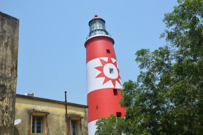
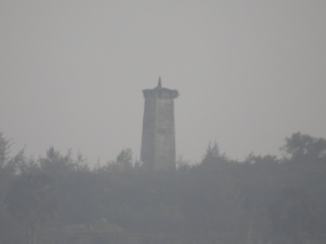
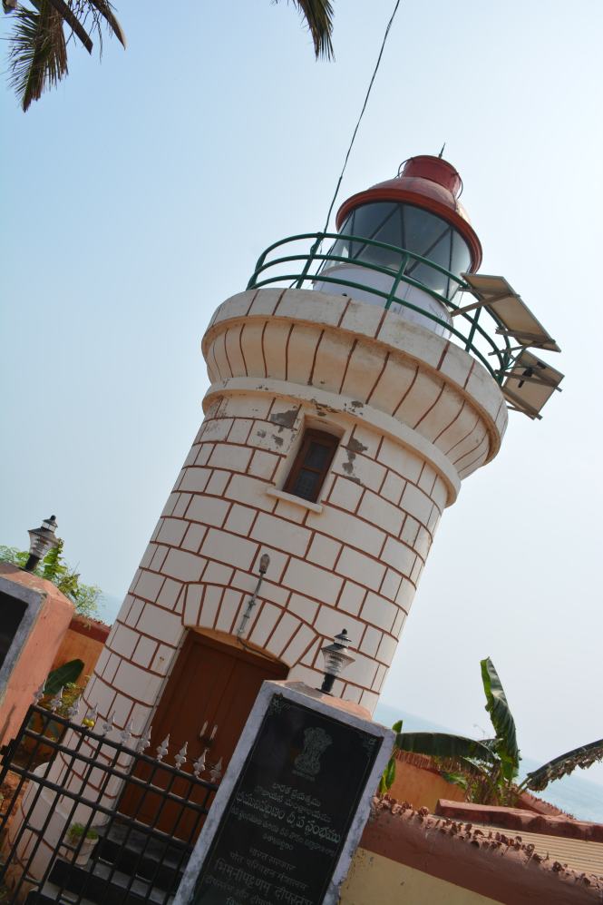
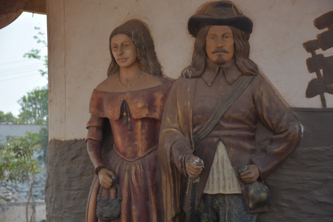
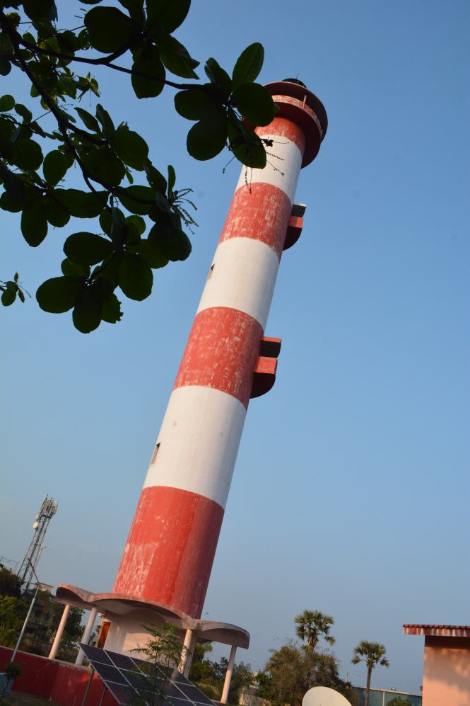
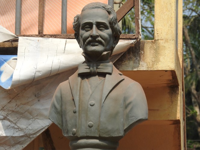
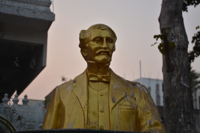
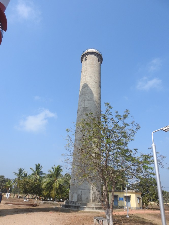
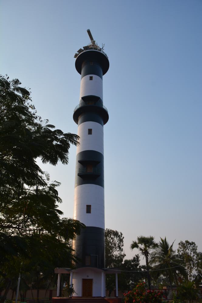
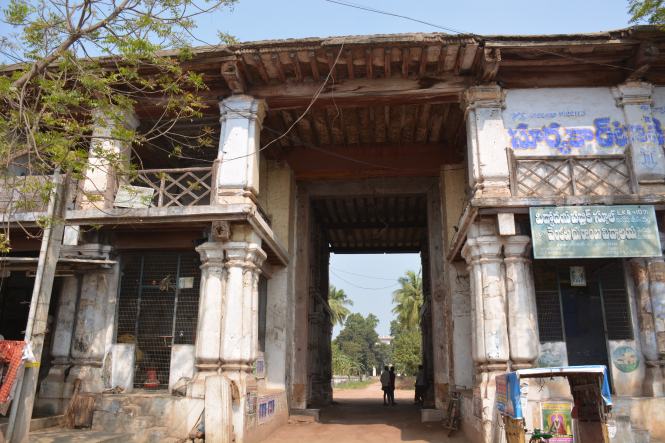
There being no significant historical or religious places the commercial activity dominates the town. But there is always something if you look for it. Not ancient but from the recent past is found. A romantic place housing a famous lighthouse called FALSE POINT LIGHTHOUSE built by the British and a cemetery for the Englishmen who worked there. This lighthouse seems to have been an institution by itself. Upon inquiry, you will come to know that this place was equipped with even a small hospital for the inhabitants who were employed in connection with the lighthouse. I will not be surprised if someone tells me that they had a priest to preside over the frequent funerals.

The major question is: how to reach the place. The place is shrouded in mystery and there being no Tourism Industry in Paradip, is seldom explored. An attempt has been made by an employee of the Lighthouse administration to throw some light on the history of the place. One can easily access it here:

http://www.dgll.nic.in/WriteReadData/Publication/Publication_Pdf_File/FalsepointLightHouse(2).pdf

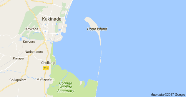
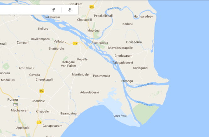
It is difficult to locate this place on the Google map. One can see a place called Batigraha- lighthouse which is quite far from the sea and the map does not show a connecting waterway. The lighthouse may be (now, after silting for more than 150 years) far from the sea but the access is by boat through a navigable channel which you don’t see on the map. During this coastal drive we have had several problems with the Google map.

There are three sources to reach the place:

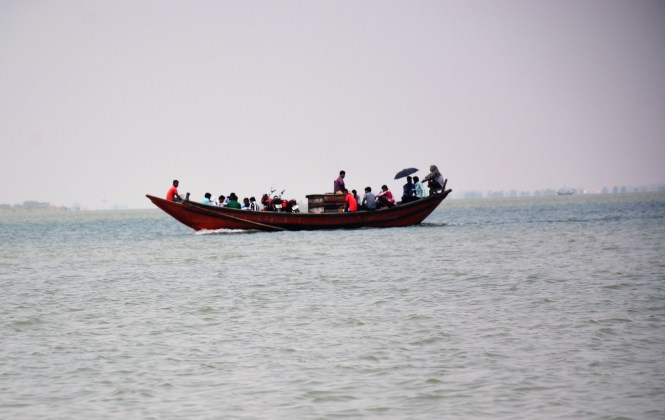
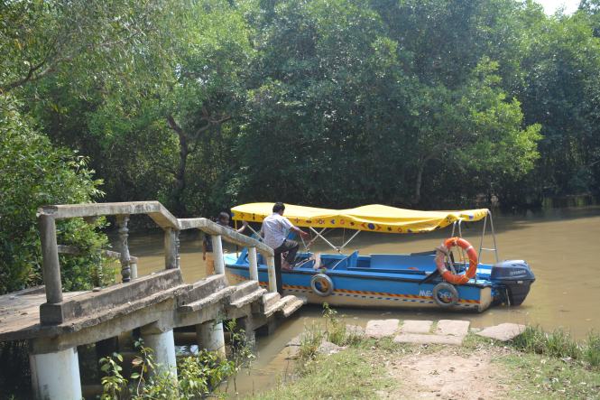
1 There is a boat service to and from the villages around which runs a ferry- looks quite dangerous. It is a schedule service and is dependent on the tide timings. And if you enlarge the picture you will see more motorcycles being carried.

DSC_2175

2 The Lighthouse has contracted a boat for supplies which makes a trip every day. You (and me) are not entitled to this service but I guess one can talk to ‘right people’

3 Look for a private operator who can hire a motorboat.

DSC_2167

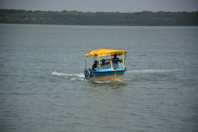
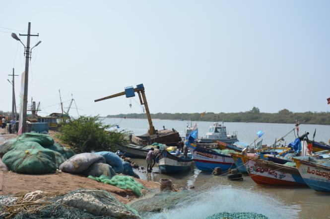
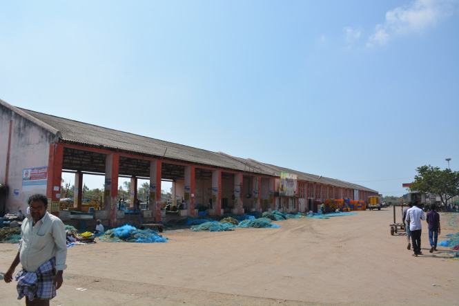
We get up very early in the morning. Our objective is to prove the manager at the OTDC Resort wrong. He has told us that it is impossible to go to False Point and return alive the same day. We wander around on extremely bad roads, damaged by the very heavy vehicles plying in the port area and reach a beach from which the boats are supposed to be plying. There is nobody around here. We return towards the town and, on the way, take a diversion to the Fishing Harbour.

DSCN5443

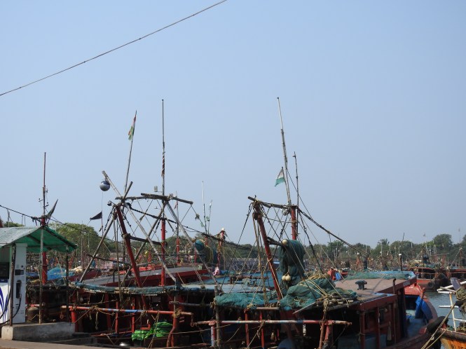
All fishing harbours in this country look alike. The difference may be in the numbers.

We make inquiries at the fishing harbour.

‘How do we go to False Point from here?’

‘No, this is not the place from which you can reach your destination. The fishing boats do not offer that kind of service’

‘What’s the alternative?’

After a brief thought the man suggested that we should perhaps hire a private boat.

‘Where do we find one?’

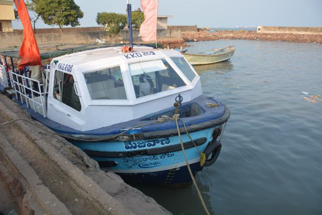
‘There are not many but there is one owned by Sahoo. Go across the fishing harbour, drive on the road along the waterside and look for a Restaurant visited by the fishing-trawler operators. We follow the instructions and reach the place.

DSC_2255

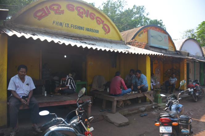
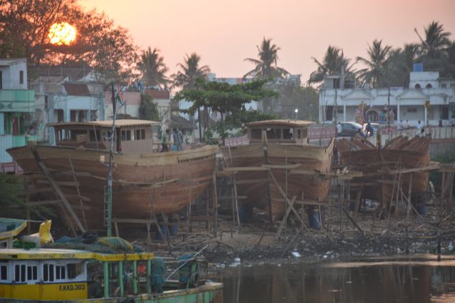
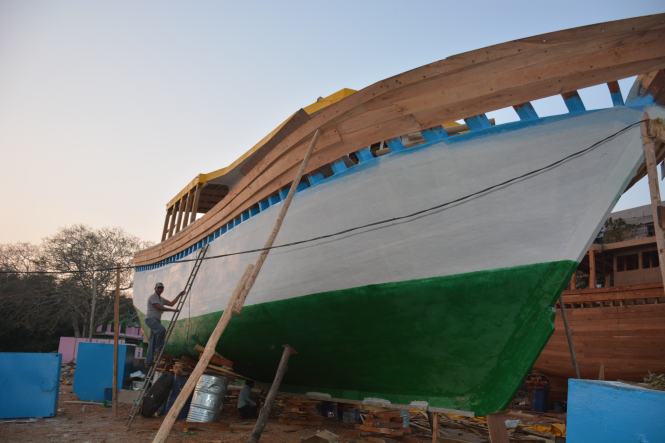
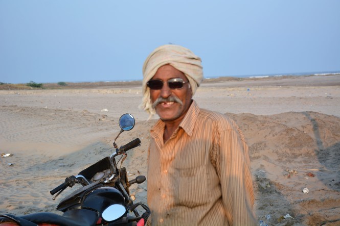
Pradipto Kumar Sahoo is more helpful than expected. He opens up even more when we describe to him our mission of the coastal travel. Pradipto is in his middle age, owns a few businesses- a restaurant, a motorboat, perhaps a fishing trawler and a distribution business in Chemicals and hardware.

Yes, he has an 8- seat motorboat but has no other customers for the day. He is trying to develop a tourism business in the Mahanadi estuary. He has problems created by the port authorities who do not want traffic in the approach channels in the port crossing the river. And then there are private parties operating dedicated private jetty operations in the area who might not like the disturbance in the channels.  He has plans for ‘Kerala-style’ houseboat operations in the Mahanadi. Ambitious, to say the least but a very practical and forward-looking person. We don’t find many of them easily.

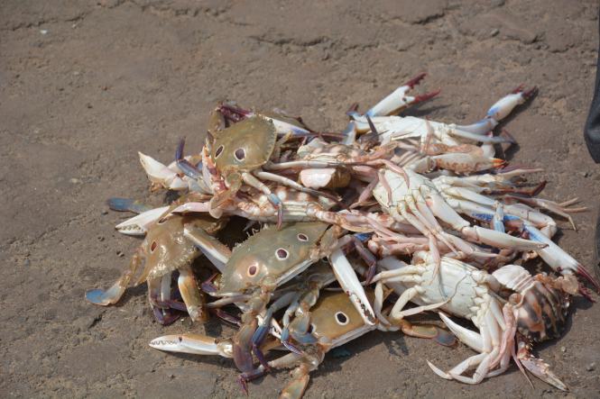
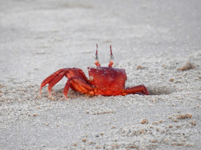
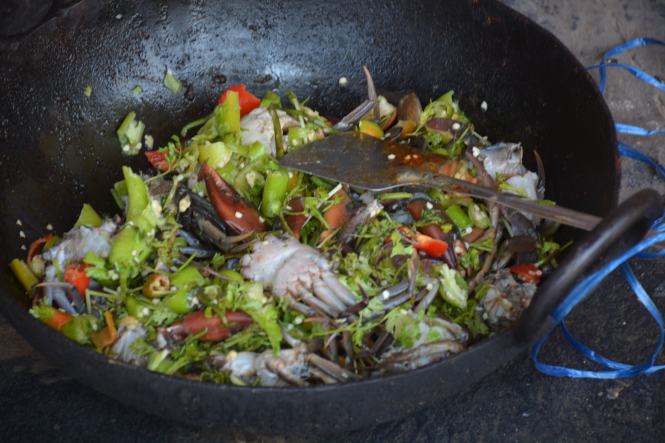
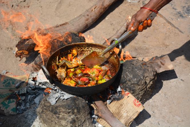
The private boat tour works out quite expensive as there is none to share the cost of the 8-seater.  We discuss and Pradipta is very understanding and considerate. We agree on a mutually acceptable figure for the boat ride of nearly four hours excluding the waiting time. We agree to come back and have lunch at his restaurant for which we select a bunch of  fresh Blue Crabs at the harbour.

DSC_2162

The licensed boat operator takes his own time to arrive. He has just returned from his native place in Andhra Pradesh last night and reported for work late and then had to go to the jetty with a plastic can to bring the diesel. In the event the boat was very efficient. We were comfortable despite the fact that we were sailing upstream.

To the left above is the storage facility for the imported Phosphates. Right Up is a barge in the estuary and at the bottom is one of the industrial establishments upstream on Mahanadi.

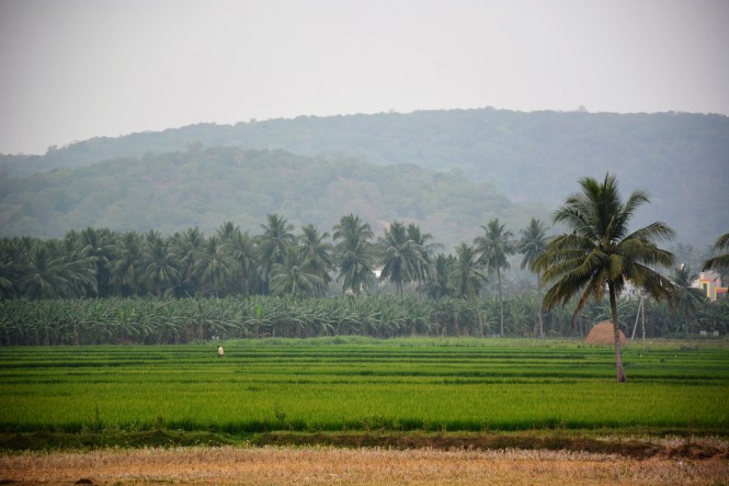
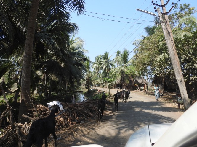
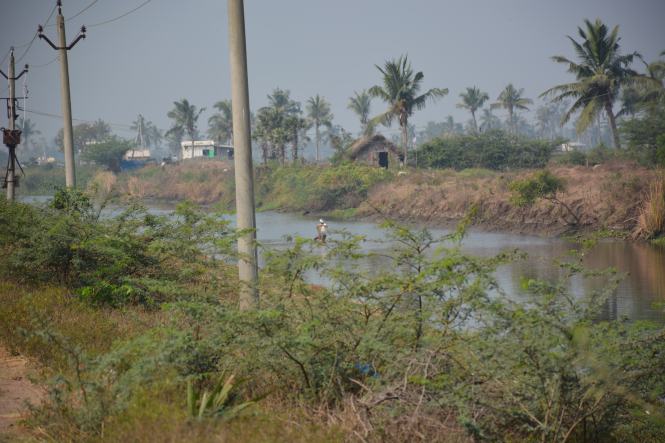
It is a great experience to go upstream through inhabited channel banks although they are not anywhere near the population density of the Kerala backwaters. The construction of the large huts needs to be studied if not already done. They look very sturdy. Unfortunately we did not have an opportunity to land and have a look.

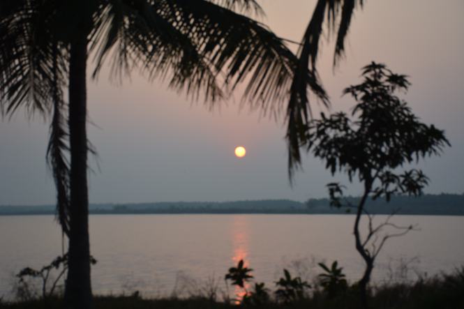
The scenes from the backwaters look pretty at this time. Life should be much more difficult in the wet monsoon days.

The picture at the bottom with the hanging pots is still a mystery for me. I showed to to several people on the mainland and nobody could explain what it is all about.

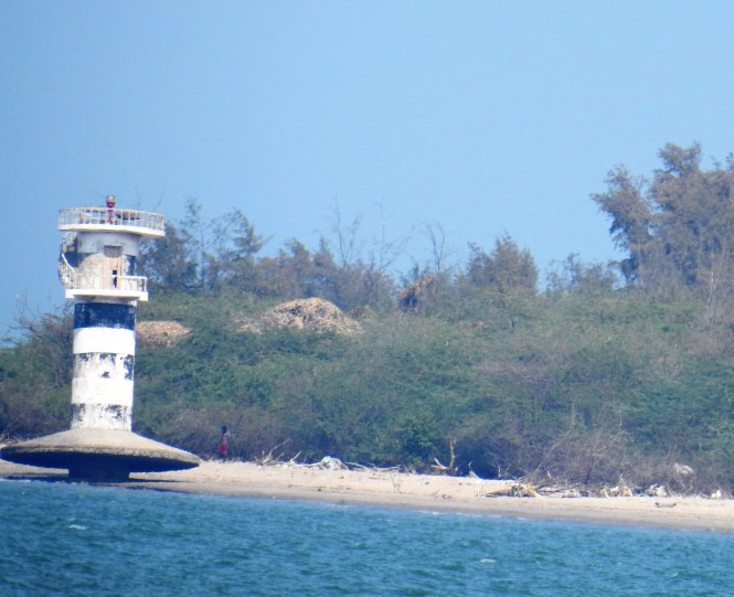
We miss the way (waterway) once and have to return back and take the correct route, losing half an hour in the process. We manage to reach the landing site which is about 200 meters from the Lighthouse.

DSC_2212

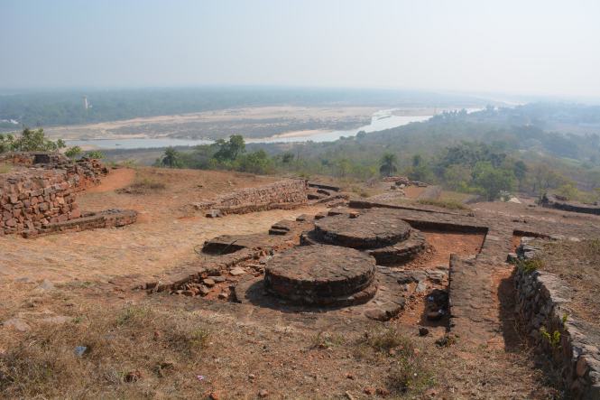
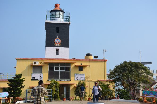
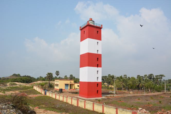
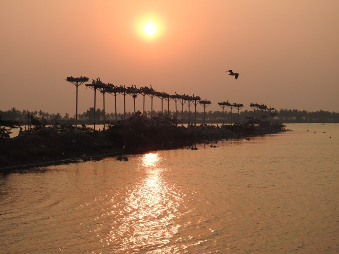
The lighthouse is a massive structure like no other we have seen in India so far. The huge plinth and the bottom, the painting and the surroundings are like no other we have seen.

DSC_2228

DSC_2223

The area surrounding the lighthouse is huge. The In-charge of the lighthouse is a very helpful gentleman who has grown up here when his father was working at the lighthouse. We are offered a climb up the lighthouse. This is unlike at other lighthouses where the suggestion would have been resisted. The people at most of the Indian lighthouses consider the visitors a nuisance. Here it was different. We turn down the offer as we have been given a total time frame by Pradipta and we need to return to the mainland in time for the lunch. The Blue Crabs are calling. In the process, we miss out on some views from the top of the lighthouse.

DSC_2234

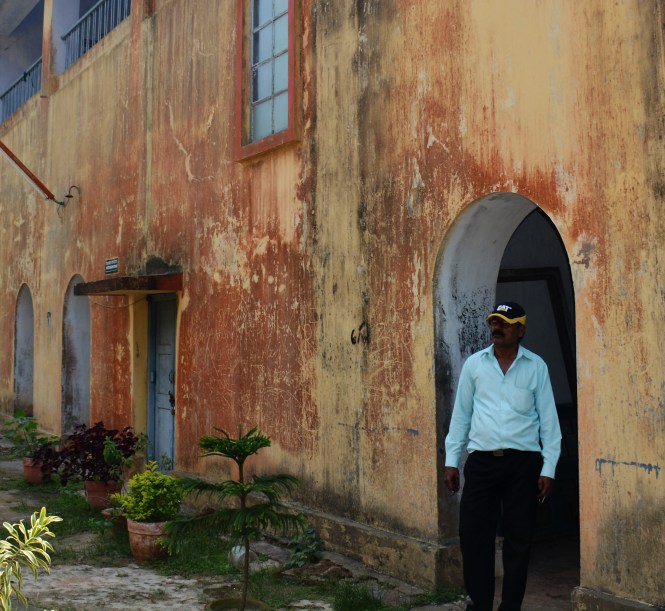
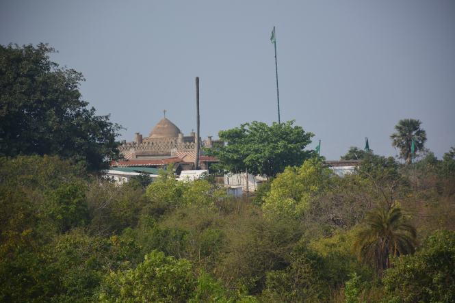
The area surrounding the lighthouse have many monuments of the past including the old utility and the residential buildings and the cemetery. Here are some of the structures in the compound.

Top Right is the cemetery, bottom left is the hospital and the right is the drinking water well.

The return journey is quite frightening and takes much longer. There is high tide now, water is rising and there is heavy wind in the opposite direction. We sail quite a distance upstream to make it to the fishing harbour at Paradip.

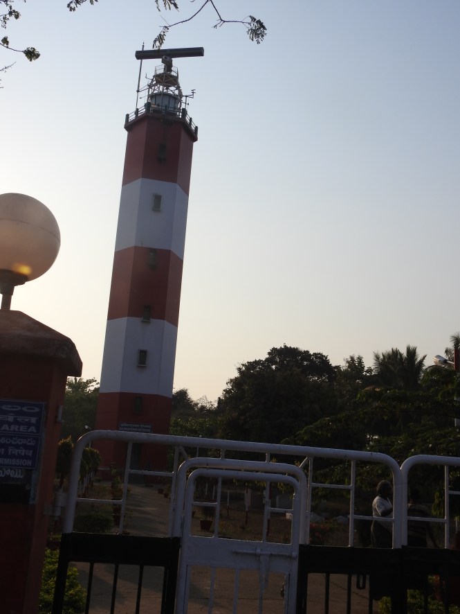
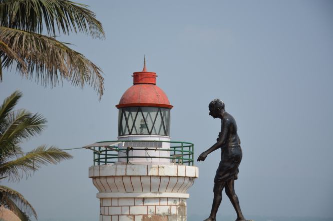
After feasting on the crabs, we move on to the resort and after some rest move to see another Lighthouse, the one serving Paradip. Yesterday we had been sent off from the gate of this lighthouse as were about 90 seconds late for the schedule timings. They try to send us off again today. The people at this lighthouse do not want visitors. The person in charge at this place in Mid-March 2017 is a particularly vicious, extremely arrogant and unfriendly bureaucrat who thinks the lighthouse and the surrounding property is his private preserve. They try to persuade us not to climb up the lighthouse despite the fact that it is officially permitted on payment of a prescribed fee.

Despite all the efforts made by the keeper to keep us away, we decide to climb. The person assigned to us inform us that we do not have a right to visit. We can be denied an entry without assigning any reason. This is downright insulting and the motive is by now clear. That prompts us to be adamant.

DSC_2258

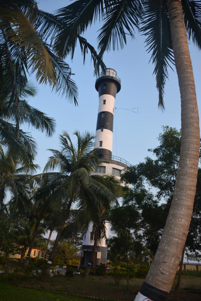
As a last attempt, the man tells us that we are too old to climb. We insist that we can and do.

It turns out to be worth the effort, climbing and fighting the petty officialdom.

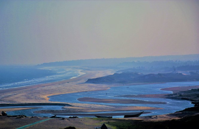
Here are the scenes from the top of the Lighthouse.

The beach:

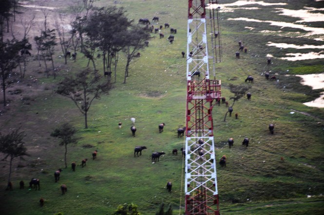
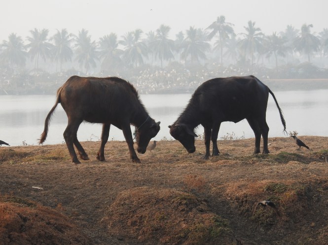
The grazing grounds for cattle:
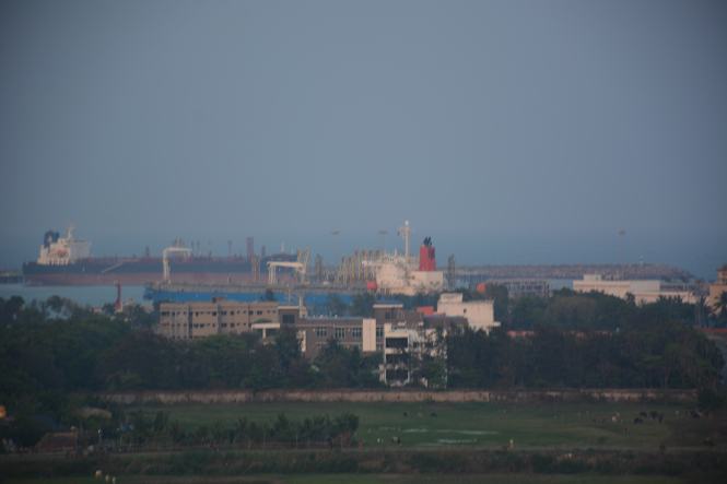
DSC_2308

The harbour side:

DSC_2289

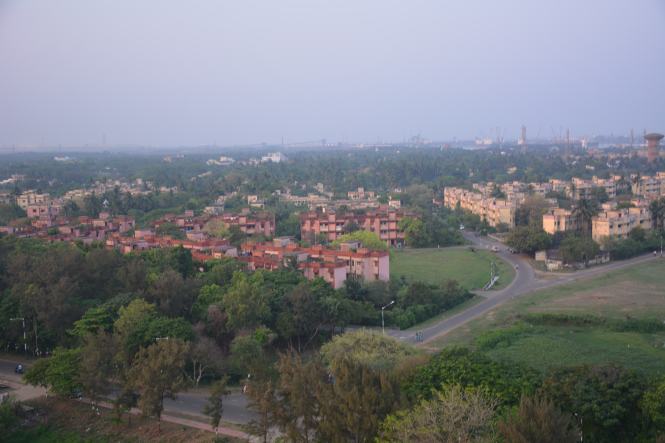
The residential part of the town which is very neat and clean- the modern town:

DSC_2298

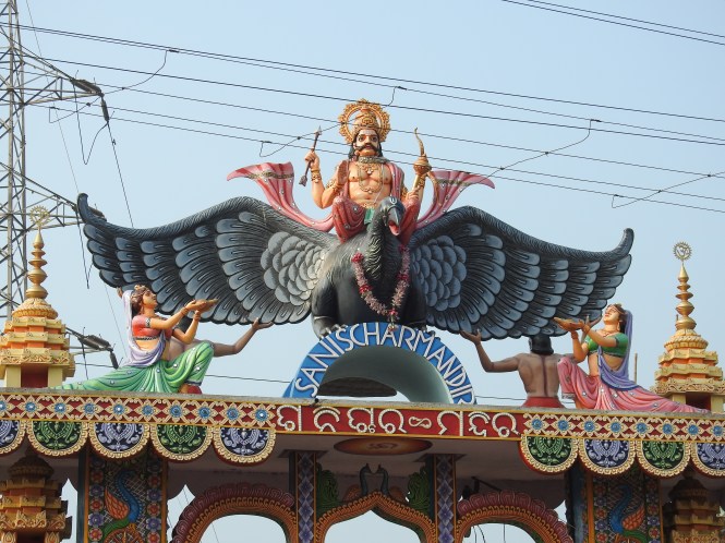
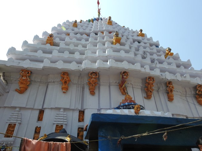
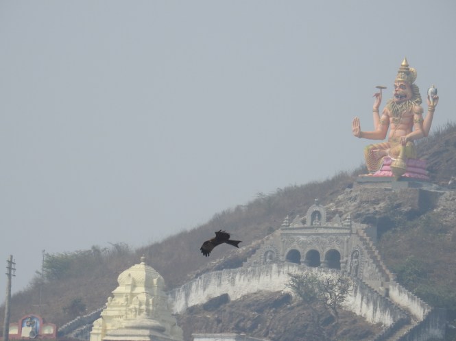
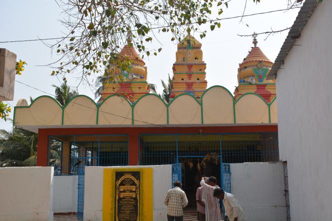
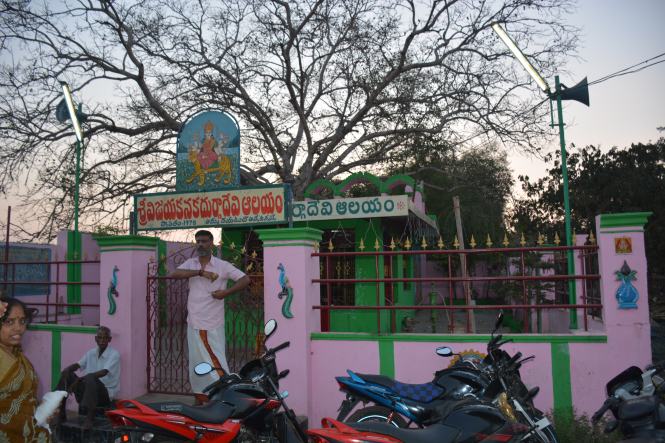
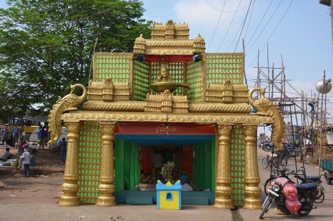
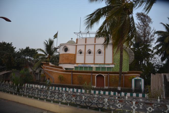
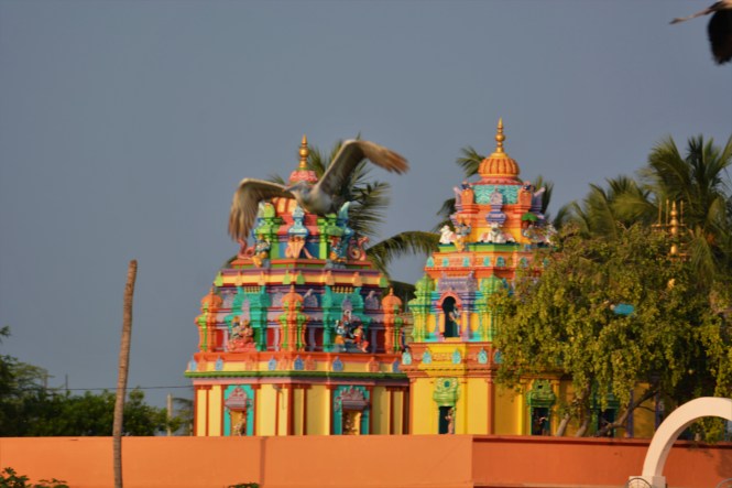
A little out of the town is this Shani temple with the ferocious ‘Shani’ right on the gate.

DSCN5528

We are done with Paradip and have to move to the next place which happens to be Bhitarkanika. We now need to cross the distributary of Mahanadi which we crossed yesterday the previous day to reach the False Point but much upstream. This part of the river is used for massive sand-mining operations, highly mechanized.

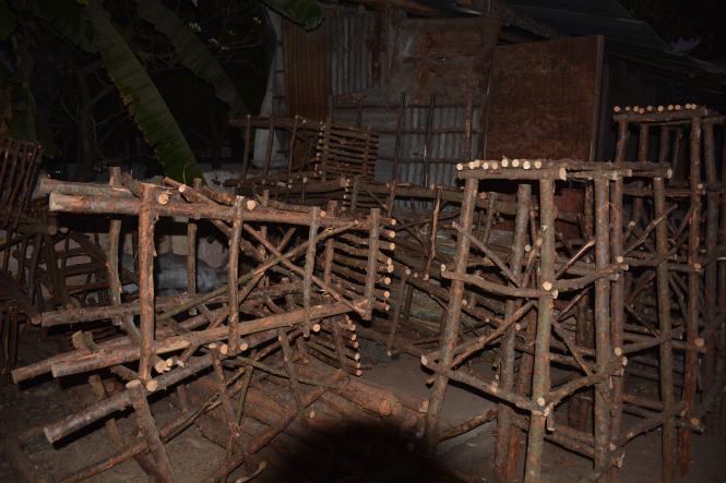
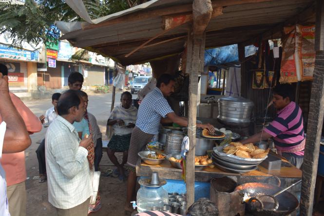
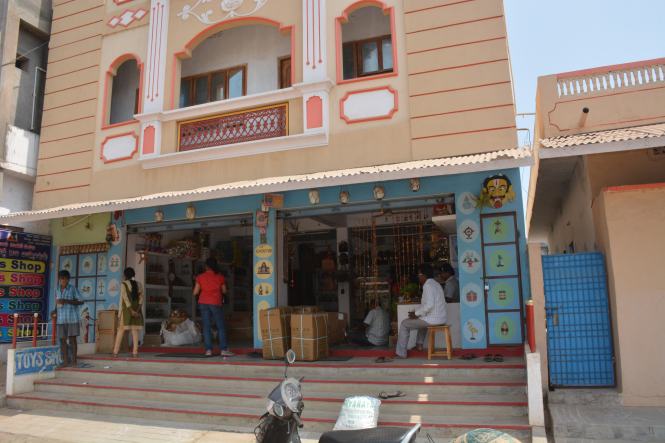
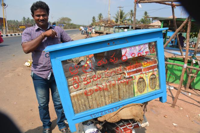
We stop on the way fro breakfast at a junction off the highway and come across a Musical Instruments shop:

DSC_2327

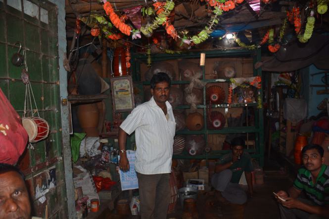
The Mrudang and a wide variety of Indian percussion instruments are here to see and buy, mostly for the religious functions.

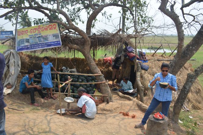
We do not find our daily dose of green coconut here and settle down for a nice watermelon:

DSC_2339

This is not an easy ride. We drive along the narrow country roads connecting villages and small towns to reach the mangrove forests which is called Bhitarkanika. ‘Kanika’ is a largely inaccessible island on the mouth of one of the distributaries of Mahanadi and the portion of the mangrove-infested estuary upstream is known as Bhitarkanika- Inner Kanika.

We take the Pattamundai-Aul-Rajkanika route to reach the place called Khola Gate in the Bhitarkanika Wildlife Sanctuary.

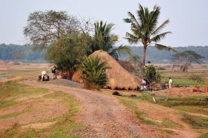
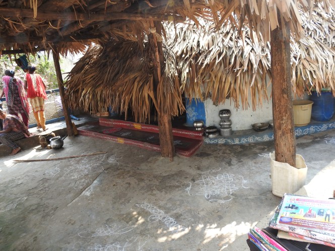
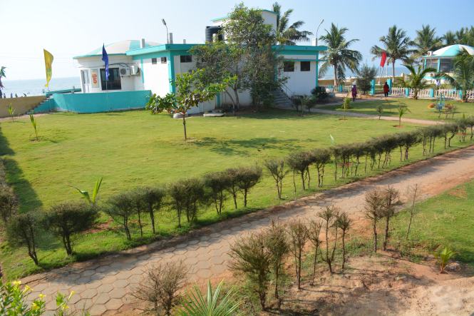
We have booked our stay at an expensive lodge as there are not many places to stay available in the area. W arrive in the late afternoon and take a short walk around the village and the riverside. The shape of the huts here is peculiar. The roof comes right up to the ground.

DSC_2430

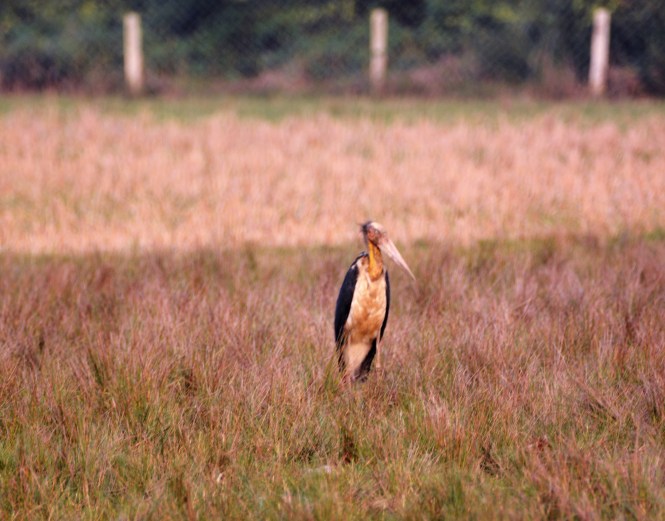
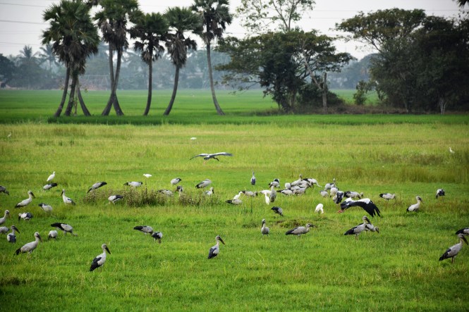
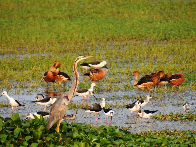
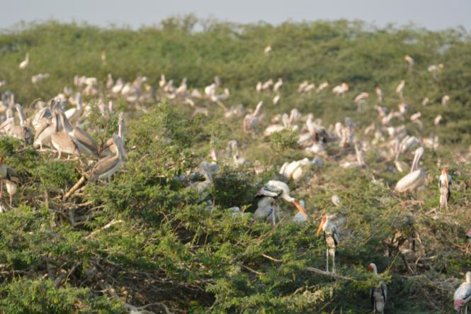
The place is promising as far as birds are concerned. We are instantly rewarded with the sighting of a Lesser Adjutant Stork.

DSC_2390

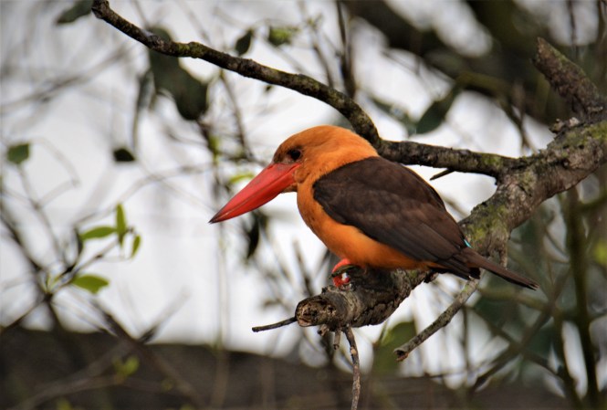
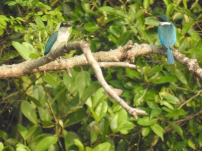
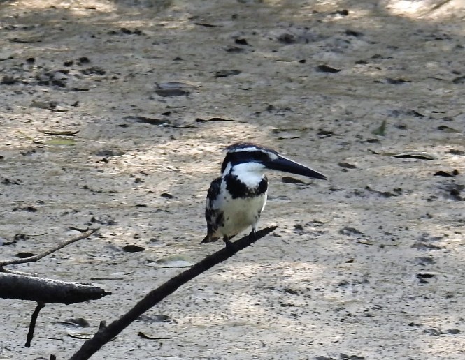
The real fun begins the next day morning. We get very early and get on to a motorboat with a well-trained guide and boatman. In the first 15 minutes of the early morning ride we spot five species of Kingfishers, a record of sorts, at least for us.

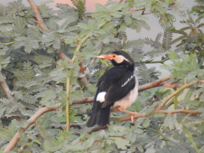
The first one to make his appearance is the Brown-Winged Kingfisher.

DSC_2523

The Black-Capped Kingfisher followed:

A pair of  Collared Kingfisher came along:

DSCN5743

And then there was the Pied Kingfisher:

DSCN5765

And then there was the Common Kingfisher and the White-breasted Kingfisher.

Bhitarkanika is mini Sundarbans. In fact, it has crocodiles in more abundance than the Sundarbans. Even birdlife is much more profuse. The only thing absent here is the Tiger and the huge Bengali crowd. In my understanding tigers don’t like noisy people and that is the reason they have become man-eaters in the Sundarbans.

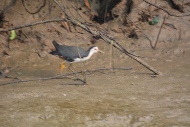
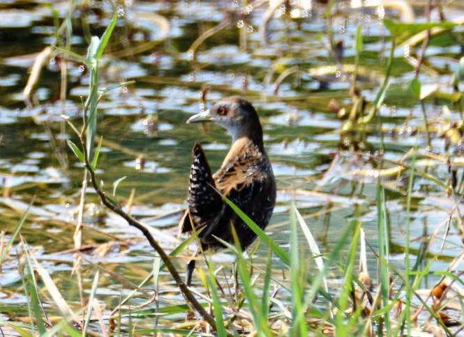
And also the other bird species like the White-breasted Waterhen which is quite common all over the country but here in the mangroves she looks very bright, clean and fresh:

DSC_2565

And here is the father of all chicken we eat- the Red Junglefowl- Gallus gallus. (apologies for a bad picture)

DSC_2578

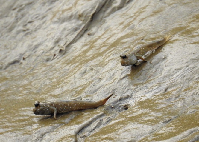
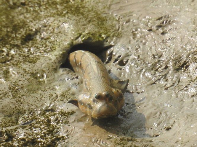
The Mudskippers are a delight to watch at the low tide when they dominate the mud between the water and the dry land:

DSCN5655

And here is an eagle and the photographer taking rest after the early morning efforts:

This estuary extends further upstream up to Chandbali and beyond. In fact, there is a tourist boat service run by OTDC from Chandbali to the sanctuary. The boat service would take about two hours but reaching Chandbali by the road takes considerable effort and time.

We take the Pattamundai-Aul-Rajkanika road to reach the banks of Baitarana river and cross the bridge into Chandbali.

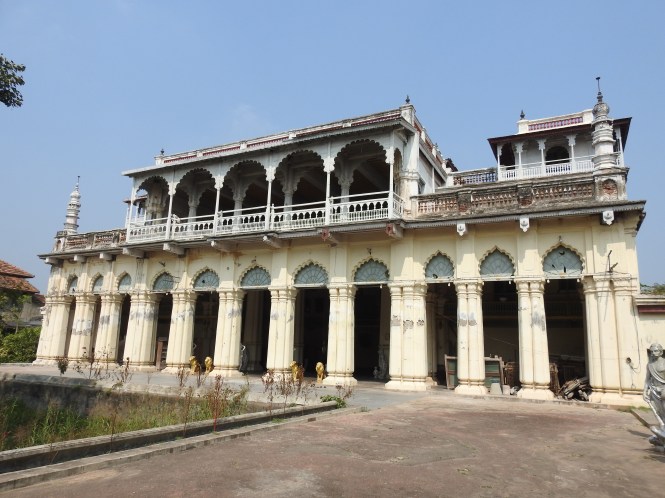
At Aul we stop to buy some fruits and we are told by the locals that Aul used to have a palace which is now not accessible as we should proceed to Rajkanika and visit the palace there. When you say (or I say) ‘palace’ it implies kings have stayed in this little hut. And this one is highly rated.The Telegraph, the prestigious newspaper on Saturday 9th April 2011 said that this palace is ‘ poised to become a major hub for overseas tourists’ Six years down the line the palace is closed and waiting for the overseas tourists to come and open it. This palace is said to be housing the ‘largest crocodile skull’. Does this imply that it is the skull belonged to the largest crocodile? I doubt. In any case this palace looks pretty with open grounds inside and outside the gates. There were tell-tale empty ice-cream cups on the outer grounds (from where the pictures below were taken) to indicate a recent evening of festivities.

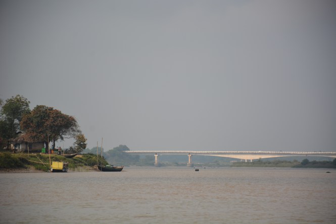
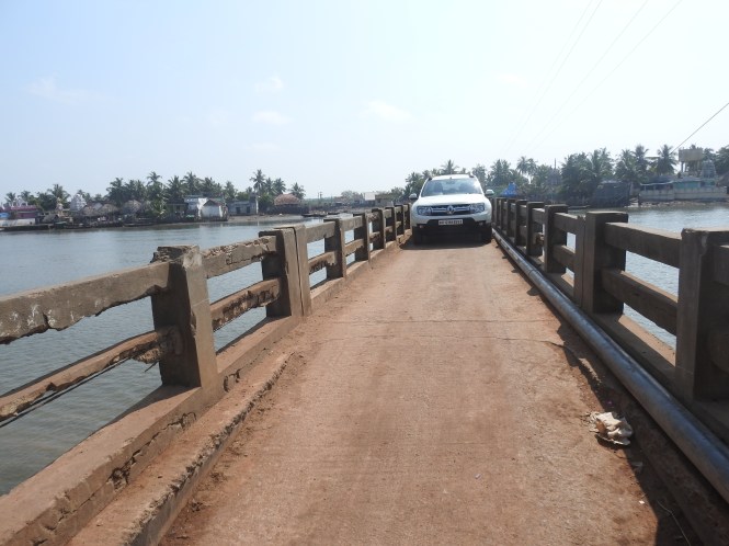
One need to cross this bridge on Baitarna river to reach Chandbali from the south side.

DSC_2871

Chandbali was an important riverine port in the early part of the last century. It connected the agricultural hinterland of this part of Odisha with Calcutta by the river and the sea. Hardly any signs of the past glory of the port are visible to-day. The town is used by the people who intend visiting Bhitarkanika and those visiting the temple at Aardi. The Aardi shrine is easier to visit by boat from here rather than by road from the north. Chandbali has an OTDC Aranyanivas. The term Aranyanivas is used for the hotels and resorts which were earlier Forest Department guest houses.

As we not find anything interesting around and we decide to take a boat upstream on the Baitarana to a place called Aaradi. This place is famous for its temple of Akhandalamani. It is a Shaivate temple and has a legend about its origins. It is too long a story to be dealt with here.

DSCN5911

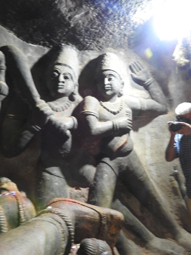
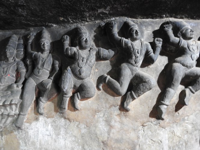
What assaults your senses here is this crass depiction of sexual acts on the walls of the temple. This appears to be a peculiarity of Odisha temples. I am not sure if anyone has an explanation for this feature which is not found in other Shiva temples or at least not found in such explicit manner.

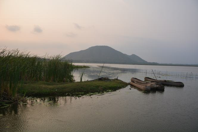
The Baitarana upstream from Chandbali is otherwise an interesting boat ride. The major economic activity perhaps is sand-mining.

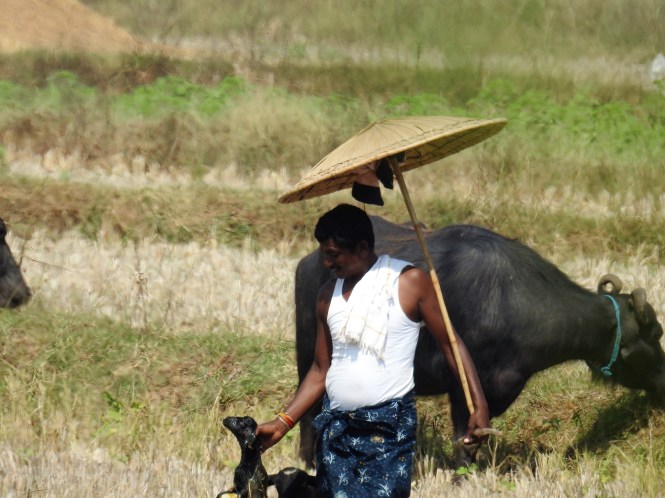
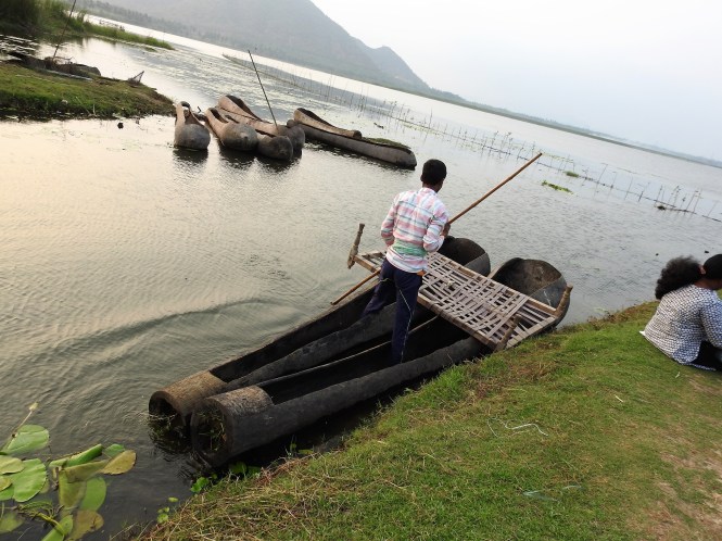
The mode of transportation around the area is the country boat.

Coastal Odisha journey will continue in the next post.


Text by Suryakiran Naik

Photographs by Suryakiran Naik & Veena Naik


107.ODISHA.(1) AROUND GOPALPUR-ON-SEA

We leave Somepeta and get on the National Highway to cross the Andhra Pradesh border into Odisha. It is not that simple. The highway takes you into Odisha and back into Andhra at least at two places before finally leaving Andhra behind.

DSCN4450

Normally in India one does not feel that one is crossing one state into another. There are a number of overlapping factors in the border areas- language, food, culture etc. The places where the division into states (or the Federal nature of Indian Union) come into sharp focus are the points where the state governments have their Border Check Posts. At most of these check-posts one can see ques of trucks running into miles, waiting for their turn to cross the check-posts, making a border look like a huge traffic jam which it partly is. The reason is that the ques are formed on the road. There is no separate lane for the border check posts. This results in the passenger vehicles not requiring a check also to be stuck in the traffic. This also results in two adjoining states of the Union of India looking like two different countries.

Gopalpur is a village on the Odisha coast and has a passably good beach. Why this place is called ‘Gopalpur On Sea’ is a mystery. I guess this is the creation of some idle Englishman who did not find a better thing to do when in the service of the Honourable Company. The history buffs will tell you that Gopalpur was a big port during the days of the East India Company and was rich and what not. They may also tell you that the Honorable Company used to import rice from Burma through this port. The import part could be true but not the claim of being a big port. Further, Gopalpur that we see now, the resort village could not have been a port at all. It is a flat, straight beach where no ships can be berthed. The possibility is that the area several kilometres to the north of the village had a port in the sheltered waters of the creek. Not Gopalpur on Sea, sir. Even the new port which is being developed is some miles north of the creek, further away from the beach town. Incidentally and surprisingly the new port is on the shore without any protection.

Probably because of the romantic name- Gopalpur-On-Sea, I had great expectation of the place. It turned out to be a damp squib, as the Englishman who christened it would most likely describe it today.

The beach is quite good, long and straight, used by holiday makers, tourists, fishermen and defecators at the same time without any conflict of interest.

DSC_0998

DSC_1000

We are put up at a hotel just behind the Gopalpur Lighthouse, right on the seashore. We do not make an attempt to climb the lighthouse.

Forts, the sea forts, happen to be one of the landmarks along with the Lighthouses that we have decided to visit on this journey. The rationale is that we will be able to cover the maximum part of the coast without missing much. Not far from G-O-S there is a fort.

Potagarh is a sizable fort and looks more like a combination of two or three forts or fortresses, on the banks of the Rushikulya river or at the point where the river meets the sea. In Andhra they call it ‘mixing’. I am not sure what they call it in Oriya.

It is a sad reflection on Indians’ lack of sense of history that we are still not sure when this fort was constructed and by whom. And this is not about ancient history, it is about a 17th century  masonry structure which is largely intact. One theory or speculation is that it was built in the 17th Century by a Muslim Faujdar of the Kutubshahi sultans. The reason given in support of this is that there exists a Mosque within the fort complex. The second claim is on behalf of Monsieur De Bussy, a Frenchman. The evidence? Existence of two graves of Frenchmen in the fort. Date? 1753. And then the claim on behalf of the Honourable East India Company represented by Edward Costford, Resident of Ganjam. When? He was the Resident from 1768 onwards.

And here is the graffiti on the walls and the arches, something I deeply hate.

We return to our base just before sunset and on the way, could see a few industrial complexes including one of Indian Rare Earths.

DSCN4466

More interesting is the government built elaborate ‘shelters’ for the people who might be affected by cyclones. It is very interesting. I would have liked to study how it works and the extent of the area is covers.

DSCN4462

Reviewing our progress at the end of the day we realize that as we drove we missed an important geographical formation between Andhra and Odisha. A creek- pure creek without any major freshwater flowing into it – is formed between the two states and the state boundary runs through this creek. This is an interesting phenomenon and we decide to explore it although we have to drive back south on the highway with all the trucks blocking our way and making life difficult. In the event the place is found to be worth visiting. If there was an ancient port in this area, probably this should have been the place. It has everything that a good harbour would need.

If you look at the map of the area, you will see the lagoon-like formation through which the borderline of the two states pass. You see these names of the places on either side of the border: SONPUR, SONPUR BEACH,KEUTA SONPUR & PATA SONPUR. The lagoon is named Bahuda Muhana Sagar.

Screenshot_2017-06-06-17-59-34

A bridge has just been constructed and is named after the first Chief Minister of the State. The approach road to the north is not ready. No, you can’t cross this creek. You can try but…………… We decide not to try to drive through the mud excavated by the construction equipment to the other end. We had crossed the bridge but then decide not to go further.

Just at the beginning of the approach road to the new bridge we find a small lake and the birders in us woke up to spend an hour along the lakeside.

And here are the lakeside Gods.

We return back to the highway and make our way to two places, not very far from each other, which have historical and religious significance. One is a Buddhist politico-religious site at Jaugada where Emperor Ashoka had placed an edict after his conversion to the Buddhist way of life and the other is the famous temple of Taran Tarini, both in Ganjam district.

First we drive to Jaugada and find that the road to the site is blocked by the farmers who are drying their produce on the approach road. The only option we have is to walk about a couple of kilometres through hot sun. the farmers are protected by the very efficient equipment that have designed which provides the shade without depriving their heads of the cool breeze.


DSC_1262

The farmer and his cool hat.


JAUGADA is worth visiting. It is quite a sizable area covered with granite boulders ideal for inscribing edict in the pre-paper days. The 3rd Century BC edict is in Prakrit language and is written in Mauryan Brahmi script. Of course, so I have been told. The other thing that I have been told is that the edict, among other things, speaks about protection of animals and wildlife. In short non-violence and love of all living things, particularly the animals. I am sure it does not extend to plant life.

What is commendable about the edict is that the way it has been protected by Archaeological Survey of India. Full marks to them for the maintenance of the site.

DSC_1246

Located 32 Kms from Brahmapur, on a hill is the shrine of Maa Tara Tarini. This is a very complex Puranic deity. The shrine is one of four major ones of the Shakti Cult and one of the four ‘Shakti Peeths’. Out of the four two are in Odisha, one in Bengal and one in Assam. I would like to excuse myself from the religious aspects of this phenomena (which is too complex to be discussed here) and stick myself to things like the gate to the town where the temple is located. ( Here are some pictures).

And the efficiency of the cable car that takes the pilgrims to the top of the hill without any effort on their part. Of course, there is a road driving option also available to get on to the top.

The view of the Rushikulya river from here would be much better in the morning and at the sunset. We happened to be at the place in the mid-afternoon. And this is how it looked.

DSCN4566

The temple or the combination of various places which together makes the shrine attract a large number of pilgrims from all over the region and even from far away places.

The farmers at the foot of the hill are not blessed by the Maa with any comforts. They have to live with their drudgery although a few among them are making good money off the visitors selling them various things- refreshments and charms.

DSC_1232

DSCN4559

DSCN4560

Text: Suryakiran Naik

Pictures : Suryakiran Naik & Veena Naik

March 2017.

106.ANDHRA PRADESH. (10) Vizianagaram, Srikakulam, Baruva.

The two northernmost districts of Andhra Pradesh, Vizianagaram and Srikakulam are bordered by Odisha state on the western side and the history of these two districts intermingle with that of adjoining districts of Odisha, meaning they have had common ruling dynasties in history. This is quite common among the modern Indian States.

Vizianagaram is not to be confused with Vijayanagar empire although the empire ruled over this place briefly. Vizianagaram is not exactly a seaside town but is 18 kms form the seashore and qualify to be visited by TheBlueDrive which has a 30 Kms range from the seashore permitted.

As we drive towards Vizianagaram, my mind is trying to recollect why this place sounds familiar to me. Vizianagaram………. Late that night I remember it. Rajah of Vizianagaram Vs Commissioner of Income-tax, a landmark case related to the principal of Heads of Income being not interchangeable. That was in 1980, 37 years ago (not the case, my reading of it), when I was in the second year of my law degree.

It is small town. We reach late in the afternoon and intend to spend only one night. The town is typical of the erstwhile principalities ruled by the princes who succeeded to smaller geographies at the demise of the larger empires and ruled till the White Man appeared at their doorsteps and fleeced them. The rulers of this small principality are known to have erected a fountain in the middle of London, England.

This is not a spectacular place and hence there are no spectacular pictures and then there is the short time allocated to this place. We decide on two places to visit. One is the Fort, a modest one which happens to be in the middle of the town, and a temple to Goddess Sarasvati, a rare thing. We do a round of the fort on the day of our arrival and the temple the next day morning before we proceed to Srikakulam.

DSC_0610

The fort and the modest palace within it are now flush with educational institutions of various kinds. Hats off to the Rajus, the erstwhile rulers who have donated a huge amount of space to these institutions. The fort has among it’s deities the Goddess Sarasvati. The rulers seem to have given her the due importance. The last ruler is duly honoured within the precincts of the fort.

DSC_0594

Statue of Shri P V G Raju


The Goddess of learning is honoured in the fort precincts.

DSC_0600

Sarasvati carved in stone, Vizianagaram Fort.


The flag of the erstwhile principality is still raised in the fort.

DSC_0603

Vizianagaram State Standard


The next morning stopover before we proceed to Srikakulam is the Gyan Sarasvati temple. It is not easy to find. It is not very old and temples to Sarasvati are not common either. People have been building temples to all kinds of Gods and Goddesses from the Hindu pantheon but very few of them have found it necessary to similarly honour the Goddess of Knowledge. This temple is perhaps a fallout of the dedication to the Goddess by the erstwhile rules of the principality.


From the perspective of an atheist who considers the attainment of knowledge as the supreme human endeavour, paying obeisance to the symbolic manifestation of knowledge does not surely amount to idolatry. Consequently, I enter and fold my hands at the temple with conviction and without remorse.


The new students who start their schooling are given a sanctified slate before they start attending the school. With great difficulty I convince the temple trustee to part with one for me. Yes, I am willing to make a small donation. I will preserve this.

DSCN4124

Off we go after a roadside breakfast towards Srikakulam, through the farmland on both sides of the road, greenery all over even at the onset of the summer.

We stop at the sight of this man to make enquiries about what he is carrying and where. He is carrying food for the farm workers who have been working there since the morning. Going by the timings the people may have been working in the fields since the first hints of light.

DSC_0621

Carrying lunch to the farm.


And here is a type of small umbrella the farmers in coastal Andhra use to protect themselves from the scorching sun. It reminds one of Vietnam and neighbouring places where such equipment is in use. Here the raw material seems to be the leaves of the ubiquitous Tada palm.

DSCN4238

The Sunshield, Andhra style.


X X X X X X

Three rivers flowing down from the Eastern Ghats meet the Bay of Bengal in Srikakulam district, the northernmost of the Andhra Pradesh districts. River Nagavali hosts Srikakulam town on it’s banks. Vamsadhara forms a sandy beach at Kalingapatnam and Mahindra Tanaya forms a spectacular land & seascape at Baruva. This is coastal region in its truest sense.

We find a hotel overlooking the Nagavali in the old part of the town and begin with the Kalingapatnam area. Kalingaptnam is an ancient city and a major port through which the east coast of India was trading with the countries of the south-east Asia. There are no remnants of it to be seen. Incidentally Kalingapatnam is not related to Kalinga kingdom or the Kalinga war. That place is located in present day Odisha near Bhubaneshwar.

Kalingapatnam is a huge sandy beach and here we discover a culinary invention- Bamboo Chicken. Spiced chicken pieces are cooked in a Bamboo on open fire. The bamboo piece is a single use item. We are tempted to taste it but that was the last order he was delivering as he had run out of chicken. The boys who bought the last order are also carrying Tadi, the sap of the palm tree which when heated would turn into a liquor or perhaps that is what they are carrying. It goes well with the Bamboo Chicken, they tell us. We don’t get to taste either.

Beyond Vamsadhara one can see an old Lighthouse. Can we go and see it? ‘ Yes, but not from here as there is no bridge on the river. You will have to go to Srikakulam and comeback from the other side’. We drop the idea and make do with pictures from a distance.

DSCN4142

The current operational lighthouse is closer to the village and far off from the seashore. Perhaps the sand has accumulated since the lighthouse was constructed increasing its distance from the sea.

DSCN4131

The area along the river is a major sand mining area. One can see the tractor trolleys collecting sand, a sight repeated on a large scale on Mahanadi in Odisha.

Apart from rice the farmers here grow a black lentil like Moong but not exactly like the popular green moong.

Salihundan is a hill overlooking Vamsadhara from the south and on which are found relics of a Buddhist monastery. Not much is known about the place except that it would have been active from the 2nd century BC to 12th Century AD. This could have used for the spreading Buddhism to the South East Asia through the Kalingapatnam port. The site is accessible by a good road up to about half a kilometre to the top of the hill. A place worth visiting even if you are as ignorant about the Buddhist architecture as I am.

The view of the river is spectacular from the top of the hill.

DSC_0710

On the way back we come across this temple to the Kurma avatar of Lord Vishnu.

DSCN4163

Srikakulam is more famous for it’s Suryanarayan Temple. No photography is allowed inside and we satisfy ourselves with the outsides.

Srikakulam makes its ladders from the round poles.

DSC_0673

Our last stop in the state of Andhra Pradesh is at Baruva on the banks of river Rushikulya, 105 Kms. from Srikakulam. We drive along the coastal road which goes through a major salt manufacturing area and picturesque countryside. One gets to witness this only if one sticks to the coastal road and avoid the temptation to take the highway which is further west, away from the sea.

We have booked a room at the APTDC’s Haritha Beach Resort. The APTDC has found the most beautiful locations for their properties but they appear to be grossly underutilized and poorly maintained. The areas along the northern coast of the sea does not have any major population centre and that explains the fact there are not many visitors to these beautiful beaches. This is the view of the Mahendra Tanaya river as it meets the see , as seen from the top of the lighthouse.

DSC_0880

Here is a tower which one can see from the Lighthouse at Baruva. We could not find any information about it. Is it an abandoned Lighthouse?

Here is the landside view. The little road is the one leading to the Haritha resort.

DSCN4399

The lighthouse is next door to Haritha resort and we climb up to see the surroundings. Worth the climb.

The life on the beach is very active in the absence of many visitors. One can see a number of live seashells.

In Baruva village we make a discovery. The village has a lake just on the outskirts and a pond near the Hanuman statue on the road leading to Somepeta. Between them these water bodies hold a large number of bird species. They are not just the ordinary species. We could find a rare Baillon’s Crake here!!

DSC_0841

Baillon’s Crake

And here are the lesser avian mortals.


Somepeta is the small town, bigger than Baruva where we had breakfast on two consecutive mornings. The roadside eatery serves delicious and fresh south Indian snacks at unbelievable prices. The two of us could eat Idlis and Vadas and Dosas and were asked to pay only Rs. 35/-. We felt guilty. Tea however is not served at the same place. We had to cross the road to find the teamaker.

DSC_0762

The cinema poster between these two eateries is alluring.

DSC_0768

With Somepeta we end our journey through Andhra Pradesh and make our way to Odisha.

Text by Suryakiran Naik

Pictures by Suryakiran Naik & Veena Naik

suryakiran.naik@gmail.com


105.ANDHRA PRADESH. (9) Visakhapatnam , Thotlakonda,Bheemili, Bheemunipatnam.

The Visakhapatnam Metropolitan Region starts almost immediately after one leaves Anakapalle. A large hill appears from nowhere on the sea coast. In fact the Eastern Ghats are located much further to the west. The hills of Vizag appear to be the foothills of the eastern ghats somehow detached from the main range to create a city in between.

The city and the region around is an ancient settlement. The history goes back to the days of Kalinga Kingdom in Odisha of which it was a part. In the subsequent centuries it was ruled by the Cholas from Tamilnadu and some local kings until it fell into the hands of the French in the 18th century. The British wrested control from the French in the early part of 19th century and ruled till the Indian independence.

Vizag as the town is also known as  is a great natural harbour, a major port and an important naval base of Indian Navy. The combination of these gives the metropolitan region a population of over five million, the largest in the state of Andhra Pradesh. Kailasgiri Park on the northern side of the town is a standard tourist attraction with road access as well as a ropeway. The views of the beach and the sea below justifies the climb.

We just pass through the Zoological park which occupies quite a large area on the side of a hill close to the sea.


The War Memorial on the beach is another place we visit as probably everyone does when he is in Vizag.

10

We have not lined up many places to see in the city. There is a famous lighthouse of course and a couple of other hills which we would see to get a view of the town from the top.

Dolphin’s Nose Lighthouse must rank among the most visited lighthouses in the country. It is on the tour operators itinerary. To reach the Dolphin’s Nose is quite difficult. One has to take a round of the entire town and climb a hill from the south side to reach it. The shorter roads are in the Naval area and not open to public.

The lighthouse is not a great structure but the views from the lighthouse are.

5

There is a Dargah close to the lighthouse. We skip it.

9

The next day we start early and continue along the road north of the city towards Beemunipatnam with the Rushikonda beach as the first halt.

The development of the city is in the narrow space north to south with the hills forming the obstruction towards the west. This continues throughout till Beemunipatnam.

Not far from Rushikonda are several hills in which ancient Buddhist sites have been found, some of them are quite well preserved despite their age of 2000 years+.  Bavikonda and Thotlakonda hills are the ones we decide to visit.

We visit both the places in quick succession. For someone not conversant with the Buddhist architecture they look the same- the Viaharas and the Stupas etc.


At Bavikonda ( which means Hill of Wells), we find a number of water cisterns created to collect rainwater which would perhaps last the monks a whole year as it would be difficult to find alternative source of water on the hill.

The Yellow-whattled lapwing breeds well in the hills keeping company and providing background sounds to the Buddhist stupas.

19

The entrance arch to the   Thotlakonda    site built by the Andhra Pradesh government is more grandiose that anything the Buddhist monks might have thought of constructing 2000+years ago.

24

Thotlakonda entrance gate

About 15 Kms north of Rushikonda the river Gosthnai meets the sea after encircling the hills which form the backdrop to Vishakhapatnam town. Bheemili beach is next stop. What distinguishes the beach is the large number of sculptures and statues in concrete depicting various religious themes.


Bhimili beach has a lighthouse, arguably the shortest one in the country. It is called Bheeminipatnam Lighthouse and is about 10 meters in height, overall.

DSC_0535

The Lighthouse

Gandhiji’s statue looks strange, probably the walking stick has been taken away it.

DSC_0553

Gandhi and the Lighthouse.

The Telugu love for statues and sculptures does not end here. It continues to the Bhimunipatnam town and beyond into the hills.

DSCN4094

Naracimha  on the Hill

In the town square itself there are a couple of sculptures, quite prominent.

DSC_0569

Mermaids by the dozen

DSC_0575

From the scriptures


The major one and worth looking at in detail is depicting various facets of the life of the town and probably the region.

Fisherwoman. (The birds are real, not a part of the sculpture.

Men at sea, catching fish.

DSC_0567

The townsfolk.

DSC_0559

And the white man who spent time here, not in the very distant past.

DSC_0560


Text by Suryakiran Naik  suryakiran.naik@gmail.com

Pictures by Suryakiran Naik & Veena Naik

104.ANDHRA PRADESH. (8) Ethikoppaka Vadrapalle & Anakapalle

The eastern Ghats are not as majestic and extensive as the Western Ghats but this range has it’s own charm. In coastal Andhra Pradesh one can feel their presence only when one drives north from Kakinada towards Vishakhapatnam. The low but pretty hills towards the west look beautiful and have their own little secrets. The Paddies in low lying areas with the banana and coconut plantations in the progressively higher lands is almost the norm.

DSC_0261

Higher up in the hills are the means to sustain a small institution. We are here to visit this little artistic industry. The village of Ethikoppaka is not widely known outside but has a rich tradition of making lacquered wooden toys. About 20 families here are involved in making various types of wooden toys and other decorative articles for the last hundred years or so.

DSC_0288

The wood used is exclusively a single species of tree called Ankudu in Telugu and known to science as Wrightia tinctoria , a softwood tree found in the Eastern Ghats. The other ingredient is the lac made from certain species of insects found in the region. Together they lend a distinctive brilliance to the artefacts made.

The village is small and in the middle of nowhere. One has to leave the highway and drive on the village roads to reach the little hamlet. For us it was worth it. Here are the shops in the village mainly visited by the traders from various places including exporters.

The variety produced is amazing, given the limited range of ingredients used. Here are some samples.

The manufacturing is done in residential houses almost as a domestic activity using small lathes and a lot of manual work. The owner of the shop we visited invites us to see how the manufacturing is done. A room at the entrance to the house is all the space that is used in shaping the wood on a small lathe machine.

Here is a video.

Error
This video doesn’t exist


ANAKAPALLE is our next stop. It is not a seaside town but is not very far from the sea, the Pudimadaka beach is about 25 Kms.

The first place we visit is the Vadrapalli Lake and Kondakarla Bird Sanctuary. Although designated as a Bird Sanctuary there is hardly any government presence here and much less by way of infrastructure. But this place is a gem, not to be missed.

DSC_0317

To start with it is a serenely beautiful lake with  hills for the background making it picturesque. The birds? No, there are not many at this time of the year (last week of February). The migratory species have already departed leaving the locals to enjoy the lake without crowding.

DSC_0356

Hillside cut to build a temple on the shores of the lake


There are two things an observer will not fail to see here. One is the boats which are used on the lake. They are unique. The bottom portion of the Tala or the Toddy palm (Borassus flabellifer) is dug out to make the canoe in which a single person (or may be two although I did not see one carrying two people). It appears to be an innovation of the fishermen operating on the lake. However further innovation has resulted in joining two of the canoes together for the tourist trade.


The boatmen offered to take us around the lake in one of these contraptions. Fearing for our lives, we declined.

DSCN3856

How can the artists be left behind when the local invention has been a success? The boats get their decorative paint.

DSC_0341

The villagers around the Vadrapalli lake appear to be resourceful people, using the locally available materials to fashion their means of livelihood. Apart from the canoes they have their own fishing equipment. The traps with one-way doors are laid in the lake and the fish collected using the canoes.


Here is another interesting equipment. This fishing net is made by using the spines of the Borassus palm leaves and reinforced by the synthetic material. The conical nets are like the miniatures of trawl nets used in the commercial fisheries on the seas.

The fish caught here are not only the edible species but also a few of the ornamental tropical fishes for the aquariums.

DSC_0376

We return to the main village road and proceed towards east, the seashore. Our destination is the Pudimadaka Lighthouse.

One has to pass through a fast coming up Industrial Park with excellent roads and then through the salt pans to reach Pudimadaka. We miss a turn which leads us to Lighthouse and land in the thickly populated fishing village. We are guided to the lighthouse on the narrow footpath through a maze of huts to reach the rear side of the Lighthouse. Language is a serious issue.

DSCN3924

The saltpans on the way.


The seashore is rocky and one can see the large rocks and hillocks in the sea, probably the reason for the existence of the lighthouse. Otherwise the fishermen here seem to be using the very small traditional boats and there is no port nearby.


DSCN3922

Fishing boats on the beach.


Here is a typical house on the hill slope leading to the Lighthouse.

DSCN3920

And here is the lighthouse.

DSC_0383

And the Pudimadaka temple.

DSC_0396

It is ti,e for us to return to Anakapalle for the night halt. Whilst travelling in this region one cannot fail to notice that the farmers are growing sugarcane but one does not see any sugar mills. Upon inquiry I am told that this region produces Jaggery (or Gudh) on a large scale. We decide to stop at a roadside jaggery making unit.

DSC_0398

The process used as simple as elsewhere in the country.

Squeeze out the juice from the cane.

DSCN3937

Collect the juice in a vessel.

DSC_0404

Boil the juice using the cane residue called bagasse and there you are.


You have to only squeeze the jaggery in the desired mounds for transportation to the market.

The next we come to know is that Anakapalle is among the largest Jaggery markets in the country, in fact ranked 2nd after another one in Uttar Pradesh. We decide to have a look at the market named after the Filmstar turned Chief Minister of Andhra Pradesh.

DSCN3978

This place deals exclusively with Jaggery. We were hoping to see the trading, how the sale is made by the farmers. No, the day and time is not right. It is saturday and no auctions are held. Come back on Monday around 10 am.

But you are welcome to look around. In fact the traders or agents whoever they are were very happy to have visitors on the premises. They fed me chunks of jaggery despite my protestations that I am diabetic.

What we could witness was the arrival of vehicles loaded with jaggery and the unloading process for storage till the auctions on Monday.

The Jaggery is not packed or wrapped by the farmer producers. That process is done by the traders after they purchase the goods. Hence we can see only the naked mounds of various weights.

This lot was sold earlier yesterday and is now ready wrapped in plastic sheets and gunnies and ready for transportation.

DSC_0425

The unloading:


The storage in the vast open warehouses.

You must have noticed that the jaggery comes in various colours and shades and that determines it’s quality. There are various grades commanding various price levels. The top quality is the lightest in colour.

What happens to the darkest variety?

It is sold

Why do people buy it? is it edible?

It is bought to make country liquor

Is it legal?

Well, we don’t make or sell liquor here.

DSCN3949

With this information we leave Anakapalle and continue towards Vishakapatnam.

Text by Suryakiran Naik

Pictures by Suryakiran Naik &  Veena Naik

Videos by Veena Naik


103.ANDHRA PRADESH. (7) Kakinada & Kadiyapulanka

Yanam to Kakinada is a short distance but we have booked a room at the Haritha Beach Resort owned and operated by the AP Tourism Development Corporation which is located by the sea at the northernmost corner of the town or perhaps outside the town as the place is called Vakalpudi. As we are travelling from the southern side we cross the almost the entire town to reach the place.

1

In the vicinity of the resort is the Lighthouse. It is known as Vakalpudi Lighthouse. We are allowed to climb the stairs up but decline as we are a bit tired after the long drive in the morning.

1a

Apart from being a seaport, Kakinada is also a major fishing harbour. Right in the centre of the town one can see a large number of fishing boats anchored in the creek which cuts across the town.

Kakinada also has a sizable fishing boat making industry. The location is right in the centre of the town along the creek. One can watch the various operations related to making wooden boats.

8

It is a busy little place with boats at various stages of completion.

This one is almost complete and getting painted.

DSC_0224

There is a temple in the midst of the shipbuilding area. A small temple probably with the specific function of blessing the boats under construction.

DSC_0236

When you are visiting the boat building yard, you can’t fail to see the little market for dry fish in the vicinity. The eastern seaboard of India appears to be fond of dry fish much more than the inhabitants of the western part of the country. One can see dry fish sold in most of the coastal places.


Probably the only recreational place Kakinada offers to the visitors is the Hope Island. This island has formed during the last two hundred years (200) and is a tadpole shaped. The 16 Kms long island is more of a sandbar with vegetation. The slim southern end extends up to the Coringa wildlife sanctuary near Yanam. It is said that this island is responsible to make the  Kakinada port the safest harbour on the east coast of India.

hope

AP Tourism provides boat facility to travel from the Fishing Harbour to the island and back.

DSC_0027

The boat ride is a return trip with a very short stay at the island. The island by itself offers nothing. It is barren except for a lighthouse which you notice as you approach the island.

DSCN3637

The ride between the harbour and the island takes you through a busy shipping lane.

One can even watch midstream loading of ocean-going vessels.

People visiting the island in the boat seem to be doing so for the pleasure of the ride rather than actually doing something on the island. In our boat is a large family and as we approach the island we realize that they have come as a group to celebrate the first birthday of this little boy. We join the festivities and act as the unofficial photographers.

DSC_9993

DSC_9991

Hope island is rich in seashells. We pick up several of them for our collection.

DSCN3661

The island seems to have a population of pretty squirrels. This one is nibbling at a coconut washed ashore, perhaps from the offerings made to some God.

KADIYAPULANKA is not exactly a coastal place but we decide to visit it for its famous nurseries and flower market. Located near Rajahmundry along one of the Godavari’s many water canals the place is worth visiting. From Kakinada one drives westwards through the green countryside and the maze of canals which support year-long agricultural and horticultural activities in the region.

DSC_0043

A large gathering of Openbilled Storks


The entire place is awash with plant nurseries. Countless. And they seem to be growing all kinds saplings, jut name what you want.

The main road divides the flower market into the Wholesale and the Retail parts. The Wholesale market building is under construction and is custom-designed for the products traded here.

We are a bit late for the early morning auctions but still can see the huge quantity of flowers traded, and the vast variety.

The smaller retail market is all the more interesting. It is here that one can see the garland-making and value-addition to the flowers sold on the opposite side, around a small temple.

DSC_0159

Temple in the flower market.


Garland making appears to be major activity here. The garlands are custm-made for various uses. Temples & Gods, Marriages, political functions etc. etc.

DSCN3763

DSCN3756

The giant garland, made to order. for a temple.


DSCN3778


DSCN3773

On the roadside near the retail flower market, this man sells home-made sweets unique to this region.

DSC_0177

The sugar and other ingredients are wrapped in a thin sheet of what looks like a paper but is in fact a film made with starch gleaned from the water in which rice is boiled. It is called Pootharekulu.

DSC_0178

Pootharekulu


To wind up this post here is a brief video of how they make Rs 5000/- per piece garland.


Text: Suryakiran Naik

Pictures : Suryakiran Naik & Veena Naik

Video : Veena Naik

suryakiran.naik@gmail.com

102.ANDHRA PRADESH. (6) Sacramento, Yanam, Coringa.

Between Antarvedi in the south to Yanam in the north the river Godavari meets the Bay of Bengal by means of 4 distributaries, forming a classic river delta, rich with soil brought in by the river. This is the rice bowl of India made all the more useful and productive by an intricate network of canals and waterways. The irrigation system is credited to the British administration and more specifically to an irrigation engineer who has become a legend by the name of Sir Arthur Thomas Cotton. The importance of the irrigation system built by Sir Cotton is of immense importance to the region and is so acknowledged by the people benefited by it. You will see the statues raised to the memory of Sir Cotton everywhere competing for space with the post-independence political leaders. In 2015 a ‘Pindaparidhanam’ ceremony was conducted on the banks of Godavari to the memory of Sir Cotton, a honour reserved for one’s departed ancestors. That gives us an idea about the degree of reverence the people have for this irrigation engineer.

DSC_9783

Sir Cotton on Horseback at a village square.

DSC_9677

Sir Cotton with Lord Parashurama for company.


3

Bust at a village in West Godavari district


4

Among the statues at Yanam


Starting from Dindi on the banks of Godavari we decide to make a stopover at Yanam (which is a part of the Union Territory of Puducherry) but before we do that we have another spot to visit, a lighthouse in fact.

DSC_9951

The new Lighthouse (L) and the old one (R)


 One has to pass through Bojjavaripeta and Kandikuppa in the Amalapuram Taluk to reach a fishing village called Pora to find a lighthouse named Sacramento Lighthouse. Is the name not a contrast to the surrounding places? Does it not sound very foreign? The lighthouse got it’s name from a ship that floundered and perished in the sands near the coast. The sand bars formed along the coast in this area of east Godavari district are notoriously treacherous. To ensure safety of the ships the Sacramento Lighthouse was completed in the year 1895.

DSCN3544

The orignal 1895 lighthouse, now discarded.


 The picture below shows the lighthouse compound with the staff quarters bearing the imprint of colonial administration.


 Sacramento Lighthouse is difficult to reach. It is not the distance but the terrain. One has to drive through a maze of village roads, cross a number of fish and prawn culture ponds, cross a couple of mangroves and at last a bridge so narrow, a car can barely pass. This must be one of the narrowest motorable bridges anywhere!!

DSCN3554

village on the way.


DSCN3550

A Bridge Too Narrow


 The striking part of the region indeed the whole of Andhra Pradesh is the existence of large number of statues at every conceivable place.


XXXXXXXX  YANAM

DSCN3575

Yanam Entrance


DSCN3576

The trademark gates of Puducherry at all the 4 places


When you cross the last distributary of the mighty Godavari, you drive into the former French territory of Yanam. Yanam which is now a part of the Union Territory of Puducherry and the surrounding areas of Andhra Pradesh have nothing to distinguish between them. One can walk from one to the other without knowing. The only differentiating factor perhaps is the price of fuel and liquor which is lower on the Yanam side.

We try to find some ‘French’ past- architecture, art, food, monument etc. There is none or next to nothing. Yes, there are a couple of government buildings and a Church. Surprising? Or we were not properly guided.


 What dominates the town is the post-independence riverside beach and recreation area on the north Bank of Godavari, replete with statues of politicians and the large plaques indicating which politician inaugurated the statues.


Yanam has a couple of good restaurants purely local and do not indicate even remotely any French influence. Culturally the place is pure Andhrite. We could witness the procession of Virabhadra right in the centre of the town.

DSC_9940

 Yanam is now shaping up in a different way. It is the hub for the KG-2. The Krishna-Godavari Gasfields. Reliance group is quite active here.


DSC_9837

XXXXXXXXXXXXXx Coringa.

The area north of the mouth of Godavari where there is considerable drilling activity for natural gas is also a bilogical hotspot. The dense mangrove forest has prompted the Andhra government to declare a sizable area as a wildlife Sanctuary. Coringa is located between Yanam and the port town of Kakinada to the north.


This sanctuary will not survive long despite the dense mangrove cover. It is under threat from all directions. To to the south are the gas drilling activities. To the west are the prawn culture ponds which are almost inside the sanctuary. The overall picture of the sanctuary indicates that it is being turned into a picnic spot. A road  inside is even named. To add to the problem are the huge number of students who make the sanctuary a lovers lane.

DSC_9913

Nobody seems to be bothered about the wildlife for which the place was set up.


At low tide the mudskippers are quite active in the mangroves.

DSCN3524

The extensive wetlands facing the Bay of Bengal and the meeting of the Godavari made this area economically important during the British regime. This is born out by the fact that there used to be extensive shipping activity along this part of the coast. In spite of the wetlands and the mangrove cover the area boasted two lighthouses. We have seen one at Sacramento and another one was supposed to be functional at a place in the mangroves in the past. It is no longer functional and cannot be reached by road. There is a possibility of reaching the place by a boat journey of four hours as indicated by the boat operators. We decided to pass it and be satisfied with a pictureof it found in the sanctuary.

DSC_9868

Text by Suryakiran Naik. suryakiran.naik@gmail.com

Photographed by Veena Naik & Suryakiran Naik

101.ANDHRA PRADESH. (5) KAIKALURU TO ANTARVEDI


Kaikalaru may not ring a bell even among the born Andhrites. It is a very small town. The only reason this place has achieved some kind of fame is perhaps the presence of a bird sanctuary and that precisely is the reason for us to be here. The Sanctuary is called Kolleru Bird Sanctuary.

The first hurdle is finding a place to stay. We have driven all the way from Kuchipudi and don’t want to dance here looking for a hotel. There are not many options available. There are a couple of lodges in the town. The best one among them admits us for a night with a condition that we will wind up and disappear from the place before 8 am. A ‘marriage party’ has booked the entire hotel from early morning onwards, next day. We agree to the terms and conditions and dump our bags and proceed to Kolleru, not very far, for a sunset view of the birds. This is the second time in Andhra Pradesh that we found it difficult to get a place to stay, courtesy marriages.

We dump our bags and rush to the sanctuary which is not very far off for a sunset view. Not bad. Lot of birds though not a great variety. The winter has ended and most of the migrants have found their way back to their homes. We have to make-do with whatever is left behind. Not bad. We enjoyed.

1

To their credit the Forest Department of the AP government has maintained this place very well. Creditable cleanliness. The guys around there try to make some money by taking people for a boat-ride in the lagoon which is not really required. You can see all the birds without the boat ride. Interestingly most of the people visiting the sanctuary do so for the boat-ride.

2

4

The steel structures that you in the picture above are unprecedented on a large scale like this. Anyways the birds make good use of these stands.

The silhouettes of the birds seen against the light of the setting sun are really worth seeing.

We get up early the next day to make sure we are not thrown out of the room by the ‘marriage party’. We get back to the Sanctuary for a sunrise session of pictures. Lovely. There is a bund through the sanctuary over which the locals take their buffaloes for grazing in the wetlands beyond which adds to the glamour of the place.

8

Among the species we found were Asian Pied Starling, not found on the west/south coast of India.

DSCN3284

Asian Pied Starling

And a few other passerines.


After a round of morning birding we continue northwards. We drive through the towns of Bhimavaram and Narsapur to cross the Godavari at Dindi. The Godavari delta is charming. The greenery appears to be year-long. As much as nature there is a human being who takes the credit for this. Sir Arthur Cotton a British irrigation engineer is worshipped in this part of the world, deservedly. He will appear in detail in another post in this series.

The riverside is calm and serene:

DSC_9682

From east Coast of Godavari,late in the evening.

Kaikalaru to Dindi is a long drive taking us the entire morning. We reach the Dindi Coconut Country Resort for a late lunch. This place is on the east bank of the river. The river is navigable for small craft and the surrounding countryside is lush green with coconut plantations and paddy fields.

This greenery stays with you all along the coastal belt and more particularly in what is called the Krishna Godavari Basin. We are in the month of February, but that does not seem to make any difference here with the irrigation-induced greenery.

The next day morning  we drive to a place called Anatarvedi. Coconut plantations, harvesting and processing is a part of the life here.

Rope-making out of the coconut husk does not seem to be an industry here. We did not see it anywhere. Maybe it did not develop here or the locals here were quick to abandon it with the advent of the nylon. Or perhaps we did not notice it.

Antarvedi is where one of the three distributaries of the great Godavari meet the Bay of Bengal and is considered as a holy place by Hindus. The modern people in Andhra call it ‘MIXING’. The term ‘mixing’ here means mixing of the sweet waters of the river with the saltwater of the sea. ‘Mixing’ is a widely used term in Andhrite English. Is Teluglish the right word?

Before we reach the mixing place, we come across this very popular temple of Laxminarasimha . The pilgrimage to Godavari ‘mixing’ is not complete without visiting the temple.

The Mixing ( I continue with this word as I don’t know a better substitute. Confluence does not appear to be right term as it refers to mixing of two rivers) by itself is not a spectacular place. In fact it is not a specific place. It is a general area where the river meets the sea and this is not the only place. This river meets the sea at three different places and  this is the last northwards ( or eastwards depending on how you hold the map).

The lighthouse is more than a kilometer from the seashore and does not give a much better view of the mixing from the top.

The  Red Ghost Crab appears here in large numbers.

DSCN3419

This boy insisted that he has a Driving Permit.

DSC_9763

There is a temple between the town and the beach. We stop here for a few pictures of the Deepstambha, the lamp-post which is wooden, for a change. In most other temples they are made of metal.

Done with the mixing and we take a different route to get back to the Coconut Country Resort, through a different set of villages and diffrent canals, for a part of the way. And then we stumble upon another temple with a lot of artwork on its walls. Unfortunately we have did not bother to ask for the name of the place and the temple and all the writing are in Telugu. Anyway the paintings are done by someone who understands art.

As you drive around the rural and semi-urban areas of Andhra Pradesh, you cannot escape he Telugu love of statues. They are everywhere. This tempts me to make a separate post on that subject. Here are a few.

The above selection includes mythological figures, recent politicians, Irrigation Engineers etc. Andhra Pradesh is incomplete without these images.

Text by Suryakiran Naik

Pictures by Veena Naik & Suryakiran Naik

suryakiran.naik@gmail.com


100.ANDHRA PRADESH. (4) Guntur-Uppalapadu,Undavalli, Machilipatnam, Challapalli, Kuchipudi.

We leave Nizamapatnam and decide to drive to Guntur although it is not on the coast. The idea was to see the Chili growing region and the sight of red Chilies being dried in large quantities. Added to this was the desire to see Vijayawada-Amaravati. and how the new capital of the state shaping up.

Looking back, it was a disastrous decision. We missed a lot of coast, a Sanctuary and a Lighthouse in the Krishna river delta. In fact, we missed out on the entire Krishna river basin. However, there was the possibility that we would not have made it at all if we had tried to drive in the area. Krishna meets the Bay of Bengal using three different distributaries creating the delta which is marshy and wet. There are hardly any roads in the region. We were warned by an engineer at one of other lighthouses that it would be difficult for us to reach the Lighthouse as it requires a journey of 3 hours by country boat in addition to long road journey.

1

If you look at the map above it clearly shows the absence of habitation in the Delta. I am not yet sure if made a major mistake by going up the Krishna and coming back to join the coast at Machilipatnam. One thing is sure, we missed some coastal places and also the bridge across Krishna.

The trip to Guntur was a disaster. There was no scene of drying chilies. It was not the season. We could not manage to get a reasonable accommodation and when we found one it had a horrible parking underground with an incline of more than 180 degrees.

Having come all the way to Guntur we decided to visit Uppalapadu a bird sanctuary located not far from the town. In fact, it is a largish Pond facing a temple which many birds find it convenient to breed.

It is managed by Forest department and they charge an entrance fee. The birds are the usual Spot-billed Pelicans, the Jacanas and a few others.

DSC_9022

DSC_9164

DSCN3059

Spot-billed Pelican

In short this is the Beginners Guide to birds. I hope the Guntur residents make good use of it.

We have now to get back to the coast and continue with our travel programme. We have to either get back to near to Nizamapatnam and cross Krishna downstream  or cross Krishna at Vijayawada and go south- eastwards. Our destination is Machilipatnam. We decide on the latter.

We decide to visit Undavalli Caves on the way.

DSCN3129

Undavalli caves are dated to 4th and 5th Century. Initially started as a Buddhist Viharas carved into the hill by Buddhist monks, the place was taken over by Hindus later on. It appears to be as a result to change of royal mind of the local kings who initially supported the Buddhist but later on favoured Hindus.

The exteriors:

Some scenes of the interiors:

Most of the statues, idols and images are now Hindu.The reclining Vishnu on serpent is the highlight.

DSCN3107DSCN3109DSCN3110DSCN3105

A part of the cave is a functional temple where Puja is conducted. The carvings are numerous and are in pretty good condition. Lovers graffiti is conspicuous by it’s absence. The place being a functional temple appears to dissuades the lovers-cum-artists.

The surrounding part of the countryside is green and beautiful. The Krishna is not far from here.

As you drive through this part of Andhra you will notice that the grass /hay generated by the paddy is stored in  the fields. In other parts of the country it is carried and stored near the place of farmer’s residence. The cattle who consume the hay is generally kept nearer the residences rather than the farms.

———–

We pass through Vijayawada but do not stop. Here is the Prakasam in the town. Krishna has a large number of islands in its stream, big and small.

We reach Machilipatnam late in the day to find that all hotels in the town are fully booked till the next day. A big man’s son is getting married and a large number of guests have arrived from other places. The bride or bridegroom seem to be studying or working in US or Europe as we see a number of young white men and women around, most certainly wedding guests.

We make another round of the hotels and lodges trying our luck and at the same time considering other possibilities like getting back on to the highway and look for accommodation. At last we come to a hotel where the receptionist says that they don’t have any rooms but they can offer a suit. This is OK by us. We need to take some rest urgently. They have a basement parking like most hotels in the area do and the entrance to the parking is a steep incline.

Machilipatnam has been a French colony which was subsequently taken over by the British. There appears to be no signs of the French presence left behind. At least they are not known. Before that it also used to be the principal port of the Golconda Kingdom and a major centre for the production and export of the famed muslin cloth.

The people here seem to be big fans of Saibaba of Shirdi, not the one nearer home.

DSCN3155

There is not much to be seen in the town but there is a beach and a Lighthouse about 12 Kms away. We go for it. It is called Manginapudi beach. The stretch nearer the beach is a very pleasant drive.

The beach has an ‘entrance’. Beaches should not have entrances and exits. It is a huge beach both lengthwise (seashore) as well the breadth from the sea to the ordinary land.

DSC_9318

entrance


DSC_9319

Religious icons add colour to the flat beach.

One of the visitors to the beach:

DSC_9324

The Lighthouse at the beach is quite tall, among the tallest in India and according to the keeper, people are not allowed to climb it. Every lighthouse has its own rules. Taking pictures? No problem.

DSC_9306

Next day morning we take off from Machilipatnam to visit two small towns. Challapalli and Kuchipudi.

On the way, we again come across a canal. These canals are the lifeline of coastal Andhra.

DSC_9339

Freshwater canal used for irrigation And fishing.

Between Machilipatnam and Challapalli we come across this depiction of Lord Krishna drinking fresh milk straight from the udders of the cow.

Challapalli is the closest that we approached the Krishna river on the Diviseema Island where the last northern distributary of  the river separates the other two parts of the peninsula. We do not reach the river banks.

Challapalli was the headquarters of  Yarlagadda Jamindars who rules this place and the surrounding countryside in the 16th to the 20th centuries. In the 19th century the ruling Jamindar constructed a palace which is the purpose of our visit.

DSCN3161

The Palace or Fort


The palace is not seen easily from the main road outside which is lined up with motor mechanics. There is an outer gate. As you enter, a couple of people materialize from nowhere demanding , what else, money. They say there are the caretakers. By the time we return they have disappeared.

The palace grounds seem to start at this entrance but there are some educational institutions inside which can be accessed through this gate.

DSC_9350

Main entrance

The palace, referred to here as Fort’, is a modest building with a few artefacts and portraits in the ground floor hall. The upper floor is not open to public. All in all is not a must-see place.

The palace compound has a number of fruiting trees which invite a number of birds including parrots feeding on the bananas. The descendents of the Jamindars do not seem to mind.

DSCN3175

The next stop is Kuchipudi which gave the name to a famous dance form. The town displays the artistic inclinations of its residents.  The entrance gate to the town has been done artistically:

The town Bus Stand has a small garden!!. The Bus Stand is miraculously clean.

DSC_9400

We make a brief visit to the school where the Kuchipudi dance is taught. It is a residential academy.


Text by Suryakiran Naik

Pictures by Suryakiran Naik & Veena Naik

99.ANDHRA PRADESH. (3) BAPATLA-SURYALANKA, NIZAMAPATNAM.

Our original plan to stay at Chirala beach has gone haywire as no accommodation was available that Sunday afternoon. The nearby beach of Vodareru did not welcome us either and we were advised to go and find accommodation at Bapatla. Bapatla is a typical small town which has an engineering college.

As you enter the place various models of manual bicycle/tricycle vehicles attract your attention, a feature that will continue till the end of our tour in West Bengal. Here is a goods carrier which can comfortably double up as passenger carrier. I don’t know how they manage in the rains.

What do we do in Bapatla? The Engineering college is not likely to admit us. There are not many things to be seen here. Right? Wrong. Every place in this world seem to have something to offer as its own.

Here is a hearth, a cooking place which uses the rice husk very effectively. In fact, rice husk (and groundnut husk) can provide a lot of fuel for the rural people. The rice husk is commercially available in bags.

Probably that is the reason the Rikshaw puller we saw above is able to get a good meal at an affordable price at such places. We, coming from Pune found the breakfast ridiculously cheap. And it is GOOD and fresh, and it is not using any fancy plastics- this leaf is good enough. In Andhra they rarely serve Masala Dosa, most of the time it is the plain Dosa with Chuttney.

DSC_8881

The serving leaves under the paper, usually yesterday’s newpaper but the application forms for mobile phone connection serves the purpose better.

We had, whilst checking on the places of in this part of the world on the internet come across a place called Suryalanka or Surya Lanka. We thought we will drive down from Bapatla for a few minutes and continue on our way. When we actually land at Suryalanka, we change our mind. The beach is quite good. When we say, a beach is good, please also consider the fact that both of us are born and brought up in Goa.

We make a reservation at the APTDC’s Haritha Beach Resort for the next day and return to Bapatla for the night halt as we have already booked at a hotel there, but not before we see this fried-fish market at the beach.

A variety of fish is available on the beach, ready to eat and at fiercely competitive prices.

The next day we return to Suryalanka. The Haritha beach resort is as close to the beach as possible. If it is any nearer water will enter the rooms at high tides. That is the reason probably they are built on stilts. Just in case.

DSC_8898

DSC_8910

If you are a keen observer you will, late in the evening, find the lights from two different lighthouses from the middle of the Suryalanka beach- to your right (which is south) is the Vodarevu lighthouse we visited yesterday and to your left (the north) you see the lights of Nizamapatnam lighthouse. This is made possible by the crescent-shaped beach starting from north of Chirala and ending south of Nizamapatnam.

The beach is quite a busy place during the day but later in the evening as people return to Bapatla and other places.

The beach is sandy but the colour of the sand is not white. It is yellowish and a lot of black.

The seawater is pumped from the beach to the private ponds in which prawns and shrimp are grown. Here you can the pipelines going across the beach. At first glance they look like fishing nets which they are not.

The RED GHOST CRAB, a creature so famous in Odisha and West Bengal coast makes its first appearance in this area. It is a fabulous creature, very shy though.

DSCN2923

The Crabs that we ate here are a different species. They are the Mud Crabs which were caught in the estuary a mile away from the beach. This is the freshest seafood one can have. Mud Crabs live a couple of days out of water, very sturdy creatures!

DSC_8904

And here is how they are cooked at the Suryalanka Beach.

DSC_8908

There is a method of cleaning fish- removing the scales which we observed here. The fish are rubbed on a stone. This would require some skill to make sure that you remove only the scales.

The Statue Culture of Andhra Pradesh starts appearing near Bapatla with some force. Between Bapatla and Suryalanka you will find this statue of Mrs. Indira Gandhi modelled on her grand-daughter.

At Suryalanka beach and the Haritha resort you can’t fail to see the Rose-Ringed Parakeets. They are in large numbers.

Our next port of call is Nizamapatnam. As the crow flies Nizamapatnam is hardly 15Kms from Suryalanka. As I mentioned earlier the light from the lighthouse there can be seen from Suryalanka. However, there are two creeks in-between and therefore no road to connect the two places. The shortest road is via Bapatla and is 40 Kms.

We first gothrough Bapatla and then branch off on a country road. Driving through the countryside is a pleasure. We skip the Nizamapatnam town and head for the coast.

The fishing harbour and market are located on the mouth of a creak. It is a sizable and busy fishing harbour.

DSC_8954

The harbour has a ice-loading bay whereby the fishing boats can get the ice directly into the hold.  This is a labour saving innovations which many of the fishing ports in India have not adopted. The process is done manually and it is quite tedious. At times the loaders have to rally across several boats to get to the target hold. Unfortunately at the time of our visit it was not operational.

The warehouses/ Cold Storage are is quite extensive giving an idea about the importance of this harbour.

DSC_8960

The fishing harbour are seems to have expanded in the near past at the cost of the Mangrove forest surrounding it. One can easily see the encroachment on the Mangrove habitat.  If this continues on a large scale there will be the harbour and no fish.

The entire fishing port area is dominated by the trade in dry fish. Fish of the low value not commanding good price at the retail market is dried. The deciding factor is the transport cost and the cost of ice.  You can’t spend money on transport and face a situation wherein there are no buyers at the end.

The dried fish has two end users. The major one in terms of quantity are the manufacturers of fishmeal used extensively as protein-rich poultry feed. This is the low quality , high volume and high weight catch. It makes sense to dry it. It is sold in bulk.

And then there is the edible dry fish which commands good price depending on where you sell it. The Ribbonfish and the Bombay Duck can make you rich if you get the right market.

DSCN2967

And if you have the time, inclination and knowledge, you can make ‘premium’ dry fish. It needs the efforts to clean, remove the innards and then dry. This lasts longer and as I said is a premium product.

DSC_8963

The cheap  bagged dry fish mostly meant for the factories with ready money will continue to dominate the market until some value addition is cleverly done.

Nizamapatnam has a lighthouse. I am not sure if it serves any useful purpose other than providing employment to a few people. This applies not only to this lighthouse but to all of them in these times of GPS etc. This one is very close to the harbour and not a problem in reaching.

We are done with Nizamapatnam, named after the Nizam of Hyderabad the erstwhile ruler.

Dont you want to visit the town?

No, Thank you. We are tired and have to drive quite a bit before we stop for the day.

We come back to the main road and see these ladies selling something off their aluminium pots.

It is Toddy ( will convert into an alcoholic beverage if fermented). It is a healthy drink rich in nutrients before fermentation. We taste some.

It is the sap of this palm tree. We use the sign language to confirm the source.

DSC_8989

We continue, leaving behind a fish-rich place.

Text by Suryakiran Naik

Pictures by Suryakiran Naik & Veena Naik.