75. GOD’S OWN COUNTRY- 3. Thalassery, Muzhappilangad & MAHE

It is 31st of December and we have planned to celebrate the New Year at Mahe which is a part of Union Territory of Puduchery but is surrounded by God’s Own Country. Before we reach Mahe we have two other places to visit within Kerala.

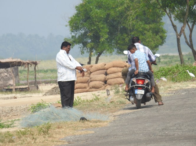
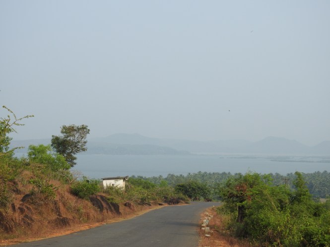
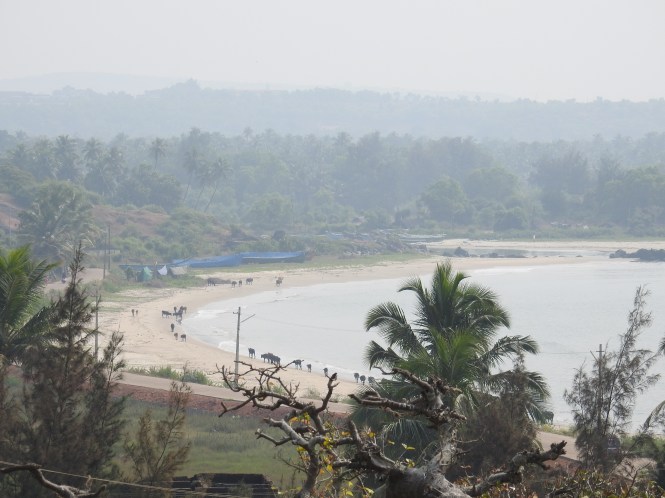
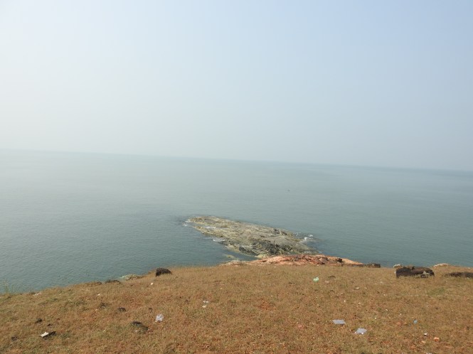
The first stop is a beach and a great novelty. Muzhanppilangad is called a Drive-In beach. Here you can drive your car on a 4 Kms long beach by paying Rs. 30/-. There is no time limit specified but there is speed limit of 20 Kmph. This is made possible by District Transport Police Commissioner’s order No. 420/16.

It is a pleasurable experience to drive 4 Kms. on the wet and firm sand by the sea and enjoy the breeze.

1

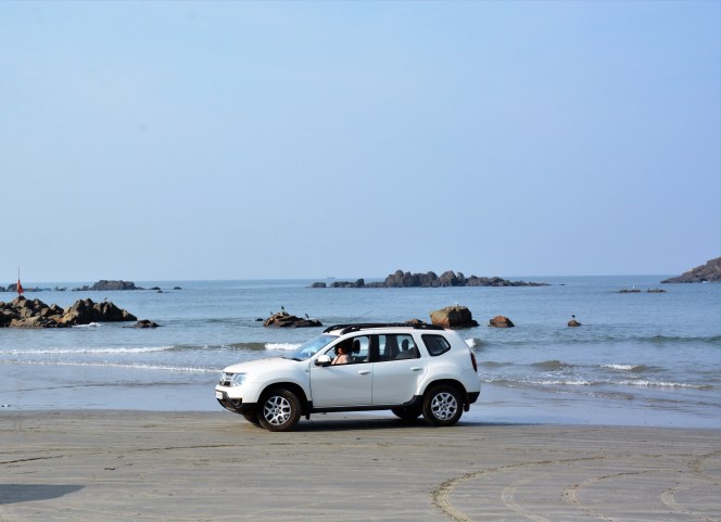
There is no extra charge for posing for photographs. Police however do make rounds in their jeep perhaps to enforce the speed limits.


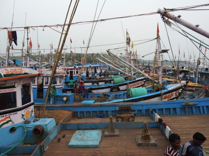
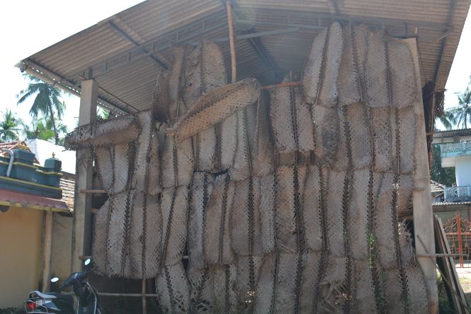
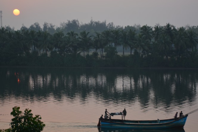
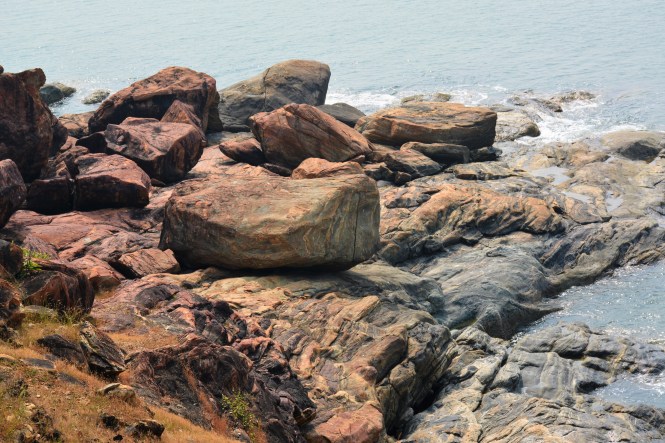
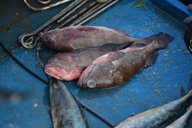
At the southern end of the beach there are a few rocks close on the beach and the Hammer& Sickle can be seen there. The fishermen seem to be unfazed by the drivers and carry on their activities.

At the southern end it is an out and out fishermen’s beach.

The fish caught here use saloon cars for transport to the market.

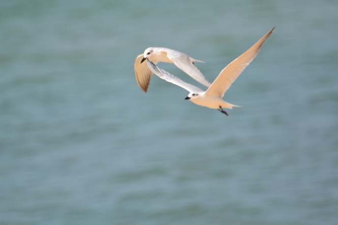
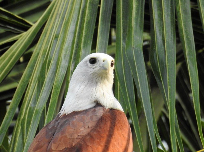
The beach has some birdlife.

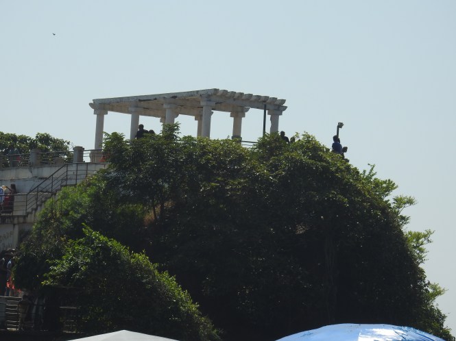
Thalassery Fort is the second stop stop. Thalassery was known in colonial times as Tellicherry and the British East India Company built a fort there in the year 1708. It was meant to be used to make the British presence in Malabar Coast firm in the face of opposition from native Kingdoms. This was achieved by 1792 when Tipu Sultan ceded the Malabar coast to the British. Compared to Bekal Fort and St. Agnelo Forts in Kannur district, this is a smaller one but was perhaps strategically more important, historically.

The fort has ‘dwarpals’, the sentries which are more often found on the gates of Hindu temples. Here they are very obviously Europeans, going by their dress and footwear.

The fort is located in the middle of Thalassery town and hence has many visitors. To the credit of Archaeological Survey of India, the fort is maintained clean and neat.

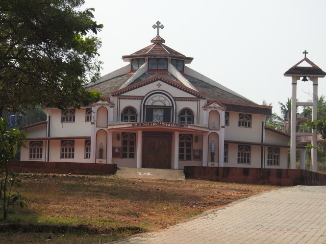
Behind the fort and closer to the sea you will find a nice little church perhaps built in the colonial times for the use of the fort’s occupants.

dsc_2813

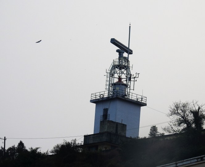
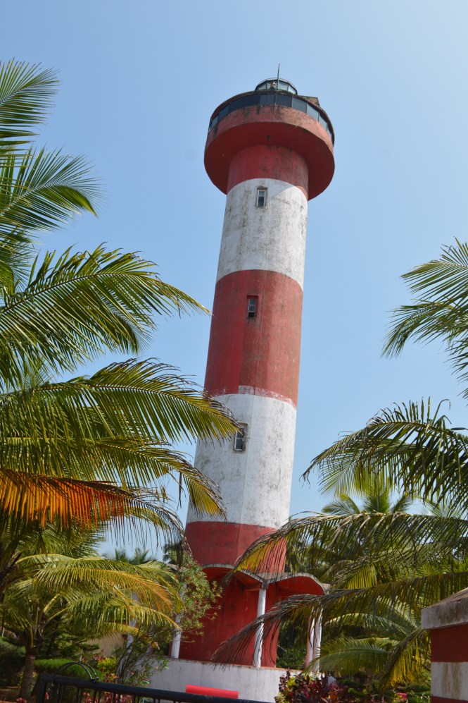
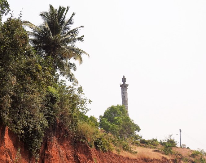
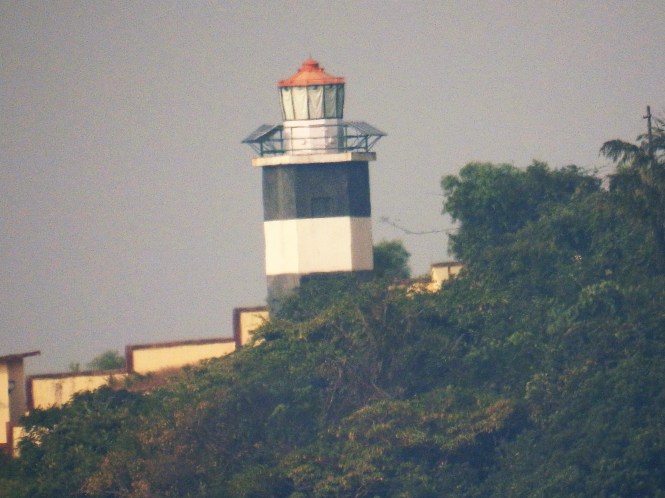
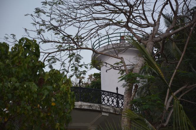
On the western side of the fort we found a Lighthouse which appears to have been abandoned.

dsc_2810

Not far from there I found this curious metal object. I could not understand the reason(s) for it’s existence.

dsc_2812

Could it be a sentry post? It has a roof. It is decorated, so it is not meant for prisoners. Just a decoration at the gate? but it is not at the front entrance either.

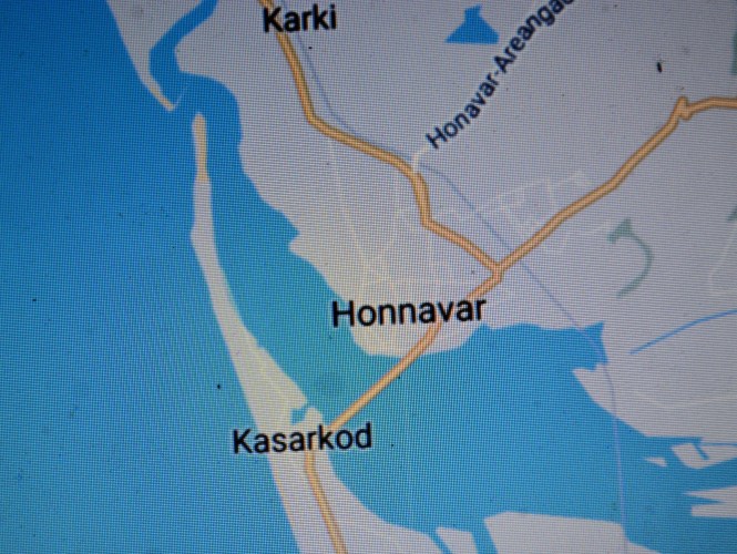
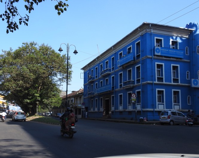
By lunchtime we hit Mahe or what is also called Mayyazhi. This used to be a French colony and we expect some good time on the New Year eve. There is none. It is total disappointment. The official celebrations organized by the District administration started at 5.30 pm and ended at 9.30 pm. They had invited a singer (solo) who sang like it is the end of the world, not the year.

dsc_2848

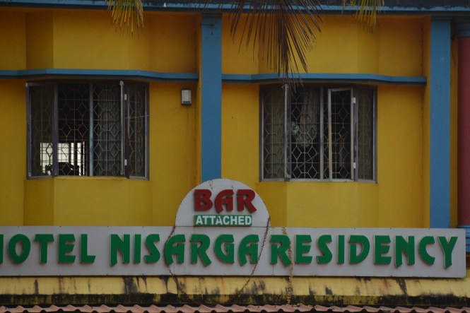
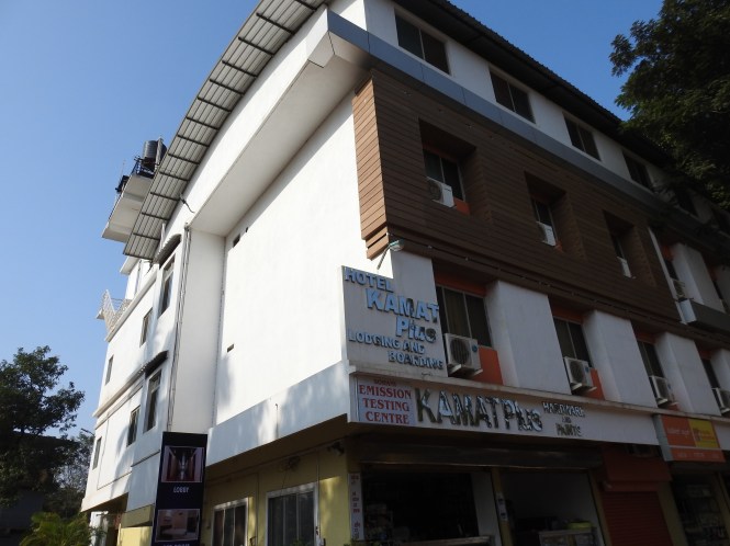
When you book a hotel for the 31st of December with a name like ‘Paris Residency’ in a past French Colony , with a facade like in the picture below you have some expectations.

dsc_2820

What would you do if they tell you that their restaurant is closed!!!! Car parking is on the roadside and there are no good restaurants around!!! And that is exactly what they did.

We dont believe the hotel manager. There is something wrong here and we decide to walk around the place.

It is indeed a small place. I dont understand what the French gained by retaining this place so long. Currently  the only beneficiaries of its status as an Union Territory are the liquor vendors. For a population of 42000 ( 2011 Census),  this small town has 72 liquor outlets. Most of the consumers appears to be the motorists passing by and the people from surrounding areas of Kerala which has a partial prohibition in place.

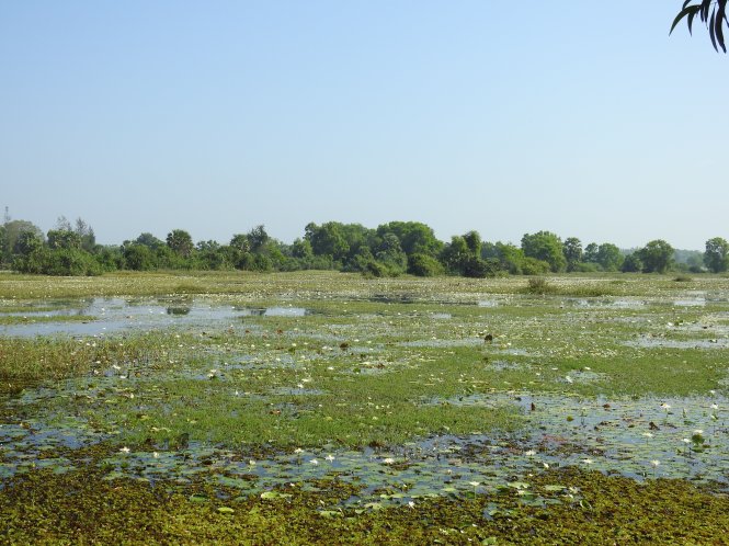
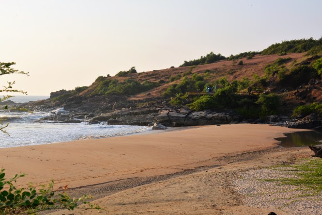
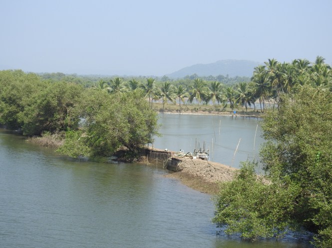
There is a small park and a walkway along the creek or the river which meets the sea nearby. Not a real beach but OK for an evening walk.

dsc_2861

dsc_2868

dsc_2866

There  is a Lighthouse on a small hillock by the side of the walkway. The visiting time was over by the time we reached there and hence had to take a picture from afar.

dsc_2871

When we ask the hotel manager about the ‘French connection’, he says there is none here. No old buildings, no old houses or anything remotely French. I believe him now. The only thing he suggests we should have a look at is the Church which is located bang on the highway. It is a nice little chruch. It was late we did not have time to find out more about it.

There is a Bus-Stop shelter on the mian road which looks like from the colonial days but no. It is of more recent origins.

dsc_2825

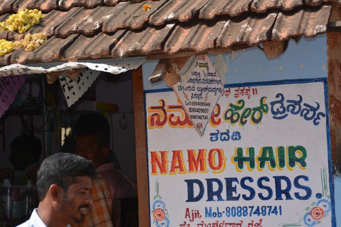
The best saloon for men in the Union Territory looks like this? well,  I could be wrong.

dsc_2823

Disappointed, we walk towards our hotel ( with the restaurant closed) worried about possible starvation on our 33rd wedding anniversary. On the way we see a stall selling fish and we start salivating. We peep in.

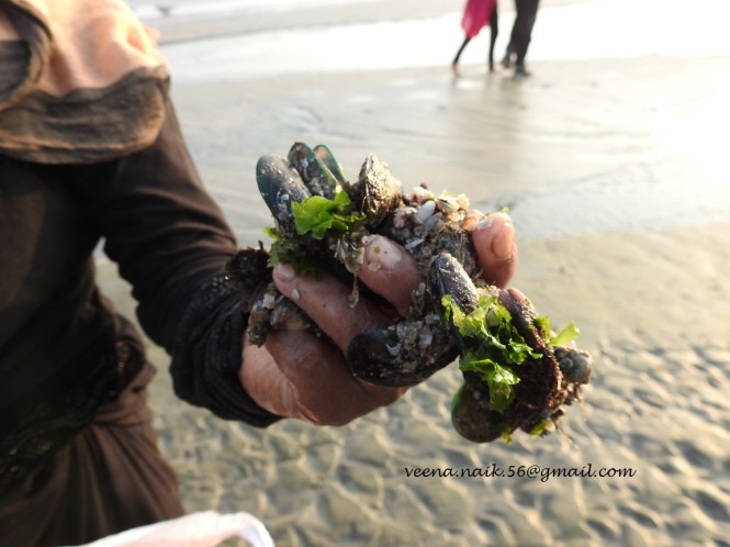
Green mussels!!!!!!!!!!!!

I shout out with joy which is short-lived when the fish vendor says that they are not offered in the restaurants.As if sent by God the man to the left in the second picture above who has come to buy fish volunteers with some information. There is a restaurant at the end of the road, opposite the park which sometimes have them on the menu.God bless him.

Our joy returns when the restaurant confirms that they do have the mussels and also chicken Shwarma to go with it. We order some of both to be delivered to us at Paris Residency.

On the side of the walkway, there are some interesting inscriptions. One is about the story of  lovers Dasan and Chandrika who have now become dragonflies and live on the Velliyan Rock in the sea. I am sure they must be eating the Green mussels.

dsc_2865

Text and Pictures : Suryakiran Naik


74. GOD’S OWN COUNTRY- 2. KANNUR

We start from Kasargod early in the morning with the intention of reaching Kannur after visiting Ezhimala which we are told is a very beautiful place. After a totuous drive along the narrow winding roads along the coast on the Valiyaparamba stretch of the coast, we reach Ezhimala. We face a barricade which smells of military. Yes, it is. Navy. This is an academy. Whom do you want to meet? who is your person inside? None.

One of the many suppliers/vendors at the gate advises me that unless you have ‘sombody inside’, you will not be able to enter inside. Try Ezhimala mountain the other side. Another dangerous drive along the narrow roads leads us to this 41 feet Hanuman.


The images below represent local deities.


Kannur was earlier known as Cannanore. Hope this rings a bell. Cannanore has a mention in many a historical record. Travellers in the past appear to be fond of this place for various reasons, spices being a major one.

Cannanore has monuments like forts, churches, mosques etc. to show for the arrival of the foreigners. We will visit them shortly. Let us start with a temple which is much much older.

This important temple which is pre-Vedic or Pre- Aryan which beats the Europeans by many centuries. Parassinikadavu Muthappan Temple on the banks of the river Velapattanam before it meets the sea is a very important pilgrimage place with extremely dangerous road curves as you descend on to the seashore to get into the temple.

The river-side temple celebrates two mythical deities -Thiruvappana and Vellattam. They are offered Fish, Meat and Toddy on the festive days. Efforts are being made to present them as the manifestations of Shiva and Vishnu. It will be an extremely difficult attempt. The presence of dogs’ images in the temple are something very difficult to explain in the traditional Vedic terms. Photography is prohibited inside the temple, not only this but in most of the temples. That makes things difficult for someone to look at things critically.


The exteriors are on the lines of other temples of Kerala but the small shrine inside this is not. Images if this canine are prominent.

dsc_2652

People wash their feet in the river which is BEHIND the temple.

dsc_2647
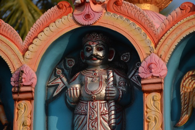
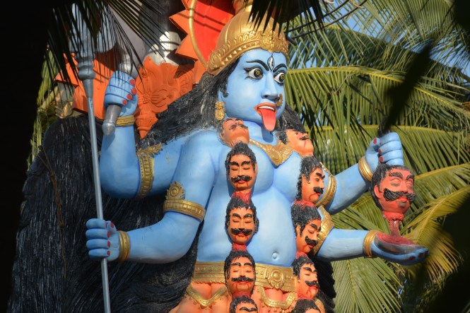
Look at the deities closely. Both are male.
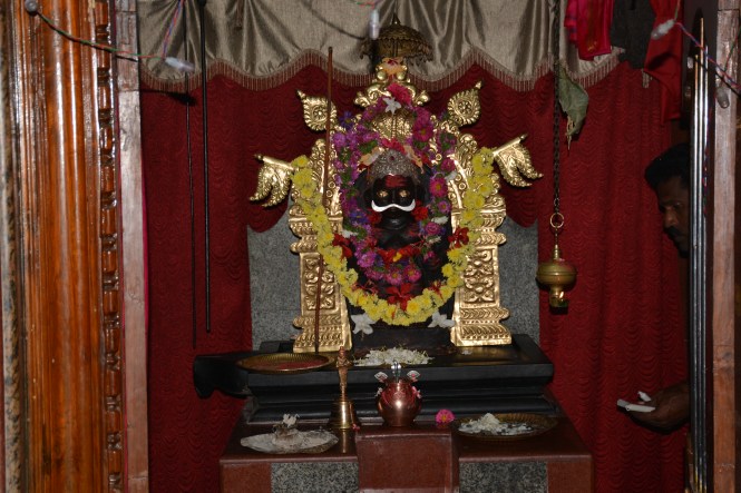
dsc_2655

It is claimed that Cannanore was historically the third largest town after Bombay and Karachi on the western seaboard of India. It traded with Arabs, Romans and whoever mattered in trade in those days. We do not find any signs of the earlier visitors but the Europeans have left behind their marks.

The Fort of St Angelo. 511 years ago Fransisco de Almeida, the Portuguese Viceroy of India built this fort. A nice place to spend a few evening hours now. I guess it waas very imprtant for the European imperialism in those days.


The design of the Watch-tower recurring from the posts on this blog from Diu southwards. There are guns still around, the new high-rise buildings providing the background.


 The local king is also honoured a short distance away.


The statue of Kerala Simha was inaugurated by a mere Colonel. The newly built masonry wall of the Portuguse fort would have been inaugurated by a central Cabinet Minister.

The town has a lighthouse by the beach. I understad that they also have a Museum. As ususal we are late and can neither go up the lighthouse or see the museum. So there we – to the beach after a brief look at the Lighthouse.


We are welcomed by the food stalls.

dscn9749

 It is tempting. The sheer variety of items- fruits, vegetables and what not served in the same plate. People enjoy here not only this vegetarian fare but also something immensely diffrent.

Do you see the people in the pictures enjoying the evening on the beach?


You would surely be wondering what they are carrying in the bags. here is what they have:

dscn9745

 The Green Mussels which grow atached to the rocks in the sea. It is a delicacy for about 4-5 months starting from December onwards on the western seaboard of India. This shellfish is available in the markets of Maharashtra, Goa, Karnataka and Kerala ( and perhaps of Tamilnadu) but one can imagine the joy of extracting them from the rocks on the seashore. You might fiond them in the markt a day later but cooking them fresh from the sea is a joyous thing. The people carrying the bagfuls were overjoyed. 

Kannur beach seems to have other joyous things. This is one of the beaches were kite-flying is in vogue. At Rs 50/- one can buy and fly a kite here.


Lovely.I am into the  practice of kite-flying ( corporate or otherwise) so I move into the more familiar territory.

Kanur has had a large number of leaders in the past leaning towards the left.They and others leaning towards right or the centre had one shortcoming . They were not immortal. When they died, they had to find a last place and what better place then the seaside?

Consequently the whos who of the north Kerala’s politics lie under the sand with the green mussels under them and the kites flying over them.


All markings are in Malayalam. I am looking for the one of A K Gopalan out of genuine respect for the man. I look around without success, walk back towards where people are sitting, find two young men who could speak English and they bring me back to this.They actually get up and walk with me to the place. I dont know if they were respecting my age or the legend of AKG. I hope it is the latter.

dsc_2672

It does not give any indication that he was a communist, A K Gopalan !!!

A few lines and pictures about the Kerala’s left today in the later posts. They are painful.

KANNUR was once part of the ARAKKAL kingdom. This was a Muslim dynasty which followed the Malayali principles of inheritance. Consequently the region could have a reigning Queen and it did. The Kingdom or the principality to be more accurate was created by the Kunjali Marakkars. We will come across them later on.

I think the history of Arakkal is a subject which has not been done justice to by Indian historians.It has plenty to speak about. Not many people know that that the Lakshadweep Islands were owned by the Arakkal kings until the British deprived them of them under a sleek and deceptive typewritten document.

dsc_2568

When you are in the area please make it a point to visit the modest museum housed in the old palace. It will tell you how the British subjugated the native Indian rulers one by one and built the British Raj.


The Malabari system of Matrilineal descent allowed the Muslim dynasty to have a ruling Queen. What more do you want, you feminists??


I would have liked to close this post with the district of Kannur but we have two more things to look at and this post is getting too long. Please allow me to stop here and pick with the other places in the south in the next one.

Thanks for reading.

Text and pictures : Suryakiran Naik

Pictures by Veena Naik


73. GOD’S OWN COUNTRY- 1. KASARGOD.

TheBlueDrive is a journey along the coast of India. When you come to Kerala you find that most of the state is along the coast. Out of the 14 districts 9 have a coastline and one is so close you can throw a stone into the sea from there.

The state starts with the district of Kasargod. This was earlier a part of the District of South Canara ( which is now part of Karnataka). Later on it was detached from Karnataka and added to Kerala. This was part of reorganization of states on linguistic basis. History has now left Kasargod district to grapple with Malayalam. In the past, it has had speakers of as many as five languages- Kannada, Malayalam, Konkani, Tulu and Beary.

When you cross into Kerala from Karnataka you don’t feel that you have done that. There are no check-posts, no barricades, no men in uniform as one would expect whilst crossing a state boundary especially a boundary between a state having no prohibition and one having partial prohibition. This is perhaps because of the fact that the coastal road is not considered important by the authorities.

A few kilometres into the Kerala territory and you start feeling the change. The north Kerala buses are painted artistically and carry a wide variety of colours and designs on their bodies. In the restaurants at lunch time water served is hot. (this might have started somewhere in southern Karnataka), the newspapers are in Malayalam, God becomes Goad to rhyme with Goat or Boat.

For most part, Kasargod is a mixture of Karnataka and Kerala.

The first monument of Kerala’s first district is at Kumbla or Kumble. I have no clue if the Cricketer has any association with this place. It has a  fort which is now on the roadside. It might have been on the seaside which is now about half a kilometre away and is separated by a railway line. The fort is not visible when you drive down. Ask for the Maruti temple. The fort is close by and does not show any signs of life.

The fort was constructed by Kaladi Shivappa Nayaka who also was involved with two more forts in this area which we will look at in this post.Kasargod has a long political history and has been visited by a number of foreign travellers in the historical times. Among them is the Portuguese traveller Duarte Barbosa. The Arabs also seem to have been travelling to the places in the district. 

Anantpadmanabhaswamy Temple at Ananthpura is another major landmark in the area. The temple is surrounded by water.

North of Kasargod town there are some more landmarks. The chief among them is the Bela Church, the oldest Roman Catholic Church in the district.

Kerala has its own distinctive style of temple architecture.The Madanantheshwara Siddhivinayaka Temple at Madhur is a fine example of this style.

dsc_2515

Unfortunately the temple is under renovation and some of the woodwork is being replaced by stonework.

The temple is worth visiting for the sheer beauty of its architecture.

Not far away from here is an old palace called Maipady Palace. Not a very maginificent one but beautiful in its humility and modesty. It belongs to the Kumbala kings.

Let us move to the south of Kasargod town. The major attraction is the Malik Dinar Mosque. One of the oldest mosques in India and constructed in the local archetectural style with no ‘minars’ which are typical of Arabic style.

Malik Ibn Deenar is believed to be a merchant who had travelled to India for trading as well as propagation of Islam. About him and similar Mosques you will see more in this blog shortly. What should be noted here is that the surroundings of the mosque are being modified to make things grand and ‘Arabic’.

Hope the interiors and the artwork is not changed to make it ‘grand’.

There are three other forts in the district and we will briefly touch on each.

The first one is within the town but one has to take some local help in locating the place. It is not easy to approach. The fort is overlooking the creeks and is called Chandragiri fort. It is a 17th century creation of Sivappa Nayak.

The views from the fort are beautiful.

The second fort is the more majestic and well-maintained one at Bekal. Shivappa Nayak created this in 1650 and is a major tourist attraction to-day.

Bekal fort has its major part jutting into the Arabian sea and it has a beach down below.

The last of the forts in Kasargod district is called Hosdurg fort. It was built by Someshekhara Nayaka of Ikkeri at a place now called Kanhangad.It is almost gone, only some few traces remain. The major part is occupied as a school and a playground.Not much is known by way of history either.

Kasargod has a number of temples. It also has a pretty lighthouse and a beach.

dsc_2503

On the eating front one cannot fail to notice pickled raw Mango and Gooseberry      ( Avala) being sold wherever you go.  There can be other things like slices of Pineapples and other sour things added.

We end the travel within the Kasargod district here and start with Kannur district in the next post.

Text by Suryakiran Naik

Pictures by Veena Naik & Suryakiran Naik


72. UDIPI (& MANIPAL), MALPE, SURATHKAL & MANGALORE.

As you drive southwards from Kundapura you come to a road junction where you need to make a choice of staying at a beach and a commercial town. For us the choice was obvious. It is the seaside and the seaside is Malpe. Let us start from there.

Malpe is an interesting place. An historical (and beautiful) beach, a geologically important island and a huge commercially important fishing harbour rolled into one at this small place.

The local language is Tulu and the Mogaveera community dominates the place. Let us have a look at the fishing harbour first. The geography of the place is as it appears in the map below.

dsc_2547

The thin slice of land between the sea and the mainland allows the fishing boats to come in and land the catch in protected waters where all facilities are available. This is probably the busiest fishing harbour on Indian coast we have seen so far. Everyone is busy loading the boats in the evening so that they can start leaving later on. Loading of ice is a major activity.

The dominant bird species at any fishing harbor in India is either the Pariah Kite or the Crow. Here at Malpe, the Brahminy Kite dominates the skies.

dscn9587

Close to the fishing harbour is a shipyard, apparently engaged in ship repair activity.

dsc_8637

When did you last see this kiosk? Before the advent of the Mobile phones these kiosks for long-distance calling were an important part of India’s communication scene. No, it does not exist at Malpe. This is just a kiosk which did not find an alternative use. History is being made very fast these days.

dsc_8635

Malpe has a lighthouse located in the Navy area and we could see it only from a distance.

dscn9617

In the evening, we decide to try out the food on the beach side shack instead of the hotel. This couple serve us very simple but fresh fish and rice.

XXXXXXXXXXXXXXXXXXXX

The biggest attraction of Malpe is perhaps the archipelago of 4 islands off the coast. The most important among them is the St Mary’s Island.

Firstly, look at this signboard of Tourism Department on the island.
dsc_8375

The title is ‘History’, and is followed by ‘Folk Legend’. What is the final word? I strongly disbelieve this theory. This guy called Vasco da Gama came to India looking for a trade route for spices. He was not a tourist looking for such small islands  without  people and spices on them. In any case he could have landed at Malpe which has a good harbor and can be seen easily with naked eyes from these islands.

The second claim for this island is  Geological. Geology  is more of an exact science and not a combination of history and folk legend. Geologist have found the rock formations on this island of immense importance. I dont understand it so I am copy-pasting from Wikipedia. The pictures are ours.

The columnar basaltic lava found in these Islands, which is very well developed in the basalts of Deccan Traps, exhibit an imposing range of hexagonal shaped or multi-faced (polygonal) columns split into a horizontal mosaic. In geological terms these are called “columnar joints“.[1] The lava rocks form regular five, six or seven-sided pillars, called “laminar lava”, and are found in varying heights in all the islands; the tallest of the columns is about 6 m (20 ft). Considering the importance and rarity of such an occurrence, these islands were classified as a National Geological Monument in 2001 by the Geological Survey of India.[4][6]

Unless you have some knowledge of geology, you will be lost as I am. To the best of my understanding lava cooled in the seawater and  created the stones. I beg the geologists’ pardon if I am wrong.

The more interesting aspect which is more easily understandable is the seashells. The island has a large number of seashell species which can be collected without much of an effort. That evening enriched our collection of seashells considerably.

Even without Vasco da Gama and the Columnar Joints, the island is a beautiful place which most people enjoy after a short boat ride from the seashore.

The island has this signboard.

dsc_8410

XXXXXXXXXXX

When history of Indian Banking is being written, the South Canara district which is now South Canara and Udupi districts cannot be ignored. In fact this region is  called the ‘cradle of Indian banking’.

Seven major Indian banks originate from Karnataka and five out of them from these two districts( in fact only one district when the banks were formed)- Canara Bank, Syndicate Bank,Corporation Bank, Vijaya Bank, Karnataka Bank, Vysya Bank and State Bank of Mysore. The first five are from the two districts.

The twin towns of Udupi and Manipal are a delight to walk through. Wealth can be felt on their streets without any arrogance. This is rare. The buildings whether commercial or residential are modest. The bias towards Healthcare and Education can be seen everywhere. The only time you can smell the money is when you look at the jewelry shops.

Among these banks perhaps the most interesting story is of the corporation Bank which is said to have commenced operations from the residence of a Spice Merchant by the name of Khan Bahadur Haji Abdullah Haji Kasim Saheb Bahadur. This man is reputed to have give away all his wealth to the poor. Today this residence is a very interesting Museum of Indian coinage and currency. As photography is prohibited in the museum it is not possible for me to show you the pictures from inside, but when you are around in this area, please do make it a point to visit the museum.

This is the old square in the town and also has the offices of Bharat Beedi Works whose brand No 30 used to be a very popular Beedi brand in the region.

dsc_8671

Opposite the Museum  services in Black Magic are offered by ‘ Famous Indian Astrologer’. If you have any problems that you cannot solve,  cellphone number is provided.

dsc_8677

The beach at Kapu south of Malpe is considered a better beach and also has a lighthouse. It has smaller islands, rocks rather, where Vasco Da Gama had no chance of alighting.

dscn9641

Only birds use these rocks for sun-bathing.

We move on to our last place of stay which is Mangalore. On the way is the famous educational centre called Surathkal which is separated by a river from Mangalore and is now a part of Mangalore city. Surathkal has a nice beach and a Lighthouse, third one within about 60Kms. But before we go on to the beach we visit a ‘Gudh’, jaggery vendor on the roadside. There are two varieties :Tad Vella and Sundi Vella. This item is made from the sap of a palm which grows wild in this area and at many other places along the Indian coast.

kap

The one to the right is the Tad Vella, the ordinary and cheaper one. The one to the left is the Sundh Vella which has ‘Sunth’, (dried ginger) and other herbs like Tulsi in it. It is sold in smaller pieces and is more expensive. The container to the right is made from the leaves of the palm.

Here is the Surathkal beach and the Lighthouse:

Mangalore , now officially called Mangaluru,  Kudla in Tulu, Kodial in Konkani and Maikala in Beary. The last mentioned is a local language spoken mostly by the Muslim population. It has Arabic content. This is mostly a commercial town with a large number of temples and Churches thrown in.

This monument called Sultan’s Battery or ‘batery’ is a short tower used to protect the town from the invaders from the sea through the Gurupura river. It was used by Tipu Sultan

It’s current use is for the meetings of young people. Among the activities is celebration of birthdays. This young lady is preparing for one such occasion.

dsc_8734

Mangalore is filled with all kinds of religious places: Temples, Mosques and Churches of many deniminations. The town itself is named after Goddess Mangaladevi. here is her abode, a modest one.

dsc_8795

The other one Gokarnanatha Kshetra   is a temple complex of immense complexity. Look at the pictures below:

It has political statements and non-conventional deities rubbing shoulders with the traditional Gods.

dsc_8819

dsc_8815

dsc_8814

The Christian churches which were very visible are these:

We cannot conclude with Karnataka with Mangalore as there are other places down south till the Kerala border.

We drive down south looking for the Karnataka-Kerala Boder by the seaside. For doing that one has to cross the Nethravati River. The border between the two states is not a river as would be expected.

We drive along the national highway and turn towards the sea wherever we find a road. We find places like Ullal, Someshwara and Batapadi. From Ullal one can see the Mangalore  across the cliff. The Ullal industrial estate has a number of fish processing industries many of which make the Poultry Feed out of fish.dsc_8772

From Ullal to the border of the state we come across several  localities and one major temple called Ashwatha Katte located on a cliff by the sea.

Among the other things that we see in this area are a temple whose Dwarpal has the head of a pig.

dscn9716

and a goat with reddish colour hair.

dscn9715

The main square of Ullal has the statue of Veera Rani Abbakka, the 16th century queen of Ullal who successfully defended her kingdom from the Portuguese advances for 4 decades.She deserves a better statue.

dscn9723

After all this we continue our main task of the day. Finding the boundry between Kerala and Karnataka. Braving the very narrow coastal mud(read sand) roads and taking the help of Google maps and the GPS we reach at a dead end facing a lake very close to the see. Open the google map and look for the boundry which cuts through this lake and the sandbar.

With this TheBlueDrive has completed 4 states and 2 Union Territories. The next of course is God’s Own Country. Keep reading.

Text : Suryakiran Naik

Pictures: Veena & Suryakiran Naik.


71. BHATKAL, KUNDAPURA, BARKUR

We leave Murudeshwar and drive south. The first town that we come across is Bhatkal. A sculpture depicting gold jewellery welcomes you to the town.

Bhatkal is a Muslim-dominated town and is sometimes called mini Dubai. This is the home to the Nawayath Muslim Community who speak a version of the Konkani language called Nawayath which has a vocabulary of substantial number of Arabic words. The tone and the accent however is Konkani. It is said that a large number of people here have their roots in southern Yemeni region of Hadhramaut.

The names of the places in the town, the signboards and just about everything in the town looks Muslim and at times Arabic.

We visit the fishing harbour and the Lighthouse at Jali. The fishing harbour is a busy place.

dscn1166

dscn1160

 The night we stayed in Bhatkal was the night of the supermoon. The moon looked good from Bhatkal.

dscn1171

Looking back, I feel we did not do justice to Bhatkal. We should have done a bit more of exploration but the town or the people in the town look secretive.

From Bhatkal the next town down south is Kundapura but there are many smaller places along the way. Shiroor, Baindur, Bijoor, Maravanthe etc. The seaside of these small places is really nice though not commercially developed.

We keep driving till we miss our way and end us at a place called Gangoli.

We intended to be at the Kodi beach near Kundapura. There is a huge geographical mess created here by the rivers, creeks,islands, rocks, estuaries etc. Geting around this maze requires a lot of time and we failed to get to the intended place. Never mind. No regrets.

dsc_3174

The reason we wanted to go to Kodi beach is to have a look at the Lighthouse. We try not to miss the lighthouses. They are the surest connecting dots to coastal travel.

Will you be surprised to know that the controlling office for all of India’s Lighthouses is in NOIDA and nowhere near the seas? Now, that is democratic politics.

We pass by the lighthouse without noticing it. We return and do the same drive again. No. It is not there although the Google map shows it. On our second return we find it. Why did we not seen it earlier? One, we were looking at these seagulls who came too close and two, the lighthouse is too close to the road. There is no way anyone seating in a car could see it.

dsc_8270

dsc_8358

dscn1220

By this time it is time to eat some food. We find our way to Kundapura city. We  had been recommended a restaurant in Kundapura for the authentic local food.

I think the Shetty guys serve the same food in Mumbai as well as Kundapura. No change.

This part of the world is called Tulunadu. You don’t mess up with these guys. If you watched Hindi movies in the 1970’s and 1980’s you will understand what I mean. We had a villain simply called Shetty. He did not have a first name and that made him all the more dangerous.I was never frightened of Prans and Prem Chopras from up north. They only talked. This bald guy called Shetty could break all the unbreakable things. He had the audacity to challenge the-then He-Man called Dharmendra which the other villains did not dare to do. Think about it.

Incidentally ‘Tulunadu’ comes from the speakers of a language called Tulu. Those of us who think that there are only 4 south Indian languages need to go back to school again. Linguistic scholars consider Tulu a more advanced language than the other 4 in certain respects.

Let us shift gears from Languages to Birds. 8 Kms. south of Kundapura you will come across a place called Thekate. Take a left turn and drive 1.5 Kms. You have reached a place called Malyadi. It has an old abandoned clay quarry which has turned itself into a birding area.

dscn9469

The accumulated water and a large variety of trees surrounding the quarry has created an environment conducive to existence of a large number of bird species. We could look at about two dozens in a short span of time.

Veena had these four captured. Upper two are aquatic and the lower  two arboreal.

From Nature let us go to History and enter through this arch into a much neglected territory called Barkur.

dscn9533

After the town of Brahmavar south of Kundapura take a left on the highway through a huge gate and you will be there. This is another huge geographical confusion in the midst of which flourished a town called Barkur, encircled in the map.


According to the Wikipedia article on Barkur, it was a ‘flourishing port’ in the 15th and 16th centuries. The current Google map shows a different picture. There must have been massive silting of river Seetha on the banks of which Barkur is situated.

Anyway Barkur was an important place in the history of Tulunadu and therefore we try to look around for some monuments. We wander around without any assistance from anyone. Language is an issue. The roads are narrow and there appears to be a general apathy towards the past among the general public.

dsc_8576

The above is an important temple. It is a stone structure, stone being used even for the roofing. This is called ‘Kallu Chappara’- stone roofs.

There is a tank opposite the temple which might been a part of the temple once but now a public road separate both. The tank has a peculiar vegetation growing on the surface and looks weird.

dsc_8575

Here is another stone temple:

dsc_8604

The place is an important pilgrimage center for the Mogaveera community who originate from the area around the place.

Barkur is supposed to have 365 temples. Possible. What we could see were a few of of them. Some new, some old and some combinations of both. In the picture ot the bottom you can see a Deepstambha (light tower) made of stone,obviously ancient and a temple which shouts at you saying that it is newly built.

Apart from the temples which are intact one can easily see many stone articles which are obviously parts of temple related structure. Only an expert in architecture and history can comment on this. At any rate the place needs some attention.

Here are some more stewn across the town:

There is one area called ‘Fort’ which appears to have received some attention from the ASI. At least they have a signboard there and a rude watchman who seems to be totally against people visiting the place. You can however peep in and see this:

Here is a place attached to a temple where the ‘rath’,the God’s vehicle is stored. It will probably be used once in a year when the Deity is taken out in a procession.

dsc_8590

What I am trying to show is not the ‘rath’ but the construction material which is widely used in coastal India in western and southern parts. These are the woven coconut leaves which are called ‘mall’ in Konkani. The weaving can be done before the leaves are fully dry.

As early as 50 years back this was an important material especially for cladding during the monsoons as protection to the walls from windy rains. The advent of plastic seems to have made it largely obsolete.

Text by Suryakiran Naik

Pictures by Suryakiran Naik & Veena Naik

70. HONNAVAR, KASARKOD, APSARKONDA &MURUDESHWAR.

We leave Kumta and drive south, not very sure of where we will stop for the day. It could be Honnavar which is very near, or Bhatkal which is a bit too far for TheBlueDrive itinerary. In the event, we settle for Murudeshwar but not before looking at some really interesting places on the way.

As you leave Kumta, keep looking to your left. On a small hillock, you will find a memorial column.The hill is being cut down to make way for the 4-laning of the road and the new road will be quite close to the memorial when completed.

dscn1037

This is called Colonel Hill. It dates back to 1854. Col. Hill heading 14, Madras Native Infantry of East India Company died here. ‘Hill’ has assumed double meaning here.I could not find much infirmation about this guy who is honoured with such a tall column.

I will find out and let you know. I am deeply suspicious about the military men. I am almost certain that they get killed because of excessive drinking.

The picture below should be considered another memorial although it is not intended to be one. This is a Mangalore tiles factory. This particular building material has been very popular in the last  century in the coastal regions of western India. It has also been exported to many other countries of Asia as well as Africa.

dscn1082

dsc_8585

These tiles were first manufactured by a German missionary by the name of Georg Plebst. The tiles are named after the town of Mangalore but were manufactured all over the North & South Canara as well as Goa. One can still see the chimneys of the kilns dotting the skyline. Most of the buildings including temples on the west coast of India were roofed by these beautiful tiles until we were cursed by concrete.

Honnavar does not offer anything special. We go looking for the Lighthouse which is sort of hidden behind government buildings on the edge of a hill.

At the Honnavar fishing harbour, we go looking for someone who can take us to the island of Basavaraj Durga. This island houses a fort (durga) and is also known to have the wild goats. The fort was built in 1690 by the Vijayanagara rulers. We find a boat owner who is willing to take us there from opposite the creek – a place called Kasarkod (not Kasargod). He is offering a boat ride for an exorbitant Rs 5000/- for two of us and with the condition that we will not land. Without landing we can see neither the fort nor the goats properly. It was a dicey offer which we decline.

All the same we decide to go and visit Kasarkod. If we had done that we would have missed something very interesting. Look at the map below. Kasarkod is a long narrow strip of land (at places it is hardly 50 meters wide) where the river Sharavathi meets the Arabian sea. One can stand on the sea shore and shout at a person on the river bank.I will not be surprised if in the heavy monsoon storms the water from the sea flies and falls into the river.

This is how it looks on the Google map.The island is not seen here.

dsc_2541

Just off this beach one can see the island fort, about half a kilometre away. It seems the locals visit this place on Makar Sankranti Day ( 14th January) en mass to offer prayers in a Hindu temple on the fort.

dsc_8174

We meet some of the people involved in a commercial activity of fishing and fish-drying in the area. They have been doing this for a long time but have now been threatened by the Ports authorities with ejection. The Port Authority claims the land as its own. At least I dont see the logic behind this.

We meet two brothers here who are Catholics and have relatives in Goa. Very friendly guys who offer us water which is very sweet. It is from a well on this peninsula. They are into this fish drying business. The end-users are the chicken-feed manufacturer, mostly Mangalore based. Those of you who claim to eat only chicken and not fish, please take a note of this.

dscn1157

It is very interesting to note that the birds like House Crow, Pariha Kite and the Brahminy Kites here are very co-operative with each other  and share the same space. Otherwise they are fierce competitiors.


This plant species survives the harsh enviornemnt created by the saline water and high temperatures.

………………………..xxx……………………………xxxx……………………….xxxxx…………

Our next stop is quite different but is not very far from this seaside phenomenon. The beach south of Kasarkod extends to a place called Apsarkonda.

This beach can be viewed from a hill close to the Highway. It is very deceptive. When you drive down south from Honnavar, there is no indication that here could be such a beautiful beach hiding behind those hillocks.

Apsarkonda or Apsarakonda is a place where the ‘apsaras’ are supposed to be taking bath in the ‘konda’, the pond.

This pretty waterfall appears out of nowhere and forms the pond hardly a couple of kilometers from the Arabian sea. Nature never fails to surprise you.

There is a temple on the hill which one has to pass before descending the steps to the waterfall and the ponds. This is among the signs displyed at the temple.

dsc_8054

I presume one can eat inadible things.

The area above the falls is an active breeding ground for many butterflies.The Tourism department has done some funny construction on the hill. They could have handed over the site to the forest department for a butterfly park.

dsc_8058

From these natural wonders we drive into a grotesque religious display on the seaside.
Murudeshwar is quite a famous place. It became more popular after the Konkan Railways started operations and set up a station nearby.

We spend a day at this place without understanding if it is a  resort location or a religious place. From the temple on the beach  one is inclined to think that it is religious.

There is a story about the Shivalinga and Ravana associated with this place which is too complicated for my small brain.

dscn1079

It is an impressive structure particularly at night.

dscn1054

The hillock at the back of the temple has a display of prominent Hindu religious entities. I wish I had a bird who could take me around without filling petrol.

This man is instigating violence which is a cognizable offence under Indian Penal Code.

dsc_8040


The place was supposed to be a fort. We  look for the remnants but could not find any. We could not go on the north-west side which is seems to be under the control of the hotels around the hill.

Speaking of hotels, there are many around here, including those who make BAR the most prominent part of their signboard.

dsc_8049

Nearby there is a ‘Parlar’, which is only for ‘Ladis’

dsc_8048

Text by Suryakiran Naik  suryakiran.naik@gmail.com

Pictures by Suryakiran Naik & Veena Naik

69.MIRJAN,AGHANASHINI & KUMTA

We leave Gokarn and intending to take the coastal road towards the south, take a right turn before reaching the highway. We reach Tadadi  from where we are told we can cross the Aghanashini river and drive towards Kumta. That is where we are going to spend the night. At Tadadi village which has a Barber shop named NaMo, we are told that we can do the crossing anytime during the day. When we reach Tadadi the story changes. Yes, we can cross the creek but not our car. The ferry takes only passengers, not vehicles. I think it was my mistake. I never said that we wanted to cross with the car. Those who advised us must have thought that we would be gifting away the car before crossing or we would cross, visit the place and come back.

1

We turn back and get on to the highway. We do cross the Aghanashini but at a different place eastwards where the river is much narrower and has a bridge over it. But before we do that we visit a well-kept fort called Mirjan Fort.

Mirjan Fort is supposed to have been built in the early 17th Century by Adilshahi governor Shareef-Ul-Mulk, ruling from Ponda in Goa. It is guessed that the construction of the fort was done on an existing structure about which not much is known. The fort was probably built on the bank of the creek but by now the creek has changed direction creating a gap between the two.

6

The fort has plenty of visitors as it is less than 2 kms. from the highway. It is said that the fort’s watch towers were built in such a way that the enemy could be observed from inside without the observers being seen.

7

This is how it was done except that the enemy in the 17th century did not come in Bajaj autorikshaws . Some more views of the fort.

 Mirjan is also the name of the place and the Konkan Railway crosses the river not far from the fort. The highway goes above the railway track parallel to the river.

12

The river along the highway looks serene and very calm at the sunset.

13

-.-.-.-.-.-.-.-.-.-.-.-.-.-.-.-.-.-.-.-.-..-

Kumta Town is not on the river bank as one might have expected. It is located the more towards the hills, perhaps necessitated by the town’s long tradition of the Woodwork artists. Most of the temples in coastal Karnataka and Goa and even beyond have the woodwork like the latices, windows, doors and other artifacts made by the artisans from Kumta and around. Kumta also produces the ‘raths’ the ceremonial vehicles of Gods and Goddesses, entirely made of wood.

Here are some of the temples:

Most of the wood articles are made-to-order but a few smaller items are found inthe displays of the shops and workshops.

The temple related work is no longer the mainstay of the business but the the orders for the designer furniture is increasing. Wooden showpieces are also in vogue and keep the artisans busy.

Kumta market offers a number of fruits and vegetables popular in the Konkan region.

A few Kilometers south of Kumta is the place called Hollegad. Here you will find the sculptors giving shape to stones. Mostly but not necessarily Gods and Goddesses.

Skilled artists use very basic hand tools to create beautiful objects.


You can cast yourselves in stone or get your favourite God cut out.

Aghanashini is the place which we tried to cross to from Taladi port unsuccessfully. It is to the north of Kumta. We are duty bound to visit it. The coast from Aghanashini to Kumta has a number of beaches.

The village is approached by a good road sliding down a hill.

dscn0960

This signboard announces the presence of jetty for crossing the river mouth.

dscn0983

The village has a small bit busy fish market offering a variety of seafood.

The Lighthouse near Gokarn on the opposite side is clearly visible.

dscn0969

The dominant bird species on the waterfront is the Brahminy Kite.

dscn0980

Stitched fishing boats are still in use in this part of the world.

We leave Aghanashini for coming back to Kumta town from as close to the sea as possible. On the way we go to Kadle beach and also see the church at Kadle.

dscn1003

We also observe that the fishermen here use nets to cover the drying fish. This practice is not widespread.

The beach at Kumta is nice and has a place on a nearby hill nicely done for the evening strolls.

dscn1020

dscn1014

The colour granite on the seashore continues from up north of Karnataka.

dscn1017

dsc_7965

Text by Suryakiran Naik    suryakiran.naik@gmail.com

Pictures by Suryakiran Naik & Veena Naik


68.ANKOLA , GOKARN & (TULSI VIVAH)

The third part of the title to this post is in the brackets for the simple reason that it is not a place but a festival.

We leave Karwar with a heavy heart. The sea (and Kali river) has been very generous to people of Karwar. They enjoy such variety of seafood that we have not seen on Indian coast so far in this expedition.

When we started TheBlueDrive, one of our friends gave us a clue. The colour of water changes from place to place and we should photograph it. Yes, the colour changes but the subtlety of it is so sensitive, one cannot capture it in a camera and faithfully record it. Modern techniques can change the colour and the texture and the tinge and whatever so much, this exercise would be meaningless. All the same I remembered the advice when I saw the black colour of the waters of river Kali.  The picture below is just an attempt but when you see the waters especially in the creek, it is darker than the rest we have seen.

1

We pass through the town and proceed towards Ankola. The southern half of Karwar town is dead. Dead because it is under the Armed Forces. When a place becomes a Cantonment or a Naval Base it ceases to be a town. The town or the village becomes subservient to the Armed Forces. The charm of the place is lost to the ‘regulations’. Many of these ‘rules and regulations; inherited from the British were meant to separate the Superior White Man from the Inferior Brown Man and they still separate the Superior Services Men from the Inferior Civilian Men. The road from Karwar southwards is closed to your right by erecting a fence of tin sheets, to prevent people seeing the Naval Base. This looks ridiculous if one understands the power of modern photographic equipment and the Satellites. Defence Budgets shall always remain beyond questioning. It looks like the armed forces do not want their own people to see what the potential enemies can see by other means. The dispute about allowing the annual Christian fest on the Anjediv island still continues.

Anyway. What one can see immediately after leaving Karwar is the presence of a species of Bamboo growing on the hill slopes. You will not see this so profusely in the coastal areas in the nort but a similar species is seen in the interiors.

2

The night before we leave Karwar we observe that the market of Karwar has a riot of flowers and sugarcane. It would have baffled an outsider to the region. We could guess that the preparations for the festival of Tulsi-Vivah due tomorrow are on.

After reaching Ankola we make a halt at ‘Kamat’ hotel close to the highway with the intention of resting for the day and looking at the Tulsi-Vivah event in the evening.

dscn0861

The Kamat establishments are clean and dependable but most of them are vegetarian.

After a couple of hours of rest we decide to go and have a look at the seashore. There are a number of beaches near the small town. We choose to go around north to south and have a look. We drive through the villages preparing for the Tulsi Vivah event in the evening. Lovely ambience all around.

The twin beaches a few kilometres from the town are beautiful. One cannot fail to notice two things here.

One, a temple on the rocks by the sea. The devotees offer firewood to this deity. As we cannot read the Kannada script, we fail to gather much information about this and there were not many people around who could speak the languages we speak.

dsc_7658

dsc_7678

The other thing is the presence of white sandstone. We had observed this stone in Malvan fort in Maharashtra. Now it is acquiring shades of colour which will become brighter and more varied as we move southwards.

The beach is devided into two by a small hillock. the northern part is a clean beach with the temple at the end. The southern part has a fishing harbour. The hillock inbetween has a quantity of broken beer and liquor bottles giving an indication of its use.

dsc_7643

dsc_7665

dsc_7646

dsc_7688

Veena and her camera are after a Kingfisher that just landed on the coconut palm.

dsc_7673

This is the one. Don’t think that this is the one who you see frequently. The one frequently seen is the White-Breasted Kingfisher. This one is a much rarer Black-Capped Kingfisher, although they look similar, they are not the same.

dscn0829

We return to the town and proceed to a temple to watch the Tulsi-Vivah proceedings. The first temple we visit has two Tulsis in its compound. Here the Tulsi Vivah is observed as Tulsi Puja. The Tulsi plant and its pedestal is covered by sugarcane brought by the devotees who do not celebrate the festival at their own homes for some reason or the other.

dsc_7703

dsc_7704

In the neighbourhood people do the wedding in their own compound. Some wait for the village priest to come and do the ceremonies, some do on their own.

dscn0872

Tulsi Vivah is a very complex story from Padma Purana involving a woman by name Tulsi and Lord Vishnu. The Wikipedia article on the subject is very simple and lucid. https://en.wikipedia.org/wiki/Tulsi_Vivah

Tulsi Vivah is incidentally the Title of 1971 Bollywood movie starring Dara Singh and Jayashree Gadkar, a local girl from Sadashivgad who made it big in Marathi films.

There are many ways the Vivah is conducted. In Ratnagiri and Sindhudurg districts of Maharashtra a full-fledged wedding ceremony is conducted. Here in North Kanara district it looks more like a worship (puja) of the plant. The common item is the sugarcane and the Tulsi plant growing in front of the houses and temples. ‘Prasad’ of puffed rice is distributed.dsc_7707

Later at another place near Gokarn we could find this simpler decoration using mango leaves.

Incidentally Hindu weddings stop being conducted during Monsoon months and do ot resume until the Tulsi’s wedding is conducted.

dsc_7884

We visit another temple at Ankola to see the actual proceedings in the hands of the temple priest. This was more elaborate and we made videos.

Here the bride as well as the bridegroom were suitably decorated.

Between Karwar and Gokarn there are a number of small beaches all along the coast. We decided to skip them. There are also a number of temples but none very significant. Ankola has a church called Church of St Paul’s Mar Thoma.

dscn0866

Gokarn is a pilgrimage centre for Hindus. It has the famous Mahabaleshwara (Shiva) temple and half a dozen other temples.

The place located between the estuaries of Aghanasini and Gangavali and also has a long beach which is favoured by western tourist.

dsc_7717

The tourist trade seems to have become more important than the pilgrimage trade.The shops and what they sell will bear this out.

The ladies selling flowers at the temple have been trained by the western tourists to pose for photographs and demand money.

dsc_7752

The ‘Malabar Coast’ is supposed to start from Gokarn and end up at the end of peninsular India. However going by the current district nomenclature we are still on the Canara Coast. May be the names are overlapping. As if to prove that this is a part of Malabar Coast, spices are being sold on the roadside near the Gokarn temple, off the large bags as they used to do in olden times.

In the following picture you can see the Rath or the vehicle of Lord Mahabaleshwara. It has been dismantled and stored. It will be assembled for His use on the festival days. The mortals have parked their vehicles by the side.

dsc_7756

From Karwar onwards you will see this Korean brand of icecream  very prominently wherever you go.

dsc_7722

You will wonder why Koreans chose this place to popularize their brand and not other bigger places.

The reason is this is not Korean or Japanese or Chinese as it looks. This is a combination of two Konkani words. Hanga (here) and yo (come) meaning Come Here.

Text by Suryakiran Naik

Pictures by Suryakiran naik & Veena Naik


67. SADASHIVGAD & KARWAR.

The British and the Portuguese appear to have been on extremely good terms in India especially in the 19th and 20th Centuries. This is borne put by their co-operation in respect of their territorial boundaries in India. The boundaries with British India and Portuguese colonies of Diu, Daman and Goa also bear testimony to this fact. The best example of their good relations is the southern border of Goa with coastal northern Karnataka. This boundary between the two empires is not marked by any physical barrier. When you drive from Goa into Karnataka in this part you will scarcely notice that this was boundary between two competing European Powers. In fact, the island of Anjediv which was a Portuguese fortress offshore is several kilometres inside the erstwhile British territory and totally removed from Goa. Looking at the map one would be tempted to suggest that the boundary should have been the Kali Nadi- the Black River.

dsc_0914

Before you cross the Kali Nadi and approach Karwar, the place to visit is Sadashivgad which is on the northern bank of the river. You will of course cross Majali and the Majali beach on the way.

The fort of Sadashivgad has a history as all the forts have. This appears to be the southernmost coastal Fort that King Shivaji visited during his reign. Records indicate that he had taken over the fort and built a temple there. The supporting community in this southern adventure of the Maratha King was the Bhandari community and the king built a temple in the lower part of the fort. The fort is attributed to the Sunda kings who also occupied the Cabo de Rama fort in Goa. However the structure belongs to the earlier Kings of Vijaynagar who had a strong presence in this area.

Before the bridge on Kali river was built, Sadashivgad used to an important terminus for the road vehicles. One had to cross the ferry from here to reach Karwar. Now a second bridge is under construction as a part of the Coastal Highway project.

The fort is in two parts. The lower part has the Durga Devi temple King Shivaji built. Below this is a mosque.

dsc_7428

dsc_7421

The fort is also having a couple of other extensions down below which we did not visit.

This lady has just come out of the Durga temple. She was in tears and pleaded with Goddess for a long time to save her hard-earned money she has been saving for her old age and hiding it from her son who is probably after the money. Her money is in Rs. 500/- notes which were de-monetized last night. She does not know what to do. The best thing she could think of was to come to the temple and confide to the Goddess Durga. She did it a bit too loudly and Veena picked it up.

As she comes out of the temple we stop her and Veena explained to her that nothing has happened to her money and she can always get it converted  or deposit it in her bank account which she says she has. She goes away about three fourth satisfied with the explanation.

dsc_7430

The upper part of the fort can be approached in a car. The climb is steep at one place but not difficult. Not much remains by way of a Fort, only a few items and overgrown shrubs.


The beauty of the fort lies in the views of the area down below: the beaches, the coconut plantations, River Kali meeting the sea.The lower left picture shows the road from the north towards Goa.


As you cross Kali River and enter Karwar, watch out for a small temple to your left. The signboards are in Kannada script. This is a unique temple. The deity worshiped here is called Khapri. Khapri means a negro, black man of African origin.

dsc_7544

He is worshipped here and offered Liquor and Cigarettes. An annual Jatra is held every year. This is when people come here in large numbers offering the above two items. The pujari explained that they can be offered any time, not necessarily at the time of the annual fair.

The legend is that this Khapri came here ‘many many’ years ago and was protecting the people of the area. He is treated as the ‘Rakhandar’, the protector.

dsc_7541

This is late afternoon and the temple is closed. We wait for it to open. At 6 in the evening the Pujari who does not look like one appears. Very quickly he changes his attire to look like one.

dsc_7556

This temple and the deity is very popular among the fishermen community. They do not enter the boats in the sea after the monsoons without the consent of the Khapri God.

There are many people from the African continent who sailed on to Indian coast with Gujarati and Arab traders. Some were also brought as slaves and some as soldiers in armies. The Khapri here could be any of these. The Pujari says nobody knows the exact origins. It is his family function to run this temple and do the Puja regularly. The only certain thing is the African origin of Khapri. incidentally in Konkani the term Khapri is used to denote a negro. The Khapri God appears to be quite influential here. We could see all passers-by either folding hands in the direction of the temple or bowing or doing both.

dsc_7555

***********

The coast of Maharashtra and Goa has very few islands. You enter Karwar and there are a number of them. From the shore one can see a few of them. Obviously we want to visit some of them. Our first choice is the one with the Lighthouse.We look for the boats to take us to the islands. We end up in the fishing harbor. The fish species are now changing. We can now see the Tuna and others which we did not encounter in the northern waters.

dsc_7532

dsc_7534

Salting and drying of Mackerel is an important activity.

dsc_7526

We don’t find anyone here who could take us to the islands. We are directed to a place south of the town where there is a water sports centre. The activity here is at a low. The tourist season has not started. ‘The boats seat 16 people and it would be very costly for us to hire the whole boat’. In short they are not interested until the large number of people come. They would call us if they find others. As we can’t live in Karwar forever, we look for other boats. We are directed to the northern end of the town where the River Kali meets the sea. ‘There is a fishing village where you might find the boatmen’.

We find Nagesh and his brother here. They ask for Rs 1500/- to take us to two of the islands. very reasonable. Nagesh’s phone number is 9141320933, just in case you need his services.

Would you accept the Rs 500 notes ? ( de-monetized yesterday)

‘No problem’

‘What would you do with them?

‘Deposit in the Bank. No problem for me. I don’t have black money’

This is in stark contrast with what we saw with the lady at the temple earlier.

dsc_7578

We agree with Nagesh to take us to two islands, one in the river and another one in the sea. The island with the Lighthouse and is not part of the deal. He is very proud of this boat and its 27 HP Ruston engine. He has full confidence in the engine which is about half a century old.

First we go to the Kalika island in the river which has a Kalika Devi temple.

dsc_7558

The above picture should frighten the most hardened criminal and dissuade him from doing anything wrong.

dsc_7572

This is a small island and is surrounded by mangroves. It  requires a skilled boatman to approach it. The Forest department of Karnataka has done a good job by declaring it a ‘sacred mangrove’. This will prevent its destruction.

dsc_7562

We leave the Kalika Matha and head for the island in the sea. The ‘Mata’ of north and west has turned into ‘Matha’, indicating that we are in the south of the country.

The island in the sea we are visiting is called Kurumgad. It is a sort of tourist spot. Accommodation is available. A new road is being built. It has a couple of temples. The road to the main one was blocked during our visit by overgrown shrubs. We are told that the temple is active only during the annual festival. The presiding deity of this temple resides at a place called Kadwad ( not Karwar) and is brought here on the occasion of the annual festival (Jatra). I can see history here. The Portuguese were active here and even had an island called Anjedive not far from this island. In all probability the Portuguese must have prevented the people from worshiping the idol which was taken away far inland to Kadwad.

The journey to and from the island was more interesting than the island itself.The waves in the sea at the mouth of the river are tall and menacing but quite harmless.

dsc_7584

The island has dense vegetation and good many species of birds.

dsc_7591

The jetty is very small and can take only one boat at a time. After taking a round of the island when we are about to return, we had to cross two other boats to reach ours.

dsc_7605

On the way back Nagesh points out to us several Dolphins very close to our boat. He slows down and allows us to watch them. I still have a doubt if they were dolphins as they did not jump up as dolphins do. They could be Porpoises.
dsc_7611

It is now time to visit the fish market of Karwar. Not very large but has a large number of species both fresh and dried.


Now is the time eat something from the sea. Karwar is known for abundant catches of fish. There are two restaurants specializing in the Karwari cuisine. ‘Amrut’ is a bit upmarket place. Our favourite was ‘Parvati’  which served a vast variety of seafood with boiled rice. It specializes in small and tastier varieties of fishes and shellfishes which you rarely find in a restaurant.

Indian Navy has a substantial presence in and around Karwar. They have converted a small naval ship into a museum. It is open to public.


The famous Bengali poet Rabindranath Tagore has lived in Karwar in his young days. His elder brother was the Collector during the British rule and young Rabindranath  spent time with his brother here. He had a lot to say about Karwar, inscribed here under his statue at Karwar beach.

dscn0700

Text by Suryakiran Naik

Pictures by Suryakiran Naik & Veena Naik


66. GOA, Some Random Shots.

A large part of the western coast of India is a narrow strip ranging between 50 and 100 Kms. in width between the Western Ghats and the Arabian Sea. In most places, it is closer to 50 than 100. In Goa the width is about the average, around 50 Kms and the western Ghats flanking Goa are quite low in height. The Western Ghats’ high peaks are mostly in the southern States of Karnataka, Tamil Nadu &   Kerala.  There is only one in Goa’s territory above 1000 meters, probably not even among the top 50. The experts call it the ‘Goa Gap’ which is next only to the famous ‘Palghat Gap’ in Kerala as the low elevation pass from the coastal region to the western Ghats and the Deccan Plateau. More important from our point of view is the distance from the Arabian Sea to the Ghats. This distance varies widely and sharply along the coast. You have the hill slopes practically entering the sea as observed in some of the earlier posts here and then there is Coimbatore on the Deccan Plateau in Tamil Nadu which is practically not obstructed by the Western Ghats. Goa is somewhere in between these extremes.

The other characteristic of this terrain is the rivers flowing down from the higher elevations into the sea. Most of these are seasonal rivers discharging waters into the Arabian sea in the rainy monsoon reason. A large part of most of these rivers is subject to ingress of seawater at high tides, creating the creaks. In most places one does not know what to call the body of water- river or creek. We have encountered this difficulty at a number of places during our travel so far from Gujarat southwards. This phenomenon is much more complex and interesting when the river mouth is very wide as we saw earlier at Rajapuri Creek after Mumbai and Jaigad river creek later on. This Wide-Mouth-of-River phenomenon in the region accentuates itself in Goa and has probably determined its history. The rivers Mandovi and Zuari meet sea within a short gap, creating two creeks within a close distance. Have a look at this Google map and you will get a good idea of what I am talking about. The seafaring Europeans in general and the Portuguese in particular loved this. The first one is the mouth of Mandovi and the second one is of Zuari. The space in between in very small.

mandovi

zuari

Goa is characterized geographically with these large river mouths and a short distance from the sea to the hills, giving it a small area to express itself. Goa has done well within this short space in finding itself a place on the world map as an important tourist destination.

As we enter Goa as a part this expedition, we face a peculiar problem. We are the ‘locals’, both of us being born, brought up, educated and married (to each other), in Goa. Where do we go? What do we see? For us everything in Goa is a part of our life- the normal not a part of ‘travel’. Considering this we opted for a post on ‘Forts of Goa’. This surprised many. Forts? And in Goa? Are you sure? Where did they bring them from? They are not on Goa’s tourist Menu. What happened to the beaches and all those famous tourist spots? Well, I have decided to give a miss to all those things which are well known and have been seen by practically everyone. I would have rather opted to look at a few other interesting lesser-known places in Goa but most of them fall beyond the purview of our ‘coastal travel’

Having said this I cannot altogether ignore the great churches and temples of Goa and a few other items. I will dwell on these briefly before we enter the next phase- Karnataka State or what was earlier known as Canara Coast.

These are the historical structures at what is called Old Goa along the Mandovi.

This one is the entrance to the Adil Shah’s palace reminding us of the Muslim rule before the Portuguese came. Many of the structures that you see at Old Goa are built on the Adilshahi capital.

dscn9598

And these are the churches and other structures that you see in the tourist literature of Goa.

Most of Goa’s major temples are found away from the seashore. The Portuguese conquered the seaside territories called Salcete, Bardez and Ilhas first and destroyed the temples during Inquisition. Some of them were moved further inland and survived. This one is Mallikarjun temple in South Goa with the typical architecture. The Mangalore tiles and the woodwork are the hallmarks.

dsc_6585

The wooden carvings that form the window panels are from the places down south in coastal Karnataka.

And here is another one at Fatorpa, in south Goa again.

When you are travelling in Goa you will see this Blue & White colour combination on many buildings.

It could be residences:

Chapels

Crosses

b5

Office buildings. ( this one is State Bank of India and the building had earlier housed the Imperial Bank of Portugal).

b4

And Ferryboats:

dsc_6303

If you are reading the name of the boat, you are reading the name of the village where my mother was born.

Incidentally ferry crossings are quite common given the topography of the State. In earlier times the motorized ferries were used only at the major crossings, the minor ones like this were serviced by wooden boats. Now the major crossings have bridges and the minor ones with short distances are having ferries.Passengers are not charged. Motor vehicles have to pay to cross.

Goa is known for another combination – Fish & Fenny. Fenny is a huge topic that I am reserving for another day. The Fish is not a small topic either but we can have a look at one of it’s  important aspect in Goan context.

What you see in the picture below is called a ‘manas’

dscn0025

This is almost an institution. The required ingredients are: 1. Sea and seawater. 2. A water channel like a small creek. 3. Land near 2.

You can see 2 in the lower part of the picture and 3 in the upper right.

Now have a closer look at the picture below:

dscn0026

The water which enters 3. at high tide is trapped by way of a gate. At the low tide low tide when the water recedes back to the sea through the creek, just put up a net around the gate. And you are rich!!. This method is used to harvest some of the best and tastiest fish varieties in Goa. As far as I know the hordes of tourists visiting Goa are not fed this stuff. It is for the local connoisseurs.

Did you notice that my forefathers got their fish without much of an effort? They were smart.

If you are driving in the rural parts of Goa, you might come across people walking along the roads to the tune of music.

dsc_6459

You might be tempted to join the festivities until you see the ‘caix’ being carried contains a dead body. This is a funeral.

dsc_6460

There are many many stories and legends and one among them is of Dona Paula.At this monument you have a chance of getting crushed under the tourist traffic at the peak season.

dscn9664

Of course Goa has a Lighthouse. although a small one. I am sure none of the locals are aware. They don’t have any use for this kind of western innovations.

dscn9761

If you are a serious history buff and travelling in Goa, you might come across this structure in Goa. This is the building which housed a ‘municipality’ in the western sense, one of the oldest or probably the oldest in the Eastern Hemisphere. Located at ‘Old market’ at Margao, this structure is in a bad state of repairs.

dscn0116

And this is the new one still in use.

dscn0097

Did you say there is no wildlife in Goa? There is plenty of it. It is you who have not bothered to look around because you wanted to laze around on the beaches. Goa can show off with many a dry leaves that can double up as butterflies when required.

dscn0349

dscn0341

There are mammals of course and then there are birds.You can see below Salim Ali Wildlife Sanctuary inside which there are bridges for the birds to cross.

dscn9546

Dont think that Dr. Salim Ali’s name is being misused here. He did visit Goa and probably the first scientific listing of birds of Goa was made by him, subsequently supplemented by others.

If you happen to be on your way to Karnataka in the south , please stop and pay a visit to Cotigaon Wildlife sanctuary. Even if you are not interested in the wild mammals and birds, you can still have a look at the beautiful butterflies at the small park at the entrance gate which is at a very short distance from the highway.

If you are a tourist visiting Goa in an organized tour you are most likely to miss ( because of parking problem) this ‘palace’, pronounced ‘palash’ locally.  This ancient building has seen various rulers- Hindus, Muslims, Christians, Indians, foreigners – ruling the territory. Until recently it functioned as the ‘Vidhan Sabha’, the legislative assembly.

Goa is not lacking in wisdom. The sign on the cemetery of one of Goa’s villages has this to say in Konkani. ‘Moron ek novem jivit’ which means ‘ Death is a new life.’

dscn9818

Text by Suryakiran Naik

Pictures by Suryakiran & Veena Naik