
We had stopped at Thiruchendur in the last post. We now drive towards Thoothukodi or what is better known as the port town of Tuticorin.
The coastal road from Thiruchendur to Tuticorin is about 38 Kms. and the area is sparsely populated. Perhaps because of the uncertainty caused by the cyclonic weather. It also appears to be low lying and unsuitable for agriculture as there is ingress of seawater. This makes it suitable for the salt pans and perhaps for some fisheries. One can see a number of salt pans on the road. Salt manufacturers here include Gandhi and Irwin of Gandhi-Irwin Pact fame. Google for more details.


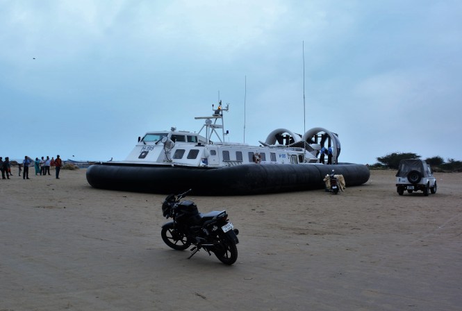
Tuticorin is a port of considerable importance as it is the only major port between Kochi on the west coast and Chennai on the east. It also has some beaches. We landed at the harbour beach to watch the landing of a Naval Hovercraft.
The port has spawned a number of industries including a power plant with imposing view on the horizon.


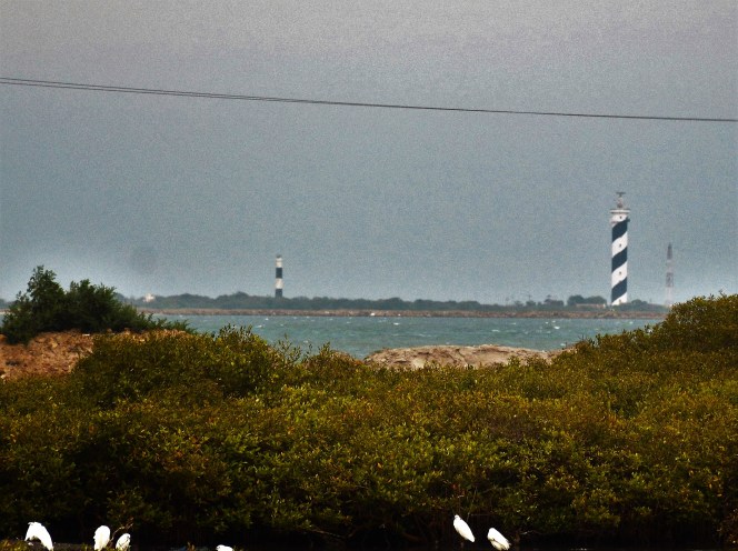
The area around Tuticorin has two light houses within the vicinity of each other. They can be seen together and photographed in one frame. I guess this is not a very common occurrence anywhere.
Our day in Tuticorin was a Sunday and without much activity except the visit to another beach. The Shrine Basilica of Our Lady of Snow is an imposing and good-looking monument in the town.


We resume travel the next day morning towards Ramanathapuram.
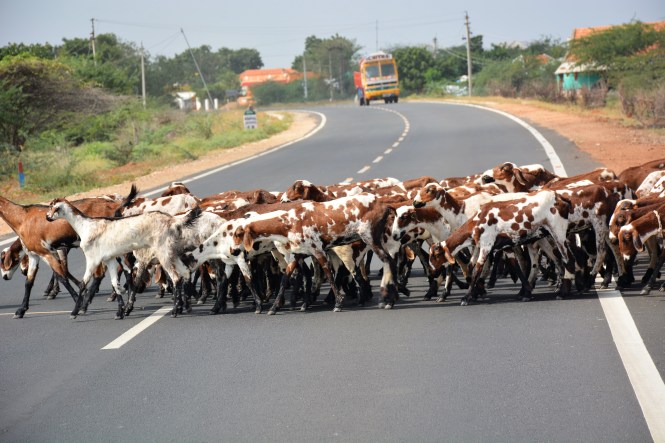
The first stop is a brief one caused by a large herd of goats crossing the road. The area we are driving through is arid and sandy with hardly any agricultural activity. Goat rearing is viable in the presence of a widespread growth of salt-tolerant species of Acasia shrubs.
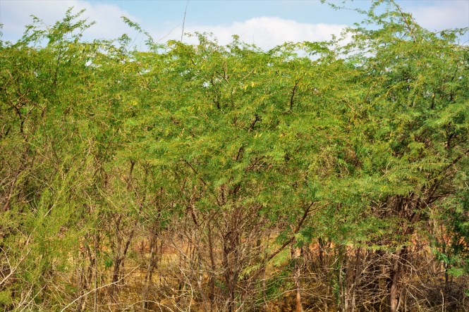
The next stop is to see how this same species of Acasia is burnt down to make coal.


The next stop is at a Tamil shrine, probably pre-Aryan. In the absence of any inscriptions that I can read, I can only make a guess. There was no one to explain what it is and even if I found someone, there would be the problem of finding a language understood by both.


We move on and stop again at this small village on the roadside to witness this practice of using highways to process grain. Here the farmers are using the road which happens to have a cleaner and smoother surface than any in the villages. This practice prevails in many parts of India. At many places the harvest is laid on the road for the passing vehicles to do the process of chaffing. The grain is a coarse millet.


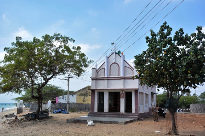
Our next stop is a planned one. It is called Vembar. It is planned because it has a lighthouse. We turn right on the state highway at Surangudi and approach the seaside. The road is a beauty. If you are in the area, please drive along it. Vembar has a beach, a Lighthouse and a nice little Church on the seaside. There could be more in the town which we do not visit.
It is not the visitor’s time at the Lighthouse. Thank you.


Here is the church.
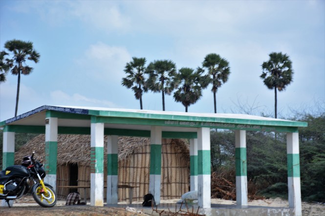
And here is the newly built fish auction place.


After a brief stopover, we return back to the road and after a nice little drive return to the seashore again. This time in search of an island called Nallatanni which appears on the google map. The place is called Periyakulam.
Periyakulam fish market
We make inquiries if we can hire a boat and make a landing on Nallatanni.
‘Yes, you can’.
‘Is it inhabited?’
‘No. It is barren’
‘Can you help us with a boat?’
‘Sure, but you will have to get the permit’
‘Permit? From whom?’
‘Forest Department’
‘From where?’
‘Madurai’
‘No, Thank you’.
The above is a transcript of a conversation which involved a few languages and a large number of gestures in sign language.
I know to get that permission will take several months and I will have to fill up forms in Tamil.
I fail to understand what the Forest Department is doing on this island. There is no way one can argue with Government. The grey hair in the picture below are mine.
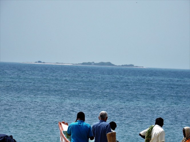
From the looks of it, the island should be a beautiful place. I will not be far off the mark if I say that this is used as a private picnic spots by the politicians and bureaucracy. That explains the need for the permit. As we go around the beachfront and among the fisher folks, we find that this is a Christian community. The names of the boats make it clear.

And then something strikes me with great force. There are no fishing nets around as one would expect. There are the boats of course, the people are obviously fishermen but then where are the nets?
The island brought us here. Something else is keeping us here. Serendipity is the English word invented for this.
Closer scrutiny of the fishermen’s activities reveal a different method of fishing and one extremely Eco-friendly and viable in the long term. It eliminates waste and catching of very young fish.
This perhaps is not the only place where this method of fishing is practiced. We have done more than half of India’s coast by now but I did not notice is elsewhere. I am sure it is being practiced elsewhere. I sincerely hope so.
What these fishermen do is as follows.
They take long fishing lines and attach hooks of large size (size 14). Baits of large pieces of neatly cut fish are attached to the hooks.


This is a laborious and time-consuming process.
The results are spectacular. All fish caught is of large size. There is no wastage and wanton killing of young fish. The catch brought to shore was uniformly of large fishes-nothing less than 250-400 gms apiece.


Periyakulam experience will always remain in my memory. I am sure it is sustainable and economical otherwise the folks have no reason to adopt it. It can succeed only when all of them in the community adopt it.
Ervadi.
After we are done with this place we take another beautiful road up north-east and join the highway to drive to Ervadi.
Ervadi is known for its ‘Dargah’. Dargah is an institution which is generally reserved for Muslim , more particularly Sufi, saints. Dargah and Tombs need to be distinguished. Dargah has a spiritual-religious connotation. Ervadi is a place which is out and out political. It has nothing to do with saints but the place is still called a ‘Dargah’
Al Qutbul Hamid wal Gausul Majid Badhusha Sultan Syed Ibrahim Shaheed is said to the ruler of Madina in Saudi Arabia and the 18th direct descendant of Prophet Mohammed. He left Arabia somewhere in the 12th century and came to Erwadi. Erwadi was then ruled by the kings or princes from the nearby place called Ramanathapuram. The Sultan demanded that the ruler of the place embrace Islam which the king declined to do. Following the Islamic tradition, the Sultan waged a war and killed the King and established his own kingdom. The descendants of the king in course of time come back and kill the descendant of Sultan, making him a Martyr and Shaheed. This Middle-eastern concept of ‘martyr’ and ‘shahid’ being foreign to the rulers of Ramanathapuram, there are no such entities and monuments at their place. The complexities of history are not something that can be handled in this humble travel blog. Some pictures, however, would not be out of place.


This place is said to cure mentally deranged people. Highly unlikely. It should be creating a lot of people in that class. Until 2001 they used to chain people of unsound mind here ( I guess they were ‘believers’) who died after a fire broke out, most probably caused by a person of ‘sound mind’.
We now drive on to another Islamic place with a very different character and history. If you can look at this place and compare it with the last one we saw, you will find that the unnecessary violence of the former was not at all necessary.
It is not surprising that Islam had reached the eastern coast of India during the lifetime of Prophet Mohammad. This is thanks largely to the commercial contacts between the people of Arabia and India during the pre-Islamic days. The merchants brought Islam to southern parts of India about 500 years before the conquerors came with it in the northern parts of the sub-continent.
Kilakarai or Keelakarai. Does it ring a bell? The claim to hosting the first mosque in India is successfully defended by the Cheraman Juma Palli at Kodungalur in Kerala. We had a brief look at it in an earlier post on this Blog. The generally accepted date of establishment of this Mosque in Kerala is 629 AD. However, it is quite possible and probable that an year before this, in 628 AD a mosque was functional at Kilakarai in Tamilnadu. The Palaiya Juma Palli built in the Dravidian architectural style and almost resembling the south Indian temples in their interiors, still exists in this small seaside town. There are doubts about its continued functioning as a mosque since then but the structure has stood here continuously over the centuries. The Kodungalur mosque was built in the Kerala style of architecture. The Kilakarai mosque was built in the Tamilian temple architecture style. To-day nothing short of the Arabic style would do. Islam has reached its intolerant best.
Arabian merchants, mostly of Yemeni origins have been trading with Indian coast throughout recorded history. They appear to have had a settlement at Kilakarai or whatever name the place was known by at that time, in the Pandian kingdom. They adopted Islam as everyone did those days in Arabia (which includes Yemen). It was logical that they brought it to India and established a mosque here. This was a good 5 centuries before the ‘Dargah’ we saw earlier.
Here are some pictures I took of the place.


The history of the mosque is shrouded in mystery but the generally accepted story is that Bazan ibn Sasan the governor of Yemen ordered its construction. Plausible theory given the fact the place had long standing trade relationship with Yemen and that there was a settler Arab trading population here. The graves of some of the Arabs associated with the Mosque are in the forecourt as seen in the above pictures. The interiors with the Dravidian influence are seen herebelow:


Kilakarai also has a small fishing harbour and a Lighthouse.


We move on towards Ramanathapuram but intend to skip the place. We want to cross the Pamban bridge and get into Rameshwaram for the night halt.
We again take a smaller and narrower road towards our destination keeping close to the seashore and avoiding the better roads away from the coast.
In the process, we come to see some interesting places in the countryside. First we see a cluster of villages very prosperous and a lot of water around. We see the village ponds with a lot of greenery, signifying a lot of water resources.


And then we come to places, closer to Ramanathapuram and the highway which look green but have a significant problem of lack of potable water. We could see a number of women with plastic containers walking long distances to fetch water.


This has been a long post and covering a longer distance than the normal. Allow me to stop it here and resume with Pamban in the next.
Text by Suryakiran Naik
Pictures by Suryakiran Naik & Veena Naik.
