As you drive southwards from Kundapura you come to a road junction where you need to make a choice of staying at a beach and a commercial town. For us the choice was obvious. It is the seaside and the seaside is Malpe. Let us start from there.
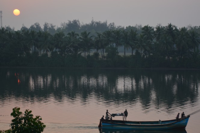
Malpe is an interesting place. An historical (and beautiful) beach, a geologically important island and a huge commercially important fishing harbour rolled into one at this small place.
The local language is Tulu and the Mogaveera community dominates the place. Let us have a look at the fishing harbour first. The geography of the place is as it appears in the map below.

The thin slice of land between the sea and the mainland allows the fishing boats to come in and land the catch in protected waters where all facilities are available. This is probably the busiest fishing harbour on Indian coast we have seen so far. Everyone is busy loading the boats in the evening so that they can start leaving later on. Loading of ice is a major activity.


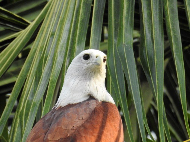
The dominant bird species at any fishing harbor in India is either the Pariah Kite or the Crow. Here at Malpe, the Brahminy Kite dominates the skies.

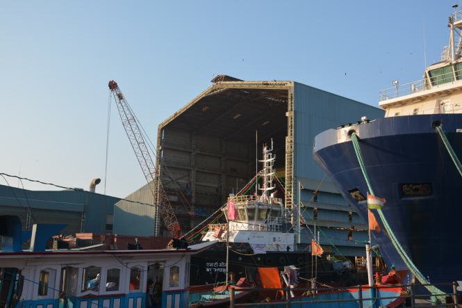
Close to the fishing harbour is a shipyard, apparently engaged in ship repair activity.
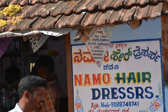
When did you last see this kiosk? Before the advent of the Mobile phones these kiosks for long-distance calling were an important part of India’s communication scene. No, it does not exist at Malpe. This is just a kiosk which did not find an alternative use. History is being made very fast these days.

Malpe has a lighthouse located in the Navy area and we could see it only from a distance.

In the evening, we decide to try out the food on the beach side shack instead of the hotel. This couple serve us very simple but fresh fish and rice.


XXXXXXXXXXXXXXXXXXXX
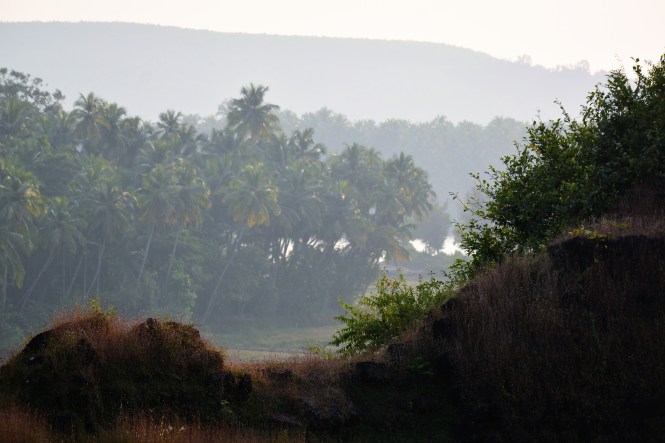
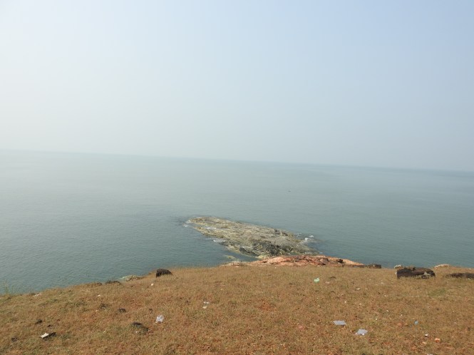
The biggest attraction of Malpe is perhaps the archipelago of 4 islands off the coast. The most important among them is the St Mary’s Island.
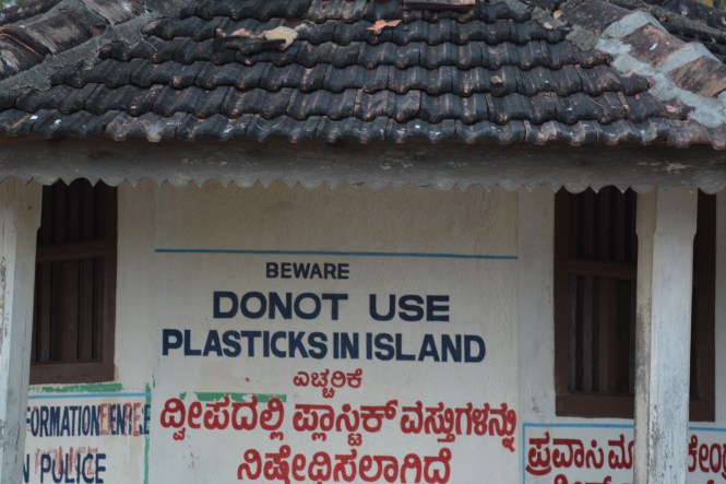
Firstly, look at this signboard of Tourism Department on the island.

The title is ‘History’, and is followed by ‘Folk Legend’. What is the final word? I strongly disbelieve this theory. This guy called Vasco da Gama came to India looking for a trade route for spices. He was not a tourist looking for such small islands without people and spices on them. In any case he could have landed at Malpe which has a good harbor and can be seen easily with naked eyes from these islands.
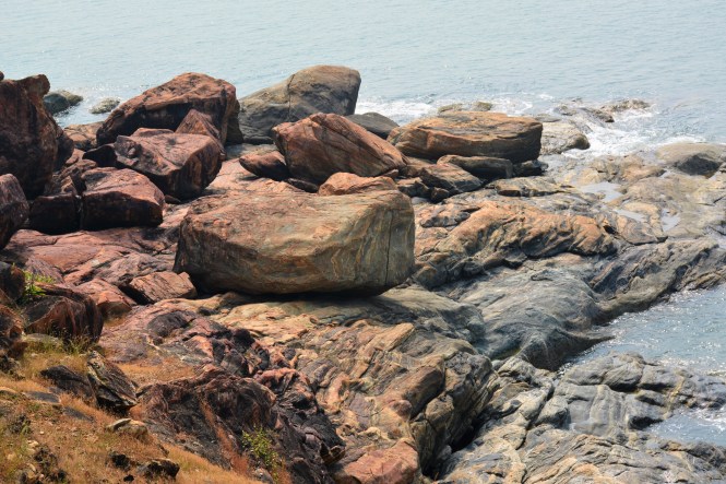
The second claim for this island is Geological. Geology is more of an exact science and not a combination of history and folk legend. Geologist have found the rock formations on this island of immense importance. I dont understand it so I am copy-pasting from Wikipedia. The pictures are ours.
The columnar basaltic lava found in these Islands, which is very well developed in the basalts of Deccan Traps, exhibit an imposing range of hexagonal shaped or multi-faced (polygonal) columns split into a horizontal mosaic. In geological terms these are called “columnar joints“.[1] The lava rocks form regular five, six or seven-sided pillars, called “laminar lava”, and are found in varying heights in all the islands; the tallest of the columns is about 6 m (20 ft). Considering the importance and rarity of such an occurrence, these islands were classified as a National Geological Monument in 2001 by the Geological Survey of India.[4][6]


Unless you have some knowledge of geology, you will be lost as I am. To the best of my understanding lava cooled in the seawater and created the stones. I beg the geologists’ pardon if I am wrong.
The more interesting aspect which is more easily understandable is the seashells. The island has a large number of seashell species which can be collected without much of an effort. That evening enriched our collection of seashells considerably.
Even without Vasco da Gama and the Columnar Joints, the island is a beautiful place which most people enjoy after a short boat ride from the seashore.


The island has this signboard.
XXXXXXXXXXX
When history of Indian Banking is being written, the South Canara district which is now South Canara and Udupi districts cannot be ignored. In fact this region is called the ‘cradle of Indian banking’.
Seven major Indian banks originate from Karnataka and five out of them from these two districts( in fact only one district when the banks were formed)- Canara Bank, Syndicate Bank,Corporation Bank, Vijaya Bank, Karnataka Bank, Vysya Bank and State Bank of Mysore. The first five are from the two districts.
The twin towns of Udupi and Manipal are a delight to walk through. Wealth can be felt on their streets without any arrogance. This is rare. The buildings whether commercial or residential are modest. The bias towards Healthcare and Education can be seen everywhere. The only time you can smell the money is when you look at the jewelry shops.
Among these banks perhaps the most interesting story is of the corporation Bank which is said to have commenced operations from the residence of a Spice Merchant by the name of Khan Bahadur Haji Abdullah Haji Kasim Saheb Bahadur. This man is reputed to have give away all his wealth to the poor. Today this residence is a very interesting Museum of Indian coinage and currency. As photography is prohibited in the museum it is not possible for me to show you the pictures from inside, but when you are around in this area, please do make it a point to visit the museum.


This is the old square in the town and also has the offices of Bharat Beedi Works whose brand No 30 used to be a very popular Beedi brand in the region.

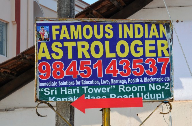
Opposite the Museum services in Black Magic are offered by ‘ Famous Indian Astrologer’. If you have any problems that you cannot solve, cellphone number is provided.
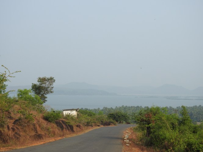
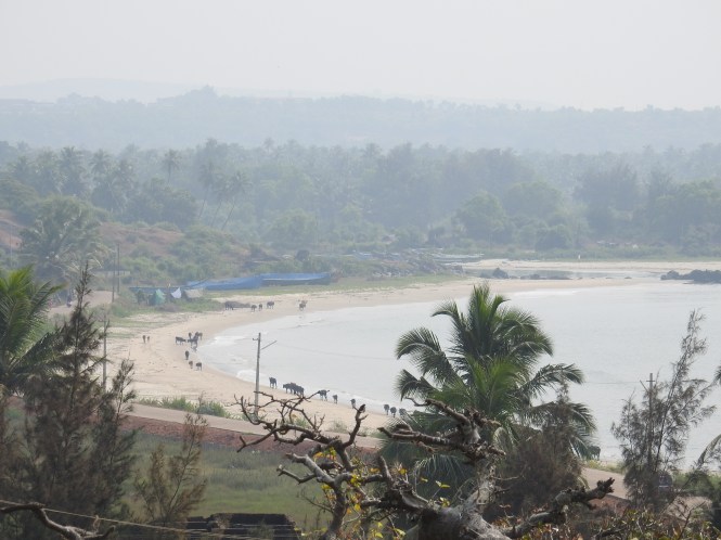
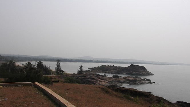
The beach at Kapu south of Malpe is considered a better beach and also has a lighthouse. It has smaller islands, rocks rather, where Vasco Da Gama had no chance of alighting.

Only birds use these rocks for sun-bathing.


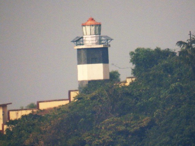
We move on to our last place of stay which is Mangalore. On the way is the famous educational centre called Surathkal which is separated by a river from Mangalore and is now a part of Mangalore city. Surathkal has a nice beach and a Lighthouse, third one within about 60Kms. But before we go on to the beach we visit a ‘Gudh’, jaggery vendor on the roadside. There are two varieties :Tad Vella and Sundi Vella. This item is made from the sap of a palm which grows wild in this area and at many other places along the Indian coast.
kap
The one to the right is the Tad Vella, the ordinary and cheaper one. The one to the left is the Sundh Vella which has ‘Sunth’, (dried ginger) and other herbs like Tulsi in it. It is sold in smaller pieces and is more expensive. The container to the right is made from the leaves of the palm.
Here is the Surathkal beach and the Lighthouse:


Mangalore , now officially called Mangaluru, Kudla in Tulu, Kodial in Konkani and Maikala in Beary. The last mentioned is a local language spoken mostly by the Muslim population. It has Arabic content. This is mostly a commercial town with a large number of temples and Churches thrown in.
This monument called Sultan’s Battery or ‘batery’ is a short tower used to protect the town from the invaders from the sea through the Gurupura river. It was used by Tipu Sultan


It’s current use is for the meetings of young people. Among the activities is celebration of birthdays. This young lady is preparing for one such occasion.

Mangalore is filled with all kinds of religious places: Temples, Mosques and Churches of many deniminations. The town itself is named after Goddess Mangaladevi. here is her abode, a modest one.

The other one Gokarnanatha Kshetra is a temple complex of immense complexity. Look at the pictures below:


It has political statements and non-conventional deities rubbing shoulders with the traditional Gods.


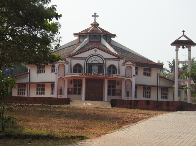
The Christian churches which were very visible are these:


We cannot conclude with Karnataka with Mangalore as there are other places down south till the Kerala border.
We drive down south looking for the Karnataka-Kerala Boder by the seaside. For doing that one has to cross the Nethravati River. The border between the two states is not a river as would be expected.
We drive along the national highway and turn towards the sea wherever we find a road. We find places like Ullal, Someshwara and Batapadi. From Ullal one can see the Mangalore across the cliff. The Ullal industrial estate has a number of fish processing industries many of which make the Poultry Feed out of fish.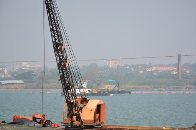
From Ullal to the border of the state we come across several localities and one major temple called Ashwatha Katte located on a cliff by the sea.


Among the other things that we see in this area are a temple whose Dwarpal has the head of a pig.

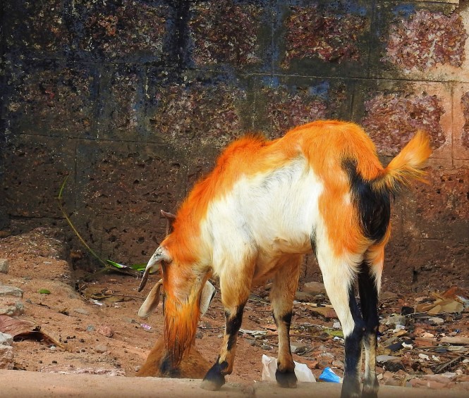
and a goat with reddish colour hair.
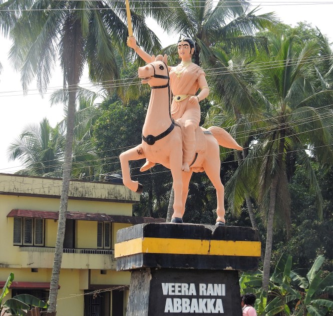
The main square of Ullal has the statue of Veera Rani Abbakka, the 16th century queen of Ullal who successfully defended her kingdom from the Portuguese advances for 4 decades.She deserves a better statue.
After all this we continue our main task of the day. Finding the boundry between Kerala and Karnataka. Braving the very narrow coastal mud(read sand) roads and taking the help of Google maps and the GPS we reach at a dead end facing a lake very close to the see. Open the google map and look for the boundry which cuts through this lake and the sandbar.


With this TheBlueDrive has completed 4 states and 2 Union Territories. The next of course is God’s Own Country. Keep reading.
Text : Suryakiran Naik
Pictures: Veena & Suryakiran Naik.